GregCocks · @GregCocks
281 followers · 366 posts · Server techhub.social3D Nation Study Hub Site Now Available! [NOAA + USGS]
--
https://nauticalcharts.noaa.gov/updates/3d-nation-study-hub-site-now-available/ <-- NOAA technical article / ‘press release’
--
https://iocm.noaa.gov/planning/3DNationStudy.html <-- NOAA 3D Nation Elevation Requirements and Benefits Study
--
#GIS #spatial #mapping #elevation #opendata #bathymetry #webportal #data #businesscase #offshore #benefits #benefitsstudy #3D #data #terrestrial #marine #offshore #hydrospatial #usecase #national #USA #datasets #datacollection #planning #3DNation #3DTNM #3DEP #topobathy #topographic #bathymetric #coast #coastal #businessuse #maps #CoNED #gischat #NOAA #USGS
@NOAA @USGS
#gis #spatial #mapping #elevation #opendata #bathymetry #webportal #data #businesscase #offshore #benefits #benefitsstudy #3d #terrestrial #marine #hydrospatial #usecase #national #USA #datasets #datacollection #planning #3dnation #3dtnm #3dep #topobathy #topographic #bathymetric #coast #coastal #businessuse #Maps #coned #gischat #noaa #usgs
IBCSO · @ibcso
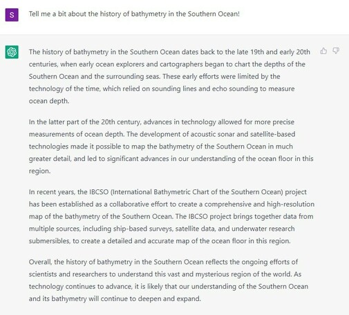
10 followers · 14 posts · Server masto.aiIBCSO made it into the history books of bathymetry (at least according to chatgpt)
#geoscience #oceanography #ocean #antarctica #bathymetry
#science #earthscience #seafloor #bathymetric #southernocean
#geoscience #oceanography #ocean #antarctica #bathymetry #science #earthscience #seafloor #bathymetric #southernocean
GregCocks · @GregCocks
129 followers · 148 posts · Server techhub.socialPacific Seamounts 2018 Expedition Report [British Columbia, Canada]
--
https://publications.gc.ca/collections/collection_2022/mpo-dfo/Fs97-6-3460-eng.pdf <-- report as a PDF
--
[Tang.ɢwan – ḥačxwiqak – Tsig̱is Area of Interest (TḥT AOI)]
#environmental #marine #mining #data #management #environment #biodiversity #canada #offshore #GIS #spatial #mapping #remotesensing #sonar #bathymetry #bathymetric #britishcolumbia #seafloor #seamounts #HaidaNation #NPSEP #ocean #oceanconservation #oceanography #survey #expedition #research #rov #underwater
Fisheries and Oceans Canada
#environmental #marine #mining #data #management #Environment #biodiversity #Canada #offshore #gis #spatial #mapping #remotesensing #sonar #bathymetry #bathymetric #britishcolumbia #seafloor #seamounts #HaidaNation #npsep #ocean #OceanConservation #oceanography #survey #expedition #research #rov #underwater
GregCocks · @GregCocks
68 followers · 85 posts · Server techhub.socialSatellite-Derived Bathymetry Online [shared paper]
--
https://ihr.iho.int/articles/satellite-derived-bathymetry-online-validation-study-upscaling-sdb-sdb-potential/ <-- 2022 shared paper
--
https://doi.org/10.3133/sir20185024 <-- 2019 USGS report on the technologies
--
#GIS #spatial #mapping #satellitederivedbathymetry #SDB #validation #coastalmapping #hydrospatial #bathymetry #satellite #remotesensing #elevation #global #survey #EarthObservation #bathymetric #coastal #global #marine #ocean #nearshore #nautical #Seabed2030 #EMODnet #accuracy #precision #vertical #4S #water #hydrology #clarity #nearshore #cloud #programming
#gis #spatial #mapping #satellitederivedbathymetry #sdb #validation #coastalmapping #hydrospatial #bathymetry #satellite #remotesensing #elevation #global #survey #earthobservation #bathymetric #coastal #marine #ocean #nearshore #nautical #seabed2030 #emodnet #accuracy #precision #vertical #4s #water #hydrology #clarity #cloud #programming
Derek Law · @GIS_Bandit
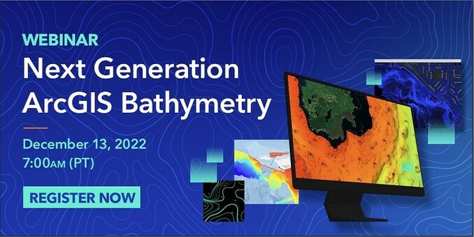
120 followers · 80 posts · Server mastodon.worldIn 1 week, #esri webinar: Next Generation #ArcGIS #Bathymetry http://esri.social/fuM850LSMTK
#bathymetric #hydrology #marine #ocean #survey #cartography #mapping #maps #GIS #esri #ArcGISPro
#esri #arcgis #bathymetry #bathymetric #hydrology #marine #ocean #survey #cartography #mapping #maps #GIS #arcgispro
Derek Law · @GIS_Bandit
173 followers · 113 posts · Server mastodon.worldIn 1 week, #esri webinar: Next Generation #ArcGIS #Bathymetry http://esri.social/fuM850LSMTK
#bathymetric #hydrology #marine #ocean #survey #cartography #mapping #maps #GIS #esri #ArcGISPro #mapstodon
#mapstodon #esri #arcgis #bathymetry #bathymetric #hydrology #marine #ocean #survey #cartography #mapping #maps #GIS #arcgispro


