Ruth Mottram · @Ruth_Mottram
1525 followers · 1055 posts · Server fediscience.org
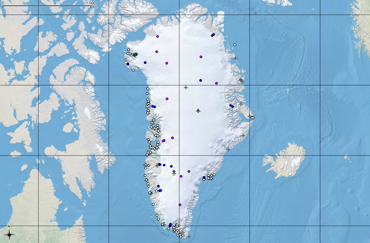
A quick #15MinuteMap for #30DayMapChallenge - it's back to #QGreenland to show the #Network of #AWS on the #IceSheet, including #PROMICE + #GCNet (now also part of #GEUS operated Promice). White dots indicate human settlements.
#GEUS #GCNet #PROMICE #icesheet #aws #network #QGreenland #30DayMapChallenge #15minutemap
Ruth Mottram · @Ruth_Mottram
1525 followers · 1055 posts · Server fediscience.org
Apparently my #15MinuteMap for #30DayMapChallenge did not come through properly yesterday evening (it was late) so I'm reposting:
For this I used the wonderful #QGIS #QAntarctica package to plot #pelagic productivity (background greens), important #bird sites (large green dots + data from #KrillBase (black dots) The theme is #Green
#green #KrillBase #bird #pelagic #QAntarctica #qgis #30DayMapChallenge #15minutemap
Ruth Mottram · @Ruth_Mottram
1525 followers · 1055 posts · Server fediscience.orgBefore I head home for Friday night #FamilyFilmEvening, here is a #15minutemap for #30DayMapChallenge - again, I can't take much credit for this. I used the wonderful #QGIS #QAntarctica to plot #pelagic productivity (background greens), important #bird sites (large green dots + data from #KrillBase (black dots) The theme is #Green
#green #KrillBase #bird #pelagic #QAntarctica #qgis #30DayMapChallenge #15minutemap #FamilyFilmEvening
Ruth Mottram · @Ruth_Mottram
1527 followers · 1055 posts · Server fediscience.org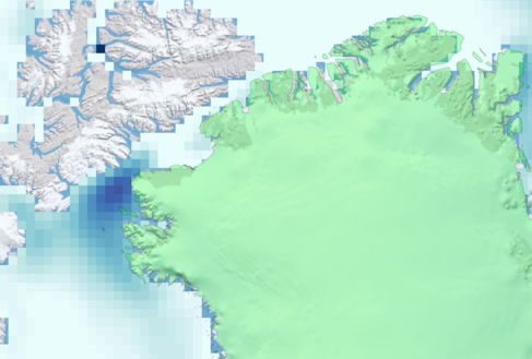
An ultra quick one for #30DayMapChallenge - and I can't really claim much credit for this one, I made it in #QGIS using QGreenland as a #15minutemap : #Polygons of #Arctic #SeaIce around #Greenland in March 2016 - here picking out the #NorthWaterPolynya
#NorthWaterPolynya #Greenland #seaice #arctic #polygons #15minutemap #qgis #30DayMapChallenge