Copernicus EU · @CopernicusEU
881 followers · 5805 posts · Server respublicae.eu
RT @DisastersChart: In these maps, #Sentinel1 data are used to estimate flood areas in the #Philippines following Tropical Storm Megi / #AgatonPH: https://disasterscharter.org/web/guest/activations/-/article/flood-flash-in-philippines-activation-756-
In the third map, the data indicates decreased water levels between 11 and 23 April.
🐦🔗: https://nitter.eu/CopernicusEU/status/1519291598336663552
#Sentinel1 #philippines #AgatonPH

MapAm💜re · @MapAmore
523 followers · 1021 posts · Server en.osm.town
Stay safe, and dry, everyone!
---
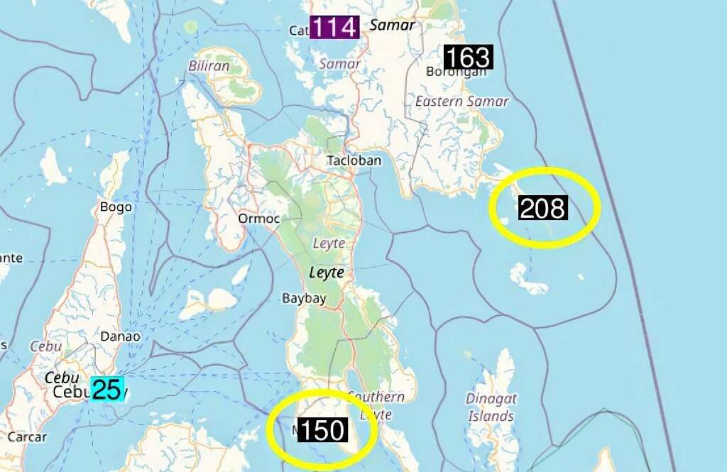
RT @MatthewCuyugan
Two weather stations broke their all-time greatest 24-hr rainfall for the month of April yesterday, April 9, due to TS #AgatonPH.
Guiuan, E. Samar
N: 208 mm [04/09/2021]
O: 136 mm [04/13/2014]
Maasin City, S. Leyte
N: 150 mm [04/09/2021]
O: 138 mm [04/04/1994]
📷: OGIMET
https://twitter.com/MatthewCuyugan/status/1513079455547338757
#OpenStreetMap #inthewild #AgatonPH