
it's kat! · @kathimmel
1584 followers · 15399 posts · Server mstdn.social
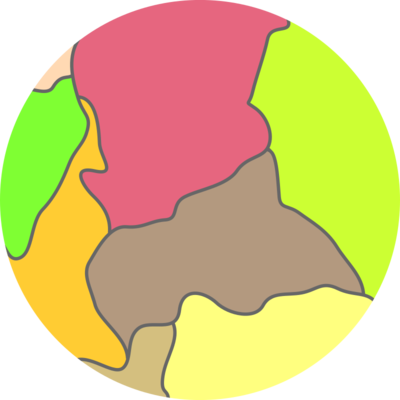
i really need to get back to my paris vegan metro map project - before it's too late.
#art #illustration #cartography #vegan #paris #metro #artNouveau #hectorGuimard
#HectorGuimard #artnouveau #metro #Paris #Vegan #Cartography #Illustration #Art
Evan Centanni (PolGeoNow) · @polgeonow
47 followers · 94 posts · Server mstdn.social
Lower house of #USA legislature last month passed a bill including a clause banning country's Defense Department from using maps that show #Taiwan as part of #China. https://www.taiwannews.com.tw/en/news/4944541
But version of the bill passed by upper house (US Senate) doesn't include the clause about maps of #China and #Taiwan, so whether it goes into effect depends on how they reconcile the two versions.
#mapping #cartography #geography #maps #politicalcartography
#politicalcartography #Maps #geography #Cartography #mapping #China #Taiwan #USA
Bryan Hansel · @bryanhansel
5106 followers · 3285 posts · Server mstdn.social
It's always exciting to see a course offering fill quickly. My Hand Drawn Maps: Exploring Your Relationship with the Land course opened for registration on the 3rd. There are just four spaces left as of this morning. I'm excited.
It's part of the North House Folk School's Winterers Gathering (in November). Grand Marais, MN
The image is one of the watercolor maps that I've made. Hot press watercolor paper.
#WaterColor #Maps #Art #Minnesota #Cartography

ManyRoads :coffeecup: · @ManyRoads
539 followers · 4579 posts · Server mstdn.social
If you are a map collector, like me, you may find this site of interest [FREE]:
"Ryhiner collection: maps of the world index"
#Cartography #Maps #History #Bern #Genealogy #Research
https://www.ub.unibe.ch/research/special_collections/map_collections/ryh/index_eng.html
#Research #genealogy #bern #History #Maps #Cartography
Adriano🌍 · @adrase
22 followers · 75 posts · Server mstdn.social
Artemis · @Artemis201
289 followers · 3104 posts · Server mstdn.socialAdditional geography: tropic of Stars (the most sunward location you can see stars), and the tropic of twilight (the nightward circle where you can see the horizon).
Obviously instead of an equator we've got a terminator/terminus.
#geography #Cartography #navigation
#navigation #Cartography #geography

Siobhan M. Ickes 🏳️🌈 · @NeonEsoterica
6 followers · 12 posts · Server mstdn.social
Bryan Hansel · @bryanhansel
4799 followers · 2830 posts · Server mstdn.social
The troubling heat in Texas and its ties to climate change in 5 maps
How long until Texans start their climate migration to Minnesota?
Link is a gift article. Even if you don't subscribe you can see the maps and article.
Evan Centanni (PolGeoNow) · @polgeonow
25 followers · 64 posts · Server mstdn.socialNew free PolGeoNow article: #Croatia adopted the #euro currency on Jan 1, 2023, becoming the first new member of the #Eurozone in more than eight years. https://www.polgeonow.com/2023/06/euro-currency-croatia-joins-eurozone-2023.html
#cartography #geographyteacher #geography #intergovernmental #currencyunion #mapping #geopolitics #europeanunion #europe #EU #economics @geography
#economics #EU #Europe #EuropeanUnion #geopolitics #mapping #currencyunion #intergovernmental #geography #geographyteacher #Cartography #Eurozone #euro #croatia
Evan Centanni (PolGeoNow) · @polgeonow
27 followers · 66 posts · Server mstdn.social
New free PolGeoNow article: #Croatia adopted the #euro currency on Jan 1, 2023, becoming the first new member of the #Eurozone in more than eight years. https://www.polgeonow.com/2023/06/euro-currency-croatia-joins-eurozone-2023.html
#cartography #geographyteacher #geography #intergovernmental #currencyunion #mapping #geopolitics #europeanunion #europe #EU #economics @geography
#economics #EU #Europe #EuropeanUnion #geopolitics #mapping #currencyunion #intergovernmental #geography #geographyteacher #Cartography #Eurozone #euro #croatia
Evan Centanni (PolGeoNow) · @polgeonow
25 followers · 63 posts · Server mstdn.socialPolGeoNow just published our latest (subscribers-only) professional overview map report on the war in #Ukraine, including full-country map and #Donbas closeup, updated for the capture of #Bakhmut. More info: https://polgeonow.com/2023/06/ukraine-control-map-russian-control-bakhmut.html
#Russia #OSINT #controlmap #conflictmapping #geopolitics #UkraineWar #UkraineRussiaWar #RussiaUkraineWar #geography #maps #cartography #mapping @geography @geopolitics #internationalrelations #security
#Security #internationalrelations #mapping #Cartography #Maps #geography #RussiaUkraineWar #UkraineRussiaWar #UkraineWar #geopolitics #conflictmapping #controlmap #osint #Russia #Bakhmut #Donbas #Ukraine
Evan Centanni (PolGeoNow) · @polgeonow
27 followers · 66 posts · Server mstdn.socialPolGeoNow just published our latest (subscribers-only) professional overview map report on the war in #Ukraine, including full-country map and #Donbas closeup, updated for the capture of #Bakhmut. More info: https://polgeonow.com/2023/06/ukraine-control-map-russian-control-bakhmut.html
#Russia #OSINT #controlmap #conflictmapping #geopolitics #UkraineWar #UkraineRussiaWar #RussiaUkraineWar #geography #maps #cartography #mapping @geography @geopolitics #internationalrelations #security
#Security #internationalrelations #mapping #Cartography #Maps #geography #RussiaUkraineWar #UkraineRussiaWar #UkraineWar #geopolitics #conflictmapping #controlmap #osint #Russia #Bakhmut #Donbas #Ukraine
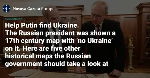
ManyRoads :coffeecup: · @ManyRoads
361 followers · 3908 posts · Server mstdn.social
Cartographic Lesson #12
"Help Putin find Ukraine:
The Russian president was shown a 17th century map with ‘no Ukraine’ on it. Here are five other historical maps the Russian government should take a look at..."
https://novayagazeta.eu/articles/2023/05/29/help-putin-find-ukraine-en
#Anthropology #Archaeology #Humanity #Maps #Ukraine #Rus #History #Europe #Slavic #Cartography
#Cartography #slavic #Europe #History #rus #Ukraine #Maps #Humanity #archaeology #anthropology
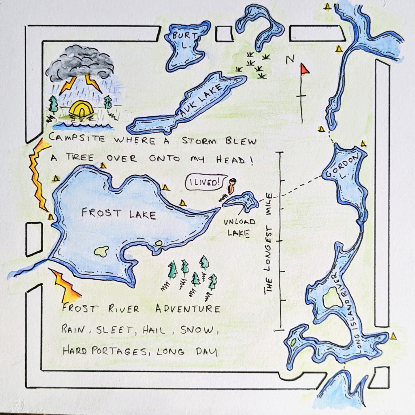
Bryan Hansel · @bryanhansel
4602 followers · 2351 posts · Server mstdn.social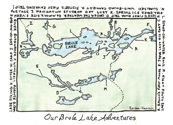
One of my hand-drawn maps. I'm going to be teaching a one-day course on making maps at the North House Folk School during Winterer's Gathering.
#bwca #Minnesota #Cartography #Art

Richard Jones · @rlcj
484 followers · 449 posts · Server mstdn.social
Is it just me who finds the #OrdnanceSurvey #map #symbols for #SolarFarms dissatisfactory? Not only are they too literal and insufficiently simplified (note #church symbols)—I’d suggest a stylised #sun alone would suffice—but what really gets my goat is the symbols’ orientation, which implies that the sun shines from the north-west quarter of the #sky (which in the #Northern #Hemisphere it NEVER DOES!). #Saturday #morning #rant over! #BadDesign #Cartography #Maps #Symbology
#symbology #Maps #Cartography #baddesign #rant #morning #saturday #hemisphere #northern #Sky #sun #church #solarfarms #symbols #Map #ordnancesurvey

EUROMAT · @EUROMAT
207 followers · 19186 posts · Server mstdn.social
RT @SmithHelmut
#SebastianMünster, A #map of #Germany, 1525, that allows you to calculate, among other things, dates of lunar eclipses for the next 50 years and when #Easter falls. #twitterstorians #cartography #FroheOstern
https://upload.wikimedia.org/wikipedia/commons/c/c8/Sebastian_Munster_-_New_l%C3%BCstig_und_k%C3%BCrtzweilig_Instrument_der_Sunnen_mit_yngesetter_Landtafel_Teutscher_Nation.jpg
#froheostern #Cartography #twitterstorians #Easter #Germany #Map #sebastianmunster
Evan Centanni (PolGeoNow) · @polgeonow
12 followers · 49 posts · Server mstdn.socialJust discovered this totally free, super-high-resolution printable map of world's countries by cartographer extraordinaire Tom Patterson, using new projection that shows all countries at their correct relative sizes with minimal distortion:
http://equal-earth.com/index.html
#geography #geopolitics #map #maps #cartography #world #mapping #geographyteacher @politicalscience
#geographyteacher #mapping #world #Cartography #Maps #Map #geopolitics #geography
Stuart Dunn · @stuartdunn
232 followers · 33 posts · Server mstdn.socialMy Inaugural Lecture (also marking the end of my time as Head of Department of @kingsdh) "The Spatial Humanities: A Challenge to the All-Knowing Map" will be held at King's on 20th June. Drinks afterwards. It will also be livestreamed (not the drinks alas).
#spatialhumanities
#digitalhumanities
#digitalplacemaking
#cartography
#Cartography #digitalplacemaking #digitalhumanities #spatialhumanities
Stuart Dunn · @stuartdunn
246 followers · 38 posts · Server mstdn.socialMy Inaugural Lecture (also marking the end of my time as Head of Department of @kingsdh) "The Spatial Humanities: A Challenge to the All-Knowing Map" will be held at King's on 20th June. Drinks afterwards. It will also be livestreamed (not the drinks alas).
#spatialhumanities
#digitalhumanities
#digitalplacemaking
#cartography
#Cartography #digitalplacemaking #digitalhumanities #spatialhumanities

GeriAQuin · @GeriAQuin
113 followers · 494 posts · Server mstdn.social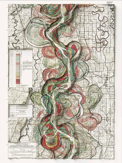
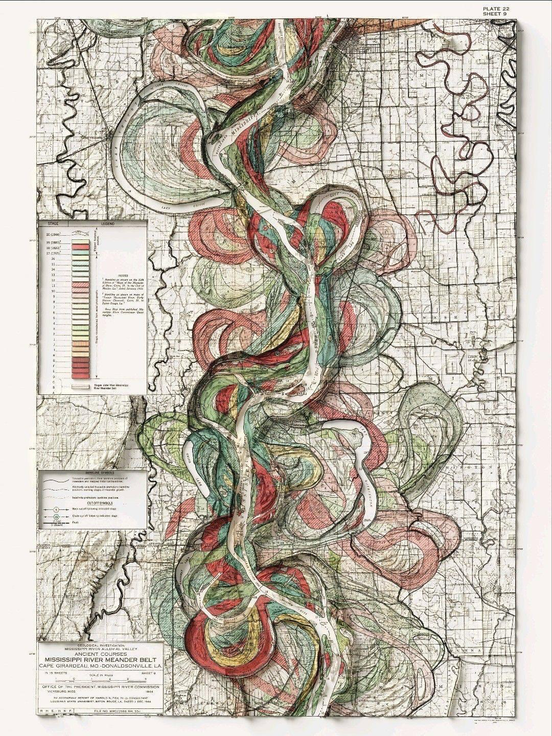
Mississippi River Meander Belt Map (c.1944) with lidar added for shaded relief. Harold Fisk and the US Army Corp of Engineers created an incredible map set that shows the temporal shifts of the Lower Mississippi River.
#cartography #geology #gis #lidar #mississippiriver
#mississippiriver #lidar #gis #geology #Cartography