GRASS GIS · @grassgis
316 followers · 39 posts · Server fosstodon.orgThanks for such a nice tweet @Joinup_eu!! Much appreciated 🙌
Kudos to @MarkusNeteler @vaclavpetras @VeronicaAndreo @CMBartonASU @HuidaeCho @lindakladivova @CaitlinHaedrich and many other @OSGeo and @foss4g folks within the #grassgis community 🍻🚀
---
RT @Joinup_eu
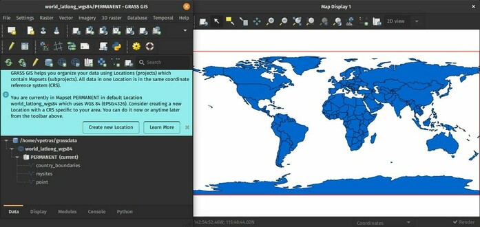
👩🏻🏫Keen on an #OpenSource #GeographicInformationSystem that provides powerful raster, vector & #geospatial processing capabilities in a single integrated software suite?
💻Chec…
https://twitter.com/Joinup_eu/status/1625789584842846209
#grassgis #opensource #GeographicInformationSystem #geospatial
Copperchips · @Copperchips
5 followers · 163 posts · Server mastodon.socialGeospatial Solutions in maps refer to specialized services for geographic information systems (GIS) and mapping. These services typically provide custom solutions for businesses and organizations that require advanced mapping capabilities and data analysis.
Visit Us: https://bit.ly/40MWY5K
#geographicinformationsystem #copperchips #gis #geo #GEOSpatialSolutions #userexperiencedesign
#GeographicInformationSystem #copperchips #gis #geo #geospatialsolutions #userexperiencedesign
IMBE · @imbe
379 followers · 544 posts · Server ecoevo.socialImpacts of sea-level rise on #prehistoric #coastal communities: land use and risk perception during the Mesolithic-Neolithic transition in central #Mediterranean #Spain https://doi.org/10.1080/17445647.2022.2071649 #IMBEpapers @ElodieBrisset #GeographicInformationSystem #DigitalElevationModel #paleogeography #CoastalArcheology #Mesolithic #EnvironmentalRisk #SealevelRise
#prehistoric #coastal #mediterranean #spain #imbepapers #GeographicInformationSystem #digitalelevationmodel #paleogeography #coastalarcheology #Mesolithic #environmentalrisk #sealevelrise
data.europa.eu · @EU_opendata
197 followers · 830 posts · Server respublicae.euRT @Joinup_eu: 👩💻Looking for a #OpenSource #GeographicInformationSystem that provides powerful raster, vector & #geospatial processing capabilities in a single integrated software suite?
📍Check out the @GRASSGIS latest release ( 8.2.0)!
👉https://joinup.ec.europa.eu/collection/geographic-information-system-gis-software/solution/grass-gis/release/820
@underdarkGIS @mapserving
🐦🔗: https://n.respublicae.eu/EU_opendata/status/1613573735184728064
#OpenSource #GeographicInformationSystem #GEOSPATIAL
GRASS GIS · @grassgis
278 followers · 29 posts · Server fosstodon.orgRT @Joinup_eu
👩💻Looking for a #OpenSource #GeographicInformationSystem that provides powerful raster, vector & #geospatial processing capabilities in a single integrated software suite?
📍Check out the @grassgis latest release ( 8.2.0)!
👉https://europa.eu/!hpHQ63
@underdarkGIS @mapserving
#opensource #GeographicInformationSystem #geospatial
QGIS · @qgis
1083 followers · 27 posts · Server fosstodon.orgHello #Fosstodon, from your friendly neighborhood #OpenSource #GeographicInformationSystem
#fosstodon #opensource #GeographicInformationSystem #osgeo


