
65dBnoise · @65dBnoise
1299 followers · 256 posts · Server mastodon.social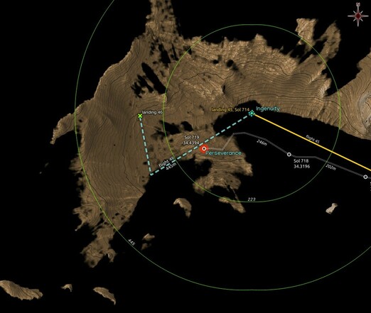
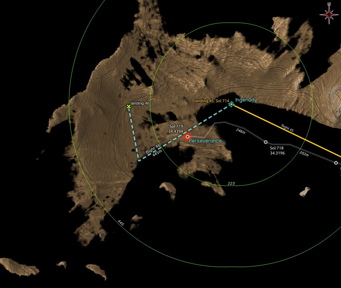
#Ingenuity should now be visible no matter where it landed after #Flight46, since most of the area for a possible landing is now visible from RMC 34.4394 where #Perseverance arrived after the Sol 719 drive.
Dashed flight path and 46th landing in cyan are wild guesses,
Map made using #QGIS with data from #NASA's #MMGIS and #HiRISE
#ingenuity #flight46 #perseverance #qgis #nasa #MMGIS #hirise #mars2020 #solarocks #space #visibility
65dBnoise · @65dBnoise
1299 followers · 256 posts · Server mastodon.social
#Ingenuity should now be visible no matter where it landed after #Flight46, since most of the area for a possible landing is now visible from RMC 34.4394 where #Perseverance arrived after the Sol 719 drive.
Dashed flight path and 46th landing in cyan are wild guesses,
Map made using #QGIS with data from #NASA's #MMGIS and #HiRISE
#ingenuity #flight46 #perseverance #qgis #nasa #MMGIS #hirise #mars2020 #solarocks #space #visibility
65dBnoise · @65dBnoise
1299 followers · 253 posts · Server mastodon.social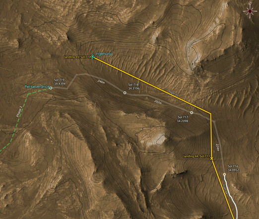
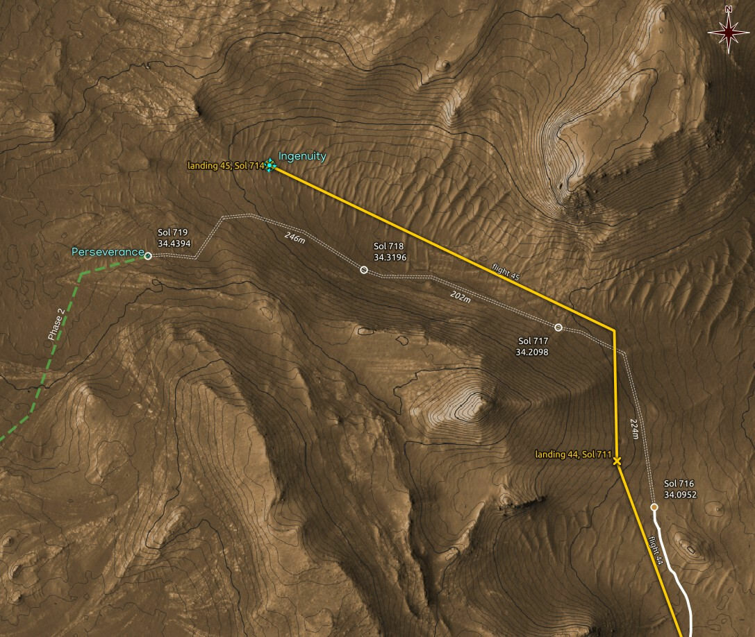
New location estimate for #Perseverance on Sol 719: RMC 34.4394. The white double dashed drive paths are guesses.
Map made using #QGIS with data from #NASA's #MMGIS and #HiRISE
#perseverance #qgis #nasa #MMGIS #hirise #mars2020 #solarocks #space #localization
65dBnoise · @65dBnoise
1299 followers · 253 posts · Server mastodon.social
New location estimate for #Perseverance on Sol 719: RMC 34.4394. The white double dashed drive paths are guesses.
Maps are made using #QGIS with data from #NASA's #MMGIS and #HiRISE
#perseverance #qgis #nasa #MMGIS #hirise #mars2020 #solarocks #space
65dBnoise · @65dBnoise
1299 followers · 250 posts · Server mastodon.social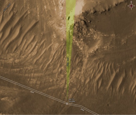
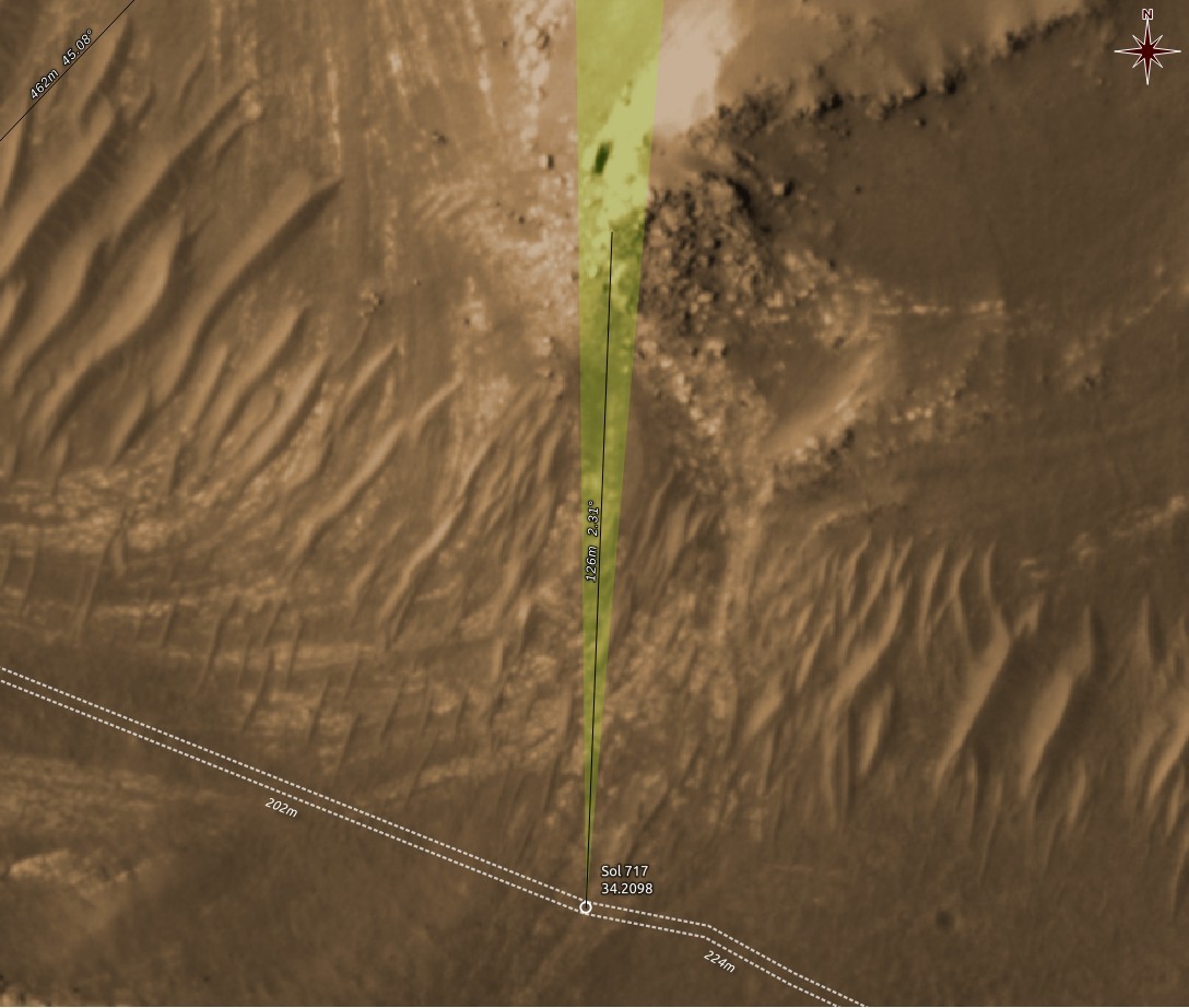
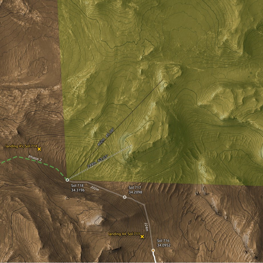
Context map showing the orientation and FOV of the MastcamZ camera when it captured the image above. The rocks are 125m away.
One more example why Sols are not good indicators of location. This is Sol 718, but the location is that of the end-of-drive of Sol 717.
Maps are made using #QGIS with data from #NASA's #MMGIS and #HiRISE
#qgis #nasa #MMGIS #hirise #perseverance #mars2020 #solarocks #space
65dBnoise · @65dBnoise
1299 followers · 246 posts · Server mastodon.social
65dBnoise · @65dBnoise
1299 followers · 244 posts · Server mastodon.social
New location estimate for #Perseverance on Sol 718: RMC 34.3196. The estimate is based on single image metadata. The white double dashed paths are guesses.
Maps are made using #QGIS with data from #NASA's #MMGIS and #HiRISE
#perseverance #qgis #nasa #MMGIS #hirise #mars2020 #solarocks #space
65dBnoise · @65dBnoise
1298 followers · 237 posts · Server mastodon.social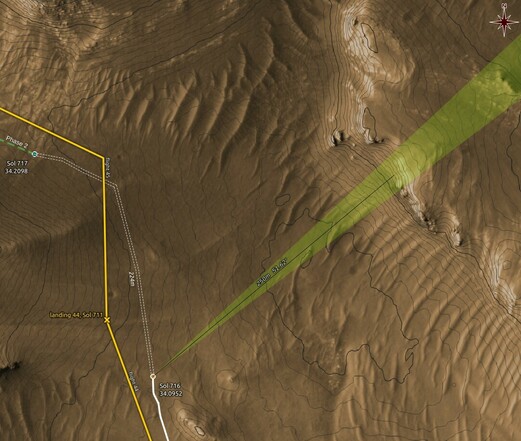
65dBnoise · @65dBnoise
1298 followers · 230 posts · Server mastodon.social
Map showing the orientation and FOV of #Perseverance's NAVCAM when the image above was captured.
#perseverance #qgis #MMGIS #hirise #mars2020 #nasa #solarocks #space
65dBnoise · @65dBnoise
1298 followers · 228 posts · Server mastodon.social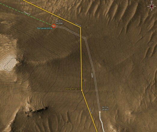
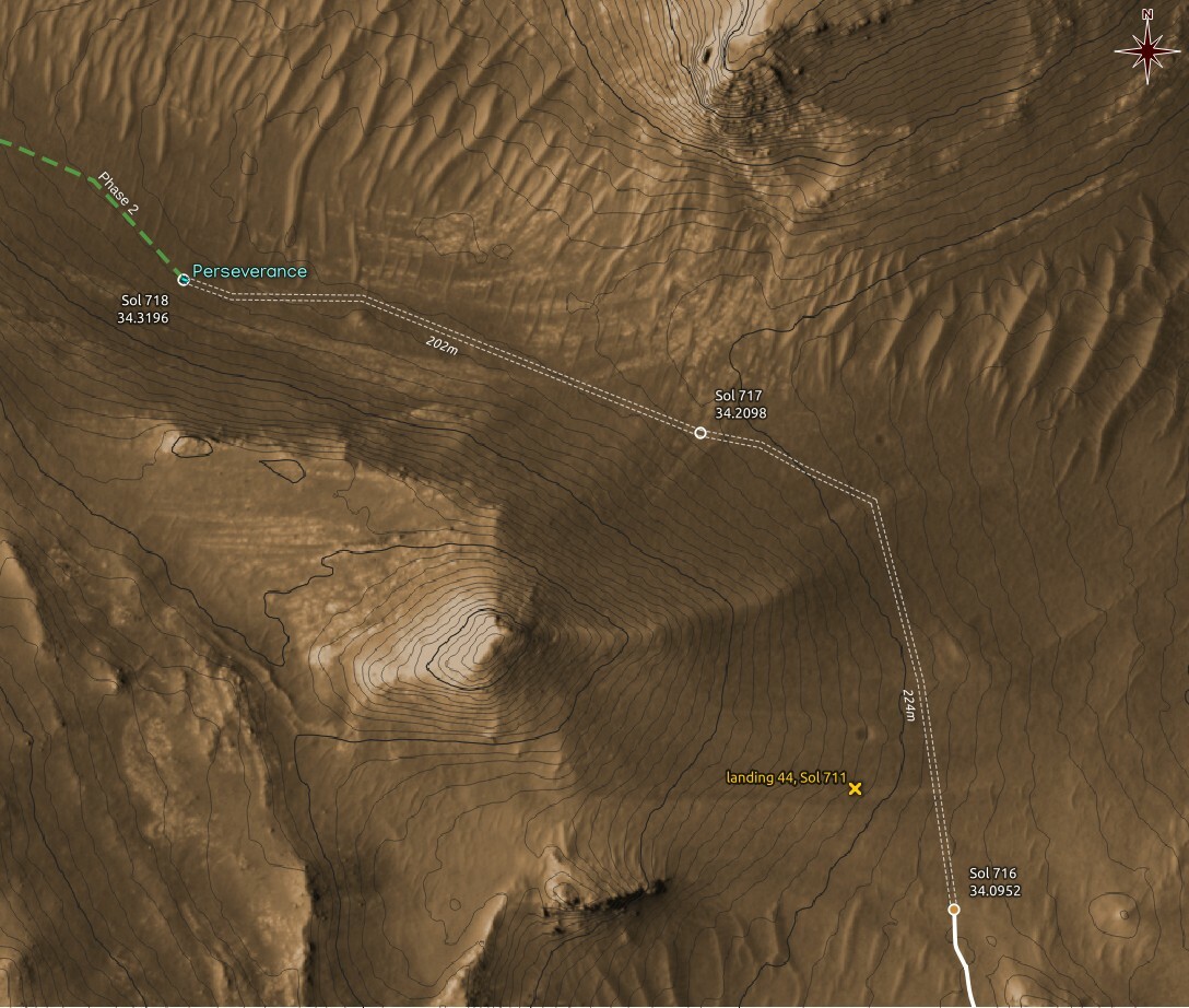
New location estimate for #Perseverance on Sol 717:
RMC 34.2098, ~220m NNW, around the foot of a 35m hill. #Ingenuity should be visible from this location.
Provisional estimate, based only on image metadata.
#perseverance #ingenuity #mars2020 #nasa #hirise #MMGIS #solarocks #space #qgis
65dBnoise · @65dBnoise
1298 followers · 228 posts · Server mastodon.social
New location estimate for #Perseverance on Sol 717:
RMC 34.2098, ~220m NNW, around the foot of a 35m hill. Provisional estimate, based only on image metadata.
#perseverance #mars2020 #nasa #hirise #MMGIS #solarocks #space #qgis
65dBnoise · @65dBnoise
1298 followers · 228 posts · Server mastodon.socialNew location estimate for #Perseverance on Sol 717: RMC 34.2098, ~220m NNW, around the foot of a 35m hill. Provisional estimate, based only on image metadata.
#perseverance #mars2020 #nasa #hirise #MMGIS #solarocks #space #qgis
65dBnoise · @65dBnoise
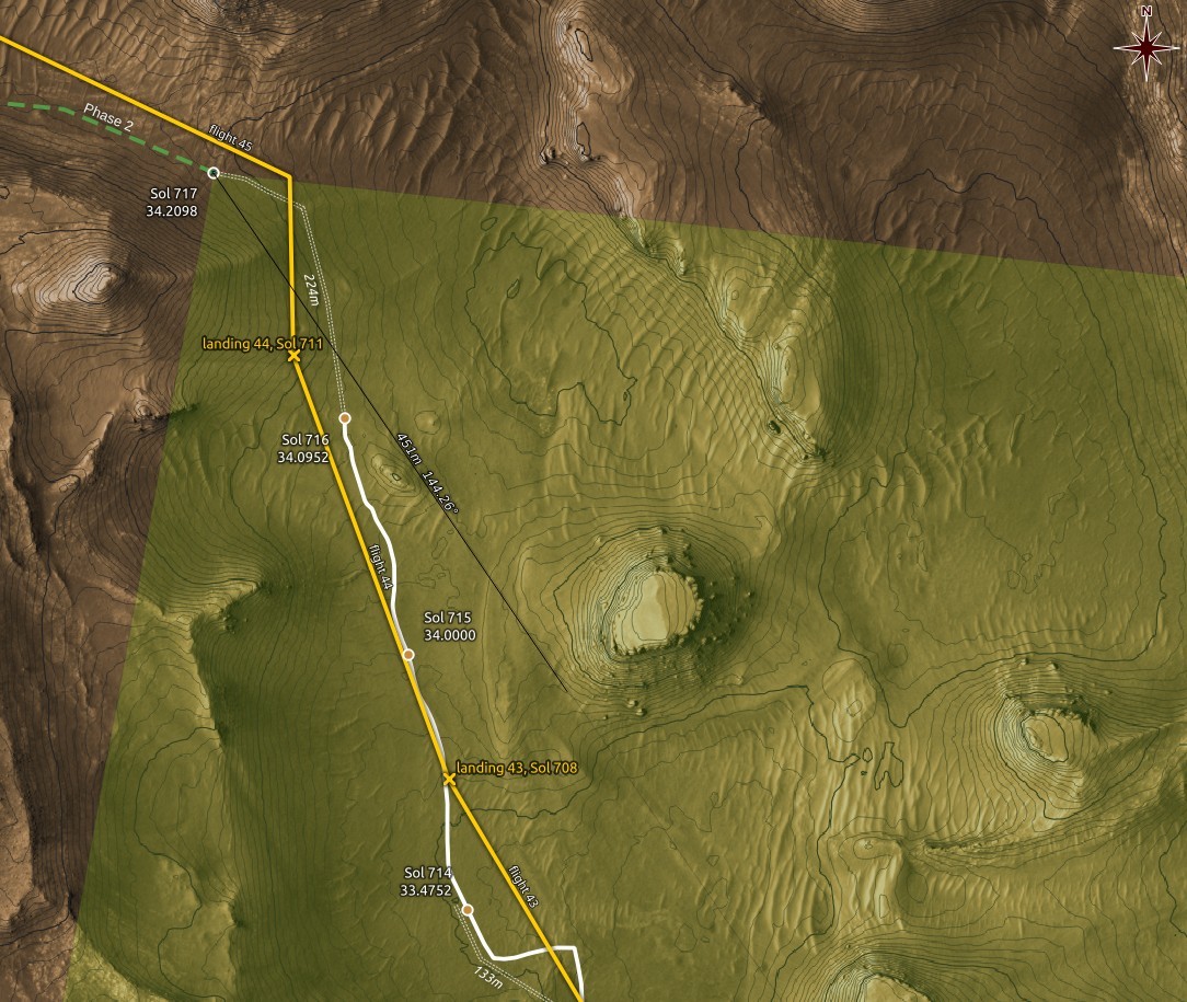
1295 followers · 170 posts · Server mastodon.socialKen Farley's presentation in #MEPAG39 showed a path along the east side of the foothills that lie to the west of the valley ahead of #Perseverance, but more interestingly it shows a mark for science activity around the place where #Ingenuity is currently located after its #Flight44.
The red mark shows the #MarsHelicopter's 44th landing, the green path is from the presentation. The background map is drawn in #QGIS with data from #HiRISE and #MMGIS
#MEPAG39 #perseverance #ingenuity #flight44 #marshelicopter #qgis #hirise #MMGIS #mars2020 #nasa #solarocks #space
65dBnoise · @65dBnoise
1295 followers · 170 posts · Server mastodon.socialKen Farley's presentation in #MEPAG39 showed a path along the east side of the foothills that lie to the west of the valley ahead of #Perseverance, but more interestingly it shows a mark for science activity around the place where #Ingenuity is currently located its #Flight44.
The red mark shows the #MarsHelicopter's 44th landing, the green path is from the presentation. The background map is drawn in #QGIS with data from #HiRISE and #MMGIS
#MEPAG39 #perseverance #ingenuity #flight44 #marshelicopter #qgis #hirise #MMGIS #mars2020 #nasa #solarocks #space
65dBnoise · @65dBnoise
1295 followers · 170 posts · Server mastodon.socialKen Farley's presentation in #MEPAG39 showed a path along the east side of the foothills of the valley that lies ahead of #Perseverance, but more interestingly it shows a mark for science activity around the place where #Ingenuity is currently located its #Flight44.
The red mark shows the #MarsHelicopter's 44th landing, the green path is from the presentation. The background map is drawn in #QGIS with data from #HiRISE and #MMGIS
#MEPAG39 #perseverance #ingenuity #flight44 #marshelicopter #qgis #hirise #MMGIS #mars2020 #nasa #solarocks #space
65dBnoise · @65dBnoise
1296 followers · 112 posts · Server mastodon.social
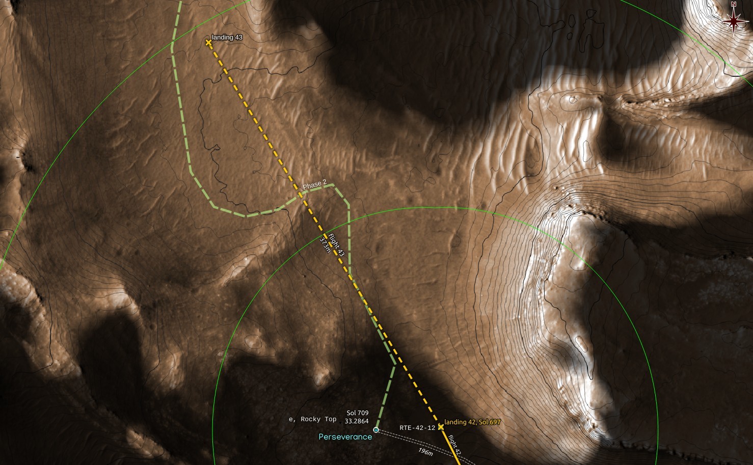
My estimate for the location of #Ingenuity's #Flight43 landing; a 373m straight line distance. Dark areas are not visible by the #MarsHelicopter.
It is possible that the flight path was not straight, which would account for the 390m given in #NASA's announcement.
#ingenuity #flight43 #marshelicopter #nasa #qgis #hirise #MMGIS #jpl #mars2020 #solarocks #space
65dBnoise · @65dBnoise
1295 followers · 104 posts · Server mastodon.socialChanges in LOS with different possible one-way 390m #Flight43 landings, to the NW.
#Ingenuity #MarsHelicopter #NASA #HiRISE #MMGIS #Solarocks #Space #QGIS
#flight43 #ingenuity #marshelicopter #nasa #hirise #MMGIS #solarocks #space #qgis
65dBnoise · @65dBnoise
1295 followers · 104 posts · Server mastodon.socialChanges in LOS with different possible one-way 390m #Flight43, to the NW. Of course a 390m flight could also follow a dog legged flight path 🤔
#Ingenuity #MarsHelicopter #NASA #HiRISE #MMGIS #Solarocks #Space #QGIS
#flight43 #ingenuity #marshelicopter #nasa #hirise #MMGIS #solarocks #space #qgis