
Tuomas Väisänen 📼🧟♂️ · @waeiski
587 followers · 831 posts · Server vis.social@kristinHenry Cool! We are not so far removed from each other then! I think #AAG, #NACIS or #StateOfTheMap could be good ones although definitely focused on geography. What conferences are you planning on checking out? Anything with maps?
Data Art installations are awesome! There is one at our campus, which shows variations in air quality in a cool way. And another one that uses a Kinect and a sandpit to create a dynamic digital elevation model.
Stamen Design · @stamen
609 followers · 24 posts · Server vis.social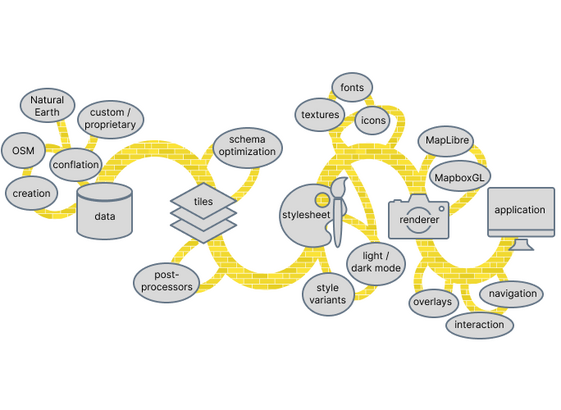
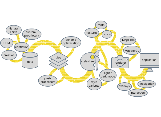
New on our blog: a conversation between @mizmay and @alan about "Full Stack Cartography". In this short recorded interview, we asked Alan and Stephanie to summarize their thoughts on the contemporary landscape of web mapping, and explain what the phrase Full Stack Cartography means to them. https://stamen.com/what-is-full-stack-cartography/ #cartography #mapping #maps #design #opensource #fullstack #fullstackcartography #podcast #mapscaping #NACIS
#NACIS #mapscaping #podcast #fullstackcartography #fullstack #opensource #design #maps #mapping #cartography

Niklas Jordan 🌳 🌋 🌍 🛰 · @niklas
114 followers · 1344 posts · Server niklas.social
Great talk!
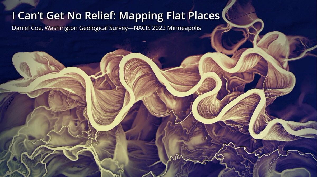
RT @geo_coe@twitter.com
Here is my #NACIS talk from couple of weeks back—mapping techniques for low-profile terrain: https://youtu.be/G5SpMLzFApA #lidar #maps #geomorphology
#geomorphology #maps #lidar #NACIS