The Big Data Cluster · @cznbigdata
236 followers · 813 posts · Server fediscience.orgOne of the most vulnerable parts of the #CriticalZone is a coastline. Especially in #hurricane season.
This story from the #USGS describes some of the ways researchers are working to better understand the #ComplexSystems that work where land meets ocean.
#complexsystems #USGS #hurricane #CriticalZone
J9Cody :arcgis: :python: 🛰️ · @J9C
84 followers · 86 posts · Server mapstodon.spaceA new topobathymetric lidar dataset for the Potomac River from the #USGS 3D Elevation Program (3DEP) is available for download. Uses: estimating concentrations of contaminant plumes; engineering for bridges and roads; mapping aquatic habitats for biological assessments; and flood mapping.
https://www.usgs.gov/news/technical-announcement/new-usgs-national-map-data-reveals-potomac-rivers-submerged-topography
#ICPRB #potomacriver #3dep #lidar #gischat #bathymetry #TopographyTuesday
#USGS #icprb #potomacriver #3dep #lidar #gischat #bathymetry #topographytuesday
The Big Data Cluster · @cznbigdata
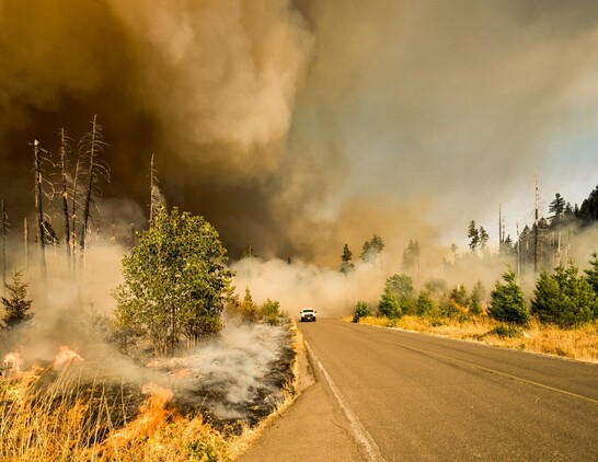
235 followers · 783 posts · Server fediscience.org#Wildfire disturbances in the #CriticalZone have widespread impacts on soil and water #chemistry. Which are things members of the #BigData Cluster are very interested in.
We are among many, many researchers around the world studying these #ComplexSystems and how they function as part of a healthy critical zone.
The #USGS highlights some of this work happening in #California: https://www.usgs.gov/programs/climate-adaptation-science-centers/news/igniting-change-evidence-based-review-california
#california #USGS #complexsystems #bigdata #chemistry #CriticalZone #wildfire
The Big Data Cluster · @cznbigdata
235 followers · 775 posts · Server fediscience.orgNext week. The next #USGS Friday's Findings.
Seeing the Bigger Picture: Using Aerial Photos to Assess Tufted Puffin Habitat in Oregon
We study the #ComplexSystems of the #CriticalZone which supports all surface life on Earth. Including #puffins.
https://content.govdelivery.com/accounts/USDOIGS/bulletins/36b313e
#Puffins #CriticalZone #complexsystems #USGS
J9Cody :arcgis: :python: 🛰️ · @J9C
51 followers · 35 posts · Server mapstodon.spaceThe #USGS National Geospatial Technical Operations Center (#NGTOC) is seeking high school, associate, undergraduate, graduate level student (working towards a degree in Geography) to gain practical experience in using GIS, and analyzing scientific data. NGTOC Office of Operations creates, manages, and delivers #elevation and surface water mapping data in support of The National Map. Please see https://www.usajobs.gov/job/738912900 which closes on 8.9.23. #gischat #hydrology #STEM #mapping
#USGS #ngtoc #elevation #gischat #hydrology #stem #mapping
· @NaturalNews
6168 followers · 31363 posts · Server brighteon.social#USGS study: At least 45% of #tapwater nationwide #contaminated with #foreverchemicals
https://www.naturalnews.com/2023-07-26-usgs-45percent-tap-water-us-contaminated-pfas.html
#USGS #tapwater #contaminated #foreverchemicals
· @NaturalNews
6113 followers · 30200 posts · Server brighteon.social#USGS announces #codered aviation warning as Hawaii's #Kilaueavolcano erupts #NaturalDisasters
https://www.naturalnews.com/2023-06-15-usgs-code-red-aviation-warning-kilauea-erupts.html
#USGS #codered #KilaueaVolcano #naturaldisasters
· @Newstarget
2181 followers · 20974 posts · Server brighteon.social#USGS announces #codered aviation warning as Hawaii's #Kilaueavolcano erupts #NaturalDisasters
https://newstarget.com/2023-06-15-usgs-code-red-aviation-warning-kilauea-erupts.html
#USGS #codered #KilaueaVolcano #naturaldisasters
The Big Data Cluster · @cznbigdata
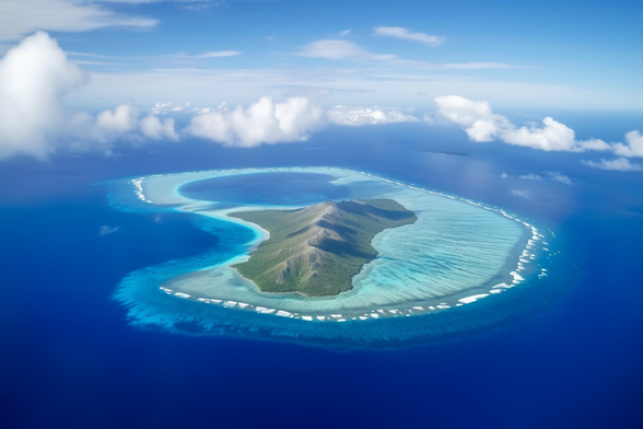
206 followers · 692 posts · Server fediscience.orgThis #Midjourney #genAI shows "low-lying coral atolls and islands in the tropical North Pacific Ocean".
Friday June 9 at 2:00 pm Eastern join the #UnitedStates #Geological Survey for "Co-Production of Satellite-Derived Vegetation Health Reports with #MarshallIslands Stakeholder Communities" which will discuss this fragile collection of #CriticalZone #ComplexSystems
https://www.usgs.gov/mission-areas/ecosystems/news/fridays-findings-june-9-2023
#USGS #EnvironmentalScience #complexsystems #CriticalZone #marshallislands #geological #unitedstates #genai #Midjourney
The Big Data Cluster · @cznbigdata
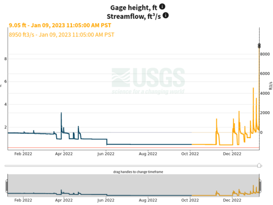
203 followers · 680 posts · Server fediscience.org#OpenAccess combined location graphs for #hydrology research. Yes, please!
#CriticalZone #UnitedStates #Geological Survey #USGS
https://waterdata.usgs.gov/blog/intro_combined_location_graph/
#USGS #geological #unitedstates #CriticalZone #hydrology #openaccess
The Big Data Cluster · @cznbigdata
185 followers · 619 posts · Server fediscience.org"Characterizing #hydrology and #pollutant inputs in urban #watersheds requires the consideration of both the natural and manmade #environment."
Fascinating #CriticalZone research from the latest #USGS WaterMarks Newsletter.
#USGS #CriticalZone #environment #watersheds #pollutant #hydrology
Dick Smiths Fair Go Supporters · @dsfgs
171 followers · 13226 posts · Server activism.openworlds.info> "We came... we saw... he died"
For years since #Gaddafi's murder 12 years ago, #Libya has been a place of chaos and division, complete with open air #slaveMarkets. We understand a number of western countries have had an active presence in the country and an influence over their media and elections.
Today the US Geological Survey (#USGS) announced two large #oil and #gas basins lie under Libya and #Tunisia.
#Gaddafi #libya #slavemarkets #USGS #oil #gas #tunisia #imperialism #africa
The Big Data Cluster · @cznbigdata
179 followers · 586 posts · Server fediscience.orgMarch 14 is the deadline to apply for a grant from the United States Geophysical Survey to create a National and Regional Climate Adaptation Science Centers in one of the places in North America facing rapid change to its climate.
Information about this opportunity linked below.
#USGS #stemgrants #climatecrisis #CriticalZone
The Big Data Cluster · @cznbigdata
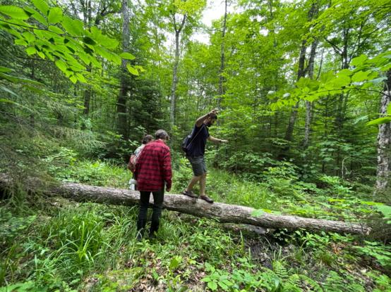
172 followers · 569 posts · Server fediscience.org#FieldworkFriday visit to the Sleepers River Research #Watershed near #Burlington, #Vermont
#Data and samples collected from this watershed play a big part in our Cluster's research projects.
Visit the watershed online: https://www.usgs.gov/centers/new-england-water-science-center/science/sleepers-river-research-watershed
#USGS #CriticalZone #data #vermont #burlington #watershed #fieldworkfriday
The Big Data Cluster · @cznbigdata
170 followers · 550 posts · Server fediscience.orgWe’ve only started to learn about the #Martian #CriticalZone. Maps like the ones featured in this story from #USGS demonstrate how much we now understand about the #geography of the #RedPlanet. Soon we will know a bit more about the #chemistry and #soil of the surface. Until we get those samples back from #Mars, we’ll have to make do with really remote sensing.
#mars #soil #chemistry #RedPlanet #geography #USGS #CriticalZone #martian
Scott Williams 🐧 · @vwbusguy
1797 followers · 4813 posts · Server mastodon.online
🇺🇸 Bewickwren 🇵🇹 · @Bewickwren
472 followers · 4190 posts · Server toot.communityThe #USGS #shake map of areas affected by the #Ferndale #earthquake in Humboldt County #California on December 20 2022
#Map
#USGS #shake #ferndale #earthquake #california #map
Dr Robert Minchin · @Robminchin
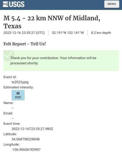
910 followers · 707 posts · Server mastodon.onlineThe Magnitude 5.4 Texas #earthquake this afternoon wobbled my office a bit despite being around 500 miles away, although I am on the top floor of the Science Operations Center. Others in #Socorro also felt it, with #USGS classifying the shaking here as III on the Modified Mercalli Intensity Scale. If you felt it, you can let #USGS know at https://earthquake.usgs.gov/earthquakes/eventpage/tx2022yplg/tellus
Dr Robert Minchin · @Robminchin
973 followers · 780 posts · Server mastodon.onlineThe Magnitude 5.4 Texas #earthquake this afternoon (4:35 MST) wobbled my office a bit despite being around 500 miles away, although I am on the top floor of the Science Operations Center. Others in #Socorro also felt it, with #USGS classifying the shaking here as III on the Modified Mercalli Intensity Scale. If you felt it, you can let USGS know at https://earthquake.usgs.gov/earthquakes/eventpage/tx2022yplg/tellus
🇺🇸 Bewickwren 🇵🇹 · @Bewickwren
405 followers · 3491 posts · Server toot.communityAn earthquake of magnitude 6.0 on the Richter scale was recorded in the southern #Mexican state of #Guerrero on Sunday. #USGS reported that the epicenter of this earthquake was 2.5 miles (4 kilometers) northwest of Corral Falso.
https://earthquake.usgs.gov/earthquakes/eventpage/us6000j8lp/executive
#mexican #Guerrero #USGS #mexico #earthquake

