schrockg · @schrockg
21 followers · 46 posts · Server mapstodon.spaceProfile of a domestic drone maufacturer. With roots in the motion picture industry. Freefly Systems #uas #uav #rpas #aerialmapping #surveying #geomatics https://bt.e-ditionsbyfry.com/publication/?m=36207&i=789316&p=16&ver=html5
#uas #uav #rpas #aerialmapping #surveying #geomatics
ClearSkyImaging · @uk_csi
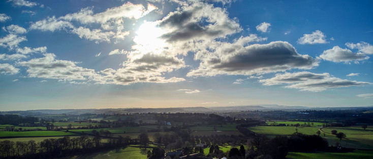
90 followers · 141 posts · Server mstdn.socialLast week was a bit of a mishmash of weather, but we finished off with imaging of some land parcels near Leominster in Herefordshire.
Nice views towards the South Wales hills and mountains in the sunshine at the end of the job.
#Drones #AerialMapping #Hereford #Herefordshire #Shropshire #Photography #AerialPhotography
#aerialPhotography #Photography #shropshire #Herefordshire #hereford #aerialmapping #Drones
schrockg · @schrockg
15 followers · 25 posts · Server mapstodon.spaceWinner and Finalists in the Surveying and Monitoring category of the Year-in-Infrastructure Awards: https://gogeomatics.ca/yii-infrastructure-awards-surveying/
#infrastructure #surveying #geomatics #damsafety #mobilemapping #aerialmapping
#infrastructure #surveying #geomatics #damsafety #mobilemapping #aerialmapping
Joeyfingis · @Joeyfingis
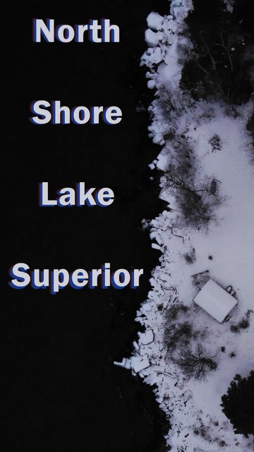
57 followers · 231 posts · Server mstdn.socialI had the pleasure of putting my drone through the paces in cold weather and low light this weekend at a gorgeous north shore cottage. If you're looking to get a #mavicmini or #MavicAir2 , consider a used #mavicair to save some money! #DronePhotograhy #drones #aerialPhotography #AerialMapping #videographer
#videographer #aerialmapping #aerialPhotography #Drones #dronephotograhy #mavicair #MavicAir2 #mavicmini
ClearSkyImaging · @uk_csi
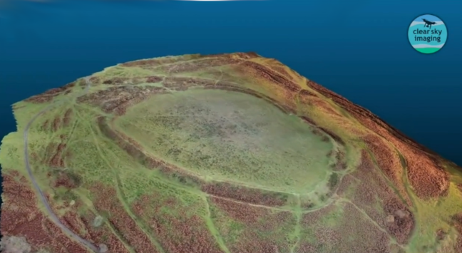
81 followers · 96 posts · Server mstdn.socialFor those who were interested in our aerial image of Nordy Bank HillFort we recently shared.
We also made a '3d Model', again using OpenDroneMap, and from that, produced a 'flyby video'
#drone #DroneMapping #Photogrammetry ##AerialMapping #3dModel #HillFort #Shropshire #UK #IronAge #OpenDroneMap
#opendronemap #ironage #UK #shropshire #hillfort #3dmodel #aerialmapping #photogrammetry #dronemapping #drone
ClearSkyImaging · @uk_csi
90 followers · 141 posts · Server mstdn.socialFor those who were interested in our aerial image of Nordy Bank HillFort we recently shared.
We also made a '3d Model', again using OpenDroneMap, and from that, produced a 'flyby video'
#drone #DroneMapping #Photogrammetry ##AerialMapping #3dModel #HillFort #Shropshire #UK #IronAge #OpenDroneMap
#opendronemap #ironage #UK #shropshire #hillfort #3dmodel #aerialmapping #photogrammetry #dronemapping #drone
ClearSkyImaging · @uk_csi
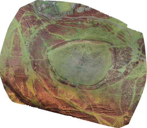
75 followers · 95 posts · Server mstdn.socialNordy Bank is a univallate hillfort on the flanks of Brown Clee Hill, the highest hill in Shropshire.
Here's a composite of some 540+ drone photos, mostly from a P4Pro, but some from a Mavic Pro, all stitched together using OpenDroneMap of the hillfort and it's environs.
OpenDroneMap handled the 2 sets of images from 2 different drones effortlessly!
#HillFortWednesday #Shropshire #Drone #DroneMapping #uk #CleeHills #AerialMapping #DronePhotograhy #HillFort #OpenDroneMap
#opendronemap #hillfort #dronephotograhy #aerialmapping #cleehills #UK #dronemapping #drone #shropshire #hillfortwednesday
ClearSkyImaging · @uk_csi
90 followers · 141 posts · Server mstdn.socialNordy Bank is a univallate hillfort on the flanks of Brown Clee Hill, the highest hill in Shropshire.
Here's a composite of some 540+ drone photos, mostly from a P4Pro, but some from a Mavic Pro, all stitched together using OpenDroneMap of the hillfort and it's environs.
OpenDroneMap handled the 2 sets of images from 2 different drones effortlessly!
#HillFortWednesday #Shropshire #Drone #DroneMapping #uk #CleeHills #AerialMapping #DronePhotograhy #HillFort #OpenDroneMap
#opendronemap #hillfort #dronephotograhy #aerialmapping #cleehills #UK #dronemapping #drone #shropshire #hillfortwednesday


