
Moskito GIS · @moskitogis
3 followers · 38 posts · Server ruhr.social#DXFGeoDat - ein kleines Tool mit viel Potential. DXF-Dateien transformieren war noch nie einfacher! #Moskito #GIS #MoskitoGIS #Transformation #ALKIS #DXF #ETRS89 #UTM #DHDN #GK
https://moskito-gis.de/index.php/de/Beitraganzeigen/DXFGD-AKfiG-n.html
#dxfgeodat #Moskito #gis #MoskitoGIS #transformation #alkis #dxf #etrs89 #utm #dhdn #gk

Fedora · @fedora
51 followers · 49 posts · Server digitalcourage.social@thijs_lucas Um die Flächenaufteilung zumindest für den Straßenraum zu bestimmen, könnte das Straßeninformationssystem des #LBV #SH hilfreich sein: https://www.schleswig-holstein.de/mm/downloads/LBVSH/Aufgaben/Strassenbau/strasseninfobank.pdf
Um das für #Kiel zu testen, habe ich eine Anfrage über #FragDenStaat gesendet: https://fragdenstaat.de/anfrage/auszug-aus-dem-strasseninformationssystem/
Danke an @MisterOpenData für den Tipp beim #WebMontag #wmki.
Gedanke: In einem weiteren Schritt könnte mensch die Daten daraus mit #ALKIS Daten und Orthophotos verbinden. Dann sind wir auch wieder beim Thema #Fernerkundung.
#kiel #Fernerkundung #alkis #wmki #webmontag #fragdenstaat #sh #LBV

Kate 🏳️⚧️ · @0xff00bb
77 followers · 816 posts · Server fosstodon.org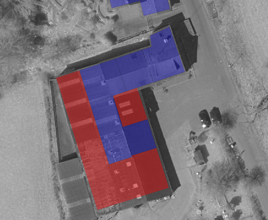
Generating building diffs between official data (#ALKIS #NRW) and #OpenStreetMap. In the background the official #infrared #DOP images.
Will be used to semi-automate (humans will still review it) the import of highly accurate geometry data into OSM (not only from ALKIS data).
Once we have the mapping between OSM and ALKIS objects we can also use it to set a lot of tags in OSM based on the information contained in ALKIS.
#alkis #nrw #openstreetmap #infrared #dop #cartography #maps #qgis
Moskito GIS · @moskitogis
3 followers · 28 posts · Server ruhr.socialAlles neu macht der Mai – bei uns gibt es Neues im #acadALKIS! #Moskito #GIS #MoskitoGIS #ALKIS #NAS #Shape #Kataster #Flurstück #Liegenschaften #Geodaten #Geobasisdaten
https://moskito-gis.de/index.php/de/Beitraganzeigen/acadALKISUp.html
#acadalkis #Moskito #gis #MoskitoGIS #alkis #nas #shape #kataster #flurstuck #Liegenschaften #geodaten #geobasisdaten
Moskito GIS · @moskitogis
3 followers · 26 posts · Server ruhr.socialDie Arbeit mit #Enklaven im #GIS kann Nerven kosten. #Moskito hat den Schlüssel zum Erfolg! #MoskitoGIS #ALKIS #NAS #Shape #Kataster #Flurstück #Liegenschaften #Geodaten #Geobasisdaten
https://moskito-gis.de/index.php/de/Beitraganzeigen/MU6.40.406.html
#enklaven #gis #Moskito #MoskitoGIS #alkis #nas #shape #kataster #flurstuck #Liegenschaften #geodaten #geobasisdaten

pyQGIS · @pyQGIS
30 followers · 77 posts · Server social.anoxinon.de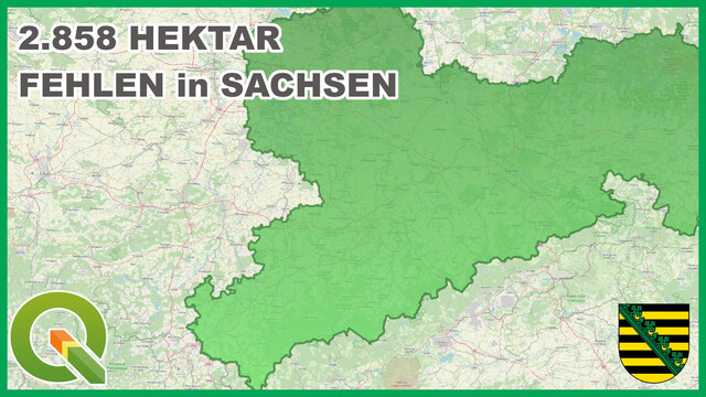
Mit offenen #ALKIS Daten, ein wenig Berechnungen in #QGIS und schwupps sieht man, dass Fläche in Sachsen "fehlt". Siehe Video: https://youtu.be/IdwRHq6FNBw
Moskito GIS · @moskitogis
3 followers · 23 posts · Server ruhr.socialEine Punktlandung für die #Genauigkeiten in den #NAS-Daten mit acadALKIS. #Moskito #GIS #MoskitoGIS #ALKIS #NAS #DXF #Shape #ALB #Kataster #Flurstück #Liegenschaften #Geodaten #Geobasisdaten
https://moskito-gis.de/index.php/de/Beitraganzeigen/NAS-Pia.html
#genauigkeiten #nas #Moskito #gis #MoskitoGIS #alkis #dxf #shape #alb #kataster #flurstuck #Liegenschaften #geodaten #geobasisdaten
Moskito GIS · @moskitogis
3 followers · 22 posts · Server ruhr.socialMit acadALKIS und #Moskito nehmen Sie jetzt die Punktgenaugkeiten unter die Lupe! #GIS #MoskitoGIS #ALKIS #NAS #DXF #Shape #ALB #Kataster #Flurstück #Liegenschaften #Geodaten #Geobasisdaten
https://moskito-gis.de/index.php/de/Beitraganzeigen/PiNXD.html
#Moskito #gis #MoskitoGIS #alkis #nas #dxf #shape #alb #kataster #flurstuck #Liegenschaften #geodaten #geobasisdaten
Moskito GIS · @moskitogis
3 followers · 21 posts · Server ruhr.socialDas Suchen hat ein Ende - acadALKIS hilft jetzt Finden! #Moskito #GIS #MoskitoGIS #ALKIS #NAS #DXF #Shape #ALB #Kataster #Flurstück #Liegenschaften #Geodaten #Geobasisdaten
https://moskito-gis.de/index.php/de/Beitraganzeigen/Sia.html
#Moskito #gis #MoskitoGIS #alkis #nas #dxf #shape #alb #kataster #flurstuck #Liegenschaften #geodaten #geobasisdaten

geoObserver · @geoObserver
345 followers · 217 posts · Server mastodon.social
KomGIS+: Deutsche Gründlichkeit & die ALK-ALB-Flächendifferenz? https://geoobserver.wordpress.com/2023/02/20/komgis-deutsche-grundlichkeit-die-alk-alb-flachendifferenz/ #KomGIS #ALKIS #ALK #ALB #gistribe #gischat #fossgis #foss4g #OSGeo #spatial #geospatial #mapping #gis #geo #geoObserver @PyQgis
#komgis #alkis #alk #alb #gistribe #gischat #fossgis #foss4g #osgeo #spatial #geospatial #mapping #gis #geo #geoobserver
Moskito GIS · @moskitogis
3 followers · 14 posts · Server ruhr.socialMit #DXFGeoDat meistern Sie jede #Transformation im Handumdrehen - ein kleines Tool mit viel Potential. #Moskito #GIS #MoskitoGIS #ALKIS #DXF #ETRS89 #UTM #DHDN #GK https://moskito-gis.de/index.php/de/Beitraganzeigen/DXFGD-AKfiG-n.html
#dxfgeodat #transformation #Moskito #gis #MoskitoGIS #alkis #dxf #etrs89 #utm #dhdn #gk
pyQGIS · @pyQGIS
6 followers · 7 posts · Server social.anoxinon.de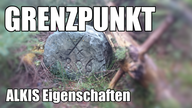
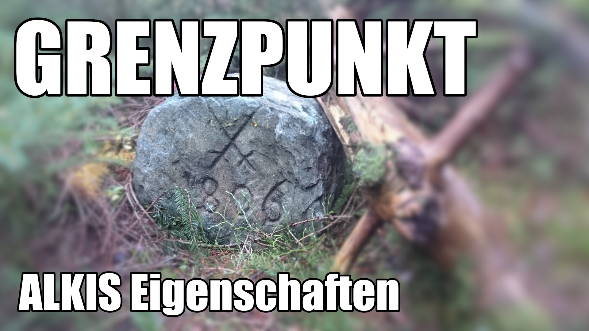
Im aktuellen Video https://youtu.be/4pV73bB850c erläutere ich die im Kataster abgespeicherten #ALKIS Eigenschaften von #Grenzpunkten.
pyQGIS · @pyQGIS
3 followers · 5 posts · Server social.anoxinon.de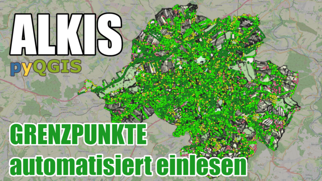
pyQGIS · @pyQGIS
2 followers · 1 posts · Server social.anoxinon.de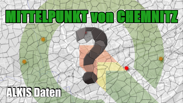
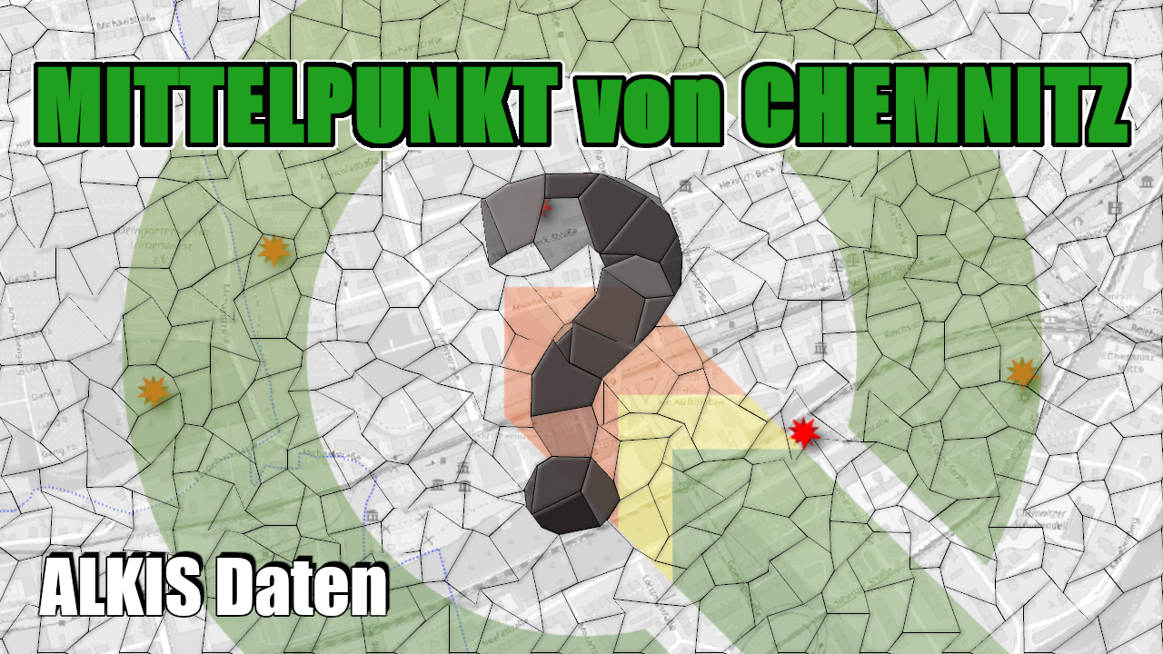
Neues Video online. Siehe https://youtu.be/Vcp7-f2ioTs
Diesmal bestimmen wir den Mittelpunkt von Chemnitz mit #QGIS, #ALKIS Daten und nutzen auch #python.