Keith Jenkins · @kgjenkins
436 followers · 569 posts · Server mapstodon.spaceDoes #ArcGISPro have an equivalent to GDAL's rgb2pct.py?
This is trivial in QGIS, but I'm trying to help someone using ArcGIS Pro who needs to convert an RGB-encoded landcover dataset into simple byte values.
(Why this 10-class landcover data is distributed as gigantic uncompressed 3-band RGB is a whole other question...)
Atanas Entchev · @atanas
314 followers · 1022 posts · Server mastodon.cloudTesla DuBois · @TeslaDuBois
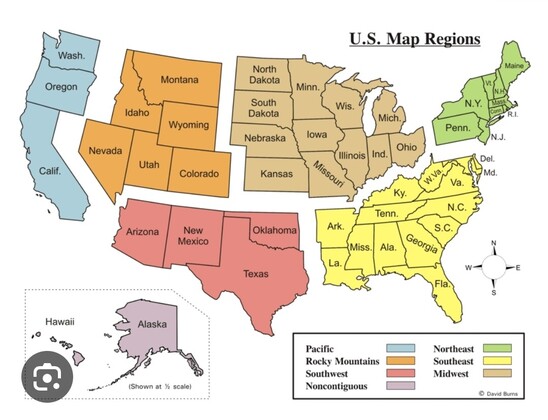
308 followers · 210 posts · Server fosstodon.org#gischat I don't know why I'm coming up short on this - how can I make a map with some polygons separated like this? I'm currently trying it in #ArcGISpro but would be happy to execute it in #QGIS or #rspatial. I hope the answer isn't #Inkscape or similar, but I may go there.
#gischat #arcgispro #qgis #rspatial #inkscape
GregCocks · @GregCocks
554 followers · 494 posts · Server techhub.socialIt is upgrade afternoon!
• QGIS v2.6 --> v3.32
• pgAdmin v6.2 --> v7.5
• ArcGIS Pro v2.9.5 --> v3.1.2 (now that I no longer have dev dependencies)
Looking forward to exploring the differences - and a nice but productive distraction...
#GIS #spatial #mapping #software #arcgispro #pgadmin #qgis #gischat #opensource
#gis #spatial #mapping #software #arcgispro #pgadmin #qgis #gischat #opensource
Justin · @justincolegis
336 followers · 38 posts · Server mapstodon.spaceFinished my "Quick and Easy" Census Data in GIS - Part 2 walk through. #ESRI #ArcGISPro #Census #ArcGISOnline https://justincolegis.com/2023/06/26/quick-and-easy-census-data-in-gis-part-2/
#esri #arcgispro #census #arcgisonline
Sandon Lettieri · @XenonGT
11 followers · 8 posts · Server mapstodon.space#MapPromptMonday - Week 20 - Proportional Symbols. Decided to make a map of places using proportional symbols for population. That said, I wanted to also try and use the #spilhaus projection within #qgis. While it doesn't seem that data can be transformed into Spilhaus within QGIS, it can be used if it's already in that projection. I reprojected the data in #ArcGISPro and then made my map in QGIS. Like all maps I post online, it's made for fun and my entertainment only. 🙂
#mappromptmonday #spilhaus #qgis #arcgispro
Justin · @justincolegis
335 followers · 32 posts · Server mapstodon.spaceI just finished Part 1 of a walkthrough on a "Quick and Easy" method of using Census Data in GIS. Hopefully many will find this helpful especially how massive the census data can be. #GIS #Census #ArcGISPro https://justincolegis.com/2023/05/17/quick-and-easy-census-data-in-gis-part-1/
Derek Law · @GIS_Bandit
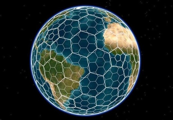
238 followers · 320 posts · Server mastodon.worldUse H3 to create multiresolution hexagon grids in #ArcGISPro 3.1 https://tinyurl.com/bnbnxwfc
#dataviz #spatial #analysis #GIS #esri #arcgis #mapping #maps #theScienceOfWhere #GISchat #geospatial #mapstodon
#arcgispro #dataviz #spatial #analysis #GIS #esri #arcgis #mapping #maps #TheScienceOfWhere #gischat #geospatial #mapstodon
Chuixiang (Tree) Yi · @TreeYi
9 followers · 4054 posts · Server mastodon.worldRT @geo_spatialist
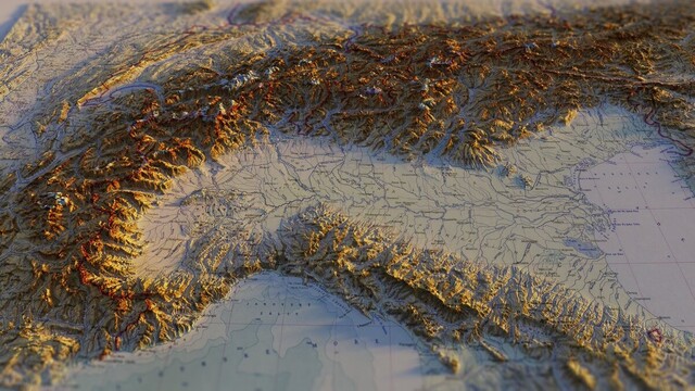
Alps sunrise 4K desktop wallpaper file for anyone who may want it. Link below.
https://drive.google.com/file/d/12jEc-Q3eoJhOcs38B-LL5F5C8YH97-lL/view?usp=drivesdk
#Alps #wallpaper #arcgispro #b3d #Italy #Switzerland #France #Austria #Germany
#alps #wallpaper #arcgispro #b3d #italy #switzerland #france #austria #germany
Derek Law · @GIS_Bandit
230 followers · 293 posts · Server mastodon.worldIn 1 week, #Esri webinar: Automating #Topographic #Map Production https://tinyurl.com/2s39zu46
#automation #mapping #cartography #ArcGISPro #GIS #esri #arcgis #GIO #TheScienceOfWhere #MapSeries #GISchat #geospatial #mapstodon
#esri #topographic #map #automation #mapping #cartography #arcgispro #GIS #arcgis #GIO #TheScienceOfWhere #mapseries #gischat #geospatial #mapstodon
Derek Law · @GIS_Bandit
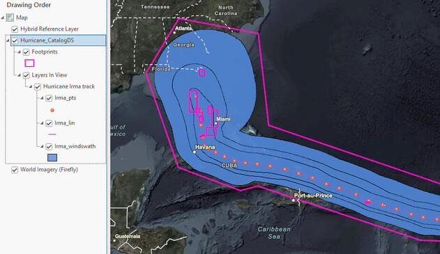
230 followers · 293 posts · Server mastodon.worldManage large #datasets with new Catalog layers in #ArcGISPro https://tinyurl.com/5kmfkaym
#data #datamanagement #dataviz #GIS #esri #arcgis #mapping #maps #TheScienceOfWhere #geospatial #GISchat #mapstodon
#datasets #arcgispro #data #datamanagement #dataviz #GIS #esri #arcgis #mapping #maps #TheScienceOfWhere #geospatial #gischat #mapstodon
Chuixiang (Tree) Yi · @TreeYi
9 followers · 3835 posts · Server mastodon.worldRT @geo_spatialist
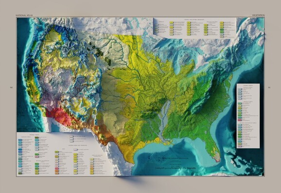
US Potential Natural Vegetation - USGS - National Atlas - 1966
3D render - with and without bathymetry
#arcgispro #b3d #GIS #geography #bathymetry #cartography
Justin · @justincolegis
336 followers · 31 posts · Server mapstodon.spaceThis is a link to my #GISSIG2023 presentation on 3D Printing Maps for The Visually Impaired that I just gave. #Cartography #GIS #3DPrinting #ArcGISPro #QGIS #GISChat https://bit.ly/JDC2023GISSIG
#gissig2023 #cartography #GIS #3dprinting #arcgispro #qgis #gischat
Josh Carlson · @jcarlson
292 followers · 533 posts · Server mapstodon.spaceForced to use Windows today for some #ArcGISPro work. Why is it so danged hard to configure date and time formats here? I have to go 4 menus deep with it set to English (Denmark) to get what I want, and it's *still* not quite right.
Just let me specify the datetime format strings, you monsters!
Derek Law · @GIS_Bandit
226 followers · 286 posts · Server mastodon.world#Geoprocessing enhancements in
#ArcGISPro 3.1 https://tinyurl.com/598r37dm
#spatial #analysis #models #tools #python #GIS #esri #arcgis #mapping #TheScienceOfWhere #geospatial #GISchat #mapstodon
#geoprocessing #arcgispro #spatial #analysis #models #tools #python #GIS #esri #arcgis #mapping #TheScienceOfWhere #geospatial #gischat #mapstodon
Derek Law · @GIS_Bandit
226 followers · 286 posts · Server mastodon.worldNew #Esri #Technical #Support Experience Live https://tinyurl.com/27rej2sx
#help #CustomerService #GIO #GIS #esri #arcgis #ArcGISPro #ArcGISOnline #ArcGISEnterprise #ArcGISAdmin #geospatial #GISchat #mapstodon
#esri #Technical #support #help #customerservice #GIO #GIS #arcgis #arcgispro #ArcGISOnline #ArcGISEnterprise #ArcGISAdmin #geospatial #gischat #mapstodon
Justin · @justincolegis
331 followers · 29 posts · Server mapstodon.spaceDoes anyone know if there is a way to see if there are multiple changes in slope for a single line in #arcgispro? I just had this random project idea to look at if a path can be uphill multiple times. #cartography #GIS #ArcGIS
#arcgispro #cartography #GIS #arcgis
Derek Law · @GIS_Bandit
226 followers · 286 posts · Server mastodon.worldIn 1 week, #esriUK webinar: #ArcGIS Update - Spring 2023 http://esri.social/sqhK50NbYeH
#ArcGISPro #ArcGISOnline #ArcGISAdmin #GIO #GIS #esri #mapping #tech #TheScienceOfWhere #geospatial #mapstodon
#EsriUK #arcgis #arcgispro #ArcGISOnline #ArcGISAdmin #GIO #GIS #esri #mapping #tech #TheScienceOfWhere #geospatial #mapstodon
Derek Law · @GIS_Bandit
226 followers · 286 posts · Server mastodon.worldWhat's New for #Spatial Analyst in #ArcGISPro 3.1 https://tinyurl.com/5dnzvcfr
#location #intelligence #analysis #GIS #esri #arcgis #mapping #GISchat #geospatial #mapstodon
#spatial #arcgispro #location #intelligence #analysis #GIS #esri #arcgis #mapping #gischat #geospatial #mapstodon
Derek Law · @GIS_Bandit
226 followers · 286 posts · Server mastodon.worldIn 1 week, #esriCanada webinar: Going from 2D to #3D with #ArcGISPro http://esri.social/PISK50N7SkY
#dataviz #visualization #GIS #esri #arcgis #mapping #maps #TheScienceOfWhere #geospatial #mapstodon
#esricanada #3d #arcgispro #dataviz #visualization #GIS #esri #arcgis #mapping #maps #TheScienceOfWhere #geospatial #mapstodon

