
Joseph Elfelt · @mappingsupport
390 followers · 279 posts · Server m.ai6yr.org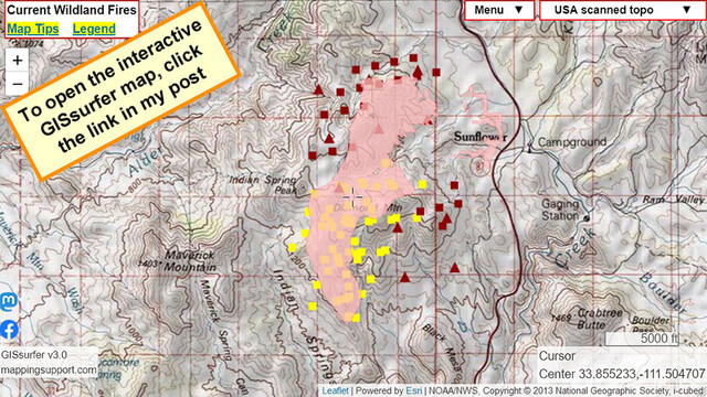
July 26 afternoon. Interactive #GIS map for #DiamondFire near Sunflower Arizona.
Dark red symbols are *heat* detection by MODIS and VIIRS satellites. This data is not real time, locations are only approximate and sometimes ‘false positive’.
To get the most benefit from the map see 2 links upper left corner.
Never rely on any map to ignore an order to evacuate.
#AZwx #AZfire #AZwildfire #Geospatial #Maps #Mapping #Leaflet #ArcGIS #WebMap
Open #GISsurfer map:
https://mappingsupport.com/p2/gissurfer.php?center=33.853521,-111.503162&zoom=13&basemap=USA_scanned_topo&overlay=VIIRS_7_day,MODIS_7_day,State_boundary,Fire_perimeter_NIFC&data=https://mappingsupport.com/p2/special_maps/disaster/USA_wildland_fire.txt
#gis #diamondfire #azwx #azfire #azwildfire #geospatial #maps #mapping #leaflet #arcgis #webmap #gissurfer

Geewhizpat · @Geewhizpat
828 followers · 2555 posts · Server newsie.social
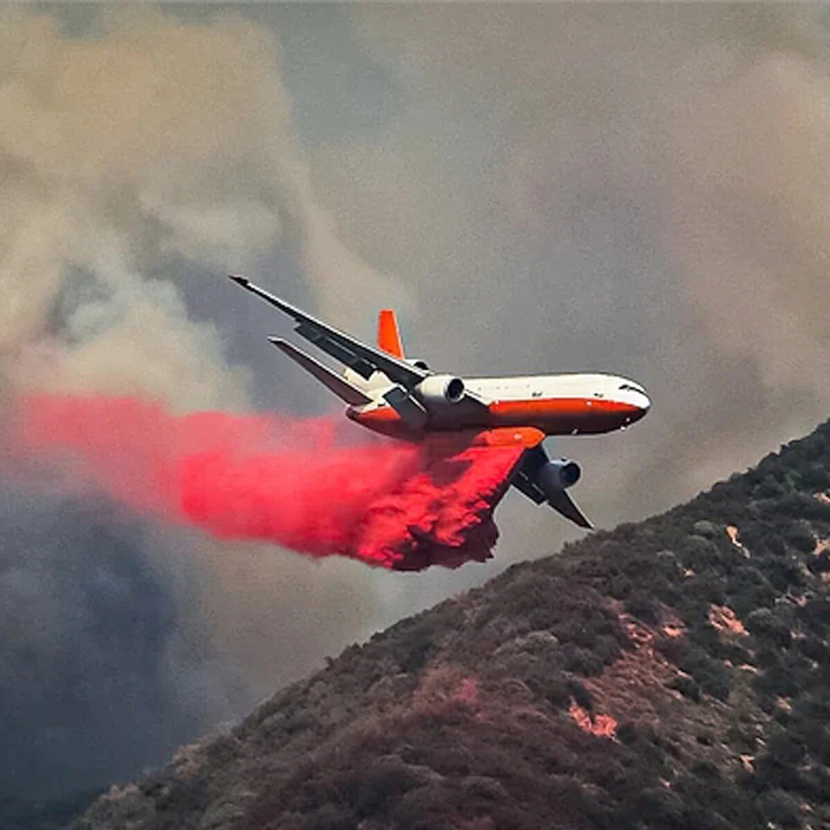
The Very Large Airtankers or the DC-10s with a 9000gal payload…or their nickname “VLAT” are not in California because CalFire’s current LAT contractors are keeping the lid on fire containment with the #CalFire fleet of small tankers…VLAT 910 and VLAT 914 are in Phoenix with the large fires in #AZ #azwildfire…VLAT 912 is in the Pacific Northwest on the tarmac in Washington…VLAT 911 is in Colorado Springs…they can be in the air in a moments notice. #avgeek #wildfire #dc10lovers
#calfire #az #azwildfire #avgeek #wildfire #dc10lovers
Geewhizpat · @Geewhizpat
806 followers · 2503 posts · Server newsie.social#DiamondFire Wildfire #azwx #azwildfire VLAT914 doing her job
#diamondfire #azwx #azwildfire