Chuixiang (Tree) Yi · @TreeYi
9 followers · 3936 posts · Server mastodon.worldRT @PythonMaps
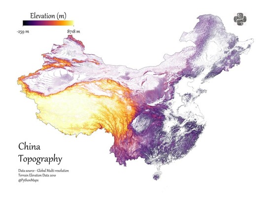
Contour line map of China. I used 50m contours and created the dataset with GDAL.
Comment and let me know which country I should make next! #DataScience #Datavisualization #Geography #China #Topography #ContourMap #Python
#datascience #datavisualization #geography #china #topography #contourmap #python
Chuixiang (Tree) Yi · @TreeYi
9 followers · 3344 posts · Server mastodon.worldRT @PythonMaps
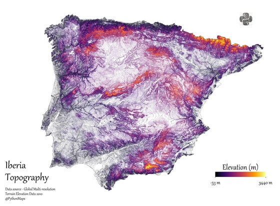
Contour line map of the Iberian Peninsula. I used 50m contours and created the dataset with GDAL.
Comment and let me know which country I should make next! #DataScience #Datavisualization #Geography #Spain #Portugal #Topography #ContourMap #Python
#datascience #datavisualization #geography #spain #portugal #topography #contourmap #python
Chuixiang (Tree) Yi · @TreeYi
9 followers · 2987 posts · Server mastodon.worldRT @PythonMaps
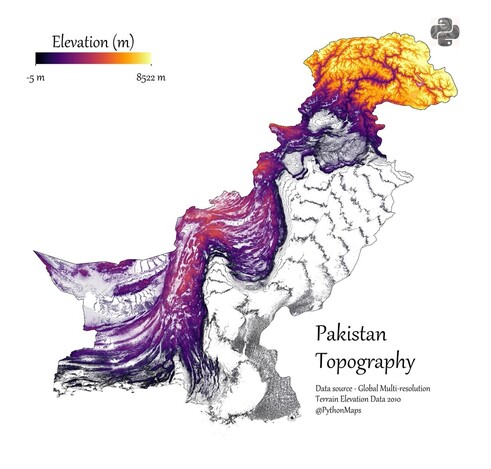
Contour line map of Pakistan. I used 50m contours and created the dataset with GDAL.
Comment and let me know which country I should make next! #DataScience #Datavisualization #Geography #Pakistan #Topography #ContourMap #Python
#datascience #datavisualization #geography #pakistan #topography #contourmap #python
bornach · @bornach
32 followers · 282 posts · Server vis.social@pentronik
SDF is a function with 2D or 3D input, so any resources on plotting contour maps of multivariable functions would be relevant
https://www.khanacademy.org/math/multivariable-calculus/thinking-about-multivariable-function/ways-to-represent-multivariable-functions/a/contour-maps
#khanacademy #contourmap #signeddistancefunction #genuary8


