
Joseph Elfelt · @mappingsupport
390 followers · 279 posts · Server m.ai6yr.org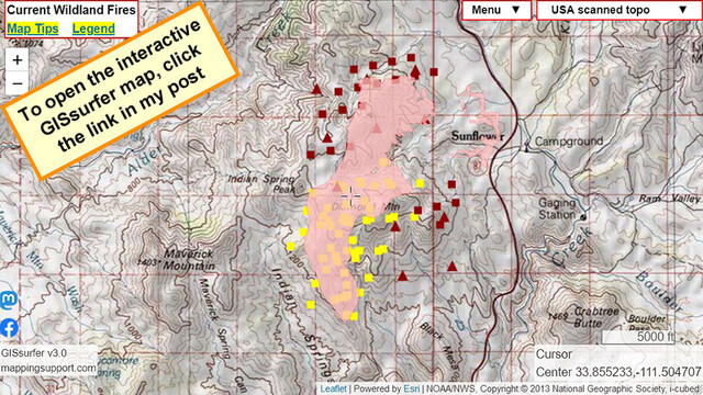
July 26 afternoon. Interactive #GIS map for #DiamondFire near Sunflower Arizona.
Dark red symbols are *heat* detection by MODIS and VIIRS satellites. This data is not real time, locations are only approximate and sometimes ‘false positive’.
To get the most benefit from the map see 2 links upper left corner.
Never rely on any map to ignore an order to evacuate.
#AZwx #AZfire #AZwildfire #Geospatial #Maps #Mapping #Leaflet #ArcGIS #WebMap
Open #GISsurfer map:
https://mappingsupport.com/p2/gissurfer.php?center=33.853521,-111.503162&zoom=13&basemap=USA_scanned_topo&overlay=VIIRS_7_day,MODIS_7_day,State_boundary,Fire_perimeter_NIFC&data=https://mappingsupport.com/p2/special_maps/disaster/USA_wildland_fire.txt
#gis #diamondfire #azwx #azfire #azwildfire #geospatial #maps #mapping #leaflet #arcgis #webmap #gissurfer

KF7CCC · @kf7ccc
91 followers · 223 posts · Server mastodon.radioA GO order for evacuation from the town of #SunflowerAZ has been ordered due to the #DiamondFire.
https://www.maricopa.gov/AlertCenter.aspx?AID=Sunflower-AZ-Wildfire-GO-EVACUATE-107

Geewhizpat · @Geewhizpat
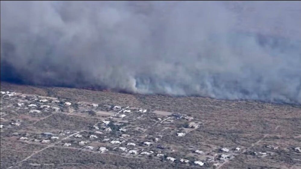
806 followers · 2503 posts · Server newsie.social#DiamondFire Wildfire #azwx #azwildfire VLAT914 doing her job
#diamondfire #azwx #azwildfire
Geewhizpat · @Geewhizpat
806 followers · 2502 posts · Server newsie.social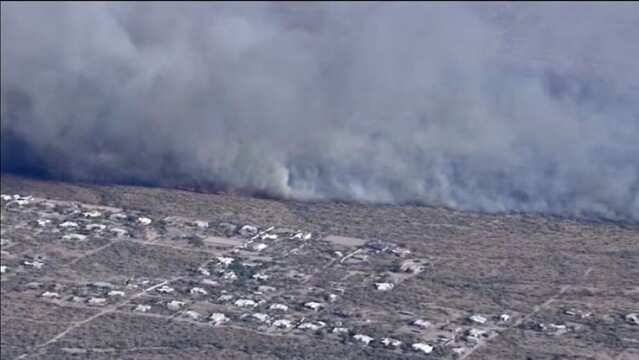
Arizona: Evacuation notices went out yesterday out near #Scottsdale for the #Diamond Fire.
Scottsdale Police have evacuated the areas west of 136th Street, south of Quail Track, and east of 144th Street.
#azfire #azwx #wildfire
10Tanker VLAT914 is also doing back to back missions on the #DiamondFire near #Phoenix. Aircraft Assisting.
1 AA, Lead Bravo 59.
Air Tankers 16, 164, 167, 914.
1 copter.
#scottsdale #diamond #azfire #azwx #wildfire #diamondfire #phoenix

AI6YR · @ai6yr
3858 followers · 22798 posts · Server m.ai6yr.orgNew account, and can't verify, but Rio Verde Foothills indeed is one of the #Arizona communities without water (because they refused to build water infrastructure). #DiamondFire (post saying there are "NO FIRE HYDRANTS AND IS STILL WITHOUT WATER") https://nitter.net/LeighHa19531434/status/1673873307752611840