
MiBaWi - Michael Barthel · @MiBaWi
288 followers · 804 posts · Server m.ai6yr.org
#Canada #BritishColumbia #Wildfires
#DonnieCreekFire
506,000 ha / 1,250,360 acres
Evacuation orders remain in place
West Kiskatinaw River Fire
25,000 ha / 61,800 acres
Evacuation orders lifted for Tumbler Ridge residents
📸 Canadian Press
#canada #BritishColumbia #wildfires #donniecreekfire
MiBaWi - Michael Barthel · @MiBaWi
288 followers · 803 posts · Server m.ai6yr.org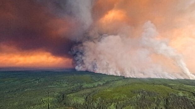
A key highway that connects #Yukon and northern #BC to the rest of the province is now threatened by the #DonnieCreekFire.
If the 4,875 km2 blaze [1,204,638.7346 acres] cuts the highway, residents north of Fort Nelson could face a more than 1,700-km detour
📸 BC Wildfire Service
Mark Ingalls :pdx_badge: · @ingalls
1308 followers · 4157 posts · Server pdx.social
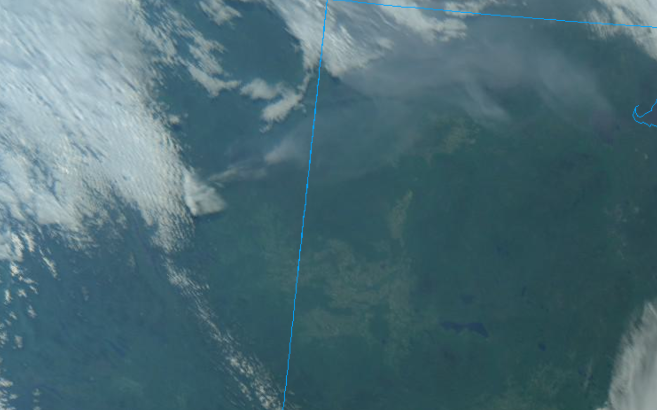
Satellite view of smoke from the #DonnieCreekFire north of Fort St. John in #BritishColumbia drifting east across the northern quarter of #Alberta Tuesday morning.
#donniecreekfire #britishcolumbia #alberta #BCStorm #abstorm #weather #fire

BC Info Bot · @bcinfo
414 followers · 28245 posts · Server mastodon.roitsystems.caGlobal News BC: All wildfire evacuation orders lifted for northeastern B.C. as rain continues https://globalnews.ca/news/9716696/wildfire-evacuation-orders-lifted/ #globalnews #britishcolumbia #news #PeaceRiverRegionalDistrict #RainfallWarnings #DonnieCreekfire #FortSt.John #BCWildfire #FortNelson #Disaster #Prairies #Weather #Fire
#globalnews #BritishColumbia #news #PeaceRiverRegionalDistrict #rainfallwarnings #donniecreekfire #FortSt #BCWildfire #FortNelson #disaster #prairies #Weather #fire