AkaSci 🛰️ · @AkaSci
1935 followers · 1880 posts · Server fosstodon.org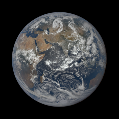
This is what Earth looks like from the Sun-Earth L1 Lagrange point, as seen by the NOAA DSCOVR satellite.
The Deep Space Climate Observatory (DSCOVR) satellite observes both the Sun and the Earth. It acts as an early warning system for solar magnetic storms.
Daily images at https://epic.gsfc.nasa.gov/?date=2023-08-30
#AdityaL1 #ISRO #DSCOVR
3/n

Daniel Fischer · @cosmos4u
1366 followers · 2303 posts · Server scicomm.xyz
Apart from a viral weather satellite video - see https://twitter.com/CIRA_CSU/status/1649124165843320832 or https://twitter.com/NOAASatellites/status/1649157234260344836 or https://twitter.com/NWSSeattle/status/1648920690790391809 - we now also have views of the #umbra of the Moon on #Earth during the April 20 #SolarEclipse from EPIC on the #DSCOVR satellite, taken from the direction of the #Sun at 3:39 and 5:27 UTC.
#sun #dscovr #solareclipse #earth #umbra

Prof. Simon Carn · @simoncarn
32 followers · 3 posts · Server mastodon.socialThe #EPIC instrument on @nasa/@NOAA's #DSCOVR spacecraft (1 million miles from Earth) has pioneered high-cadence UV observations of #volcanic SO₂ emissions from space. EPIC captured emissions from the #MaunaLoa #eruption on Nov 28-29, which injected SO₂ to a range of altitudes.
#epic #dscovr #volcanic #maunaloa #eruption
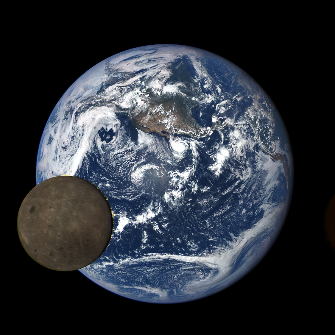
AkaSci · @AkaSci
541 followers · 267 posts · Server fosstodon.org
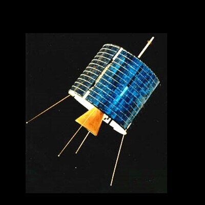
Yes, we do get images of the far side of the moon with the earth behind it, but they tend to be from farther away, like this image taken in 2015 by the NASA DSCOVR satellite, stationed at the sun-earth L1 Lagrange point at 1,475,207 km distance.
Source: https://epic.gsfc.nasa.gov/galleries/2015/lunar_transit
Further reading: https://en.wikipedia.org/wiki/Deep_Space_Climate_Observatory
#Artemis #Orion #NASA #DSCOVR
14/n

Spaceflight 🚀 · @spaceflight
383 followers · 132 posts · Server techhub.socialThis animation features #satellite images of the far side of the Moon as it crosses between the #DSCOVR #spacecraft's #telescope and the #Earth https://commons.wikimedia.org/wiki/File:Dscovrepicmoontransitfull.gif
What do you know about the #Moon ? https://en.wikipedia.org/wiki/Moon
Get a #3d #map with #Marble (#OpenSource) https://marble.kde.org/install.php
#satellite #dscovr #spacecraft #telescope #earth #moon #3d #map #marble #opensource

Marijke Louise · @MarijkeLouise
57 followers · 17 posts · Server mastodon.world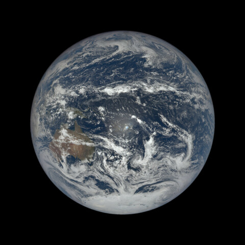
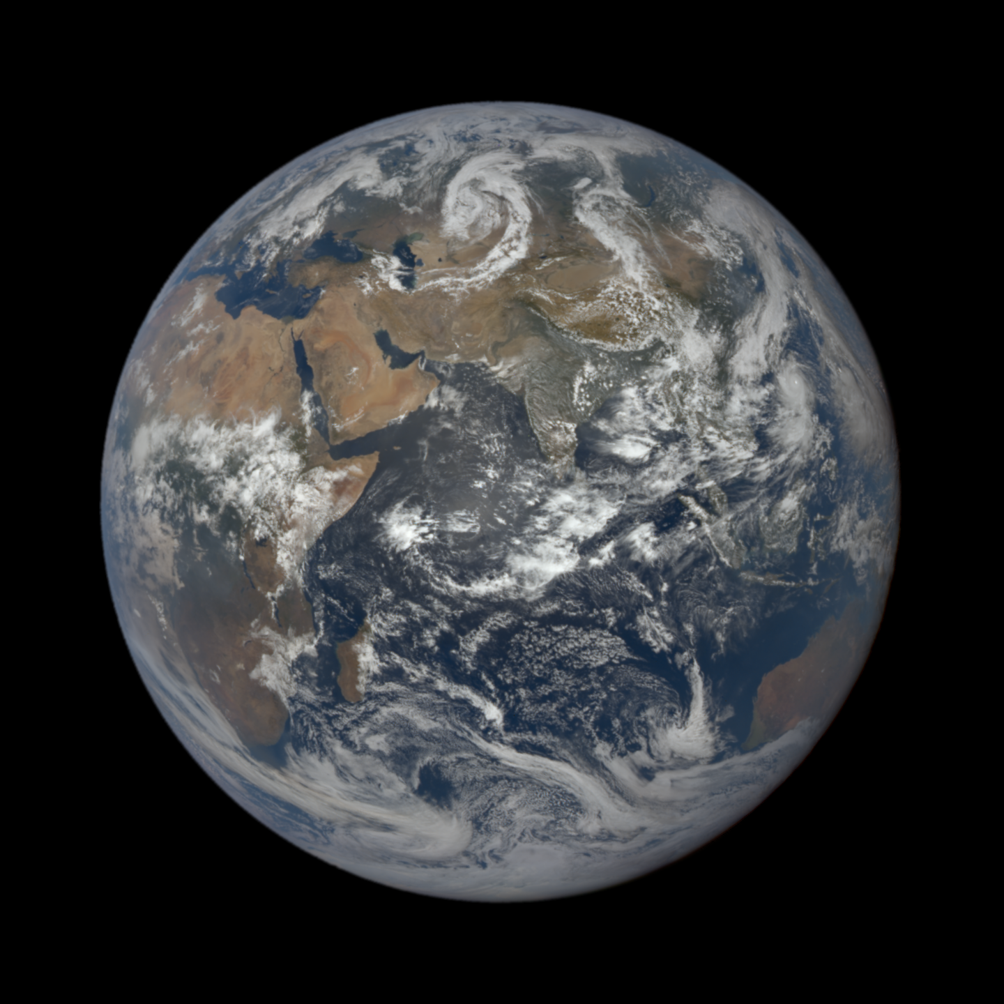
#DSCOVR is een Amerikaans ruimteweerstation dat op 1.5 miljoen km afstand van de aarde veranderingen in de zonnewind monitort, ruimteweerwaarschuwingen en voorspellingen geeft voor geomagnetische stormen die elektriciteitsnetten, satellieten, telecommunicatie, luchtvaart en GPS kunnen verstoren.
De EPIC-camera van het ruimtevaartuig maakt elke twee uur een nieuwe foto van de aarde.
Kijk maar eens op epic.gsfc.nasa.gov

sydnoise · @pl
403 followers · 11822 posts · Server mastodon.socialScott Manley, an astronomy Youtuber, created this amazing 1h 4k video of #DSCOVR images that are smoothed, interpolated and stabilized (DSCOVR rotates around a point)