Barbara Barclay · @bbarclay
41 followers · 148 posts · Server mastodon.ie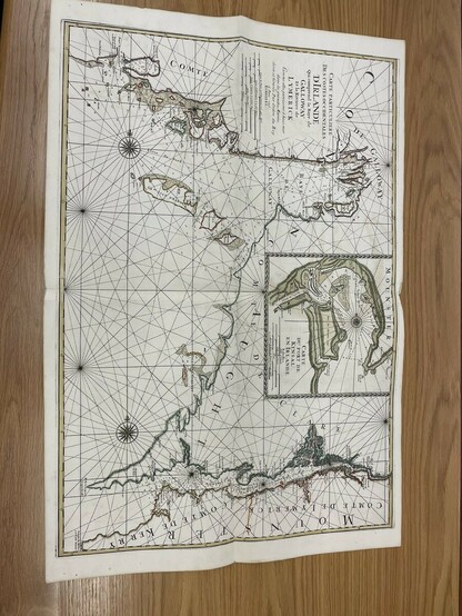
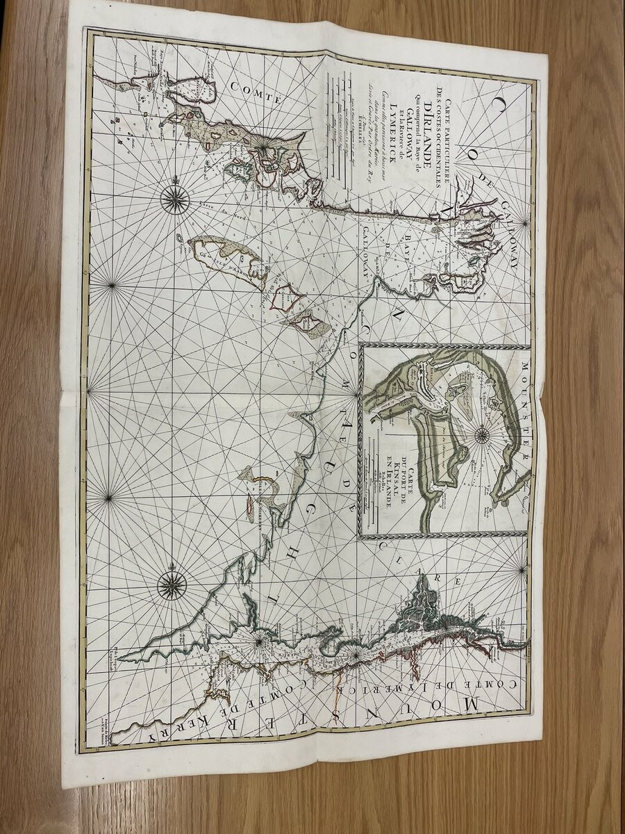
RT @UniOfGalwayASC@twitter.com
Love this Napoleonic map of Galway Bay, the Shannon estuary and Kinsale. There’s so much detail from where to anchor, where to stock up on wood and from the place names in Irish, English and French. Hours of fun!!! #EYAMapsPlans #ExploreYourArchive #CuardaighDoChartlann
🐦🔗: https://twitter.com/UniOfGalwayASC/status/1597123014549680131
#eyamapsplans #ExploreYourArchive #cuardaighdochartlann
kim_harding · @kim_harding
339 followers · 3889 posts · Server mastodon.scot
RT @nlsarchives@twitter.com
Robert Stevenson & Sons were engineers to the Northern Lighthouse Board. Their archive contains many maps and plans including this elevation of the Lismore Lighthouse at the entrance to Loch Linnhe. Explore more at https://maps.nls.uk/coasts/lighthouse/ #EYAMapsPlans #ExploreYourArchive
🐦🔗: https://twitter.com/nlsarchives/status/1597168277246996480
#exploreyourarchive #eyamapsplans
Barbara Barclay · @bbarclay
41 followers · 148 posts · Server mastodon.ie
RT @centralbank_ie@twitter.com
For #ExploreYourArchiveWeek, over the next nine days, we will showcase materials held in our archive starting with this lovely old map of Dublin. It's so fascinating to see how the city has changed over time! @ARAIreland@twitter.com @explorearchives@twitter.com #EYAMapsPlans https://www.centralbank.ie/about/central-bank-archive
🐦🔗: https://twitter.com/centralbank_ie/status/1597177537503072256
#exploreyourarchiveweek #eyamapsplans
Barbara Barclay · @bbarclay
41 followers · 148 posts · Server mastodon.ieReally enjoying the @ARAIreland@twitter.com @explorearchives@twitter.com #ExploreYourArchiveWeek hashtag today, so many gorgeous maps! #EYAMapsPlans
#exploreyourarchiveweek #eyamapsplans
Barbara Barclay · @bbarclay
41 followers · 148 posts · Server mastodon.ie
RT @centralbank_ie@twitter.com
For #ExploreYourArchiveWeek, over the next nine days, we will showcase materials held in our archive starting with this lovely old map of Dublin. It's so fascinating to see how the city has changed over time! @ARAIreland@twitter.com @explorearchives@twitter.com #EYAMapsPlans https://www.centralbank.ie/about/central-bank-archive
🐦🔗: https://twitter.com/centralbank_ie/status/1597177537503072256
#exploreyourarchiveweek #eyamapsplans
Barbara Barclay · @bbarclay
41 followers · 148 posts · Server mastodon.ie
RT @NARIreland@twitter.com
Continuing today's @explorearchives@twitter.com theme of #EYAMapsPlans, here's one of our #VO maps from 1846 featuring Dingle workhouse and burial ground. These were added by hand after the workhouse was opened in 1852 and show the effects of poverty in the area after the Famine. @ARAIreland@twitter.com
🐦🔗: https://twitter.com/NARIreland/status/1597259817688645632

the PRSD · @thePRSD
54 followers · 180 posts · Server mastodon.online
RT @devon_ex_inst
For day 1 of #ExploreYourArchive week we have Benjamin Donn's 'A map of the county of Devon, with the city and county of Exeter' (1765).
The Bideford-born maths teacher won £100 in a competition to produce the best county map, but spent £1,900 on the endeavor.
#eyamapsplans #exploreyourarchive

Ancestral Enquiries · @AncestralEnquiries
108 followers · 238 posts · Server toot.community
RT @wyorksarchives@twitter.com
We can (just!) fit a whole primary school class around our fabulous reproduction walk-on map of Wakefield in 1823. It’s great to be able to see what’s changed over the last 200 years and what hasn’t #ExploreYourArchive #HistoricMaps #WakefieldSchools #EYAMapsPlans
🐦🔗: https://twitter.com/wyorksarchives/status/1597168879582732288
#ExploreYourArchive #HistoricMaps #wakefieldschools #eyamapsplans

Kelly Cornwell · @Whoamiftr
104 followers · 87 posts · Server mastodon.world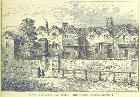
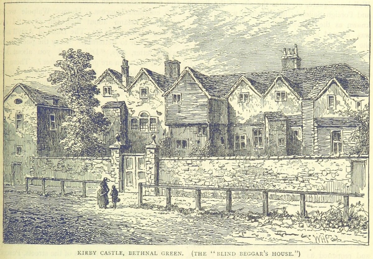
RT @LBTHArchives@twitter.com
Our beloved Bethnal Green Library turned 💯 last month! 🎂
Formerly a notorious private asylum named Bethnal House which stood on the site of a Tudor mansion, you can explore the building's fascinating history using our map collection #EYAMapsPlans #ExploreYourArchive 🔎 🗺️
🐦🔗: https://twitter.com/LBTHArchives/status/1597153479339933696
#eyamapsplans #ExploreYourArchive

Rob Fleming · @accesshistory
22 followers · 54 posts · Server zirk.us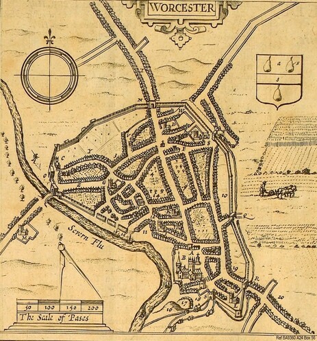
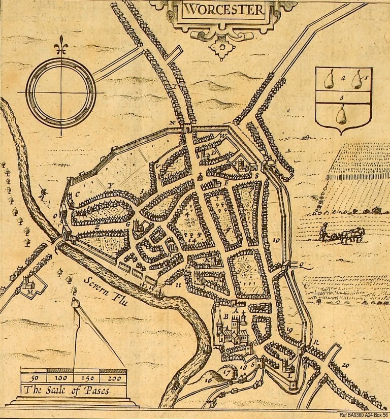
RT @ExploreThePast@twitter.com
Maps & plans are a superb resource which show what a place looked like in days gone by such as these C17th - C20th Worcester Maps. Using Maps & plans you can travel through time © WAAS Find out more: http://bit.ly/3TU0R4j #EYAMapsPlans #ExploreYourArchive
🐦🔗: https://twitter.com/ExploreThePast/status/1597138224304082945
#eyamapsplans #ExploreYourArchive