
GregCocks · @GregCocks
675 followers · 564 posts · Server techhub.social
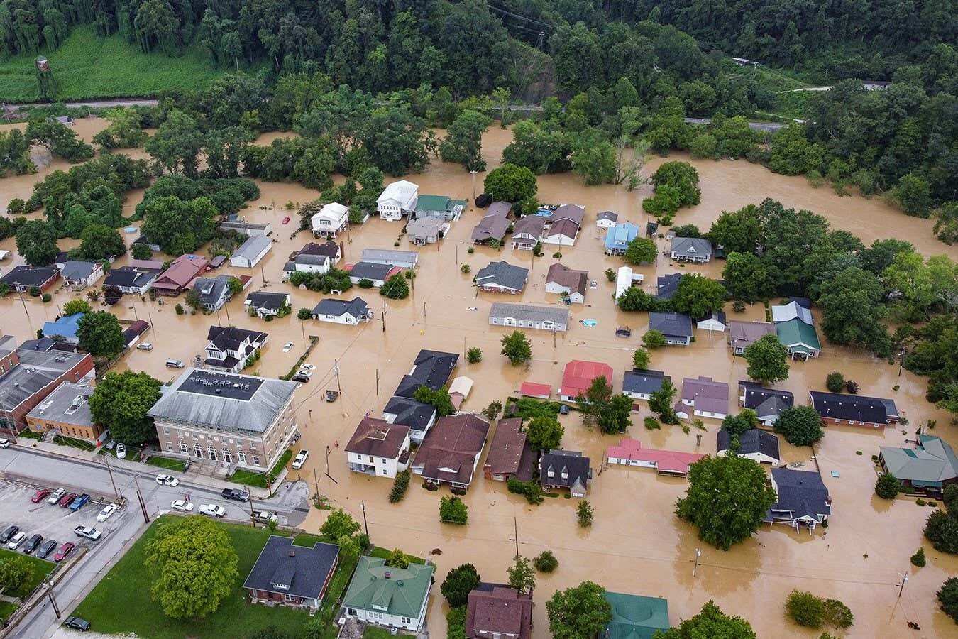
Flood Protection Based On Historical Records Is Flawed – We Need A Risk Model Fit For Climate Change
--
https://theconversation.com/flood-protection-based-on-historical-records-is-flawed-we-need-a-risk-model-fit-for-climate-change-212454 <-- shared technical article
--
#GIS #spatial #mapping #water #hydrospatial #hydrology #flood #flooding #model #modeling #planning #mitigation #naturalhazard #humanimpacts #climatechange #extremeweather #regulations #prediction #floodengineering #floodrisk #floodriskassessment #assessment #risk #hazard #riskassessment #floodmanagement #floodprotection #floodsafety #publicsafety #spatialanalysis #spatiotemporal #weatherforecast #climatechangesolutions #climateadaptation
#gis #spatial #mapping #water #hydrospatial #hydrology #flood #flooding #model #modeling #planning #mitigation #naturalhazard #humanimpacts #climatechange #extremeweather #regulations #prediction #floodengineering #floodrisk #floodriskassessment #assessment #risk #hazard #riskassessment #floodmanagement #floodprotection #floodsafety #publicsafety #spatialanalysis #spatiotemporal #WeatherForecast #climatechangesolutions #climateadaptation

Global Weather & EAS Society · @GWESOfficial
77 followers · 933 posts · Server masto.globaleas.org
Expect excessive rainfall and flash flooding in Champlain Valley and Northern Vermont today due to an intensifying weather system. Please avoid travel if possible, be alert for flood warnings, and prepare for potential evacuation. #FloodRisk #VTwx #SevereWeather #WPC #flashflood #wx #weather
#floodrisk #vtwx #severeweather #wpc #flashflood #wx #weather

Abby Crisostomo · @PlanAbby
50 followers · 42 posts · Server urbanists.socialAfter so long needing a strategic vision for #SuDS in London, things are coming together to make it happen. Now it's really important to find a chair with the focus and vision to lead it. https://apply-for-public-appointment.service.gov.uk/roles/7500?utm_campaign=13988834_LEDNet%20Update%2023%2F06%2F23&utm_medium=email&utm_source=London%20Councils&dm_t=0,0,0,0,0
#SuDS #London #sustainabledrainage #greeninfrastructure #surfacewater #floodrisk #waterquality
#suds #london #sustainabledrainage #greeninfrastructure #surfacewater #floodrisk #waterquality
Abby Crisostomo · @PlanAbby
50 followers · 41 posts · Server urbanists.socialA relatively well informed article about the Thames Estuary 2100 Plan Thames Estuary 2100! They do miss reasons for why the plan is adaptive & one can't/wouldn't want to just start building a new barrier right away. Also not enough emphasis on walls & embankments https://www.theguardian.com/environment/2023/jun/30/before-the-flood-how-much-longer-will-the-thames-barrier-protect-london
#flooding #floodrisk #thamesbarrier #london #tidalfloodrisk #climatechange #climateadaptation
#flooding #floodrisk #thamesbarrier #london #tidalfloodrisk #climatechange #climateadaptation

Hari Tulsidas :verified: · @haritulsidas
45 followers · 280 posts · Server masto.ai
Once-a-century extreme precipitation could occur every 30 years in the US by 2100, according to a new study. The researchers used climate models and historical data to project how the frequency and intensity of heavy rainfall events will change under different warming scenarios. The study warns that such events could pose serious risks for flooding, infrastructure damage, and public health, especially in urban areas.
#extremeprecipitation #climatechange #floodrisk

Andy @Revkin · @revkin
2005 followers · 1717 posts · Server mastodon.greenA potent report on #California's massive #floodrisk challenge (along with that pesky megadrought challenge). Just this.. "Most of the state’s more than 20,000 miles of flood banks and channels are operated by local governments, and many miles are on unregulated private land."
---
RT @DanielleVenton
Heads will explode when planners hear the recommendation, says @PPICNotes’s Jeffery Mount.
@ezraromero continues watching levee safety …
https://twitter.com/DanielleVenton/status/1653443890702336000
Andy @Revkin · @revkin
2002 followers · 1667 posts · Server mastodon.green
Such an important point about building mapping methods that are adaptive facing evolving data streams, science insights and community needs - @deepseadawn of course. Was *just* discussing #floodrisk data with @DrHultquist! Related #sustainwhat post: https://revkin.substack.com/p/study-finds-global-surge-of-flood-21-08-04
---
RT @deepseadawn
If new geospatial maps + tools are to help society forge a path toward #climateresilience, the m…
https://twitter.com/deepseadawn/status/1651269919525281792
#floodrisk #sustainwhat #climateresilience
GregCocks · @GregCocks
190 followers · 239 posts · Server techhub.social
The Timing Of Decreasing Coastal Flood Protection Due To Sea-Level Rise
--
https://www.nature.com/articles/s41558-023-01616-5 <-- shared paper
--
#GIS #spatial #mapping #infrastructure #future #project #planning #spatialanalysis #spatiotemporal #SLR #sealevelrise #coastal #coast #impacts #tide #gauges #climatechange #floodrisk #projection #coastalprotection #floodprotection #monitoring #vulnerability #model #modeling #IPCC #mitigation
#gis #spatial #mapping #infrastructure #future #project #planning #spatialanalysis #spatiotemporal #slr #sealevelrise #coastal #coast #impacts #tide #gauges #climatechange #floodrisk #projection #coastalprotection #floodprotection #monitoring #vulnerability #model #modeling #ipcc #mitigation

Ira Gershenhorn · @Iragersh
314 followers · 6050 posts · Server mstdn.social#Dams, #floodRisk, #seaLevelRise, highways and trains.
I want all the dams (all obsolete) on the #BronxRiver taken down.
Looking for motivation to get MetroNorth and various DOTs to pay and advocate dam removal, sediment testing, before and after monitoring, etc.
#bronxriver #sealevelrise #floodrisk #dams
Restore the Delta · @RestoreTheDelta
150 followers · 123 posts · Server mstdn.social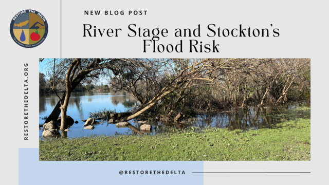
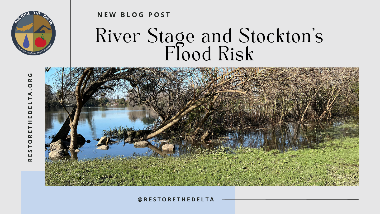
Check out Restore the Delta's latest blog post on River Stage and Stockton's #FloodRisk written by RTD's Community Organizer and Gov. Liaison Artie Valencia
#cawater #stockton
https://www.restorethedelta.org/2023/03/15/river-stage-and-stocktons-flood-risk/

Tim Gent · @tgent_fens
240 followers · 996 posts · Server mastodonapp.ukThe above sparked the thought that maybe there should be economic studies on impact of Fenland farmland being out of action. What would 25% of the Fens being unable to produce food mean for prices?
I asked ChatGPT - no firm answer but seems likely there are mean to estimate it! Full chat here, also a good example of the power of ChatGPT too https://docs.google.com/document/d/1zKEC0E3kv2hSQbkXtmJq05ILxaQJA91tEFzSunuij7E
#ChatGPT #FoodPrices #Floodrisk
#chatgpt #FoodPrices #floodrisk
Tim Gent · @tgent_fens
240 followers · 996 posts · Server mastodonapp.ukThis sparked the thought that maybe there should be economic studies on impact of Fenland farmland being out of action. What would 25% of the Fens being unable to produce food mean for prices?
I asked ChatGPT - no firm answer but seems likely there are mean to estimate it! Full chat here, also a good example of the power of ChatGPT too https://docs.google.com/document/d/1zKEC0E3kv2hSQbkXtmJq05ILxaQJA91tEFzSunuij7E
#ChatGPT #FoodPrices #Floodrisk
#chatgpt #FoodPrices #floodrisk

Brian Harrod · @BrianHarrod
253 followers · 148 posts · Server masthead.social
AXIOS: #ClimateChange means US #RealEstate is massively over valued... #OMG...Guess which state is overvalued by more than the next 5 states combined....
https://www.axios.com/2023/02/17/climate-change-real-estate-bubble
#WorldNews #News #USA #Florida #FloodRisk #RealEstateBubble #ExtreamWeather #FEMA #FloodZones #Insurance
#insurance #floodzones #fema #extreamweather #realestatebubble #floodrisk #florida #usa #news #worldnews #omg #realestate #climatechange

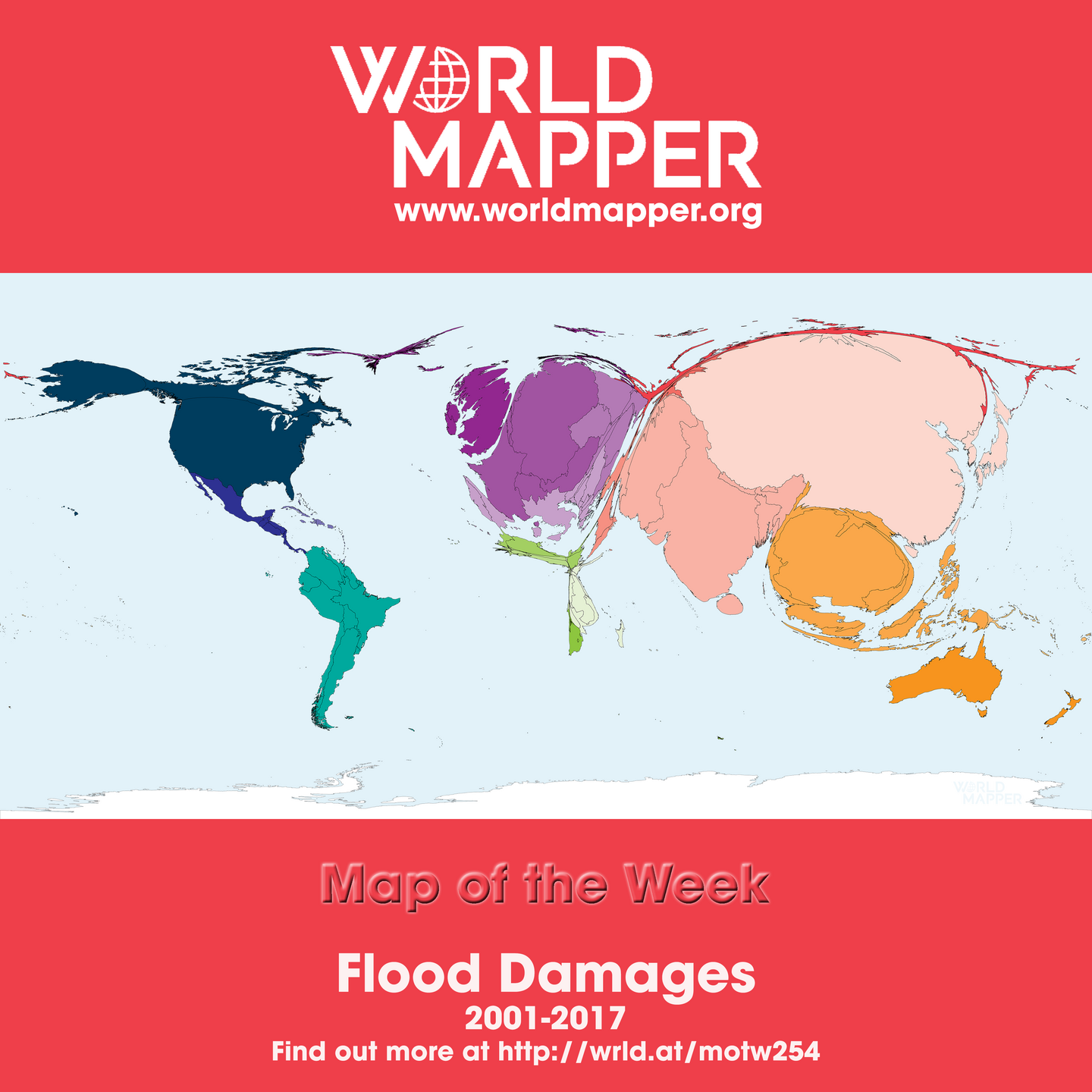
Worldmapper · @worldmapper
71 followers · 15 posts · Server mapstodon.space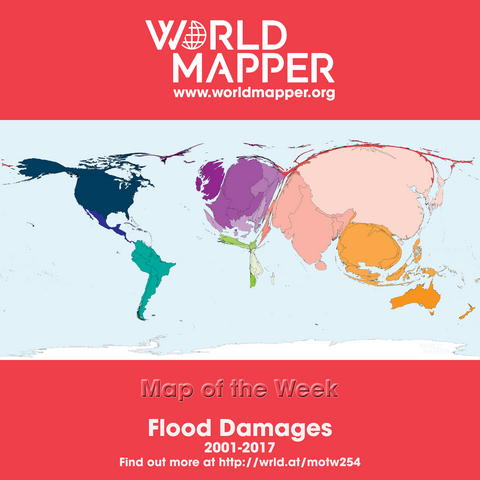
Map of the Week: Flood Damages - find out more at http://wrld.at/motw254 #maps #cartograms #cartography #worldmapper #motw #flood #naturalhazard #hazard #disaster #risk #floodrisk #damages #destruction #climatechange #globalwarming @geography
#maps #cartograms #cartography #worldmapper #motw #flood #naturalhazard #hazard #disaster #risk #floodrisk #damages #destruction #ClimateChange #globalwarming
Abby Crisostomo · @PlanAbby
40 followers · 21 posts · Server urbanists.socialBig seawalls cutting people off from the water? This same thing could happen in London if we don't get serious about delivering the Thames Estuary 2100 Plan now! It's not just about a new Thames Barrier. London still has a chance to design good waterfronts. But time is running out. https://buff.ly/3QFKx7h
#riverthames #tidalfloodrisk #floodrisk #seawalls #flooddefences #te2100plan #thamesbarrier #london
#riverthames #tidalfloodrisk #floodrisk #seawalls #flooddefences #te2100plan #thamesbarrier #london
Abby Crisostomo · @PlanAbby
29 followers · 8 posts · Server urbanists.socialNice video from the Thames Estuary 2100 team at the Environment Agency on tidal flood risk in London and the Thames Estuary. Features a few of the folks on the team I used to manage! https://youtu.be/SicYy_RZw0k
#floodrisk #climatechange #riverthames #thamesestuary #london
#floodrisk #climatechange #riverthames #thamesestuary #london

Maxim F · @mxf
37 followers · 28 posts · Server fosstodon.org
Assessing and Mitigating Ice-Jam #Flood Hazards and Risks: A European Perspective
https://www.mdpi.com/2073-4441/15/1/76
It would certainly be interesting to organize a similar workshop in #Canada, with a lot of work on-going in #icejam #modeling, both from a #floodhazard and #floodrisk perspective
#hydrology #hydraulic #floodmapping #winter #ice #river #risk #FHIMP #NRCan #ECCC
#flood #canada #icejam #modeling #floodhazard #floodrisk #hydrology #hydraulic #floodmapping #winter #ice #river #risk #fhimp #nrcan #eccc

EUinmyRegion🇪🇺 · @EUinmyRegion
13 followers · 1277 posts · Server respublicae.euRT @EUinmyRegion: In Croatia🇭🇷 an app is helping citizens to be better protected from natural disasters
Have a look at this fascinating project using #bigdata to better predict and manage #floodrisk for the security of the inhabitants
#SmartRegions #CohesionPolicy
cc @EK_Hrvatska
🐦🔗: https://nitter.eu/EUinmyRegion/status/1591020780862967809
#bigdata #floodrisk #SmartRegions #CohesionPolicy
EUinmyRegion🇪🇺 · @EUinmyRegion
13 followers · 1277 posts · Server respublicae.eu
In Croatia🇭🇷 an app is helping citizens to be better protected from natural disasters
Have a look at this fascinating project using #bigdata to better predict and manage #floodrisk for the security of the inhabitants
#SmartRegions #CohesionPolicy
cc @EK_Hrvatska
🐦🔗: https://nitter.eu/EUinmyRegion/status/1590641901841031168
#bigdata #floodrisk #SmartRegions #CohesionPolicy

maspiers · @maspiers
34 followers · 87 posts · Server mastodonapp.ukHi everyone
I'm a #drainage and #floodrisk engineer, working across the UK from a base in #Sheffield. Experienced in design, monitoring and modelling using #Autocad #Civil3d, #InfoWorks, #Microdrainage, #HECRAS, and #Excel. Old enough to do things by hand if necessary.
Active with the Sheaf & Porter Rivers Trust working to improve Sheffield's rivers.
Would rather be up a hill admiring the view.
#drainage #floodrisk #Sheffield #Autocad #Civil3d #InfoWorks #Microdrainage #HECRAS #Excel