
GregCocks · @GregCocks
612 followers · 555 posts · Server techhub.social
USGS Study Estimating A Monetary Value For Floodplain Ecosystem Services In The Chesapeake Bay And Delaware River Watersheds
--
https://www.usgs.gov/centers/chesapeake-bay-activities/science/floodplains-provide-millions-dollars-benefits-every-year <-- shared technical article
--
https://doi.org/10.1016/j.jenvman.2023.118747 <-- shared paper
--
#GIS #spatial #mapping #model #modeling #spatialanalysis #spatiotemporal #flood #flooding #floodinnundation #innundation #extremeweather #climatechange #watersheds #floodengineering #floodplains #nutrients #sediments #sedimentation #fluvial #soils #erosion #floodwaters #agriculture #farming #economics #accounting #mitigation #tradeoffs #management #landforms #geomorphology #ecosystems #publicsafety #communityhealth #appliedscience #water #hydrology #benefits #benefitstransfer #regulation #quantification #value #loss #lossanddamage #lossadjusting #Hazus #ChesapeakeBay #DelawareRiver
@usgs
#gis #spatial #mapping #model #modeling #spatialanalysis #spatiotemporal #flood #flooding #floodinnundation #innundation #extremeweather #climatechange #watersheds #floodengineering #floodplains #nutrients #sediments #sedimentation #fluvial #soils #erosion #floodwaters #agriculture #farming #economics #accounting #mitigation #tradeoffs #management #landforms #geomorphology #ecosystems #publicsafety #communityhealth #appliedscience #water #hydrology #benefits #benefitstransfer #regulation #quantification #value #loss #LossAndDamage #lossadjusting #hazus #ChesapeakeBay #delawareriver
GregCocks · @GregCocks
576 followers · 516 posts · Server techhub.social
The Impact Of Vegetation On Meandering Rivers
--
https://doi.org/10.1038/s43017-021-00249-6 <-- shared paper
--
#GIS #spatial #mapping #hydrology #river #meanders #anthropocene #vegetation #processmodeling #model #modeling #plants #trees #carboncycle #Palaeozoic #evolution #fluvial #fluvialgeomorphology #geomorphology #channel #channelisation #rivergeomorphology #impact #humanimpact #climatechange #climate #carbondioxide #anthropogenic #changes #biodiversity #aridification #dynamics #geology #soilscience #riverbanks #erosion #sedimentation #floodplain #urbanisation #deforestation #pollution #ancient #landscape #watershed #biogeochemistry #morphometry #geomorphometry
#gis #spatial #mapping #hydrology #river #meanders #anthropocene #vegetation #processmodeling #model #modeling #Plants #trees #carboncycle #palaeozoic #evolution #fluvial #fluvialgeomorphology #geomorphology #channel #channelisation #rivergeomorphology #impact #humanimpact #climatechange #climate #carbondioxide #anthropogenic #changes #biodiversity #aridification #Dynamics #geology #soilscience #riverbanks #erosion #sedimentation #floodplain #urbanisation #deforestation #pollution #ancient #landscape #Watershed #biogeochemistry #morphometry #geomorphometry
GregCocks · @GregCocks
258 followers · 346 posts · Server techhub.social
The Fluvial Geomorphology Equivalent Of ‘Ontogeny Recapitulates Phylogeny’?
--
https://www.usgs.gov/3d-elevation-program <-- USGS’s 3DEP’s open data for elevation
--
This is a ‘quick and dirty’ visualisation I made the other day with 3DEP iFSAR data to get a better sense of the fluvial geomorphology up in this area of NE Alaska near Kaktovik/Gordon, it is amazing what pops...
Lay over some hydrology vectors, some of the underlying geology boundaries, etc - and the landforms become much easier to understand in terms of origin and development - the geomorphic/hydrologic/erosional/geologic/vegetative/etc equivalent of biology's “ontogeny recapitulates phylogeny”?
#GIS #spatial #mapping #Alaska #USA #3DEP #opendata #elevation #iFSAR #remotesensing #radar #visualisation #fluvial #hydrology #geology #erosion #geomorphology #ontogeny #phylogeny #landforms #origin #development #vegetation #appliedscience
@USGS
#gis #spatial #mapping #alaska #USA #3dep #opendata #elevation #ifsar #remotesensing #radar #visualisation #fluvial #hydrology #geology #erosion #geomorphology #ontogeny #phylogeny #landforms #origin #development #vegetation #appliedscience
GregCocks · @GregCocks
253 followers · 339 posts · Server techhub.socialSimple but effective animation of a river as it meanders and erodes...
[source unknown]
https://www.usgs.gov/educational-resources/find-feature-meander
#GIS #spatial #mapping #gischat #river #erosion #meanders #riverine #animation #hydrology #water #visualisation #fluvial #sedimentation #model #modeling
#gis #spatial #mapping #gischat #river #erosion #meanders #riverine #animation #hydrology #water #visualisation #fluvial #sedimentation #model #modeling

Victor · @Victor
40 followers · 377 posts · Server spore.socialIn this article we describe the natural #hydrogeomorphological and #biogeochemical cycles of dryland #fluvial #ecosystems that make them unique, yet vulnerable to land use activities and #climatechange. We introduce Natural Infrastructure in Dryland Streams (NIDS), which are structures naturally or anthropogenically created from earth, wood, debris, or rock that can restore implicit function of these systems. #water https://www.sciencedirect.com/science/article/pii/S0048969722048379
#hydrogeomorphological #biogeochemical #fluvial #ecosystems #climatechange #water

Victor · @WWBugs
53 followers · 576 posts · Server mstdn.socialIn this article we describe the natural #hydrogeomorphological and #biogeochemical cycles of dryland #fluvial #ecosystems that make them unique, yet vulnerable to land use activities and #climatechange. We introduce Natural Infrastructure in Dryland Streams (NIDS), which are structures naturally or anthropogenically created from earth, wood, debris, or rock that can restore implicit function of these systems. #water https://www.sciencedirect.com/science/article/pii/S0048969722048379
#Water #ClimateChange #ecosystems #fluvial #biogeochemical #hydrogeomorphological
GregCocks · @GregCocks
190 followers · 241 posts · Server techhub.social
New Interactive Mosaic Uses NASA Imagery To Show Mars In Vivid Detail
--
https://murray-lab.caltech.edu/CTX/V01/SceneView/MurrayLabCTXmosaic.html <-- The Global CTX Mosaic of Mars online interactive map
--
https://www.jpl.nasa.gov/news/new-interactive-mosaic-uses-nasa-imagery-to-show-mars-in-vivid-detail <-- JPL press release
--
[since I am on a spatial Mars ‘kick’…]
#GIS #spatial #mapping #Mars #remotesensing #water #science #highresolution #RedPlanet #spaceprobe #survey #map #topography #modeling #compsite #elevation #opendata #openaccess #ReconnaissanceOrbiter #MRO #ContextCamera #CTX #HiRISE #MARCI #GlobalSurveyor #global #image #interactive #online #map #water #fluvial #hydrology #geologic #tectonics #vulcanism #geomorphology #visualization #visualisation
#CalTech #JPL #NASA
#gis #spatial #mapping #Mars #remotesensing #water #science #highresolution #redplanet #spaceprobe #survey #map #topography #modeling #compsite #elevation #opendata #openaccess #reconnaissanceorbiter #mro #contextcamera #ctx #hirise #marci #globalsurveyor #global #image #interactive #online #fluvial #hydrology #geologic #tectonics #vulcanism #geomorphology #visualization #visualisation #caltech #JPL #NASA
GregCocks · @GregCocks
190 followers · 238 posts · Server techhub.social
Sinuous Channels East Of Olympus Mons, Mars - Implications For Volcanic, Hydrological, And Tectonic Processes
--
https://doi.org/10.1016/j.icarus.2021.114798 <-- paper
-
"HIGHLIGHTS:
• [They] mapped channels and fossae within the volcanic plains east of Olympus Mons.
• Late Amazonian channels east of Olympus Mons formed by eruptions of lava or water.
• Fossae morphologies correspond to episodes of magmatic dike and sill emplacement.
• Loading of Olympus Mons may control magmatic ascent processes and eruption types..."
-
#GIS #spatial #mapping #volcanism #tectonics #Mars #surface #interior #geologicalprocesses #remotesensing #map #geology #extraterrestrial ##OlympusMons #volcanic #water #hydrology #hydrospatial #lava #fossae #morphology #geomorphology #magma #dike #sill #eruption #plains #traps #facies #map #survey #fluvial #bedrock #erosion #weathering #groundwater #surfacewater #regolith #lahar #meltwater #snow #ice #isostatic #HiRISE #CTX #imagery #chronostratigraphic #model #modeling #gischat
#gis #spatial #mapping #volcanism #tectonics #Mars #surface #interior #geologicalprocesses #remotesensing #map #geology #Extraterrestrial #olympusmons #volcanic #water #hydrology #hydrospatial #lava #fossae #Morphology #geomorphology #magma #dike #sill #eruption #plains #traps #facies #survey #fluvial #Bedrock #erosion #weathering #groundwater #surfacewater #regolith #lahar #meltwater #snow #ice #isostatic #hirise #ctx #imagery #chronostratigraphic #model #modeling #gischat

Dr Catherine Russell · @SeddyRocks
244 followers · 42 posts · Server mstdn.partyJoin us at the biggest internationally renowned #fluvial conference this summer in #Italy!😁🌍
Submit abstracts to our session "#Anthropocene #Rivers" on #anthropogenic modification & pollution of Earths rivers: https://icfs2023.it/s08
📢DEADLINE 20th Feb!
More info: http://bit.ly/3DSnaSW
#fluvial #italy #anthropocene #rivers #anthropogenic #icfs23
GregCocks · @GregCocks
21 followers · 44 posts · Server techhub.social
Long-Lived Lakes Reveal A History Of Water On Mars
--
https://phys.org/news/2022-12-long-lived-lakes-reveal-history-mars.html <-- article
--
https://doi.org/10.1029/2021JE007152 <-- shared paper
--
"... KEY POINTS
• A detailed local study of a system of seven previously unknown palaeolakes near the dichotomy in western Arabia Terra, Mars
• High resolution topographic data aids in identification and characterization of palaeolakes and regional hydrological history
• Evidence for a prolonged history of fluvial and lacustrine processes, with palaeolakes fed by groundwater and surface accumulation... "
#GIS #spatial #mapping #Mars #remotesensing #hydrology #paleolakes #lakes #lacustrine #imagery #elevation #DEM #height #basins #solarsystem #topography #geomorphology #spatialanalysis #groundwater #surfacewater #erosion #network #waterflow #flow #fluvial #lacustrine #delta #surfacefeatures #water #HiRISE #MOLAR #LiDAR
#gis #spatial #mapping #Mars #remotesensing #hydrology #paleolakes #lakes #lacustrine #imagery #elevation #dem #height #basins #solarsystem #topography #geomorphology #spatialanalysis #groundwater #surfacewater #erosion #network #waterflow #flow #fluvial #delta #surfacefeatures #water #hirise #molar #lidar

IPBES en français · @ipbesfr
168 followers · 242 posts · Server mas.toRT @Ecologie_Gouv@twitter.com
Le transport fluvial est un levier majeur pour décarboner le transport de marchandises. Il dispose d'atouts environnementaux et économiques.
@vnf_officiel@twitter.com lance une campagne de promotion du transport fluvial car une autre voie est possible.
#Fluvial #Transport @cbeaune@twitter.com
🐦🔗: https://twitter.com/Ecologie_Gouv/status/1597637412733296643

Dr. E.F. -Lalo- Guerrero · @tlalolinillotl
66 followers · 9 posts · Server mstdn.scienceThis is my #introduction :
I have a PhD in #geology from #OregonStateUniversity , my research interests are #TectonicGeomorphology and #QuaternaryStratigraphy, working with #fluvial deposits to interpret landscape evolution. I ❤️geoscience education.
Work- FT faculty at Portland CC.
Mexican-American. I am married and have 2 kids & 2 dogs. I love to ride bikes (#mtb #gravel #road). Music I ❤️ ranges from doom metal to cumbia. Buddhism makes sense to me.
I run @trailside_geology on IG.
#introduction #geology #OregonStateUniversity #tectonicgeomorphology #quaternarystratigraphy #fluvial #mtb #gravel #road
BCNscience · @BCNscience
34 followers · 5 posts · Server mastodont.cat
#Recerca
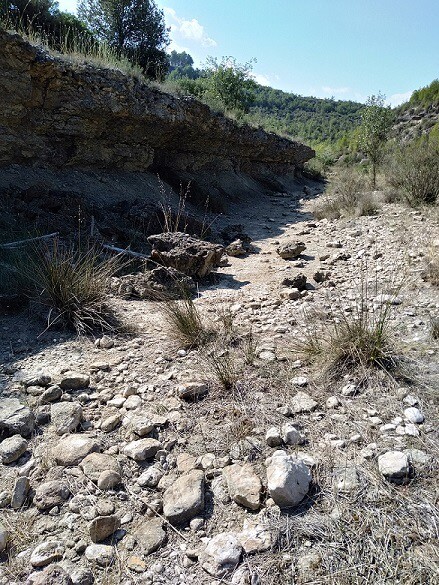
Més del 50 % de la xarxa #fluvial mundial està formada per rius temporals o intermitents. Aquests #rius presenten una alta variabilitat, tant espacial com temporal.
Un estudi liderat per investigadors de la #UniBarcelona ha identificat organismes com ara insectes o altres invertebrats aquàtics que podrien servir per avaluar l’impacte humà en la qualitat de les #aigües d’aquests rius.
https://www.ub.edu/web/ub/ca/menu_eines/noticies/2022/11/021.html
#recerca #fluvial #rius #UniBarcelona #aigues

