
Geewhizpat · @Geewhizpat
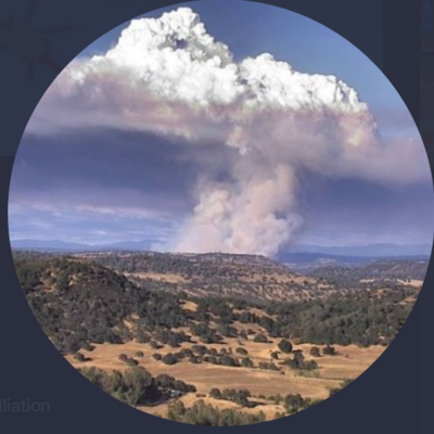
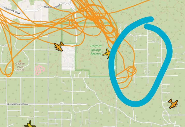
849 followers · 2602 posts · Server newsie.socialVia FirePhotoGirl: “I am calling it a day with the Gavilan Fire #perrisca #gavilanfire Check out this beautiful VLAT Drop!” Many kudos to her for this vid.
#wildfire #airtanker #avgeek
#perrisca #gavilanfire #wildfire #airtanker #avgeek
IntelEarth · @Intel_Earth
122 followers · 115 posts · Server m.ai6yr.orgFinal update for the night unless a number change occurs(acre, containment, evac order).
Calling it a night. Have a good day, be safe, and be kind all.
-IntelEarth
#RabbitFire
#GavilanFire
IntelEarth · @Intel_Earth
122 followers · 114 posts · Server m.ai6yr.org
IntelEarth · @Intel_Earth
122 followers · 114 posts · Server m.ai6yr.orgLast tankers being put on a load and hold for the #GavilanFire copters will continue working
Tankers released for the #RabbitFire copters working and the Helitankers will arrive soon

BakersRelay · @BakerRL75
771 followers · 30182 posts · Server m.ai6yr.org#EAS for Riverside: Evacuation Order East of Norbert, North of El Nido, West of Lee/San Jacinto, South of Gustin A care and reception center at Martin Luther King High School, 9301 Wood Road, Riverside, CA 92508. Large and small animals can be taken to the Riverside County Department of Animal Services shelter at 6851 Van Buren Blvd., Jurupa Valley, CA 92509 Source: Public Alert System** DO NOT RELY ON THIS FEED FOR LIFE SAFETY, SEEK OUT OFFICIAL SOURCES ***
IntelEarth · @Intel_Earth
122 followers · 112 posts · Server m.ai6yr.org

Joseph Elfelt · @mappingsupport
303 followers · 214 posts · Server m.ai6yr.org
July 15 6pm PDT. Interactive #GIS map.
Dark red symbols are latest MODIS/VIIRS satellite *heat* detection for #RabbitFire Riverside County, CA.
Red marker is general location of #GavilanFire. Too new to show up in the MODIS/VIIRS data.
Green symbol (clickable) near map center has some near real time weather data.
#CAfire #CAwx #CAwildfire #Geospatial #Maps #Mapping #Leaflet #ArcGIS #WebMap
Open #GISsurfer map:
https://mappingsupport.com/p2/gissurfer.php?center=33.850801,-117.191162&zoom=11&basemap=USA_basemap&overlay=State_boundary,MODIS_7_day,VIIRS_7_day,Forecast_discussion,Wind_temperature_and_more...&data=https://mappingsupport.com/p2/special_maps/disaster/USA_wildland_fire.txt||33.811674,-117.339477
#gis #rabbitfire #gavilanfire #cafire #cawx #cawildfire #geospatial #maps #mapping #leaflet #arcgis #webmap #gissurfer
Joseph Elfelt · @mappingsupport
303 followers · 214 posts · Server m.ai6yr.org@BakerRL75 That #GavilanFire evac map with grids - the grid identifiers are U.S. National Grid coordinates. First time I have seen that. USNG is the same as Military Grid Reference System (MGRS) except UNSG is written with spaces so it is easy to read.
BakersRelay · @BakerRL75
770 followers · 30130 posts · Server m.ai6yr.org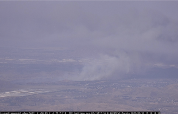
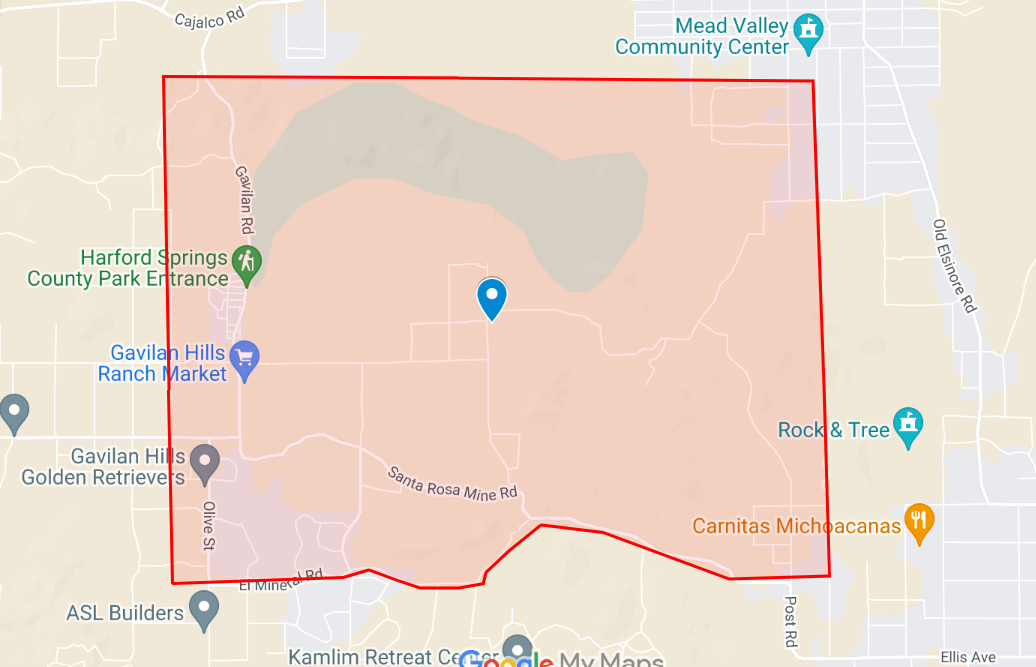
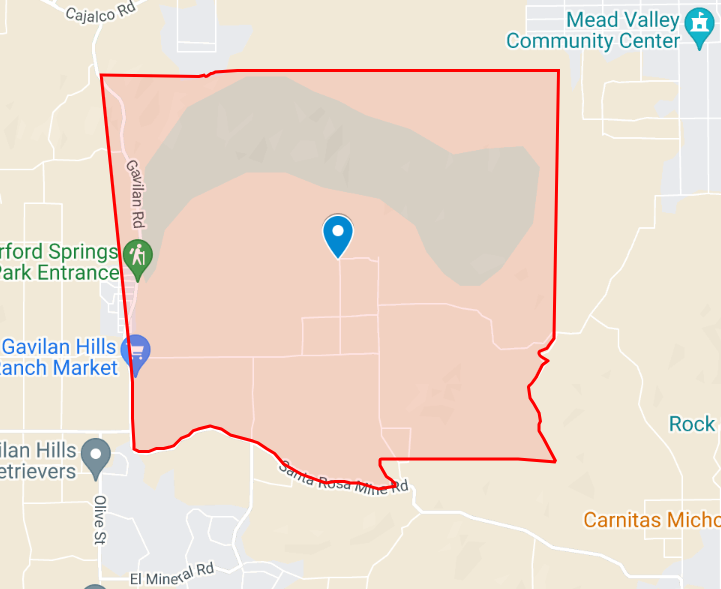
#GavilanFire Gavilan Rd & Multiview Rd, Southwest of Mead Valley - https://share.watchduty.org/i/6798
Liam WinsteadJul 15, 8:19 PM
Fire is impacting Idaleona Rd and Gold Valley Rd. Resources transitioning to structure defense. Fire was last mapped at 136 acres at 4:56PM. Updated perimeter map available at https://bit.ly/gavilanfire
IntelEarth · @Intel_Earth
120 followers · 111 posts · Server m.ai6yr.org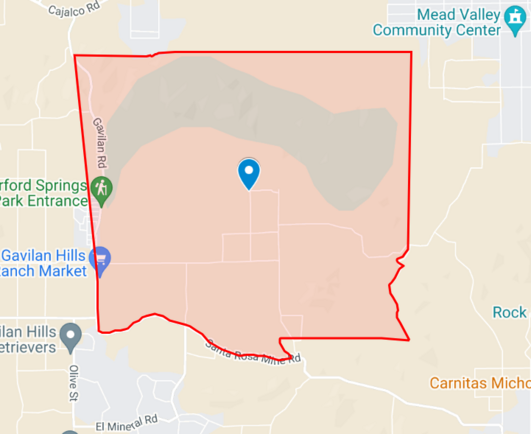
IntelEarth · @Intel_Earth
120 followers · 109 posts · Server m.ai6yr.org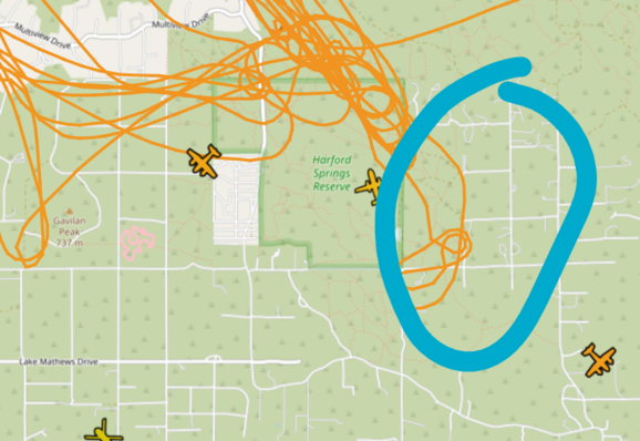
Major impact on gold valley road(area in blue), transitioning to structure defense
#GavilanFire
BakersRelay · @BakerRL75
770 followers · 30126 posts · Server m.ai6yr.org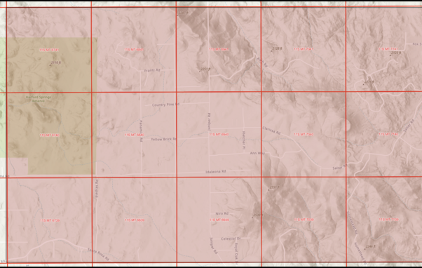
#GavilanFire @ Gavilan Rd & Multiview Rd, Southwest of Mead Valley - #GavilanFire https://share.watchduty.org/i/6798
Liam Winstead - Jul 15, 8:09 PM
Evacuation order requested for grids 6741 6841 6941 7041 7040 6940 6840 6740 7039 6939 6839 6739. Please see map above. 1 very large air tanker (VLAT) and lead plane requested.
NOTE: am asking for a grid link - BR
Joseph Elfelt · @mappingsupport
303 followers · 214 posts · Server m.ai6yr.org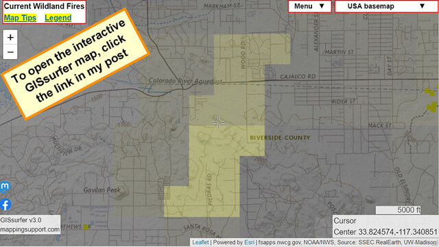
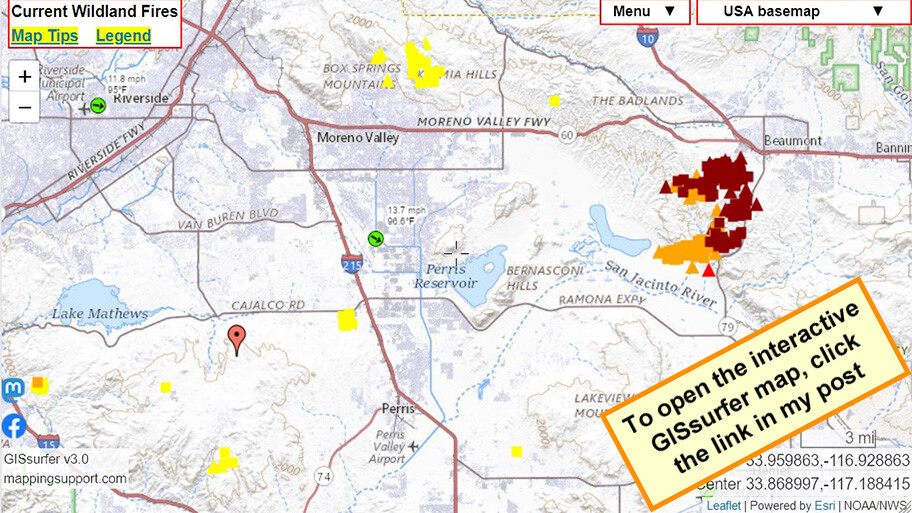
July 15, 5pm. Interactive #GIS map shows *heat* detection by GOES satellite (yellow squares) for #GavilanFire Riverside County, CA. Other colors show older fires.
Some heat detections are likely smoke in the air but not fire on the ground. But with that said, never rely on any map to ignore an order to evacuate.
Please read the “Map tips” link in upper left corner. #CAwx #CAfire #wildfire #Geospatial #Maps #Mapping #Leaflet #ArcGIS #WebMap
Open #GISsurfer map:
https://mappingsupport.com/p2/gissurfer.php?center=33.814306,-117.345314&zoom=13&basemap=USA_basemap&overlay=VIIRS_7_day,MODIS_7_day,State_boundary,Wildland_fire_name,GOES_west_fire_enhanced,Historic_perimeters&data=https://mappingsupport.com/p2/special_maps/disaster/USA_wildland_fire.txt
#gis #gavilanfire #cawx #cafire #Wildfire #geospatial #maps #mapping #leaflet #arcgis #webmap #gissurfer
IntelEarth · @Intel_Earth
120 followers · 109 posts · Server m.ai6yr.org#GavilanFire AA requesting the VLAT and and getting a fill for the 2nd LAT. TNKR101 from Santa Maria. Evac orders have been issued, working on getting a map
BakersRelay · @BakerRL75
770 followers · 30103 posts · Server m.ai6yr.org#GavilanFire #FireWx
Gavilan Rd & Multiview Rd, Southwest of Mead Valley - #GavilanFire https://share.watchduty.org/i/6798
Liam Winstead Jul 15, 7:44 PM
10 additional engines and 1 additional large air tanker (LAT) requested
Fire is 61 acres and burning in the Harford Springs Reserve. Potential for extended attack. Will make an impact to the southeast to the homes east of park. Evacuation warnings for Idaleona Rd, Yellow Brick Rd, Juniper Rd, Country Pine Rd. https://bit.ly/gavilanfire