
AI6YR · @ai6yr
4815 followers · 33316 posts · Server m.ai6yr.org
Via @pierre_markuse: Look at this super-interesting and well-written fifth part of the Gentle Introduction to #GDAL series by @rsimmon, this time dealing with shaded relief. #remotesensing #gis #dataviz #cartography #remotesensing https://medium.com/@robsimmon/a-gentle-introduction-to-gdal-part-5-shaded-relief-ec29601db654
#gdal #remotesensing #gis #dataviz #cartography

Michael Sumner · @mdsumner
422 followers · 3418 posts · Server fosstodon.orgok I'm pretty convinced that #GDAL's MDIM arraySpecs is not being parsed correctly by the gdalmdimtranslate_lib, but it is working when the spec is called by GetView() in cpp or python
finding examples is tough!! it's teaching me numpy indexing too
Michael Sumner · @mdsumner
410 followers · 3277 posts · Server fosstodon.orgwow just took a stab in the dark on #GDAL (>=3.7.0) and tried
vrt://<dsn>?ovr=-1
in the hope that it means "native data level, ignore all overviews" - and, it does!
Michael Sumner · @mdsumner
411 followers · 3246 posts · Server fosstodon.org#gdal to the rescue, use SHAPE-ZIP if the server supports, still can't unpick the curve thing easily without more C++
ftw: "geoserver/wfs?OUTPUT_FORMAT=SHAPE-ZIP"
Michael Sumner · @mdsumner
403 followers · 3141 posts · Server fosstodon.orgmany data #spatial providers don't even know about the benefits of well structured GeoTIFF (let alone the buzz of COG, STAC, Zarr, etc)
I reach out to providers, but more often than not there's just another individual there scratching head at my crazy email (who even reads bathymetry on the fly from a url, nuts right...)
at institution I can try collectively to feedback, but the #python and #rstats and #gdal communities could join forces here - is there something in the #xarray zone?
#spatial #python #rstats #gdal #xarray

Bill · @bil
635 followers · 564 posts · Server vis.socialI had a bit of fun cramming moderately-complicated spatial SQL into the "-sql" parameter of ogr2ogr. Now you can have fun with it too!
https://billmorris.io/shoals/posts/2023-08-17_land-tiles/ #mapping #sql #gdal #tiles

Mike Mahoney · @MikeMahoney218
758 followers · 852 posts · Server fosstodon.orgHas anyone had any luck using #GDAL 's SAFE driver to download Sentinel-1 from Planetary Computer STAC endpoints? When I try `gdalinfo -if SAFE /vsicurl/<some_url>` I get "not recognized as a supported file format" -- is there a correct way to do this?
I'm suspecting the authentication junk at the end of Planetary Computer URLs is causing issues.

JensWiesehahn · @JensWiesehahn
281 followers · 178 posts · Server fosstodon.orgWith #gdal, is there a way to resample a raster to a coarser grid by aggregating to arbitrary quantiles?
In `gdalwarp` there is the first an third quartile implemented as resampling method, but how to calculate the 95th percentile?
It seems to be possible with #grass `r.resamp.stats` so my guess is there is some way with gdal too.
Michael Sumner · @mdsumner
402 followers · 3023 posts · Server fosstodon.orggee I just figured out external overviews in #GDAL ... it's so easy! You make a COG with the lower resolution overviews and call it "original_file.fmt.ovr" and stick it next to the "original_file.fmt" (can be original.vrt for any other source) - I'm sure there's more to it but this alone is amazing and opens up so much
Michael Sumner · @mdsumner
402 followers · 3023 posts · Server fosstodon.org
Michael Sumner · @mdsumner
400 followers · 2997 posts · Server fosstodon.org
this repo runs a regular github actions #gha #rstats task to update with latest data, it's pretty rough but represents a lot of consolidated learnings for me
it gets some recent spatial data using #GDAL (sea ice concentration, and research vessel location) and makes a map, it's fairly simple so might be of interest if you're keen to get github actions doing work :)
https://github.com/mdsumner/seaice.map
thanks to @mattcowgill for help with gha 👌
Michael Sumner · @mdsumner
400 followers · 2985 posts · Server fosstodon.orgit is *so good* to be able to load gdal_translate args onto a dsn with vrt:// string, amazing - it just kicked in for me, I can add "scale" without that intermediate VRT file step #GDAL v3.7.0
Michael Sumner · @mdsumner
398 followers · 2920 posts · Server fosstodon.orgprobably the single best resource for #GDAL techniques and code examples is the autotest suite:
https://github.com/rouault/gdal/tree/master/autotest
it's all in Python but it's not *about Python*, it's about GDAL and all the superpower flexible and efficient facilities it has
takes a bit of orientation to understand what's in there and how to explore, but it's worth it 👌
Michael Sumner · @mdsumner
391 followers · 2715 posts · Server fosstodon.orgoh free hot tip TIL you can #GDAL vector VRT to reproject any source... something I've been trying to learn to do in cpp 😅 so much easier to wrap a little vrt text and hit that for queries #rstats
shove your source and crs in that text and hit with favourite gdal tool
https://gdal.org/drivers/vector/vrt.html#example-reprojected-layer
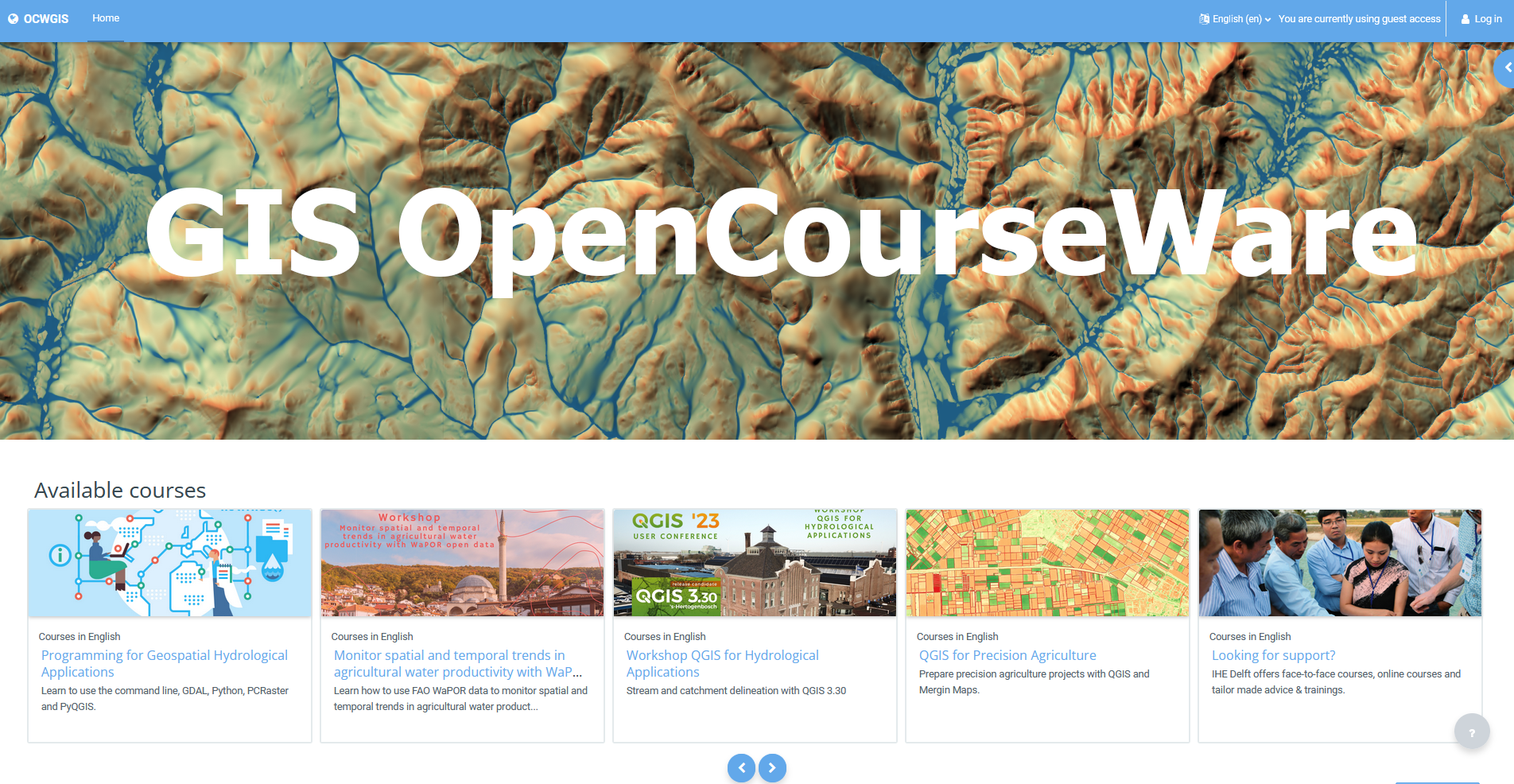
GIS OpenCourseWare · @gisocw
36 followers · 12 posts · Server fosstodon.org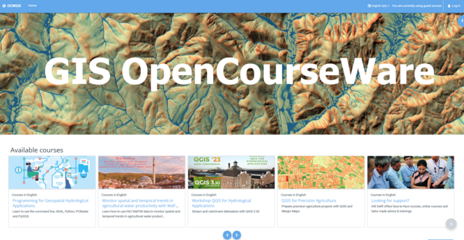
This week @hansakwast is teaching #GroundwatCh #ErasmusMundus MSc students the course Programming for Geospatial Hydrological Applications at @ihedelft. You can follow along for free at GIS OpenCourseWare! #GDAL #CLI #Python #PCRaster #PyQGIS https://courses.gisopencourseware.org/
#groundwatch #ErasmusMundus #gdal #cli #python #PCRaster #PyQGIS

Rafagas Links · @rafagaslinks
145 followers · 494 posts · Server en.osm.town"Mastering GDAL Tools" provides complete course materials for an introduction to GDAL and OGR command-line programs to create workflows for processing raster and vector data and organizing spatial ETL pipelines #gdal

GregCocks · @GregCocks
388 followers · 412 posts · Server techhub.socialPacific Crest Trail Viewshed [animation]
--
https://youtu.be/tmY27ZIVfpA <-- shared video
--
H/T Doug Newcombe
“This animation is a viewshed of the Pacific Crest Trail. A viewshed shows all surrounding terrain that is visible from a given point on the trail. The viewshed is taken at 1/10 of a mile increments. Visible terrain is light colored, invisible terrain is darker. Views are without regard for vegetation or tree cover…”
“The following viewsheds were created with GDAL, one tif for every tenth
of a mile along the 2,650 mile Pacific Crest Trail. Stitched together
with ffmpeg..”
#GIS #spatial #mapping #viewsheds #spatialanalysis #3D #elevation #Pacific #PNW #PacificCrestTrail #DEM #GDAL #ffmpeg #viewshed #animation #hiking #trail
#gis #spatial #mapping #viewsheds #spatialanalysis #3d #elevation #pacific #pnw #pacificcresttrail #dem #gdal #ffmpeg #viewshed #animation #hiking #trail
· @cartocalypse
609 followers · 634 posts · Server norden.social
Micha Silver · @Micha_Silver
57 followers · 29 posts · Server fosstodon.org
Joana Simoes · @doublebyte
183 followers · 188 posts · Server noc.socialI feel like this was a really productive code sprint, with lots of issues created in #gdal #qgis and #pygeoapi. There were some great discussions, and even some live coding 😀 Thanks to everyone who showed up online, and in-person! 👋 Hope to see you all soon! #CODESPRINT21 #OGCAPI #OGC #standards @gdal @pygeoapi @qgis
#standards #OGC #OGCAPI #codesprint21 #pygeoapi #qgis #gdal