Helen Metcalfe (she/her) · @hmetcalfe
205 followers · 65 posts · Server ecoevo.socialWhy does spatial data manipulation have to take so long...reprojecting a 5m raster of the whole of Great Britain surely can't cause too much trouble 🙈
#SpatialStatistics #rspatial #geocomputation #rstats
jebyrnes · @jebyrnes
929 followers · 983 posts · Server ecoevo.socialRT @rstatsvideo
📺 New #rstatsvideo: Geocomputation w R: Introduction (geocompr01 1)
▶ R4DS Online Learning Community (@R4DScommunity)
🗣 🇬🇧
#rstats #geocomputation
🔗 https://www.youtube.com/watch?v=lDl4pcanH-w
#rstatsvideo #rstats #geocomputation
Helen Metcalfe (she/her) · @hmetcalfe
190 followers · 39 posts · Server ecoevo.socialBeen struggling with an #RSpatial problem today, wondering if anyone here has any insights:
I want to find the nearest polygon to a point excluding the polygon that contains the point.
Been working with st_nearest_feature and excluding the containing poly from the dataset but wondering if there is a better way as I have a lot of points... Also struggling to work with sf and purrr together but that's another question!
#rspatial #rstats #geocomputation #sf #purrr
Robin Lovelace · @robinlovelace
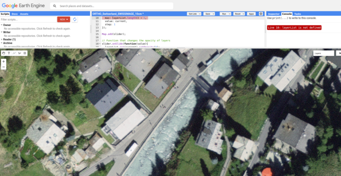
854 followers · 221 posts · Server fosstodon.orgMassive credit to the people in Switzerland who made this aerial imagery open access and freely available to all for research, innovation + more 🚀 See it on Google Earth Engine at https://developers.google.com/earth-engine/datasets/catalog/ORTHO_Switzerland_SWISSIMAGE_10cm #gis #geocomputation #map
Robin Lovelace · @robinlovelace
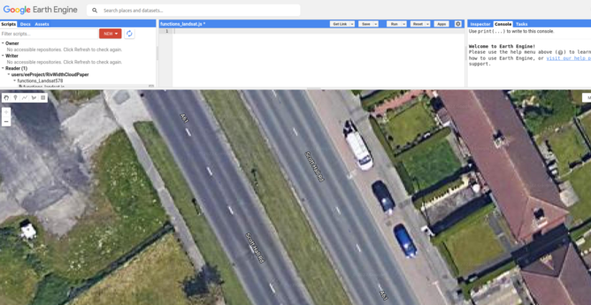
852 followers · 214 posts · Server fosstodon.orgAerial/satellite imagery from Google and other providers is now good enough to allow estimation of road widths. Anyone with Google Earth Engine experience up for helping to figure our how? Existing codebase for rivers: https://github.com/seanyx/RivWidthCloudPaper #geo #geocomputation #geocompx
#geo #geocomputation #geocompx
Joe Kopera · @geojoek
4 followers · 3 posts · Server mapstodon.spaceCheck out our great #GIS courses at UMass Amherst: https://sites.google.com/umass.edu/umass-gist/
Winter `23:
NRC 585 / DACSS 697B - Intro to GIS
Spring `23:
GEOG 693S - #Spatial Decision Making & Support
GEOG 693W - #WebGIS
GEOG 697A - #Geocomputation
ECO 697K - #Python for #ArcGIS
GEOG 668 - GIS and Spatial Analysis
ECO 653 - Applications in Uncrewed Aerial Systems (#UAS)
GEOG 560 - #Geomorphology
GEOG 592M - Computer Mapping
NRC 585 - Intro to GIS
#GIS #spatial #WebGIS #geocomputation #python #arcgis #uas #geomorphology
· @vam103
6 followers · 267 posts · Server mathstodon.xyzRT @rmarkdown@twitter.com
"Geocomputation with R, a book on geographic data analysis, visualization and modeling." -- by @robinlovelace@twitter.com https://geocompr.robinlovelace.net/ #rstast #bookdown #rmarkdown #geocomputation
🐦🔗: https://twitter.com/rmarkdown/status/1576901021896671235
#geocomputation #rmarkdown #bookdown #rstast


