Alex Kmoch · @allixender
12 followers · 11 posts · Server fosstodon.orgUniversity of #Tartu Department of #geography kicking of the new #academic year with lots of great news, new awesome colleagues and #phd students, #BSc and #MSc curricula, including our #Erasmus+ MSc in #geoinformation science and #earthobservation for environmental modelling and management and Geoinformatics for Urbanised Society- Head uut akadeemiline aastat 🎓🌍
#tartu #geography #academic #phd #bsc #msc #erasmus #geoinformation #earthobservation

Michael Nagenborg (he/him) · @mnagenborg
135 followers · 45 posts · Server social.edu.nlMy collaborators at #ITC are hiring: #AssistantProfessor #AI for accesssible and responsible #geoinformation . For more details: https://utwentecareers.nl/en/vacancies/1380/assistant-professor-artificial-intelligence-for-accessible-and-responsible-geo-information/
#itc #assistantprofessor #ai #geoinformation

ILS · @ilsforschung
100 followers · 79 posts · Server wisskomm.social
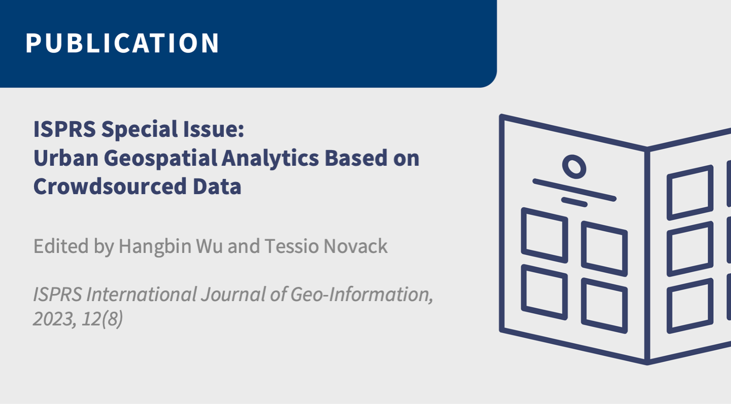
Dr. Tessio Novack, Leiter des Bereichs Geoinformation und Monitoring (ILS), hat gemeinsam mit Dr. Hangbin Wu ein Special Issue zum Thema „Städtische #Geodatenanalyse auf der Grundlage von Crowdsourced Data“ verantwortet.
Dr. Tessio Novack, Head of #Geoinformation and #Monitoring (ILS), co-authored a Special Issue with Dr. Hangbin Wu on "Urban Geospatial Analysis Based on Crowdsourced Data." ➡️ https://t1p.de/i2fff
#geodatenanalyse #geoinformation #monitoring

UNIGIS Salzburg · @unigis_salzburg
21 followers · 23 posts · Server fosstodon.org
Join the free @unigis_salzburg info-webinar, online. We inform you about our #distancelearning programs for #Geoinformatics 💻
Study fully online at the University of Salzburg. 🎓
Register now:
https://attendee.gotowebinar.com/register/5540351564430553685?source=Mastodon
#gis #gisstudy #giscertificate #onlinestudy #fernstudium #unisalzburg #geomatik #geoinformation #gisonlinestudy #unigis
#distancelearning #geoinformatics #gis #gisstudy #giscertificate #onlinestudy #Fernstudium #unisalzburg #geomatik #geoinformation #gisonlinestudy #unigis

Bundesverband Smart City e.V. · @BVSC
22 followers · 50 posts · Server smartcity.social
Der Wasserstands-#Sensor der Uni #Bonn „ist etwa so groß wie ein kleines Smartphone; dennoch hat es genug Leistung, um aus den Rohdaten den #Wasserstand berechnen zu können“, betont Prof. Dr. Kristine Larson vom Institut für #Geodäsie und #Geoinformation.
„Die von uns geschriebene Software ist #OpenSource“, erläutert Larson. „Sie kann also von jedem ohne Gebühren genutzt werden.“
#Hochwasser #Flutkatastrophe #Warnsystem #Dürre #Resilienz #IoT #SmartCity #FOSS #BVSC
#sensor #bonn #wasserstand #geodasie #geoinformation #opensource #hochwasser #flutkatastrophe #warnsystem #durre #resilienz #iot #smartcity #foss #bvsc

Christopher Kyba · @skyglowberlin
513 followers · 939 posts · Server vis.social
There's an opening for a W3 professor at LMU with a co-posting as leader of the @GFZ #Geoinformation department: https://www.academics.de/jobs/professur-w3-fuer-geodata-science-verbunden-mit-der-leitung-des-departments-geoinformation-am-helmholtz-zentrum-potsdam-deutsches-geoforschungszentrum-gfz-ludwig-maximilians-universitaet-muenchen-muenchen-potsdam-1078216
#academicjob #geoscience #geoinformation

· @aandre
1 followers · 1 posts · Server mapstodon.space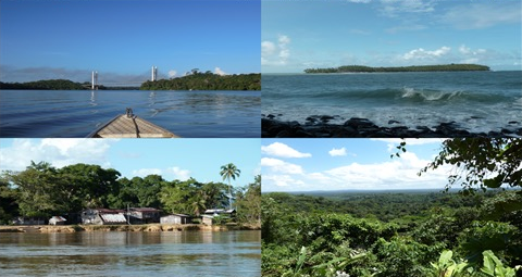
Demain commence la 2e journée du séminaire #Progysat sur l'observation des Guyanes par #satellite
https://progysat.org/fr
#Cayenne #Guyane #France
#geospatial #Télédétection #SIG #ObservationDeLaTerre #Cartographie #géoinformation
#Suriname #Guyana #Brésil #PlateauDesGuyanes
#IRD #UniversitéDeGuyane #UMREspaceDev #CollectivitéTerritorialeDeGuyane
#progysat #satellite #cayenne #Guyane #France #geospatial #teledetection #sig #observationdelaterre #cartographie #geoinformation #suriname #guyana #bresil #plateaudesguyanes #IRD #universitedeguyane #umrespacedev #collectiviteterritorialedeguyane

HeiGIT · @heigit
43 followers · 71 posts · Server mapstodon.space
🦟Have you heard about #Mosquito Alert? Our team recently spoke at the app's launch about #geoinformation and #crowdsourcing's potential to mitigate emergent #health threats from #ClimateChange.
💻Read more:
https://heigit.org/mosquito-app-alert-2/
#OpenScience #OpenSciTalk #geospatial #app #citizenscience #disease
#mosquito #geoinformation #crowdsourcing #Health #ClimateChange #openscience #openscitalk #geospatial #app #citizenscience #disease
UNIGIS Salzburg · @unigis_salzburg
9 followers · 6 posts · Server fosstodon.org
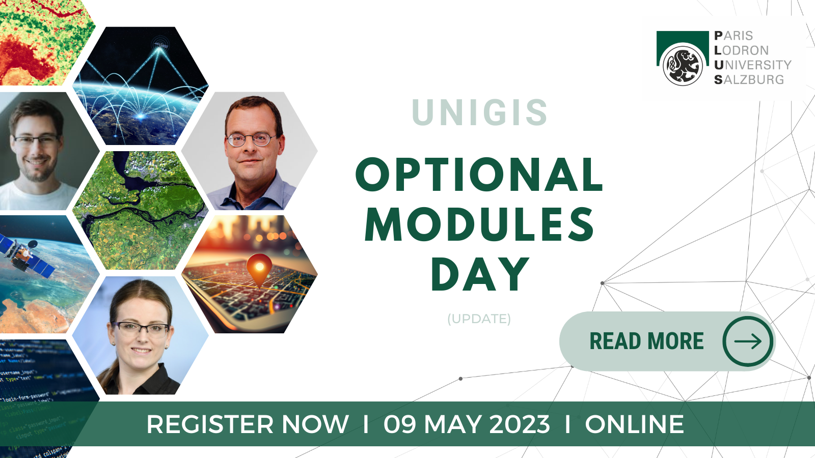
How can the #UNIGIS Optional Modules help you create your own specialisation within your #geoinformatics studies? Martin Loidl @gicycle answers this question in our latest blog post. 💻
You want to learn more? Join the Optional Modules Day on May, 9th, and meet the lecturers, among them @underdarkGIS :
https://unigis.at/en/the-unigis-optional-modules-design-your-studies-according-to-your-interests/
#unigis #geoinformatics #geoinformation #gistraining #gis #qgis

BKG · @BKG
1595 followers · 201 posts · Server social.bund.de
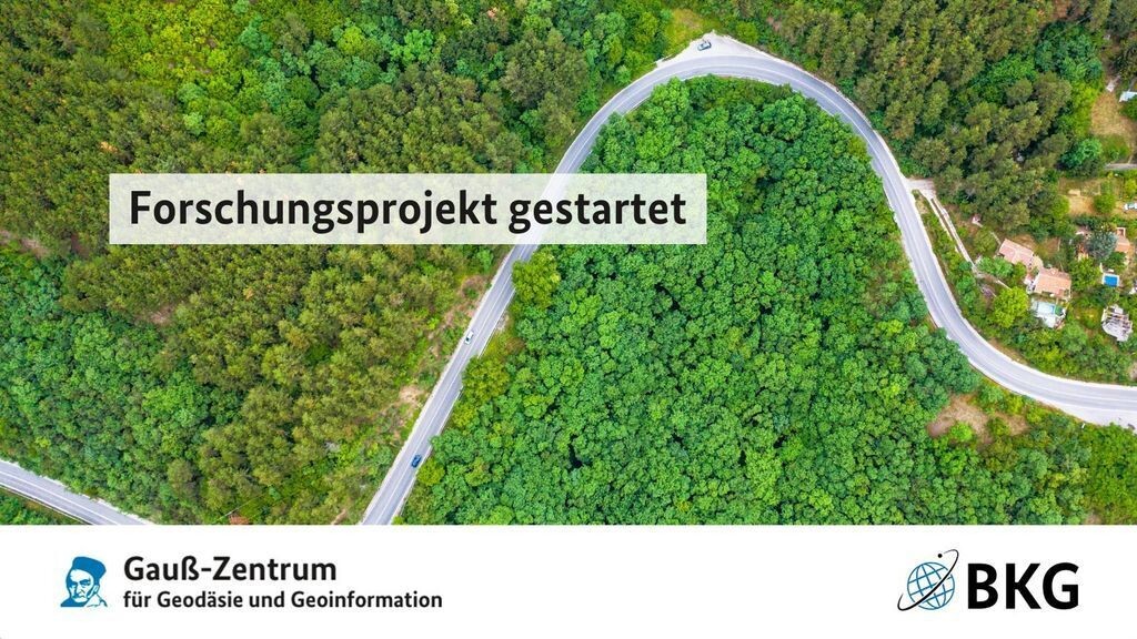
🎓 Das Gauß-Zentrum für #Geodäsie und #Geoinformation ist unser virtuelles #Forschung|szentrum.
💡 Das neueste Projekt untersucht Möglichkeiten einer harmonisierten #Analyse von historischen und modernen #Geodaten.
➡️ Mehr: https://www.bkg.bund.de/DE/Forschung/Gauss-Zentrum/gauss-zentrum.html
#geodasie #geoinformation #forschung #Analyse #geodaten #zeitreihenanalyse

Copernicus EU · @CopernicusEU
1828 followers · 8314 posts · Server respublicae.eu
RT @RSCy2023: Thank you #Copernicus for the EarthArt Exhibition displayed during the #RSCy2023 in #Cyprus on #earthobservation #space #earth - Ninth International #Conference on #remotesensing and #geoinformation of #environment. Over 1,200 people viewed the exhibit during the #RSCy2023.
🐦🔗: https://n.respublicae.eu/CopernicusEU/status/1644369509233426434
#Copernicus #RSCy2023 #Cyprus #EarthObservation #space #Earth #Conference #RemoteSensing #geoinformation #environment

falcius · @falcius
36 followers · 151 posts · Server machteburch.socialDas #ULD weist im aktuellen Tätigkeitsbericht auf die Problematik des Einbindens von Google-Maps in die eigene Webseite hin.
https://www.datenschutzzentrum.de/tb/tb41/kap04_4.html#443
Noch schöner wäre ein Hinweis auf die Möglichkeiten zur datenschutzkonformen Nutzung von #OpenStreetMap gewesen.
#FOSSGIS #Geoinformationsrecht #Geoinformation #tätigkeitsbericht #datenschutz
#uld #openstreetmap #FOSSGIS #Geoinformationsrecht #geoinformation #tatigkeitsbericht #datenschutz
falcius · @falcius
35 followers · 150 posts · Server machteburch.socialFür außenstehende Personen klingt es erst einmal sonderbar: "Die Dachneigung eines Hauses ist ein personenbezogenes Datum."
Im #Datenschutzrecht ist das für viele grundstücksbezogene #Geodaten aber herrschende Meinung. Mit der Verarbeitung solcher Geodaten in Solarpotenzialkatastern setzt sich der aktuelle Tätigkeitsbericht des #ULD auseinander:
https://www.datenschutzzentrum.de/tb/tb41/kap04_1.html#411
#Geoinformationsrecht #Geoinformation #tätigkeitsbericht #datenschutz #DSGVO
#Energiewende #LfDI
#datenschutzrecht #geodaten #uld #Geoinformationsrecht #geoinformation #tatigkeitsbericht #datenschutz #dsgvo #energiewende #lfdi

Joe_Wiegetritt · @Joe_Wiegetritt
23 followers · 91 posts · Server mastodontech.de
Fantastischer #Sonnenuntergang am geodätischen Referenzpunkt an der Burgruine #Donaustauf bei #Regensburg. #geodätischerreferenzpunkt #Pylone #Fahrrad #Radtour #PTyp 95. Europäischer Tag der #Vermessung und #Geoinformation. #surveying #survey #TagDerVermessung
#sonnenuntergang #Donaustauf #regensburg #geodatischerreferenzpunkt #Pylone #fahrrad #radtour #ptyp #Vermessung #geoinformation #surveying #survey #tagdervermessung

Ralph Straumann (@rastrau) · @rastrau
243 followers · 143 posts · Server mstdn.social
📣 Wir suchen Verstärkung für unser #DataScience-Team bei EBP in Zürich:
#GIS-Spezialist:in (m/w/d, 80–100%) https://jobs.ebp.ch/offene-stellen/gis-spezialist-in/34624bb0-084d-4524-936b-563dacf5ee72 #ArcGIS #QGIS #Python #RStats #ETL #FME #geoinformation #SwissGIS #ML
Mehr Infos über EBP findest Du hier: https://www.ebp.ch/de/career/kultur. Bei Fragen, einfach fragen 👍
#ml #swissgis #geoinformation #FME #etl #RStats #Python #qgis #arcgis #gis #DataScience
BKG · @BKG
1514 followers · 145 posts · Server social.bund.de
📣 Wir suchen so früh wie möglich Talente (m/w/d) in den Bereichen analytischer #Fernerkundung und angewandter Erdbeobachtung in #Frankfurt am Main.
📧 Bewerben bis zum 19.03.2023
#fernerkundung #frankfurt #Stellenangebot #job #geoinformation
Copernicus EU · @CopernicusEU
1654 followers · 7159 posts · Server respublicae.eu
RT @RSCy2023: Submit your abstract @RSCy2023 conference in #Cyprus for #earthobservation #space #earth #copernicus - Ninth International #Conference on #remotesensing and #geoinformation of #environment @ERATOSTHENESCoE - Deadline for submissions 17/2/23. https://t.co/F6IbPHPdte
🐦🔗: https://n.respublicae.eu/CopernicusEU/status/1618711436292939776
#Cyprus #EarthObservation #space #Earth #Copernicus #Conference #RemoteSensing #geoinformation #environment

UNIGIS Salzburg · @unigis_salzburg
5 followers · 3 posts · Server fosstodon.org
The countdown has started! Study #geoinformatics with #UNIGIS and become a geospatial professional. We offer different modules, covering key aspects of #geoinformation to prepare you for a successful #gis-career 👍 🎓
#R #QGIS #OpenData #applicationdevelopment #spatialsimulation #dbms #leaflet #js #python #mapping #map #onlinestudy #gis #onlinelearning #opengis
#geoinformatics #unigis #geoinformation #gis #r #qgis #opendata #applicationdevelopment #spatialsimulation #dbms #leaflet #js #python #mapping #map #onlinestudy #onlinelearning #opengis

GregCocks · @GregCocks
74 followers · 89 posts · Server techhub.social
Space Industry Deploying More Satellites That Deliver Sharper Images
--
https://spacenews.com/study-space-industry-deploying-more-satellites-that-deliver-sharper-images/ <-- tech blog article
--
#GIS #mapping #spatial #remotesensing #satellite #imagery #geoint #increase #commerical #resolution #geoinformation #defence #military #intelligence #event #consulting #analytics #transformation #Ukraine #incentive #geopolitical #global #social #extremeweather #disaster #spaceindustry #highresolution #spysatellite
#gis #mapping #spatial #remotesensing #satellite #imagery #geoint #increase #commerical #resolution #geoinformation #defence #military #intelligence #event #consulting #analytics #transformation #ukraine #incentive #geopolitical #global #social #extremeweather #disaster #spaceindustry #highresolution #spysatellite
UNIGIS Salzburg · @unigis_salzburg
2 followers · 2 posts · Server fosstodon.org
You want to study #geoinformatics online? 🎓 We have summarised the 5 steps you need to follow to start your geoinformatics-career with #UNIGIS! 💻📥
🔗 https://unigis.at/en/
💡 Note:
🇦🇹 German study program: You can apply until 27 Jan 2023 for the UNIGIS Professional (start: 27 Jan 2023) and until 15 Feb 2023 for the Master of Science (start: 23 Feb 2023).
#distancelearning #onlinestudy #geoinformation #gismaster #gisstudies #universityofsalzburg #zgis #qgis
#geoinformatics #unigis #distancelearning #onlinestudy #geoinformation #gismaster #gisstudies #universityofsalzburg #zgis #qgis