
GregCocks · @GregCocks
150 followers · 169 posts · Server techhub.social
A Simplified GIS And Google-Earth-Based Approach For Lineaments And Terrain Attributes Mapping In A Basement Complex Terrain
--
https://doi.org/10.1038/s41598-022-20057-2 <-- shared paper
--
#GIS #spatial #mapping #imagery #geology #geologic #geological #geologymap #remotesensing #IdanreHills #Nigeria #Africa #spatialanalysis #structuralgeology #network #structural #imagery #lineaments #terrain #methodology #stream #hydrology #geomorphology #roughness #gischat #GoogleEarth #geologicmapping #batholith #gneiss #slope #flowlines #weathering #remotemapping #hillshade #raster
#gis #spatial #mapping #imagery #geology #geologic #geological #geologymap #remotesensing #idanrehills #nigeria #africa #spatialanalysis #structuralgeology #network #structural #lineaments #terrain #methodology #stream #hydrology #geomorphology #roughness #gischat #googleearth #geologicmapping #batholith #gneiss #slope #flowlines #weathering #remotemapping #hillshade #raster

Bob Tregilus :tux: 📷 · @elaterite
370 followers · 143 posts · Server fosstodon.org
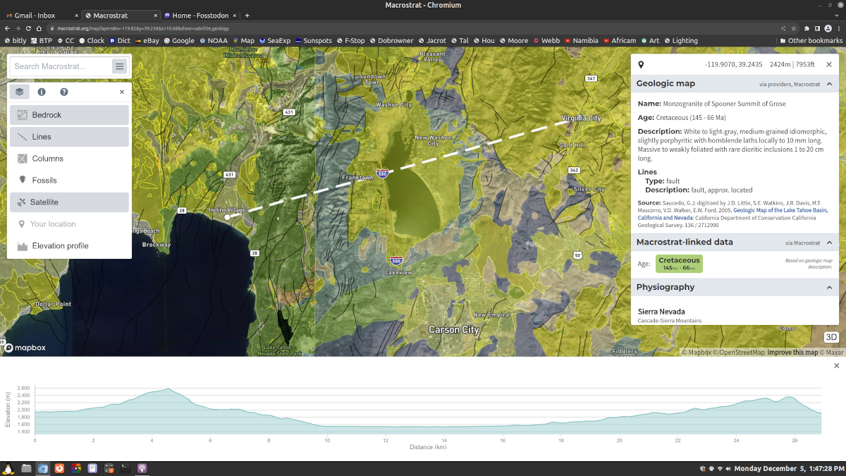
I don't know how I missed this awesome geology map tool, saw it recently here on Mastodon (and now I've forgotten who to credit for it) but here you go, just zoom in on any region to find out about the rock formations, fossils, and faults. You can also draw elevation profiles. And the entries contain linked citations to the reports the information was drawn from!
https://macrostrat.org/map/#x=-115.901&y=38.915&z=4.3
#GeoScience #Geology #GeologyMap #Rock #RockHound #EarthScience #Fossil #Fault
#geoscience #geology #geologymap #rock #rockhound #earthscience #fossil #fault