
PyCon CZ :python: 🇨🇿 · @pyconcz
44 followers · 42 posts · Server floss.social🌍 Curious about GeoPython? 👉 Check out the talk "Getting started with Satellite Data: Exploration and Processing" by Týna Doležalová & Lubomír Doležal. 🛰️🌐 Learn more: https://cz.pycon.org/2023/program/talks/101/
#GeoPython #SatelliteData #PyConCZ23
#geopython #satellitedata #pyconcz23

Jakub Nowosad · @nowosad
878 followers · 190 posts · Server fosstodon.org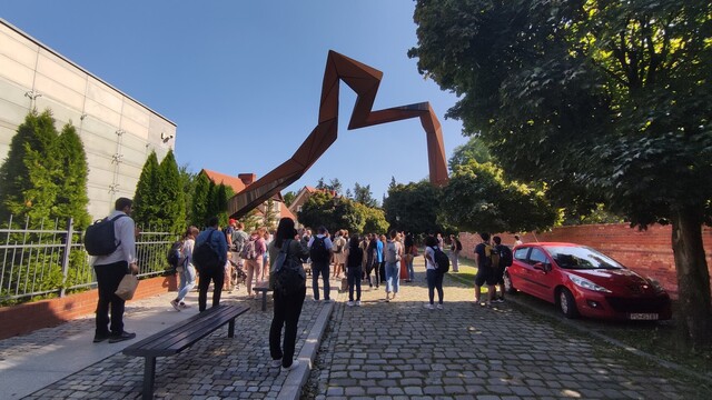
🔔 #OpenGeoHubSummerSchool2023 is now over. 🔔
A week full of lectures, workshops, hackathons, trips, social events, and more...
Many thanks to all participants, lecturers, and co-organizers!
#opengeohubsummerschool2023 #rspatial #geopython #juliageo
Jakub Nowosad · @nowosad
873 followers · 186 posts · Server fosstodon.org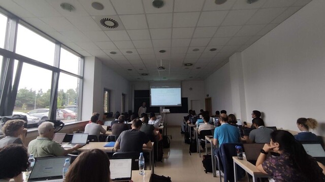
🎆 The fourth day of the OGH summer school 2023 starts soon. 🎆
Program: https://buff.ly/3L0tKdz
Room 21: https://buff.ly/3OXHJ4O
Room 18: https://buff.ly/3OTQvRw
#rspatial #geopython #juliageo
Jakub Nowosad · @nowosad
867 followers · 182 posts · Server fosstodon.org
🎆 The third day of the OGH summer school 2023 starts soon. 🎆
Program: https://opengeohub.org/wp-content/uploads/2023/08/OGH-Summer-School-Program-V.F.pdf
Room 21: https://www.youtube.com/@OpenGeoHubFoundation/streams
Room 18: https://www.youtube.com/@opengeohublivestream3047/streams
#rspatial #geopython #juliageo
Jakub Nowosad · @nowosad
865 followers · 180 posts · Server fosstodon.org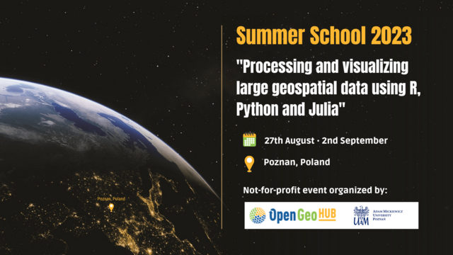
🎆 The second day of the OGH summer school 2023 starts soon. 🎆
Program: https://opengeohub.org/wp-content/uploads/2023/08/OGH-Summer-School-Program-V.F.pdf
Room 21: https://www.youtube.com/@OpenGeoHubFoundation/streams
Room 18: https://www.youtube.com/@opengeohublivestream3047/streams
#rspatial #geopython #juliageo

Sharon Machlis · @smach
2330 followers · 319 posts · Server masto.machlis.com
From @opengeohub:
📲Follow all lectures from the #OpenGeoHubSummerSchool2023 live on Youtube!
👩💻👨💻Room 21 https://youtube.com/watch?v=CwL_luh2tWs
👩💻👨💻Room 18 https://youtube.com/watch?v=G9_faMNs_3Y
🗓Check out the program and decide on your session https://opengeohub.org/wp-content/uploads/2023/08/OGH-Summer-School-Program-V.F.pdf
#opengeohubsummerschool2023 #gis #rspatial #geopython
Jakub Nowosad · @nowosad
864 followers · 179 posts · Server fosstodon.org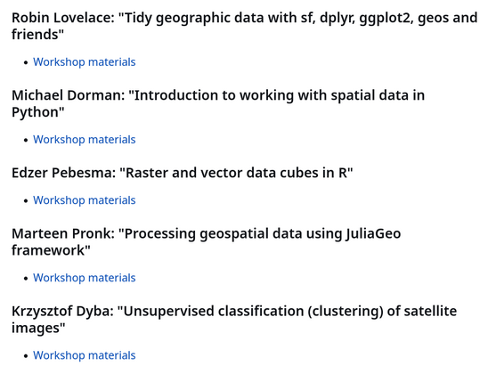
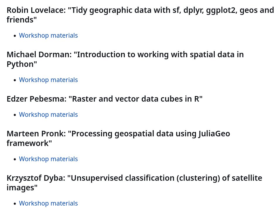
You can find an (updated) list of the OpenGeoHub summer school 2023 (#ogh2023) workshop materials at https://github.com/Nowosad/OGH_summer_school_2023.
#ogh2023 #rspatial #geopython #juliageo #gischat
Jakub Nowosad · @nowosad
864 followers · 176 posts · Server fosstodon.org
Most of the OpenGeoHub summer school 2023 lecturers are also livestreamed.
You can watch them at:
Room 21: https://www.youtube.com/watch?v=CwL_luh2tWs
Room 18: https://www.youtube.com/watch?v=G9_faMNs_3Y
Program: https://opengeohub.org/wp-content/uploads/2023/08/OGH-Summer-School-Program-V.F.pdf
#rspatial #geopython #juliageo #ogh2023
Jakub Nowosad · @nowosad
864 followers · 176 posts · Server fosstodon.org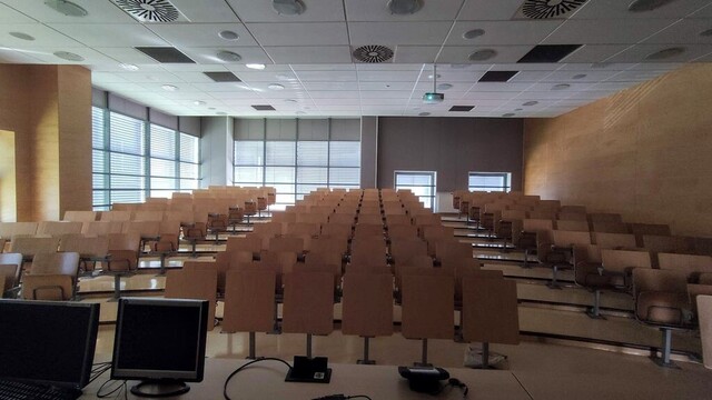
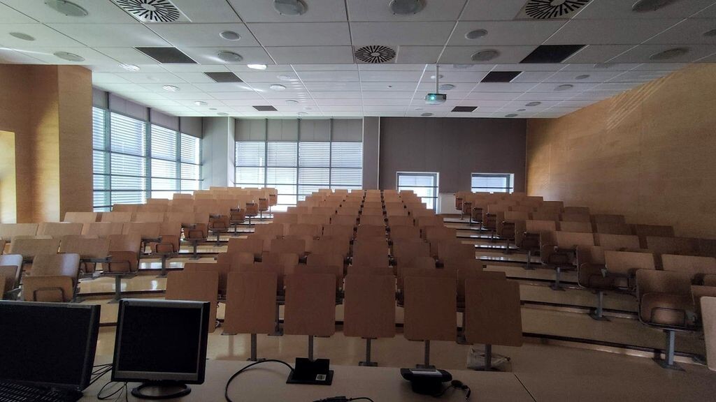
This is how a very calm room looks just a day before it will be full of the OpenGeoHub summer school 2023 (#OGH2023) participants!
See you all soon!
#ogh2023 #rspatial #geopython #juliageo
Hans van der Kwast · @hansakwast
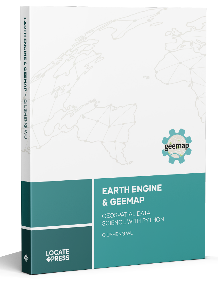
427 followers · 112 posts · Server fosstodon.orgRT @giswqs: New book release: Earth Engine and Geemap - Geospatial Data Science with Python!
11 chapters, 408 pages. Available for order from @locatepress now 👇
https://t.co/quSXiTjgnv
#geospatial #earthengine #geemap #geopython https://t.co/0Pn647WkfO https://t.co/iDhvEFN9tQ
#geospatial #EarthEngine #geemap #geopython

Qiusheng Wu · @giswqs
237 followers · 43 posts · Server fosstodon.org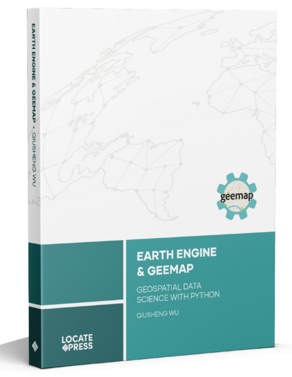
New book release: Earth Engine and Geemap - Geospatial Data Science with Python!
11 chapters, 408 pages. Available for order from Locate Press now 👇
https://locatepress.com/book/gee
#geospatial #EarthEngine #geemap #geopython
Jakub Nowosad · @nowosad
803 followers · 136 posts · Server fosstodon.org
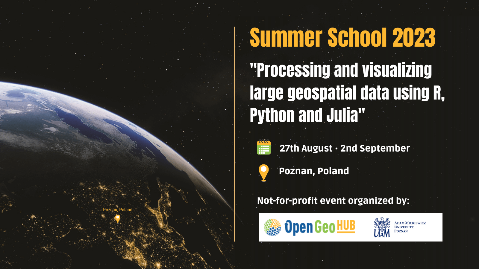
🔥OpenGeoHub Summer School 2023 will start in 7 weeks🔥
27 August 2022 – 02 September 2023
A whole week of #opensource spatial data analysis using #rstats, #python, and #julialang
See you soon in Poznan!
https://opengeohub.org/summer-school/opengeohub-summer-school-poznan-2023/
#opensource #rstats #python #julialang #rspatial #geopython #gischat #geocompx

Tom Kralidis · @tomkralidis
98 followers · 16 posts · Server noc.social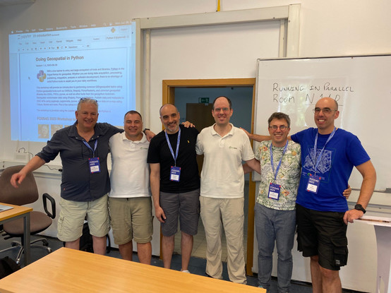
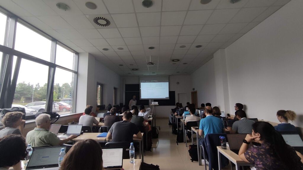
And that’s wrap! Doing Geospatial in Python workshop done for FOSS4G 2023! For the first time, we ran two parallel workshops. Kudos to @tzotsos
@pvgenuchten @luis_m_de_sousa
@justb4
@francbartoli
- fantastic job again everyone! #geopython #foss4g
Tom Kralidis · @tomkralidis
98 followers · 15 posts · Server noc.social
So nice we are giving it twice! Given the number of participants, the Doing Geospatial in Python workshop is being run in two parallel classes by the team!

Siwat · @siwat
113 followers · 1406 posts · Server mstdn.socialRT @giswqs
segment-geospatial v0.3.0 is out - segmenting satellite imagery with the Segment Anything Model (SAM).
GitHub: https://github.com/opengeos/segment-geospatial
Docs: https://samgeo.gishub.org
Notebook: https://samgeo.gishub.org/examples/satellite
#geospatial #geopython #deeplearning #segmentanything

Chuixiang (Tree) Yi · @TreeYi
9 followers · 4054 posts · Server mastodon.worldRT @giswqs
segment-geospatial v0.3.0 is out - segmenting satellite imagery with the Segment Anything Model (SAM).
GitHub: https://github.com/opengeos/segment-geospatial
Docs: https://samgeo.gishub.org
Notebook: https://samgeo.gishub.org/examples/satellite
#segmentanything #deeplearning #geopython #geospatial
Siwat · @siwat
113 followers · 1406 posts · Server mstdn.socialRT @giswqs
Introducing segment-geospatial, A Python package for segmenting geospatial data with the Segment Anything Model (SAM)
GitHub: https://github.com/opengeos/segment-geospatial
Docs: https://samgeo.gishub.org
Notebook: https://samgeo.gishub.org/examples/satellite
#geopython #deeplearning #segmentanything

GregCocks · @GregCocks
192 followers · 242 posts · Server techhub.social
Springer Makes Open Source Chapter Of Upcoming Handbook Of Geographic Information Freely Accessible In April
--
https://link.springer.com/chapter/10.1007/978-3-030-53125-6_30 <-- shared journal issue
--
H/T Doug Newcomb
[a good overview of open source GIS software stacks]
“... As a service to the readers, the reference section of this chapter includes scientific video recordings which provide additional content regarding software capabilities, historical notes and background information: #Actinia, #GeoBlackLight, #GeoPaparazzi, #GeoPython, #GeoServer, #GeoTools, #GMT, #GRASSGIS, #gvSIG, #JTS, #Leaflet, #MapServer, #NASAWorldWind, #OSGeoLive. #PostGIS, #PROJ, #QGIS, #rasdaman. In addition, scientific videos about the #OSGeo Foundation and the annual #SolKatzAwards or #GeospatialFreeandOpenSourceSoftware are included…”
#GIS #spatial #mapping #free #opensource #software #FOSS #opensourcesoftware #algorithms #geospatialtechnology #postgresql #postgres #softwarestacks
#actinia #geoblacklight #geopaparazzi #geopython #geoserver #geotools #gmt #grassgis #gvsig #jts #leaflet #MapServer #nasaworldwind #osgeolive #postgis #proj #qgis #rasdaman #osgeo #solkatzawards #geospatialfreeandopensourcesoftware #gis #spatial #mapping #free #opensource #software #foss #OpenSourceSoftware #algorithms #geospatialtechnology #PostgreSQL #postgres #softwarestacks

Qiusheng Wu · @giswqs
178 followers · 29 posts · Server fosstodon.orgVisualize #Maxar Open Data for the Turkey-Syria #earthquake using #leafmap. Search for images and return footprints as a GeoDataFrame with one line of code. Compare pre-event and post-event images side by side 👇
Notebook: https://leafmap.org/notebooks/69_turkey_earthquake/
Video: https://youtu.be/wevzJfOf5GQ
#maxar #earthquake #leafmap #geospaital #geopython

David Montero Loaiza · @dmlmont
72 followers · 14 posts · Server fosstodon.orgHey #RemoteSensing folks! I'm happy to announce the first release of #cubo, a lovely #Python package for easily creating EO mini cubes from #STAC 🛰️🧊
gh: https://github.com/davemlz/cubo
docs: https://cubo.readthedocs.io
The cool thing about #cubo is that you just need to introduce a pair of coordinates, the edge size of the cube, and the start and end dates. Then you can select the STAC collection you require (also the endpoint) and the spatial resolution!
#remotesensing #cubo #python #STAC #geospatial #geopython #dataviz #eochat #gischat