Jody Garnett · @jodygarnett
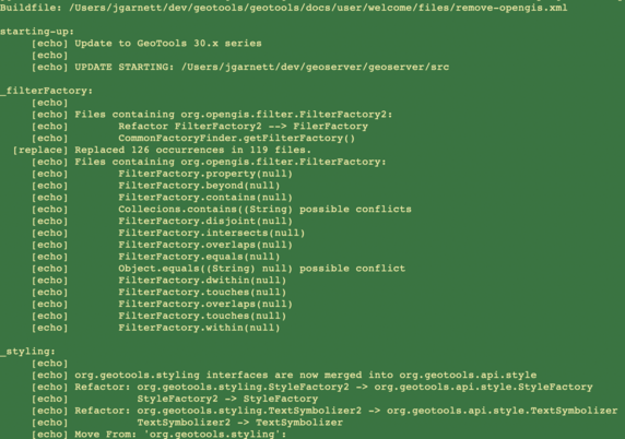
86 followers · 156 posts · Server fosstodon.orgIt is alive and powered by regex …
<replaceregexp byline="true" flags="g">
<fileset refid="envelope2D.files"/>
<regexp pattern="new Envelope2D\(\s*(.*?),\s*(.*?),\s*(.*?),\s*(.+?),\s*(.+?)\)"/>
<substitution expression="ReferencedEnvelope.rect(\2, \3\, \4, \5, \1)"/>
</replaceregexp>
Maxxium effort!
Jody Garnett · @jodygarnett
84 followers · 153 posts · Server fosstodon.orgWhat #GeoTools 30.x refactor looks like https://github.com/geotools/geotools/pull/4367/
* 5000+ files changed
* Commits 103
* Budget $25k ($12k funded + in-kind)
* Code freeze brrr!
The remove-opengis.xml script is being tested on downsteram projects; the final change count will be much larger across @osgeo projects.
Jody Garnett · @jodygarnett
84 followers · 152 posts · Server fosstodon.orgWell the @osgeo Bolesena code sprint ended, and everyone has returned home.
The #GeoTools team is ... not quite done cleaning up the mess (sigh)
Taking the long weekend + jet lag to clean up: Envelope, Envelope2D, ReferencedEnvelope, ReferencedEnvelope3D, Bounds, BoundingBox, … all without breaking code using org.locationtech.jts.geom.Envelope
https://github.com/geotools/geotools/pull/4448
While I hope to finish today, the team does not have gas in the tank to make a milestone or release candidate as planned.
Jody Garnett · @jodygarnett
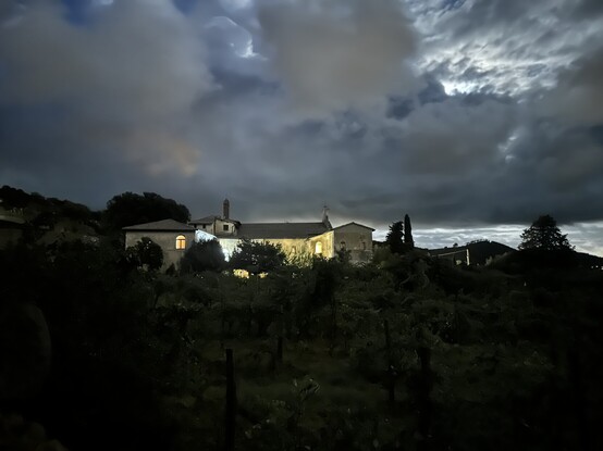
83 followers · 148 posts · Server fosstodon.orgBolsena code sprint bids good night @osgeo family
The #GeoTools crew reached an important goal today with org.opengis removed and @ianturton folding the style interface together 5 mins before dinner
Ian Turton · @ianturton
584 followers · 160 posts · Server fosstodon.orgEnd of day X of the #Bolsena #osgeo code sprint and very close to hitting merge on the style update PR (https://github.com/geotools/geotools/pull/4460) which modifies less than 600 files (just). Sitting here waiting for the downstream integration test builds to complete.
Watch out for an RC release in the very near future if you are a #GeoTools user, you will want to test this one before we ship it.
#bolsena #osgeo #geotools #opensource #codesprint
Ian Turton · @ianturton
583 followers · 155 posts · Server fosstodon.orgVery productive day at Bolsena #osgeo code sprint as temperatures lower and some rain in the air made it feel like #scotland :-) just managing to hold the happy dance in until the build server agrees with me on it working. Next stop #GeoServer tomorrow.
#osgeo #scotland #geoserver #geotools #codesprint
Ian Turton · @ianturton
583 followers · 151 posts · Server fosstodon.orgIan Turton · @ianturton
583 followers · 152 posts · Server fosstodon.orgToo late to get a picture of the food today at the Bolsena #osgeo code sprint. Lots of progress but still some failing tests, starting to look at downstream projects.
Ian Turton · @ianturton
580 followers · 148 posts · Server fosstodon.orgBolsena #osgeo code sprint day 4, worked on fixing tests this morning and retreated to the mountains to escape the heat this afternoon. Team so recovered that they are climbing a mountain now. I've formed the grouppetta and am planning to catch them on the descent.
Ian Turton · @ianturton
581 followers · 140 posts · Server fosstodon.orgJody Garnett · @jodygarnett
58 followers · 87 posts · Server fosstodon.orgDisruption ahead, refactoring from org.opengis to org.geotools.api:
https://geotoolsnews.blogspot.com/2023/07/construction-ahead-refactoring.html
I was just met with surprise at how much work will be required, and figured I better make a blog post to warn other projects and project teams.
#osgeo #foss4g #geotools #geoserver
Andrea Antonello · @moovida
12 followers · 26 posts · Server digitalcourage.socialHei ho #gischat,does anyone ideas about this never answered #geoserver / #geotools question? https://gis.stackexchange.com/questions/451263/interpolation-issues-between-geotools-and-geoserver-pixel-shift-pixel-origin
GregCocks · @GregCocks
192 followers · 242 posts · Server techhub.socialSpringer Makes Open Source Chapter Of Upcoming Handbook Of Geographic Information Freely Accessible In April
--
https://link.springer.com/chapter/10.1007/978-3-030-53125-6_30 <-- shared journal issue
--
H/T Doug Newcomb
[a good overview of open source GIS software stacks]
“... As a service to the readers, the reference section of this chapter includes scientific video recordings which provide additional content regarding software capabilities, historical notes and background information: #Actinia, #GeoBlackLight, #GeoPaparazzi, #GeoPython, #GeoServer, #GeoTools, #GMT, #GRASSGIS, #gvSIG, #JTS, #Leaflet, #MapServer, #NASAWorldWind, #OSGeoLive. #PostGIS, #PROJ, #QGIS, #rasdaman. In addition, scientific videos about the #OSGeo Foundation and the annual #SolKatzAwards or #GeospatialFreeandOpenSourceSoftware are included…”
#GIS #spatial #mapping #free #opensource #software #FOSS #opensourcesoftware #algorithms #geospatialtechnology #postgresql #postgres #softwarestacks
#actinia #geoblacklight #geopaparazzi #geopython #geoserver #geotools #gmt #grassgis #gvsig #jts #leaflet #MapServer #nasaworldwind #osgeolive #postgis #proj #qgis #rasdaman #osgeo #solkatzawards #geospatialfreeandopensourcesoftware #gis #spatial #mapping #free #opensource #software #foss #OpenSourceSoftware #algorithms #geospatialtechnology #PostgreSQL #postgres #softwarestacks
GeoNe.ws · @geonews
366 followers · 1271 posts · Server mastodon.social
GeoNe.ws · @geonews
341 followers · 1059 posts · Server mastodon.social
GeoNe.ws · @geonews
233 followers · 934 posts · Server mastodon.social
GeoNe.ws · @geonews
341 followers · 1059 posts · Server mastodon.social
Linux ✅ · @Linux
3975 followers · 2826 posts · Server linuxrocks.onlineFree Software Foundation Europe: "Go open today, there's no excuse not to" - interview with Timo Aarnio, GIS expert at National Land Survey of Finland.
"Oskari" (oskari.org) is a Free Software platform for browsing, sharing and analysing geographic information from distributed data sources.
Awarded 2nd prize in the cross-border category of the European Commission's Sharing and Reuse Awards Contest
--> https://fsfe.org/news/2018/news-20180917-01.en.html
_
#Oskari #FSF #FSFE #FreeSoftwareFoundation #TimoAarnio #GeoTools
#oskari #fsf #fsfe #freesoftwarefoundation #timoaarnio #geotools


