Data Orchard CIC · @data_orchard
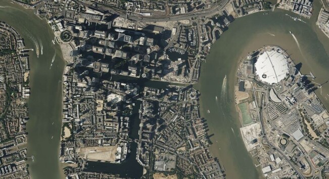
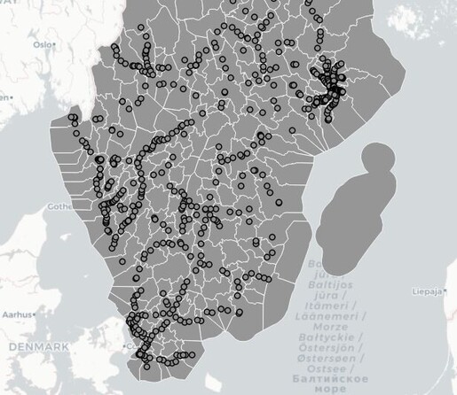
135 followers · 201 posts · Server data-folks.masto.hostPutting your #charity on the #map: How mapping can improve your mission, from DataKind UK https://medium.com/datakinduk/putting-your-charity-on-the-map-5526eba4d116 #data #GIS
GregCocks · @GregCocks
718 followers · 570 posts · Server techhub.socialRecord-Breaking North Atlantic Ocean Temperatures Contribute To Extreme Marine Heatwaves [remote sensing]
--
https://climate.copernicus.eu/record-breaking-north-atlantic-ocean-temperatures-contribute-extreme-marine-heatwaves <-- shared technical article
--
#GIS #spatial #mapping #spatialanalysis #spatiotemporal #climatechange #marine #marineconservation #marinelife #heatwave #NorthAtlantic #MarineHeatwave #fishing #fisheries #fisheriesmanagement #economics #economy #foodsecurity #watertemperature #waterquality #ecosystem #health #ecosystemchange #disease #remotesensing #satellite #climate #Copernicus #ESA @esa
#gis #spatial #mapping #spatialanalysis #spatiotemporal #climatechange #marine #marineconservation #marinelife #heatwave #northatlantic #marineheatwave #fishing #fisheries #fisheriesmanagement #economics #economy #FoodSecurity #watertemperature #waterquality #ecosystem #Health #ecosystemchange #disease #remotesensing #satellite #climate #Copernicus #Esa
GregCocks · @GregCocks
718 followers · 569 posts · Server techhub.socialCoalition For The Poudre River Watershed [Northern Colorado]
--
https://www.poudrewatershed.org/ <-- link to their page
--
https://experience.arcgis.com/experience/c9eac99fff4e4ef18ebaac101ad9a005/ <-- web map
--
“CPRW partners with landowners, government agencies, water utilities, and non-profits to collaboratively address some of the most challenging issues facing our watershed. Together, we identify the biggest problems, use science and expert input to prioritize where our projects will have the most impact and then together, we implement actions on the ground that will protect our rivers, communities, and water supply…”
#GIS #spatial #mapping #webmap #watershed #ecosystem #communityengagement #PoudreRiver #Colorado #NoCo #water #hydrology #volunteer #erosion #wildlife #rivers #forests #communityoutreach #wildfire #fire #CameronPeakFire #recovery #mitigation #ecosystemrestoration #ecosystembuilding #waterresources #waterresourcemanagement #watersupply
#colorado #NoCo #water #hydrology #volunteer #erosion #wildlife #rivers #forests #communityoutreach #wildfire #fire #cameronpeakfire #recovery #mitigation #ecosystemrestoration #ecosystembuilding #waterresources #waterresourcemanagement #watersupply #gis #spatial #mapping #webmap #Watershed #ecosystem #communityengagement #poudreriver
AI6YR · @ai6yr
4815 followers · 33316 posts · Server m.ai6yr.orgVia @pierre_markuse: Look at this super-interesting and well-written fifth part of the Gentle Introduction to #GDAL series by @rsimmon, this time dealing with shaded relief. #remotesensing #gis #dataviz #cartography #remotesensing https://medium.com/@robsimmon/a-gentle-introduction-to-gdal-part-5-shaded-relief-ec29601db654
#gdal #remotesensing #gis #dataviz #cartography
ronix · @ronix
151 followers · 307 posts · Server sueden.socialFor our upcoming meeting of the "Arbeitsgemeinschaft Geschichte und EDV" in Trier, we have created a masterclass for interested students and young historians: https://www.age-net.de/2023/09/masterclass-digitale-rekonstruktion-historischer-orte-und-landschaften/ - topic is "Digitale Rekonstruktion historischer Orte und Landschaften" - feel free to apply and share #histodon #histodonde #trier #dh #gis
#histodon #HistodonDE #Trier #dh #gis
Brett Hoover · @bretthoover
165 followers · 53 posts · Server fediscience.orgQuestion for the #GIS #satellite #RemoteSensing #Geography crowd: If I wanted to find a burn area on a roughly 0.25 - 0.5 mi stretch of land over CONUS, what product (if any) would be appropriate? LandSat-9 burned area product? Or something else?
#geography #RemoteSensing #satellite #gis
· @gishubio
3 followers · 15 posts · Server fosstodon.org3 ways to add a map to your WordPress site
https://www.gishub.io/2023/09/10/3-ways-to-add-a-map-to-your-wordpress-site/
Joseph Elfelt · @mappingsupport
571 followers · 497 posts · Server m.ai6yr.orgEach time you open this interactive #GIS map you will see the latest view of #HurricaneLee from the GOES East satellite.
#Hurricane
Open #GISsurfer map:
https://mappingsupport.com/p2/gissurfer.php?center=28.207609,-67.236328&zoom=5&basemap=GOES_East_color&overlay=Country,Forecast_error_cone,Hurricane/Storm_observed_track,Hurricane/Storm_observed_position,Hurricane/Storm_forecast_track,Hurricane/Storm_forecast_position&data=https://mappingsupport.com/p2/special_maps/disaster/USA_weather.txt
#gis #hurricanelee #hurricane #gissurfer
Vector Hugo · @gfkdsgn
3 followers · 35 posts · Server graphics.socialHey don't get me wrong @F100 , as far as I'm correct Sergei Bernstein was born in Ukraine. You could be proud of him and his contributions to #cgi #vectorgraphics #cad #DTP #motiondesign #3danimation #gis and so much more. At least one of our artist's spent quite a few hours on the tribute portrait of him, but it almost seems like you don't give a shoe about this kind of RESPECT.
Why is it that I can see you already in olive with a machine gun on your shoulder when I close my eyes?
#cgi #vectorgraphics #cad #dtp #motiondesign #3danimation #gis
John Lister - GeoScrub · @GeoScrubJohnL
14 followers · 15 posts · Server fosstodon.orgAlright as promised I am kicking this series back off where I will be showing you how to build a web map component for React.js with a variety of mapping libraries. 🗺️ 🍃
Today we have @leaflet all ready to go!
Enjoy:
https://medium.com/@gisjohnecs/part-2-web-mapping-with-leaflet-react-js-adef75f8aedc
#leflet #gis #gischat #react #webdev
Hernán De Angelis · @hdeangelis
3 followers · 3 posts · Server mstdn.socialGreat news for #grassgis and its community
NSF Grant Awarded to Enhance GRASS GIS Ecosystem
https://grass.osgeo.org/news/2023_09_06_nsf_grant_awarded/
Hernán De Angelis · @hdeangelis
3 followers · 3 posts · Server mstdn.socialGreat news for #grassgis and its community
NSF Grant Awarded to Enhance GRASS GIS Ecosystem
https://grass.osgeo.org/news/2023_09_06_nsf_grant_awarded/
Joseph Elfelt · @mappingsupport
571 followers · 497 posts · Server m.ai6yr.org#ElValleFire, #NewMexico. NNE of Sante Fe.
Interactive #GIS map shows MODIS and VIIRS satellite heat detections. This data is *not* real time, locations are only approximate. Although detections are sometimes ‘false positive’, never rely on any map to ignore an order to evacuate
Click ‘Map tips’ for more info.
#NMFire #NMwx
Open #GISsurfer map:
https://mappingsupport.com/p2/gissurfer.php?center=36.108166,-105.737228&zoom=14&basemap=USA_basemap&overlay=VIIRS_7_day,MODIS_7_day,State_boundary,USA_roads&data=https://mappingsupport.com/p2/special_maps/disaster/USA_wildland_fire.txt
#elvallefire #newmexico #gis #nmfire #nmwx #gissurfer
Randal Hale · @rjhale1971
557 followers · 707 posts · Server fosstodon.orgGood news for the GRASS GIS Folks - https://grass.osgeo.org/news/2023_09_06_nsf_grant_awarded/ #GRASS #OSGEO #GIS
Dougas J Hunley · @hunleyd
108 followers · 688 posts · Server fosstodon.orgPostGIS, ArcGIS Enterprise and the Tour de France route https://www.cybertec-postgresql.com/en/postgis-arcgis-enterprise-tour-de-france-route/ #gis #postgresql
GregCocks · @GregCocks
718 followers · 569 posts · Server techhub.socialExtensibility Of U-Net Neural Network Model For Hydrographic Feature Extraction And Implications For Hydrologic Modeling
--
https://doi.org/10.3390/rs13122368 <-- shared paper
--
#GIS #spatial #mapping #machinelearning #neuralnetwork #Unet #featureextraction #hydrography #hydrology #water #automation #remotesensing #surfacewater #NHD #bluelines #topography #deeplearning #AI #artificialintelligence #LiDAR #ifSAR #elevation #topography #ANN #HPC #model #modeling #trainingdata #Alaska #USA #watersheds #DTM #DSM #DEM #routing #network #D8 #maps #opendata #3dep #elevation #topography #USGS
#gis #spatial #mapping #machinelearning #neuralnetwork #unet #featureextraction #hydrography #hydrology #water #automation #remotesensing #surfacewater #nhd #bluelines #topography #deeplearning #AI #artificialintelligence #lidar #ifsar #elevation #ann #hpc #model #modeling #trainingdata #alaska #USA #watersheds #dtm #dsm #dem #routing #network #d8 #Maps #opendata #3dep #usgs
GregCocks · @GregCocks
682 followers · 566 posts · Server techhub.socialCoastal Storm Modeling System (CoSMoS) [USGS]
--
https://www.usgs.gov/centers/pcmsc/science/coastal-storm-modeling-system-cosmos <-- project web page
--
H/T @Anthro #GIS #spatial #mapping #coastal #storm #modeling #CoSMoS #model #spatialanalysis #extremeweather #spatialanalysis #spatiotemporal #prediction #hindcast #mitigation #planning #climate #climatechange #naturalhazard #emergencyresponse #emergencypreparedness #emergencymanagement #risk #hazard #publicsafety #stormdamage #stormsurge #stormpreparedness #flood #flooding #coastalflooding #remotesensing #hydrospatial #water #hydrology #hydrography #topobathy #SLR #sealevelrise #urbanplanning
#gis #spatial #mapping #coastal #storm #modeling #cosmos #model #spatialanalysis #extremeweather #spatiotemporal #prediction #hindcast #mitigation #planning #climate #climatechange #naturalhazard #emergencyresponse #emergencypreparedness #emergencymanagement #risk #hazard #publicsafety #stormdamage #stormsurge #stormpreparedness #flood #flooding #coastalflooding #remotesensing #hydrospatial #water #hydrology #hydrography #topobathy #slr #sealevelrise #urbanplanning
· @gishubio
3 followers · 15 posts · Server fosstodon.orgCounting points in polygons with a QGIS processing model
https://www.gishub.io/2023/09/08/counting-points-in-polygons-with-a-qgis-processing-model/
Panda · @panda
449 followers · 11946 posts · Server freiburg.socialProjektleiterIn #Gis (de fakto #QGIS) gesucht in #Freiburg #Lörrach gesucht
https://badenova-gruppe.talentry.com/share/job/366128/647496/1694153290/3
Joseph Elfelt · @mappingsupport
571 followers · 497 posts · Server m.ai6yr.org@JosephAndriano And here is an option for anyone that does not want to install an app in order to read NOAA's forecast discussion.
1. Open this GISsurfer map. (I am the developer)
2. Zoom in to your area of interest or click Menu > Search.
3. Click inside any red-outlined area.
4. Follow the link.
5. Click "Map tips" upper left corner to learn how to turn other #GIS weather layers on/off.


