Joseph Elfelt · @mappingsupport
324 followers · 238 posts · Server m.ai6yr.orgJuly 20 morning. Interactive #GIS map for #FlatFire SW Oregon.
When the map opens the “Fire weather forecast” overlay is ‘on’. To read that forecast, open the map, click the fire, follow the link.
If you have not read the “Map tips” (link in upper left corner) then you will get more benefit from the map if you take a few minutes and read through that info.
#ORwx #ORfire #GoldBeach #GIS #Geospatial #Maps #Mapping #Leaflet #ArcGIS #WebMap
Open #GISsurfer map:
https://mappingsupport.com/p2/gissurfer.php?center=42.482341,-124.066544&zoom=12&basemap=USA_scanned_topo&overlay=Wildland_fire_name,MODIS_7_day,VIIRS_7_day,USA_roads,State_boundary,NOAA_fire_weather_forecast&fire=OR,Flat&fire=OR,Flat&data=https://mappingsupport.com/p2/special_maps/disaster/USA_wildland_fire.txt
#gis #flatfire #orwx #orfire #goldbeach #geospatial #maps #mapping #leaflet #arcgis #webmap #gissurfer
Joseph Elfelt · @mappingsupport
323 followers · 237 posts · Server m.ai6yr.orgJuly 19 afternoon. Interactive #GIS map for #FlatFire SW Oregon.
View by MODIS Terra satellite. The MODIS satellites build a new image of the earth each day. Later in the day the map will open with a white background since the satellite has started to build a new image.
Map has lots of fire related layers you can turn on. Click “Map tips” upper left corner for help.
#ORwx #ORfire #GoldBeach #GIS #Geospatial #Maps #Mapping #Leaflet #ArcGIS #WebMap
Open #GISsurfer map:
https://mappingsupport.com/p2/gissurfer.php?center=42.406201,-124.285583&zoom=9&basemap=MODIS_Terra_color&overlay=Wildland_fire_name,MODIS_7_day,VIIRS_7_day,USA_roads,State_boundary&fire=OR,Flat&fire=OR,Flat&data=https://mappingsupport.com/p2/special_maps/disaster/USA_wildland_fire.txt
#gis #flatfire #orwx #orfire #goldbeach #geospatial #maps #mapping #leaflet #arcgis #webmap #gissurfer
Joseph Elfelt · @mappingsupport
319 followers · 230 posts · Server m.ai6yr.orgJuly 19 morning. Interactive #GIS map for #FlatFire SW Oregon.
Infrared flight last night 10:27pm. IR analyst determined 12,756 acres burned and fire made 4 mile run to the west in prior 24 hours. Continued spotting to the west.
To get the most benefit from the map see the 2 links in upper left corner.
#ORwx #ORfire #GoldBeach #Geospatial #Maps #Mapping #Leaflet #ArcGIS #WebMap
Open #GISsurfer map:
https://mappingsupport.com/p2/gissurfer.php?center=42.462345,-124.132118&zoom=12&basemap=USA_scanned_topo&overlay=Wildland_fire_name,MODIS_7_day,VIIRS_7_day&fire=OR,Flat&fire=OR,Flat&data=https://mappingsupport.com/p2/special_maps/disaster/USA_wildland_fire.txt
#gis #flatfire #orwx #orfire #goldbeach #geospatial #maps #mapping #leaflet #arcgis #webmap #gissurfer
Jim Bodie · @jimbodie
22 followers · 957 posts · Server mstdn.socialI am looking at Gold Beach, as in one of the British D-Day invasion beaches. Look at this overhead satellite image of the beach: https://www.google.com/maps/@49.3506166,-0.5530532,643m/data=!3m1!1e3?hl=en
Can anyone tell me what the parallel lines are? There's an awful lot of them in regular groups going into the water. I can't tell if they are weird tire tracks, or objects with height to them, or something else.
My undying gratitude to anyone that can tell me what the hell those lines are.
#France #couldbealiens #likelynotaliens #goldbeach
HikerSelma · @HikerSelma
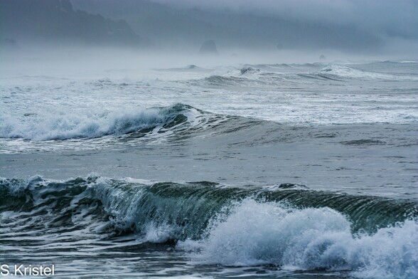
378 followers · 1154 posts · Server toad.social26 day Photography Challenge started by Steve P @Steve_p_photos.toot.community
Come join us!
DAY 18 - R
Rules below:
1 photo per day for 26 days.
Titles start with 'A' and finish with 'Z'. Please don't repeat letters.
No people/human images.
No description in the toot.
Use alt text to fully describe the photo - a picture of a tree is not acceptable.
Copy the rules into the toot.
#Photography #PhotographyChallenge #PhotographyAlphabetChallenge
#Oregon #GoldBeach #Ocean
#photography #PhotographyChallenge #photographyalphabetchallenge #oregon #goldbeach #ocean
Anthony :verified: 📸 · @amay206
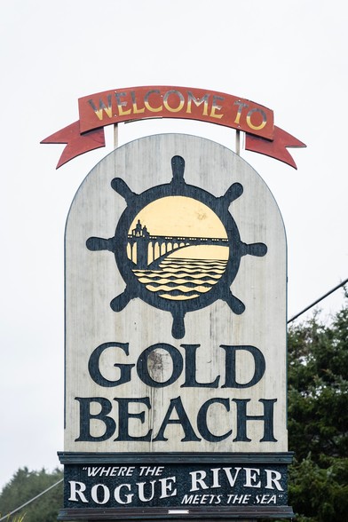
629 followers · 1370 posts · Server mstdn.socialGold Beach, Oregon
#welcomesigns #Travel #oregon #pnw #Photography #goldbeach
The World at War · @theworldatwar
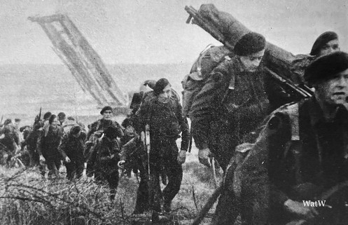
21 followers · 212 posts · Server mastodon.socialBritish Commandos press inland after Gold beach had been secured. Note the bridging tank in the background - D-day 1944 #worldwartwo #worldwar2 #ww2 #worldatwar #secondworldwar #conflict #history #worldwartwopictures #war #worldwar2pictures #historyofwar #historyofwarfare #commandos #britisharmy #goldbeach #dday #normandy #june1944
#worldwartwo #worldwar2 #ww2 #worldatwar #secondworldwar #conflict #history #worldwartwopictures #war #worldwar2pictures #historyofwar #historyofwarfare #commandos #britisharmy #goldbeach #dday #normandy #june1944
Mikado Joe 🇫🇷 · @mikadojoe
62 followers · 955 posts · Server framapiaf.org#GoldBeach - #Normandie-#1944, L'été de la Liberté
La plage qui porte le nom de code de "Gold", se situe au centre du dispositif du débarquement allié, longue de 8 kilomètres, délimitée d'Est en Ouest entre le village de La Rivière et celui du Hamel. Initialement la plage comportait quatres secteurs, hors seulement trois furent utilisés. Cette plage recevra la 50th DI Norhumbrian britannique...
http://normandie44.canalblog.com/archives/2011/12/31/23122009.html


