
Joseph Elfelt · @mappingsupport
360 followers · 266 posts · Server m.ai6yr.org
Interactive #GIS map for #GoldenFire, Klamath County Oregon.
Pink area is latest perimeter from the NIFC.
Click the basemap button (next to the ‘Menu’ button) and look under the “Overlay” heading (mobile users scroll down) to see the list of GIS layers that can be turned on. Need help? Read the “Map tips” - link in upper left corner.
#ORwx #ORfire #Geospatial #Maps #Mapping #Leaflet #ArcGIS #WebMap
Open #GISsurfer map:
https://mappingsupport.com/p2/gissurfer.php?center=43.986266,-122.499962&zoom=12&basemap=USA_scanned_topo&overlay=VIIRS_7_day,MODIS_7_day,State_boundary,Fire_perimeter_NIFC&data=https://mappingsupport.com/p2/special_maps/disaster/USA_wildland_fire.txt
#gis #goldenfire #orwx #orfire #geospatial #maps #mapping #leaflet #arcgis #webmap #gissurfer

MappingSupport · @mappingsupport
3 followers · 7 posts · Server mapstodon.space
Interactive #GIS map for #GoldenFire, Klamath County Oregon.
#RedFlagWarning today. Wind SW 20 to 25 mph with gusts around 30 mph.
Dark red triangles and squares are MODIS and VIIRS satellite heat detections in prior 6 hours. A regular pattern indicates some data *might* be ‘false positive’. To learn about heat detection data click "Map tips" upper left corner.
#ORwx #ORfire #Geospatial #Maps #Mapping #Leaflet #ArcGIS #WebMap
Open #GISsurfer map:
https://mappingsupport.com/p2/gissurfer.php?center=42.333798,-121.383133&zoom=12&basemap=USA_basemap&overlay=VIIRS_7_day,MODIS_7_day,State_boundary,Wildland_fire_name,USA_roads&data=https://mappingsupport.com/p2/special_maps/disaster/USA_wildland_fire.txt
#GIS #goldenfire #redflagwarning #orwx #orfire #geospatial #maps #mapping #leaflet #arcgis #webmap #gissurfer

BakersRelay · @BakerRL75
693 followers · 23590 posts · Server m.ai6yr.org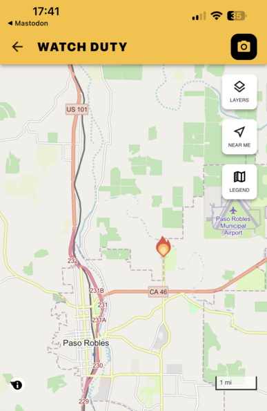
#GoldenFire #CAwx #Firewx
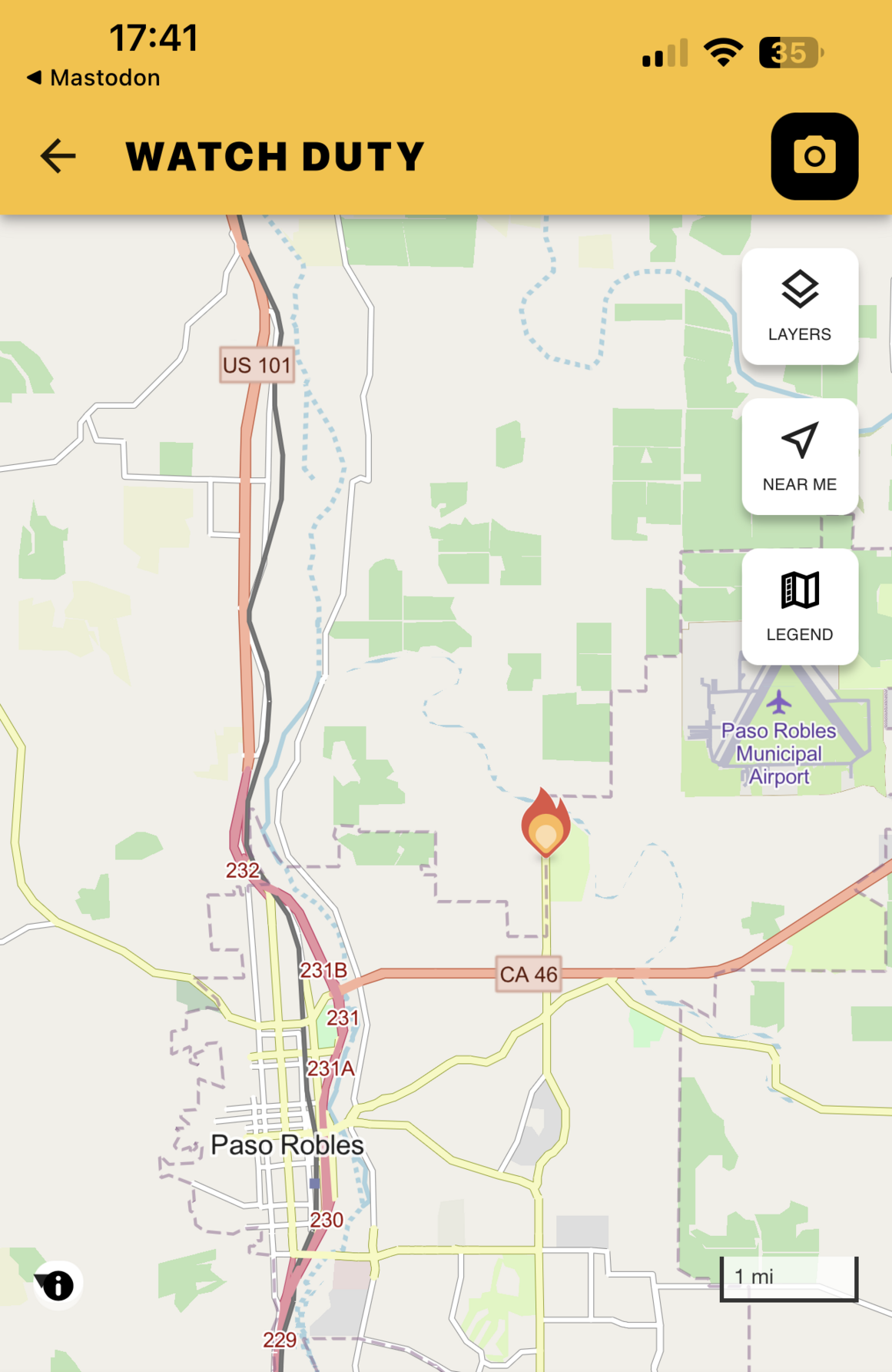
Golden Hill Rd & Circle B Rd, Paso RoblesSan Luis Obispo County
cafirescanner Jun 15th at 5:40 PM
Some small structures are now threatened per radio traffic & access for ground resources is being hindered by downed powerlines.
cafirescanner Jun 15th at 5:35 PM
Air Attack updating the fire to be 1/4-1/2 an acre w/ slow rate of spread.

BC Info Bot · @bcinfo
327 followers · 16890 posts · Server mastodon.roitsystems.caGlobal News BC: Fire severely damages courthouse in Golden, B.C. https://globalnews.ca/news/9547563/courthouse-fire-golden-bc/ #globalnews #britishcolumbia #news #Goldencourthousedestroyed #Goldencourthouseblaze #Goldencourthousefire #CourthouseinGolden #CourthouseGolden #GoldenfireMonday #StructureFire #Goldenfire #Fire
#globalnews #BritishColumbia #news #goldencourthousedestroyed #goldencourthouseblaze #goldencourthousefire #courthouseingolden #courthousegolden #goldenfiremonday #StructureFire #goldenfire #fire