André Mellentin · @eller82
169 followers · 2435 posts · Server social.tchncs.deadvmoto.ca · @advmoto
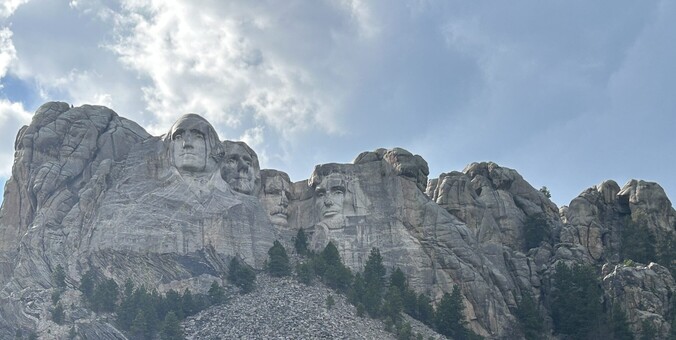
40 followers · 93 posts · Server app.bikers.socialDay 10 – Mount Rushmore https://advmoto.ca/2023/09/day-10-mount-rushmore/ #cabin #camping #DestinationRiding #get-on-adventure-fest #gpx #maps #motorcycle #motorcycling #photos #rally #RoadTrip #sturgis
Please #boost, please visit the page, #comment on the post, and #follow my #blog!
#cabin #camping #destinationriding #get #gpx #maps #motorcycle #motorcycling #photos #rally #roadtrip #sturgis #boost #comment #follow #blog
Lost Mapper · @lostmapper
8 followers · 14 posts · Server mapstodon.spaceSince the script is really not #Strava specific (but still usable on Strava GPX files), I renamed my little #GPX merge #Python script repo: https://github.com/lostmapper/gpx-merge
I also dropped Poetry in favor of built-in Python tools venv and pip.
advmoto.ca · @advmoto
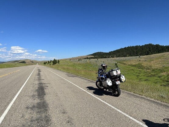
40 followers · 93 posts · Server app.bikers.socialDay 9 – Montana is Really Big…. https://advmoto.ca/2023/09/emt-day-9/ #cabin #camping #DestinationRiding #get-on-adventure-fest #gpx #maps #motorcycle #motorcycling #photos #rally #RoadTrip #sturgis
Please #boost, please visit the page, #comment on the post, and #follow my #blog!
#cabin #camping #destinationriding #get #gpx #maps #motorcycle #motorcycling #photos #rally #roadtrip #sturgis #boost #comment #follow #blog
nikohog 🚴👨💻🎮👨🍳🍺🍞📷 · @nicolashognon
243 followers · 598 posts · Server masto.bikeY a des gens qui font de longues randonnées à vélo et qui planifient eux même leur trajet/trace ? C'est quoi vos astuces ? Moi j'utilise BRouter. Quand j'ai fait Mon Neuilly sur Marne -> Macon j'ai eu quelques passages chiant. Dans le Morvan où pour me faire éviter un petit bout de départementale (qui n'était pas si passent que ça), je rentrais dans un bled plutôt que de le contourner, ce qui voulait dire se tapper un putain de raidar :( #randonnéevélo #gps #gpx #brouter
#randonneevelo #gps #gpx #brouter
Lost Mapper · @lostmapper
3 followers · 5 posts · Server mapstodon.spaceI switched from gpxpy to #Geopandas and am now generating both a #GeoPackage and #GPX file of the combined tracks: https://github.com/lostmapper/strava-gpx-merge
advmoto.ca · @advmoto
35 followers · 91 posts · Server app.bikers.socialDay 8 – Glacier to Billings https://advmoto.ca/2023/09/emt-day-8/ #accident #camping #gpx #maps #motorcycle #motorcycling #photos #RoadTrip
Please #boost, please visit the page, #comment on the post, and #follow my #blog!
#accident #camping #gpx #maps #motorcycle #motorcycling #photos #roadtrip #boost #comment #follow #blog
advmoto.ca · @advmoto
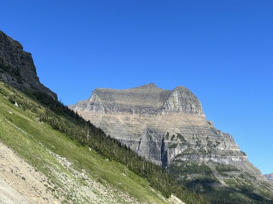
34 followers · 90 posts · Server app.bikers.socialDay 7 – We Rode to the Sun https://advmoto.ca/2023/08/emt-day-7/ #camping #DestinationRiding #gpx #maps #NationalPark #photos #RoadTrip
Please #boost. and please visit the page and #follow my #blog!
#camping #destinationriding #gpx #maps #nationalpark #photos #roadtrip #boost #follow #blog
Assibiker · @Assibiker
36 followers · 219 posts · Server digitalcourage.social@Jochen_Jansen
So unterschiedlich werden die verschiedenen Tools genutzt. Ich plane zuerst mit #Bikerouter um neue Wege zu entdecken & Pumpe sie dann in #Komoot - dort füge ich dann noch POIs hinzu.
Auch weil die App von #wahoo manchmal den #gpx von BR nicht direkt annimmt.
#gpx #wahoo #komoot #bikerouter
JP · @byjp
97 followers · 392 posts · Server hachyderm.ioI’m looking for a #cli app that can create a good-looking map SVG (or raster image, if necessary) from a #GPX file with a track.
Any suggestions?
Ideally it’d be able to run from an offline database of points of interest in the (small!) areas I’m interested in, but I realise that could still be huge, so I’d also be happy with a free or non-subscription paid service.
Garry Keenor · @25kV
749 followers · 2473 posts · Server mas.toanyone out there know of a good site for uploading a load of #gpx files and returning the total distance?
Natenom · @natenom
2268 followers · 34 posts · Server social.anoxinon.deEine #Heatmap aus #GPX-Dateien erstellen – Mit einem #Python-Tool
Man braucht übrigens kein Strava, das Tool referenziert damit nur die bekannten Strava Heatmaps übern Namen.
Nur die Kacheln für die Karte werden von #OpenStreetMap heruntergeladen.
https://natenom.de/2023/06/eine-headmap-aus-gpx-dateien-erstellen-mit-einem-python-tool/
#heatmap #gpx #python #openstreetmap #fahrrad
Tom23 · @Tom23
126 followers · 1775 posts · Server pouet.chapril.orgPour les #randonneurs adeptes de l'#opensource et qui aiment préparer leurs itinéraires au format #GPX, sachez que #QmapShack est très complet.
Il faut un peu de temps pour se l'approprier, mais je le recommande. Plus que prune et viking, bien plus limités.
#randonnée #rando
#rando #randonnee #qmapshack #gpx #opensource #Randonneurs
Camille Arillati · @camarilla
8 followers · 20 posts · Server framapiaf.org#gpx #TravelNotes
Et pour faire une carte à partir de traces gpx, il y a l'excellent logiciel libre TravelNotes (https://github.com/wwwouaiebe/TravelNotes ) qui peut même s'installer en auto-hébergement.
Celui-ci génère un fichier pdf à partir de nos traces. On peut y ajouter des notes de voyages (à partir de recherches effectuées sur openstreetmap)
Je l'ai ensuite mis sur mon téléphone et j'ai pu avoir mon carnet de route.
Au final, ma randonnée sera celle-ci (pour environ 60km)
Heinz Skunk (Mastodon) · @heinzskunk
1274 followers · 194 posts · Server social.tchncs.deDass es beim #karoo2 bzw. #Hammerhead Dashboard die Möglichkeit gibt POIs anzulegen, die dann auch im Cue Sheet auftauchen ist ja super. Dass ich die aber händisch aus dem #GPX Track wo sie hinterlegt sind übertragen muss, weil sie beim Import einfach verworfen werden, ist schon etwas nervig.
Mapping Support · @mappingsupport
107 followers · 23 posts · Server m.ai6yr.orgDid you do a fun trip this past weekend and save your GPS track? If you have a #GPX file then you can make a #GISsurfer map that displays the track. #hiking #biking #climbing #mountainbiking
Your GPX file has to be online. Google Drive provides free hosting.
For directions, including using Google Drive, start at the bottom of p.14 of this PDF.
https://mappingsupport.com/p2/help/GISsurfer-data-parameter.pdf
Open GISsurfer and display a GPX file hosted on Google Drive:
https://mappingsupport.com/p2/gissurfer.php?basemap=USA_scanned_topo&data=Bandera.gpx^https://drive.google.com/uc?id=1TVj3kiCIp7BKjSvGzDmkGEs-EniOCWGD
#gpx #gissurfer #hiking #biking #climbing #mountainbiking
Łukasz Horodecki · @LukaszHorodecki
239 followers · 216 posts · Server pol.socialJest postęp w temacie osadzania tras na blogasku \o/
Znalazłem info o niezbędnych zmianach w .htaccess i w końcu Leaflet ładuje trasę z pliku gpx. Teraz jeszcze muszę dorzucić kolorowe markery dla POI. I dokończyć pisanie tekstu. Oraz wybrać zdjęcia. Coś dużo tej roboty zostało...
#WordPress #Leaflet #OpenStreetMap #OsadzanieMap #OsadzanieTras #gpx
#gpx #osadzanietras #osadzaniemap #openstreetmap #leaflet #wordpress
· @Tungmar
38 followers · 217 posts · Server troet.cafeRouten: Gedacht für den Weg, den du gehen willst.
Tracks: Die Aufzeichnung, wo du warst.
Für viele Fälle kommt es aber auf das Gleiche raus.
Ich das mal ausprobiert:
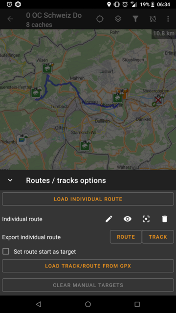
Durch langes Drücken auf Wegpunkte auf der Karte können diese zur Route hinzugefügt werden. Anschliessen kann unter dem Menu oben rechts -> Routes / Tracks -> Export individual route -> ROUTE eine #GPX Datei erzeugt werden.
Diese Datei kann unten rechts auf #Komoot über Mehr -> GPS-Datei importieren eingelesen werden.
:ferris: Naughtylus :nixos: · @Naughtylus
255 followers · 3101 posts · Server fosstodon.orgI made a small tool!
https://gitlab.com/ThibaultLemaire/marinetraffic.com-to-gpx#about
I was recently on a ship, took some pictures, but forgot to turn on my GPS and record the track myself.
With this tool I was able to get the track and use it to geolocate the pictures in Digikam by correlating the timestamps.
Plus, I also get to keep the GPX itself for later view.
Cykelbloggar 🚲 🇸🇪 · @cykelbloggar
15 followers · 84 posts · Server mas.toDela med dig av dina bästa cykelrutter https://cykelframjandet.se/nyheter/2023/04/21/dela-med-dig-av-dina-basta-cykelrutter/?utm_source=rss&utm_medium=rss&utm_campaign=dela-med-dig-av-dina-basta-cykelrutter #specialcykelvänligaturer #elcykelvänligaturer #bikepacking-turer #cykeldagsturer #naturutflykter #Cykelrutter #turismturer #grusturer #Nyheter #GPX
#gpx #nyheter #grusturer #turismturer #cykelrutter #naturutflykter #cykeldagsturer #bikepacking #elcykelvanligaturer #specialcykelvanligaturer
