
Charleston Weather · @chswx
71 followers · 1169 posts · Server chswx.social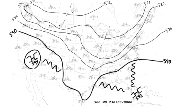
Quick upper-air analysis at 500mb shows a subtle shortwave driving convection over Georgia, with a longer-wave trough stretching from the Great Lakes to Texas. A 592dm ridge centered over Florida is keeping us in the warmth to start the week. Working on *that* post now…
#chswx #scwx #handanalysis #upperair
Charleston Weather · @chswx
48 followers · 676 posts · Server chswx.social
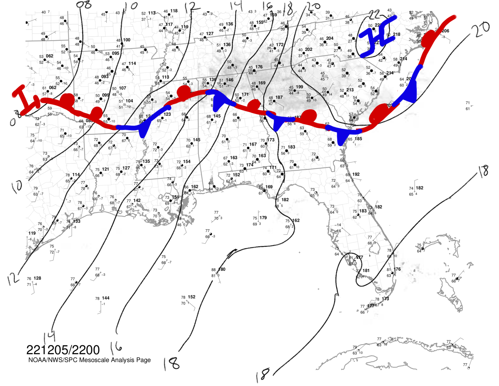
Subjective surface analysis depicts our last few hours in the warm sector before the cold front at the SC/NC border moves by this evening. Temperatures approaching 80° ahead of it, while temperatures are in the 50s behind it. Won’t rule out some showers and maybe a thunderstorm ahead of the front as it sinks southward, with more rain settling in this evening into the overnight.
#mesoanalysis #chswx #scwx #handanalysis #wxmastodon

Charleston Weather · @chswx
29 followers · 121 posts · Server chswx.social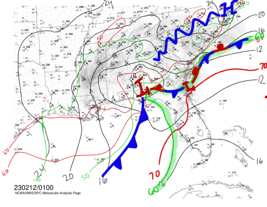
01z surface analysis across the Southeast shows the coastal front maybe 20 miles offshore of the Lowcountry this evening. A wave of low pressure is, as expected, developing off the FL/GA coasts and will ride the boundary northeast, nudging some elevated instability into the area over the next few hours. Radar is beginning to show some heavier rain building into Beaufort and Jasper counties, and this is expected to translate northeast with time into #Charleston.
#charleston #wxmastodon #handanalysis #chswx

Jared Smith · @jaredwsmith
244 followers · 280 posts · Server mastodon.online
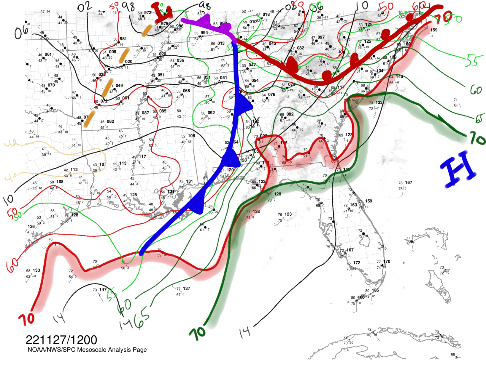
Soup weather: Cold air damming with rain falling into it. Warm air is tantalizingly close…we get it tomorrow. #chswx #wxmastodon #handanalysis #mesoanalysis
#mesoanalysis #handanalysis #wxmastodon #chswx
Jared Smith · @jaredwsmith
244 followers · 280 posts · Server mastodon.online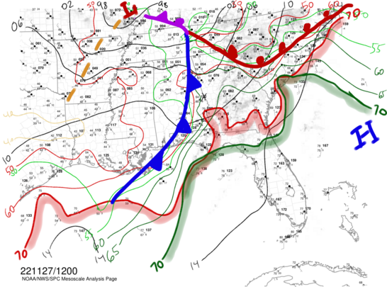
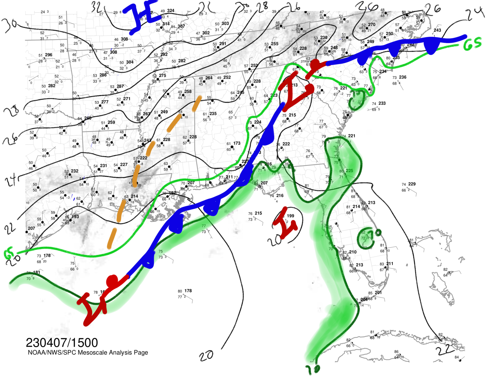
A little morning #handanalysis. Nice little tongue of 70s dewpoints coming ashore here in Charleston this morning. And by “nice” I mean “unseasonably muggy.” Cold front incoming to Georgia with the warm front lifting into the Upstate of SC. Eastern NC has the best chance to destabilize enough today for a tornado or two, though 70s dews here combined with decent hodos have me watching radar a little closer today. #wxmastodon #wxtoots #chswx
#chswx #wxtoots #wxmastodon #handanalysis