petersuber · @petersuber
4230 followers · 999 posts · Server fediscience.orgCongratulations to the three projects that just won "Advancing Open Knowledge" grants from #HarvardLibrary.
https://staff.library.harvard.edu/advancing-open-knowledge-2023
#libraries #openaccess #harvardlibrary
petersuber · @petersuber
3675 followers · 662 posts · Server fediscience.org"The #HBCU Library Alliance & #HarvardLibrary are embarking on this project [to advance] open, public access to archives & special collections pertaining to #AfricanAmerican history. Funds are provided by the Harvard & the Legacy of Slavery initiative, which has designated $6 million for this project."
https://library.harvard.edu/about/news/2023-03-08/hbcula-hl-partnership
PS: Universities can't stop states determined to prohibit the teaching of accurate US history. But they can make it easy for students to find more of the missing chapters.
#africanamerican #harvardlibrary #hbcu
petersuber · @petersuber
3634 followers · 625 posts · Server fediscience.orgUpdate. The statement is now on the #HarvardLibrary website.
https://library.harvard.edu/about/news/2023-03-03/iplc-letter-office-science-technology-policy
Another excerpt: "We want to highlight the dangers of allowing the interests of commercial #publishers to dictate the paths available to [#OpenAccess]…We refer here to the…#APC (article processing charge)…and/or institutional #ReadAndPublish agreements where libraries pay bulk APCs on behalf of their scholars and unlock institutional access to read pay-walled content."
#readAndPublish #APC #openaccess #publishers #harvardlibrary
Olivier Duquesne aka DaffyDuke · @daffyduke
485 followers · 37712 posts · Server mamot.frRT @HarvardMapColl
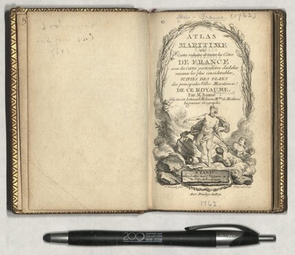
Wrapping up the petite atlases with the finely bound
Atlas Maritime (1762) by Rigobert Bonne, presenting in reduced form all the coasts and the major maritime cities of France (here shown Pas de Calais and Dunkerque), some 30 maps altogether. #maps #HarvardLibrary
Fondazione BEIC · @fondazionebeic
101 followers · 1296 posts · Server digipres.clubRT @HarvardMapColl
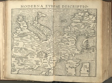
A hyperborean perspective of #Europe, with south at the top, here presented by Sebastian Münster, from the encyclopedic Cosmographiae Uniuersalis (1554 edition), and first seen in his 1540 Geographia Vniversalis. #maps #HarvardLibrary
Fondazione BEIC · @fondazionebeic
101 followers · 1296 posts · Server digipres.clubRT @HarvardMapColl
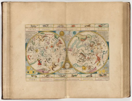
To reinforce the primacy of the stars (when the clouds allow) to navigation, Seller has a third celestial chart in the Maritimus, a double hemisphere, apparently by an engraver under a strict deadline, as the figures around the poles are very loosely drawn. #maps #HarvardLibrary
Fondazione BEIC · @fondazionebeic
101 followers · 1296 posts · Server digipres.clubRT @HarvardMapColl
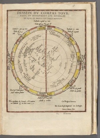
Navigational aids for the 16th c. mariner: a chart/volvelle of the stars of the northern hemisphere, along with a compass rose in full bloom! From Lucas Janszoon Waghenaer's 1590 French edition of his Spieghel der Zeevaerdt or, Du Miroir de la Navigation. #maps #HarvardLibrary
Fondazione BEIC · @fondazionebeic
101 followers · 1296 posts · Server digipres.clubRT @HarvardMapColl
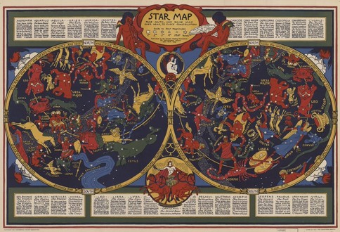
A modern presentation of the ancient stars and constellations, filled with the lore of the Greek, Babylonian, Egyptian and Assyrian traditions; here in a colorful 1930 double hemispheric chart by Elizabeth Shurtleff. #maps #HarvardLibrary
Fondazione BEIC · @fondazionebeic
101 followers · 1296 posts · Server digipres.clubRT @HarvardMapColl
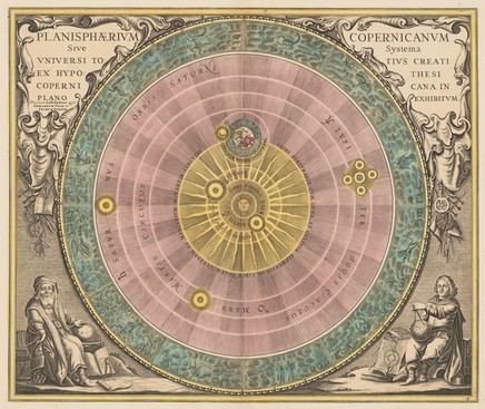
To put the #Sun in context, at least as presented by Nicolaus Copernicus, seated right, and the ancient astronomer Aristarchus of Samos, seated left; here from the 1708 P. Schenk & G. Valk edition of Harmonia Macrocosmica, by Andreas Cellarius. #maps #HarvardLibrary
Fondazione BEIC · @fondazionebeic
101 followers · 1296 posts · Server digipres.clubRT @HarvardMapColl
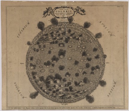
Kircher was interested not only in the terrestrial realm but also what was happening on the Sun, and in 1635, joined by Christoph Scheiner, observed our nearest star and espied multitudes of billowing volcanoes, sunspots, and an encircling fiery filament. #maps #HarvardLibrary
Robert Sander · @gurubert
171 followers · 4856 posts · Server mastodon.gurubert.deRT @HarvardMapColl@twitter.com
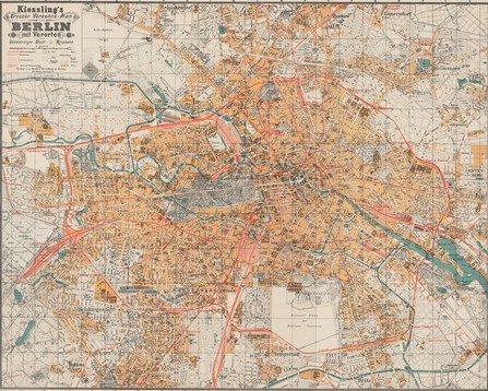
To mark V-E Day, a #map of #Berlin from 1920 by Alexius Kiessling ##VEDay75 #harvardlibrary high-res: https://digitalcollections.library.harvard.edu/catalog/990107766790203941
🐦🔗: https://twitter.com/HarvardMapColl/status/1258800326729179136
#harvardlibrary #VEDay75 #berlin #map
Raf · @Raf
298 followers · 5913 posts · Server mastodon.socialRT @HarvardMapColl@twitter.com
Driving up the east coast? Put away your GPS and use our #recentacquisition: McCauley #Map Case with a 1939 US road map. #harvardlibrary
🐦🔗: https://twitter.com/HarvardMapColl/status/1176859518036262914
#recentacquisition #map #harvardlibrary
Raf · @Raf
298 followers · 5913 posts · Server mastodon.socialRT @HarvardMapColl@twitter.com
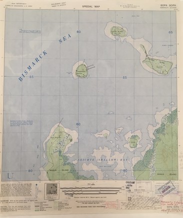
These 1944 US Army #maps of New Guinea have a topographic #map on one side and the photomap (aerial photo processed to add the grid and toponyms) on the other allowing you to see some of the process of producing the map from aerial photographs. #aerialphotography #harvardlibrary
🐦🔗: https://twitter.com/HarvardMapColl/status/1126513529220149249
#maps #map #aerialphotography #harvardlibrary
