
GregCocks · @GregCocks
150 followers · 169 posts · Server techhub.social
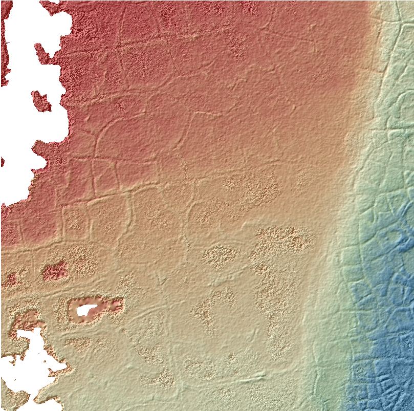
A Simplified GIS And Google-Earth-Based Approach For Lineaments And Terrain Attributes Mapping In A Basement Complex Terrain
--
https://doi.org/10.1038/s41598-022-20057-2 <-- shared paper
--
#GIS #spatial #mapping #imagery #geology #geologic #geological #geologymap #remotesensing #IdanreHills #Nigeria #Africa #spatialanalysis #structuralgeology #network #structural #imagery #lineaments #terrain #methodology #stream #hydrology #geomorphology #roughness #gischat #GoogleEarth #geologicmapping #batholith #gneiss #slope #flowlines #weathering #remotemapping #hillshade #raster
#gis #spatial #mapping #imagery #geology #geologic #geological #geologymap #remotesensing #idanrehills #nigeria #africa #spatialanalysis #structuralgeology #network #structural #lineaments #terrain #methodology #stream #hydrology #geomorphology #roughness #gischat #googleearth #geologicmapping #batholith #gneiss #slope #flowlines #weathering #remotemapping #hillshade #raster

GregCocks · @GregCocks
6 followers · 15 posts · Server techhub.social
Quality Assessment Of DEM Derived From Topographic Maps For Geomorphometric Purposes
--
https://doi.org/10.1515/geo-2019-0066 <-- shared paper
--
#GIS #spatial #mapping #DEM #LiDAR #qualityassessment #geomorphometry #SilesianUpland #topographic #remotesensing #geomorphology #geomorphometry #quantative #landsurface #hillshade #slope #QAQC #landform #drainage #hydrology #water #quality #digital
#gis #spatial #mapping #dem #lidar #qualityassessment #geomorphometry #silesianupland #topographic #remotesensing #geomorphology #quantative #landsurface #hillshade #slope #qaqc #landform #drainage #hydrology #water #quality #digital

TC (Tirthankar Chakraborty) · @TC_Chakraborty
345 followers · 241 posts · Server fediscience.org
#30DayMapChallenge Day 26: #Island
#CraterLake in #Oregon, US, with Wizard Island near its western shore.
#EOChat #gischat #EarthEngine #google #hillshade #oregon #CraterLake #island #30DayMapChallenge

Ingmar Nitze · @i_nitze
54 followers · 35 posts · Server mapstodon.space
#DSM + #hillshade #whiteboxtools from #structure-from-motion #pointcloud of aerial imagery.
beautiful #permafrost polygons visible. Output still a bit noisy. Water areas are kept empty (noData)
#dsm #hillshade #whiteboxtools #structure #pointcloud #permafrost

Raf · @Raf
298 followers · 5913 posts · Server mastodon.social
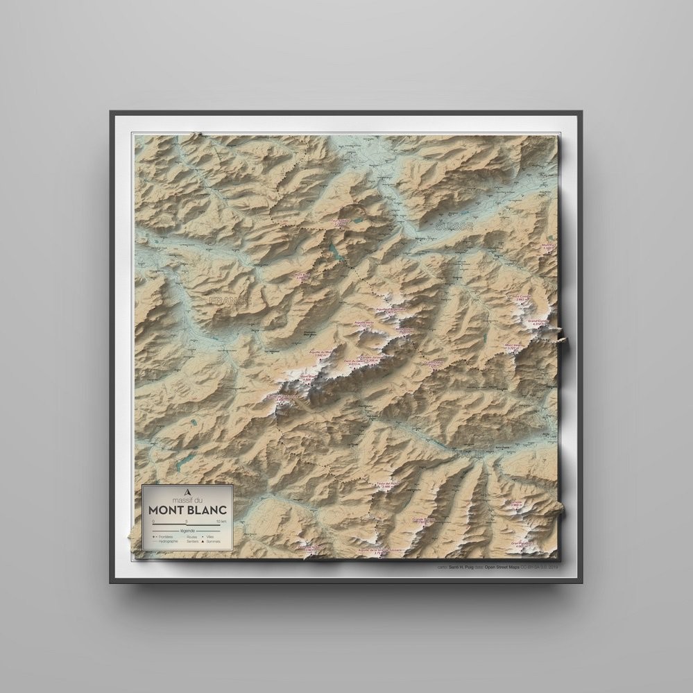
RT @santihpuig@twitter.com
New map of the #MontBlanc massif designed from scratch. Classic style but with a bit more of swag thanks to the #hillshade illuminated with #Blender. The mountains are calling!
Data: @openstreetmap@twitter.com & @USGS@twitter.com
HD: http://santihpuig.com/map/Montblanc_santihpuig.jpg
#qgis #maps #gis #cartography #mapporn
🐦🔗: https://twitter.com/santihpuig/status/1151843099066490880
#hillshade #blender #qgis #maps #montblanc #gis #cartography #mapporn