
GregCocks · @GregCocks
576 followers · 515 posts · Server techhub.social
The Kingdom of Bhutan [1965 cartography]
--
https://collections.lib.uwm.edu/digital/collection/agdm/id/30617/rec/61 <-- link to map and details
--
https://doi.org/10.1111/j.1467-8306.1965.tb00539.x <-- shared paper’s note, 2010
--
H/T @evan Applegate
[a “yam between two boulders.” (China (Tibet) and India)]
“Contained in (work): Association of American Geographers Annals of the Association of American Geographers…
Relief shown by shading and spot heights…”
#GIS #spatial #mapping #bhutan #kingdomofbhutan #map #cartographer #cartography #topography #relief #transportation #seasia #hydrology #historic #historicmaps #landform #geomorphology #terrain #gischat #AAG
@americangeo
#gis #spatial #mapping #bhutan #kingdomofbhutan #map #cartographer #cartography #topography #relief #transportation #seasia #hydrology #historic #historicmaps #landform #geomorphology #terrain #gischat #aag
GregCocks · @GregCocks
305 followers · 393 posts · Server techhub.social
How A Venetian Monk Created The First Annotated Map Of The World
--
https://lithub.com/how-a-venetian-monk-created-the-first-annotated-map-of-the-world/ <-- shared technical article
--
#GIS #spatial #mapping #map #history #cartography #medieval #mappamundi #geography #cartographer #annotations #scientific #mapmaking #culture #sources #background #interpretation #bibliography #information #encyclopedia #observation #groundtruthing #historic #historicmaps #historicmapping #historicaldata #references
#gis #spatial #mapping #map #history #cartography #medieval #mappamundi #geography #cartographer #annotations #scientific #mapmaking #culture #sources #background #interpretation #bibliography #information #encyclopedia #observation #groundtruthing #historic #historicmaps #historicmapping #historicaldata #references
GregCocks · @GregCocks
247 followers · 325 posts · Server techhub.social
Ancient Courses - Harold Fisk’s Meander Maps Of The Mississippi River (1944)
--
https://kottke.org/19/06/the-marvelous-mississippi-river-meander-maps <-- shared blog post
--
[Daniel Coe has done and continues to make amazing hydrographic cartography in this regard, see image attached]
--
“[T]housands of years of course changes compressed into a single image by a clever mapmaker with an artistic eye. Looking at them, you're invited to imagine the Mississippi as it was during the European exploration of the Americas in the 1500s, during the Cahokia civilization in the 1200s (when this city's population matched London's), when the first humans came upon the river more than 12,000 years ago, and even back to before humans, when mammoths, camels, dire wolves, and giant beavers roamed the land and gazed upon the river…”
#GIS #spatial #mapping #hydrology #mississippi #cartography #hydrology #water #river #meanders #representation #map #maps #historicmaps #banks #art #artwork #gischat #HaroldFisk
@USACE @kottke
#gis #spatial #mapping #hydrology #mississippi #cartography #water #river #meanders #representation #map #Maps #historicmaps #banks #art #artwork #gischat #haroldfisk
GregCocks · @GregCocks
228 followers · 289 posts · Server techhub.social
If The Ancient Romans Had Google Maps - Omnesviae Is A Modern Route Planner Based On The Roads Of The Roman Empire
--
https://bigthink.com/strange-maps/omnesviae-roman-roads-map/ <-- shared article
--
https://www.omnesviae.org/ <-- OmnesViae - Roman RoutePlanner
--
[combining professional and personal interests]
#GIS #spatial #mapping #gischat #network #webmap #romanempire #ancientrome #ancienthistory #transportation #infrastructure #roads #commerce #military #OmnesViae #routing #publicroads #TabulaPeutingeriana #history #ancientmaps #historicmaps #itinerarium #peutingermap #onlinemapping #onlinemap
#gis #spatial #mapping #gischat #network #webmap #romanempire #ancientrome #ancienthistory #transportation #infrastructure #roads #commerce #military #omnesviae #routing #publicroads #tabulapeutingeriana #history #ancientmaps #historicmaps #itinerarium #peutingermap #onlinemapping #onlinemap
GregCocks · @GregCocks
207 followers · 264 posts · Server techhub.social
Terra Nostra, 1550-1950 - The Stories Behind Canada's Maps [lunchtime reading for a map nerd]
--
https://www.mqup.ca/terra-nostra--1550-1950-products-9782894484531.php <-- link to book details
--
[a wonderful description of maps in their exploration, historic, cultural, economic and political settings]
“Maps have been invaluable throughout Canada's history. They promised fame and fortune to early merchant-adventurers and guided army commanders. They legitimized a politician's dominion and allowed businessmen to stake new claims. And they helped ordinary citizens build communities. Terra Nostra celebrates the mapping of Canada, in part by telling the stories of the exceptional individuals who helped to create the maps..."
#GIS #spatial #mapping #Canada #history #maps #cartography #gischat #context #historic #nationbuilding #historicmaps #economics #politics #exploration #culture #cultural #appliedscience #cartographie #geography #maplesyrup #Chesterfield
#gis #spatial #mapping #Canada #history #Maps #cartography #gischat #Context #historic #nationbuilding #historicmaps #economics #Politics #exploration #culture #cultural #appliedscience #cartographie #geography #maplesyrup #chesterfield
GregCocks · @GregCocks
189 followers · 234 posts · Server techhub.social
19th-Century London’s Extreme Wealth And Poverty, Mapped [Charles Booth's mapping]
--
https://www.bloomberg.com/news/articles/2019-11-04/charles-booth-s-london-poverty-maps-revisited <-- shared article
--
https://www.bbc.co.uk/programmes/m000wsxf <-- wonderful BBC podcast, #InOurTime
--
https://booth.lse.ac.uk/ <-- interactive website of Charles Booth’s London, London School Of Economics
--
[alongside John Snow’s famous “GIS” maps of disease mapping (specifically cholera in PWS in London in the 1850s), these 1890s and 1900s maps from Charles Booth were some of the defining ones of the history of spatial analyses]
#GIS #spatial #mapping #history #poverty #spatialanalyses # #people #research #london #UK #food #publichealth #publicsafety #demographics #CharlesBooth #maps #abjectpoverty #lowincome #gischat #CityLab #MapLab #historicmaps #historyfacts #demography #demographic #economics #income #poor #poorpeople #qualityoflife #LSE
#inourtime #gis #spatial #mapping #history #poverty #spatialanalyses #people #research #london #uk #Food #publichealth #publicsafety #demographics #charlesbooth #Maps #abjectpoverty #lowincome #gischat #citylab #maplab #historicmaps #historyfacts #Demography #demographic #economics #income #poor #poorpeople #QualityOfLife #lse
GregCocks · @GregCocks
150 followers · 168 posts · Server techhub.social
The things you find in old buildings (810, DFC)
#mapping #scribing #mapmaking #historic #historicmaps #offsetprinting #cartography #topomaps #instrumentation #byhand #USGS
#mapping #scribing #mapmaking #historic #historicmaps #offsetprinting #cartography #topomaps #instrumentation #byhand #usgs
GregCocks · @GregCocks
139 followers · 161 posts · Server techhub.social
Stokes's Capital Mnemonical Globe [1879]
--
https://curiosity.lib.harvard.edu/scanned-maps/catalog/44-990142408140203941_FHCL:13497167 <-- map
--
https://curiosity.lib.harvard.edu/scanned-maps/catalog/44-990142408140203941_FHCL:14226111 <-- companion booklet
--
[I think that I want ‘Teacher of Memory’ on my personal card, aspirational on my part]
--
“A FAIR knowledge of Geography is essential to the full development and exercise of intelligence, and is not only an advantage but a great delight. Its study however, as usually pursued, is too often wearisome and unsatisfactory. Many find the facts extremely difficult to learn, and experience an unenviable facility in forgetting them...
WILLIAM STOKES,
15, Margaret Street,
TEACHER OF MEMORY.
Cavendish Square, London, W.
January 1st, 1868.”
#FridaysOldMaps #GIS #spatial #mapping #gischat #cartography #historic #historicmaps #historymatters #globe #global #williamstokes #preservation #teaching #teacher #learning
#fridaysoldmaps #gis #spatial #mapping #gischat #cartography #historic #historicmaps #HistoryMatters #globe #global #williamstokes #preservation #teaching #teacher #learning

Kristof Doffing · @KristofDoffing
33 followers · 161 posts · Server darmstadt.social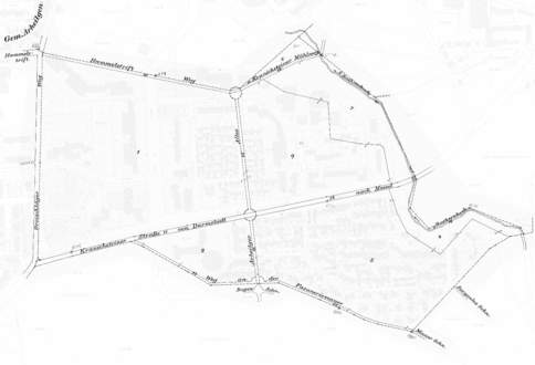
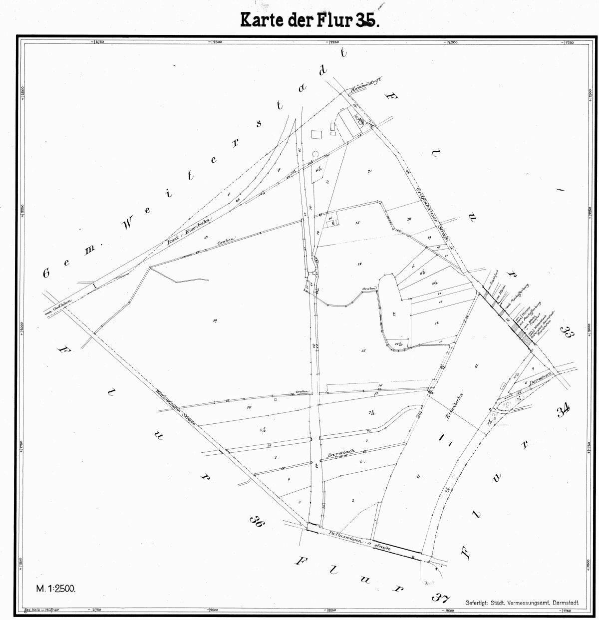
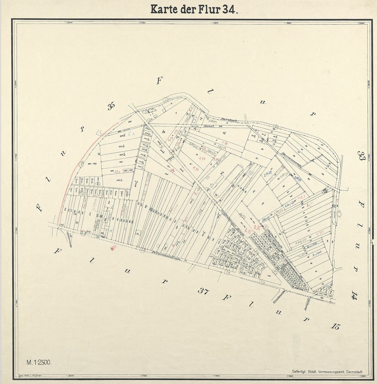
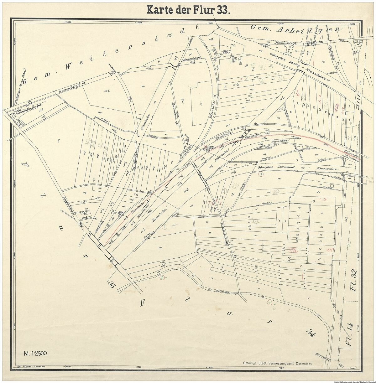
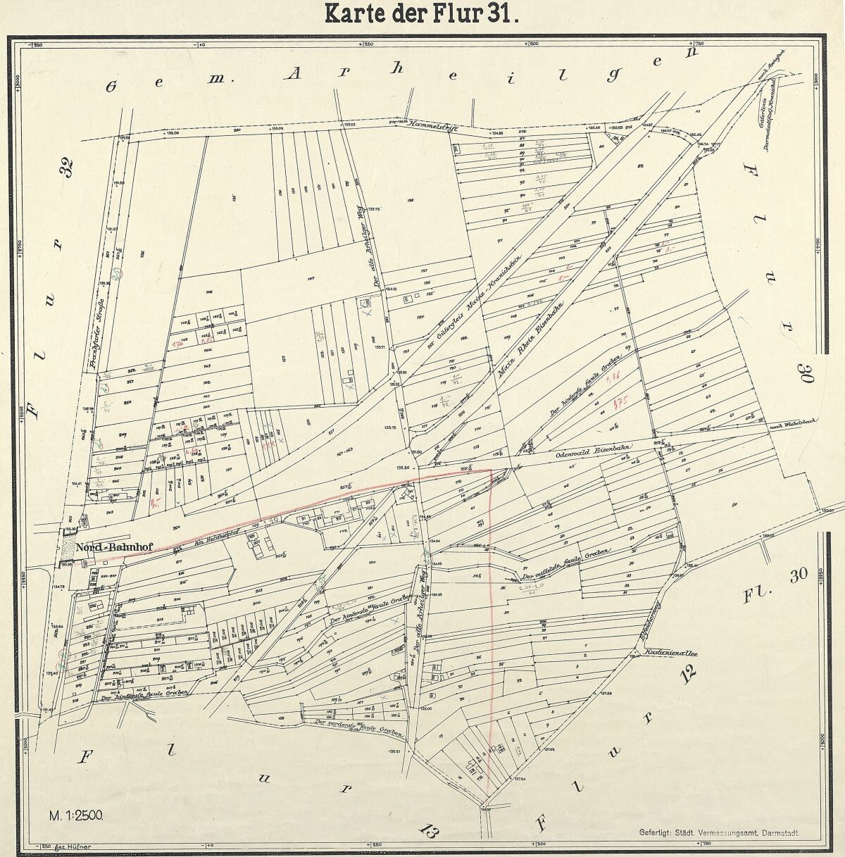
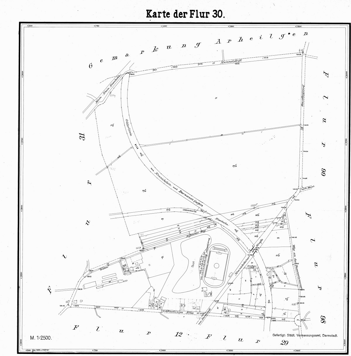
#Darmstadt 1930er-Jahre Flur 99 (#Kranichstein)
#historicmaps
#darmstadt #Kranichstein #historicmaps
Kristof Doffing · @KristofDoffing
33 followers · 161 posts · Server darmstadt.social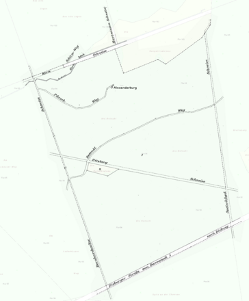
Kristof Doffing · @KristofDoffing
33 followers · 161 posts · Server darmstadt.social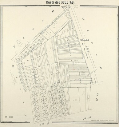
#Darmstadt 1930er-Jahre Flur 49 (#Heimstättensiedlung)
#historicmaps
#darmstadt #Heimstättensiedlung #historicmaps
Kristof Doffing · @KristofDoffing
33 followers · 161 posts · Server darmstadt.social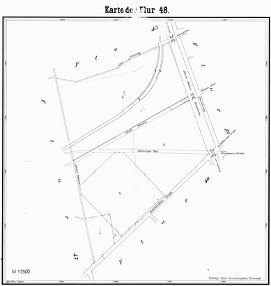
Kristof Doffing · @KristofDoffing
33 followers · 161 posts · Server darmstadt.social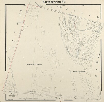
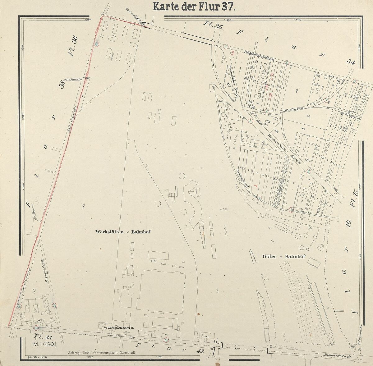
#Darmstadt 1930er-Jahre Flur 37 (Güterbahnhof und Werkstätten)
#historicmaps
Kristof Doffing · @KristofDoffing
33 followers · 161 posts · Server darmstadt.social
Kristof Doffing · @KristofDoffing
33 followers · 161 posts · Server darmstadt.social
Kristof Doffing · @KristofDoffing
33 followers · 161 posts · Server darmstadt.social
Kristof Doffing · @KristofDoffing
33 followers · 161 posts · Server darmstadt.social
Kristof Doffing · @KristofDoffing
33 followers · 161 posts · Server darmstadt.social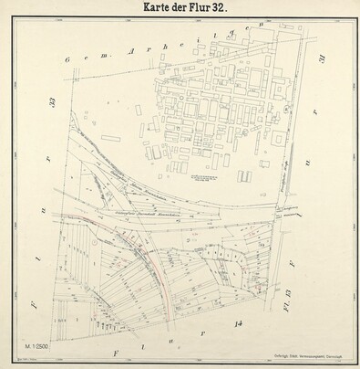
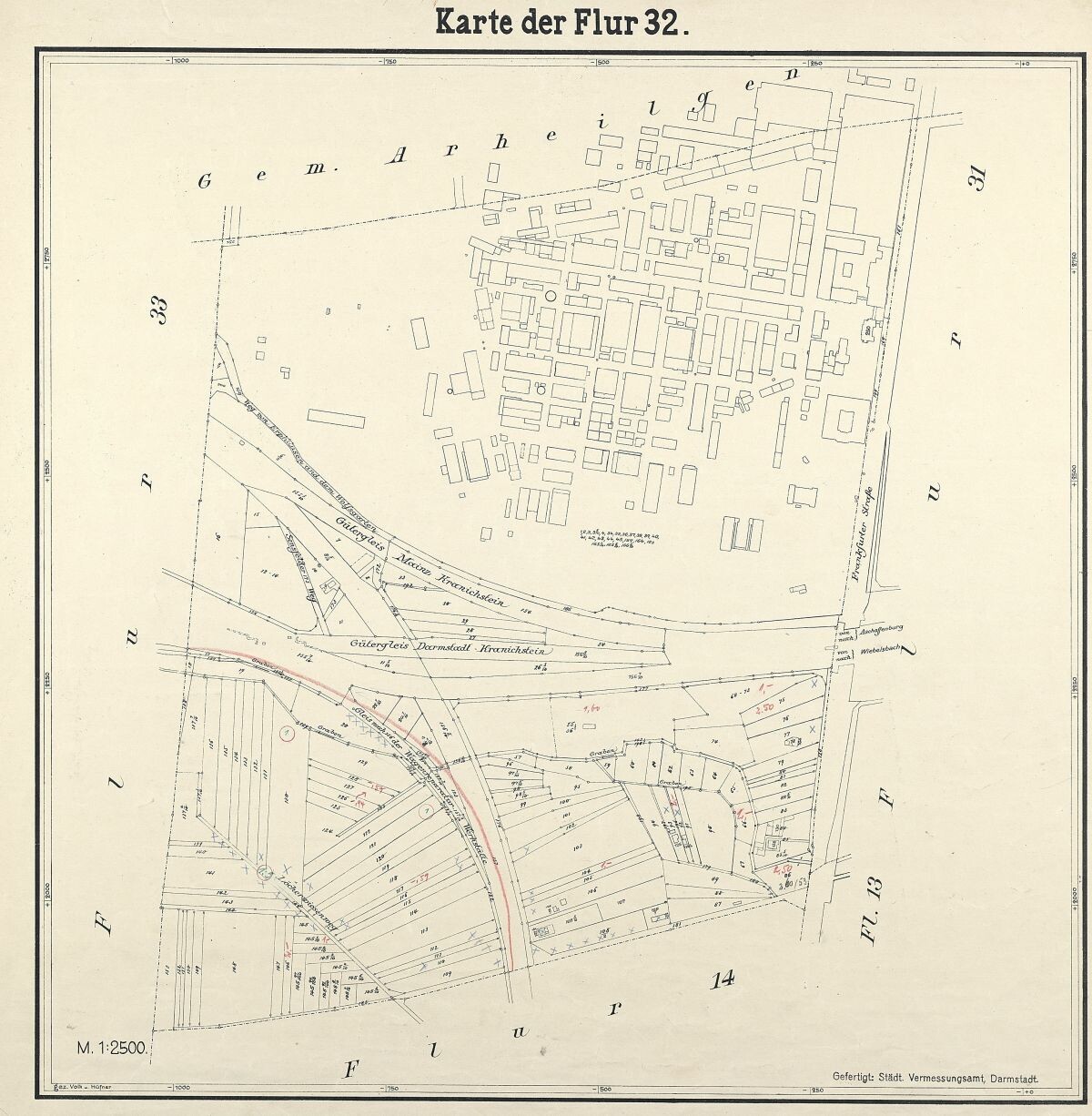
#Darmstadt 1930er-Jahre Flur 32 mit #Merck-Gelände
#historicmaps
#darmstadt #Merck #historicmaps
Kristof Doffing · @KristofDoffing
33 followers · 161 posts · Server darmstadt.social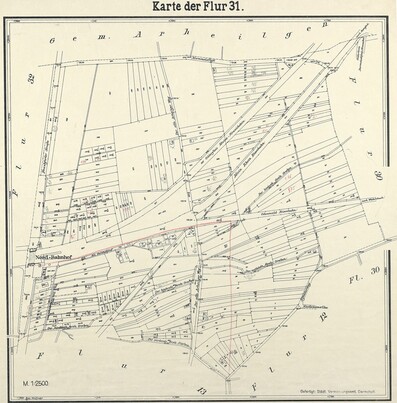