
· @nationalparks
541 followers · 243 posts · Server sfba.social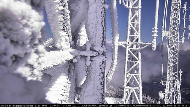
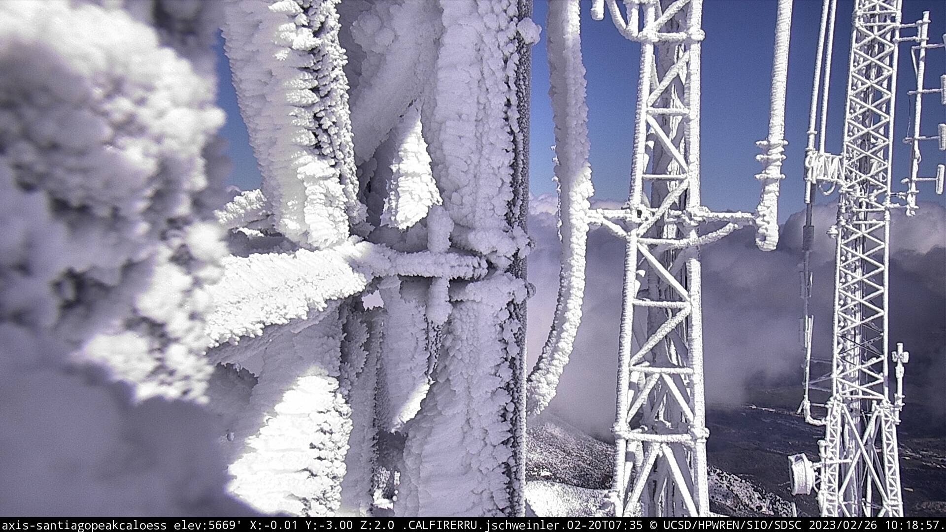
An impressive sight! View from Santiago Peak yesterday. This camera site is at 5669 feet. Image credit the High Performance Wireless Research and Education Network (HPWREN) project at the University of California, San Diego, and the National Science Foundation. Learn more at http://hpwren.ucsd.edu and #hpwren #ucsd #publiclands #photography #landscapephotography #interpretation #newtopographics #cawx and thank you to everyone who works to keep these systems running!
#hpwren #UCSD #publiclands #photography #landscapephotography #Interpretation #newtopographics #cawx
· @nationalparks
536 followers · 239 posts · Server sfba.social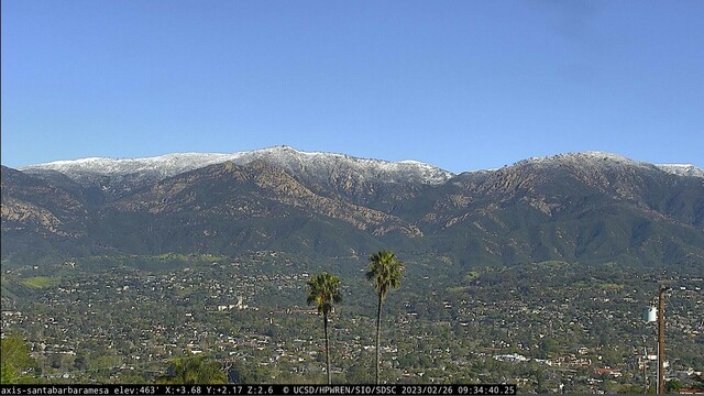
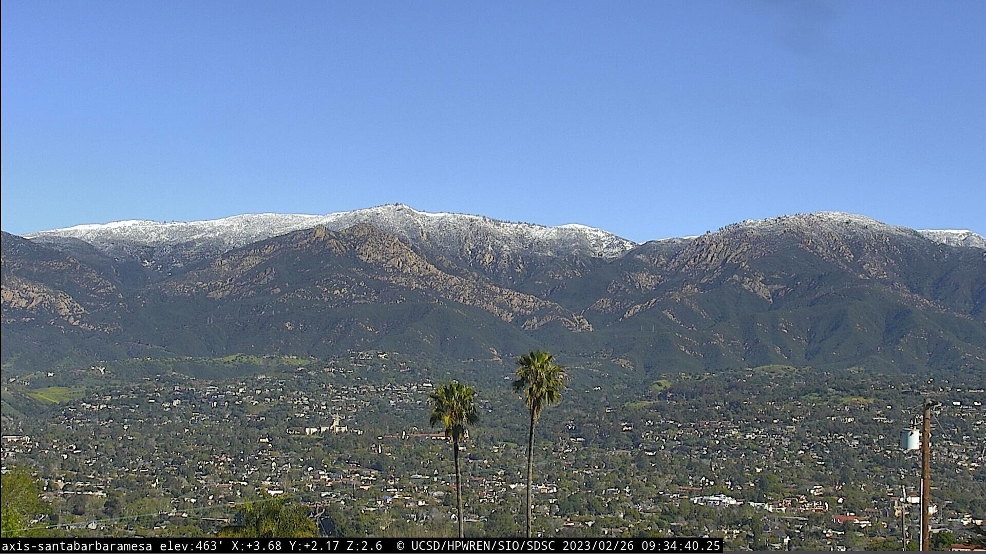
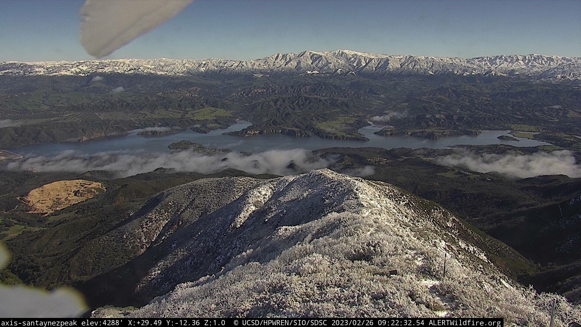
The Santa Ynez Mountains and Los Padres National Forest from Santa Barbara today. This is the north-facing camera view. Image credit the High Performance Wireless Research and Education Network (HPWREN) project at the University of California, San Diego, and the National Science Foundation. Learn more at http://hpwren.ucsd.edu and #hpwren #ucsd #usfs #forest #photography #landscapephotography #publiclands #interpretation #snow #cawx #mountains #santabarbara
#hpwren #UCSD #usfs #forest #photography #landscapephotography #publiclands #Interpretation #snow #cawx #mountains #santabarbara
· @nationalparks
536 followers · 238 posts · Server sfba.social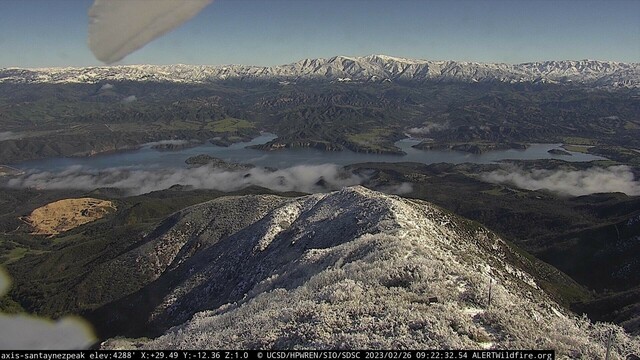
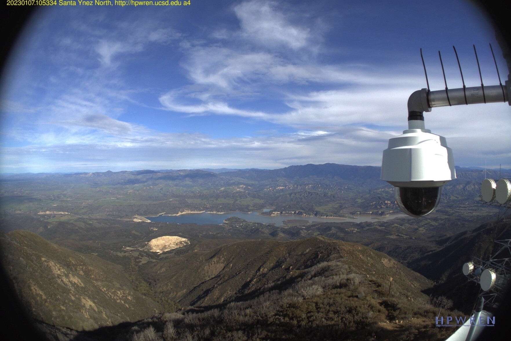
Looking out towards the Los Padres National Forest from Santa Ynez Peak today. This is the north-facing view. The view to the south includes the Pacific Ocean and Channel Islands National Park. Image credit the High Performance Wireless Research and Education Network (HPWREN) project at the University of California, San Diego, and the National Science Foundation. Learn more at http://hpwren.ucsd.edu and #hpwren #ucsd #usfs #forest #photography #landscapephotography #publiclands #interpretation
#hpwren #UCSD #usfs #forest #photography #landscapephotography #publiclands #Interpretation
· @nationalparks
512 followers · 229 posts · Server sfba.social
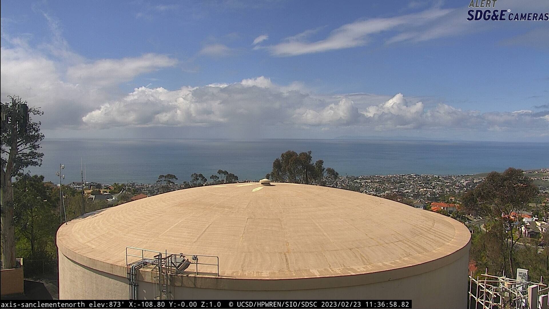
Views of the sky from 873 feet and 5430 feet today. Image credit San Clemente and the Pacific Ocean from the High Performance Wireless Research and Education Network (HPWREN) project at the University of California, San Diego, and the National Science Foundation at http://hpwren.ucsd.edu and #hpwren #ucsd #publiclands #photography #landscapephotography #interpretation #newtopographics #nps #nationalparks #mountrainier #sky and Mount Rainier National Park/Paradise from the National Park Service
#hpwren #UCSD #publiclands #photography #landscapephotography #Interpretation #newtopographics #nps #nationalparks #mountrainier #sky
· @nationalparks
476 followers · 204 posts · Server sfba.social
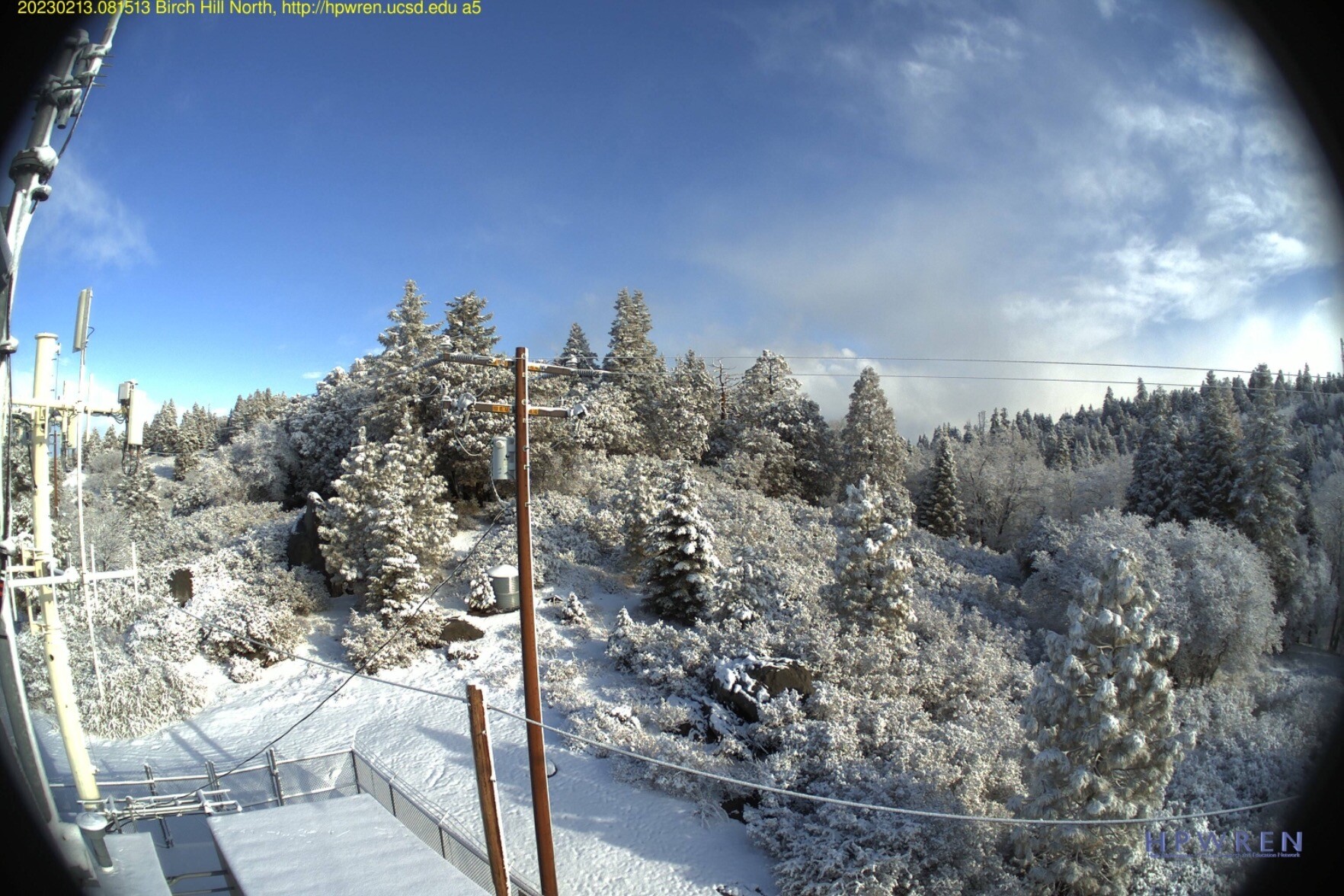
Birch Hill North today today. Image credit the High Performance Wireless Research and Education Network (HPWREN) project at the University of California, San Diego, and the National Science Foundation. Learn more at http://hpwren.ucsd.edu and #hpwren #ucsd #publiclands #photography #landscapephotography #interpretation #newtopographics
#hpwren #UCSD #publiclands #photography #landscapephotography #Interpretation #newtopographics
· @nationalparks
414 followers · 156 posts · Server sfba.social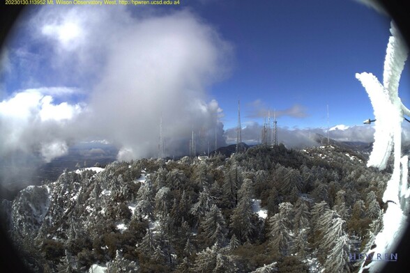
Mount Wilson Observatory today. Image credit the High Performance Wireless Research and Education Network (HPWREN) project at the University of California, San Diego, and the National Science Foundation. Learn more at http://hpwren.ucsd.edu and https://www.mtwilson.edu and #hpwren #ucsd #observatory #publiclands #photography #landscapephotography #interpretation #newtopographics
#hpwren #UCSD #observatory #publiclands #photography #landscapephotography #Interpretation #newtopographics
· @nationalparks
371 followers · 129 posts · Server sfba.social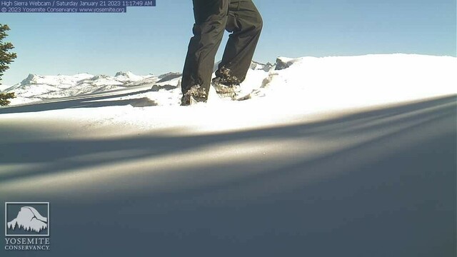
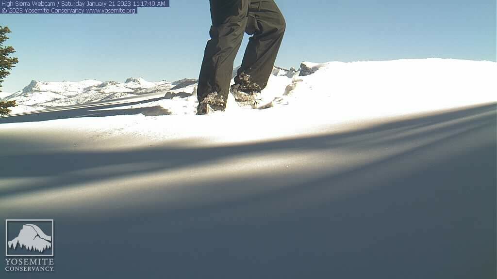
A positive winter note: Seeing snow in the mountains and water in the reservoirs (Views from Yosemite National Park and Santa Ynez Peak today). Image credit Yosemite Conservancy and National Park Service / HPWREN and UCSD and the National Science Foundation. For more information https://www.nps.gov/yose/index.htm and https://yosemite.org and http://hpwren.ucsd.edu and #nps #nationalparks #interpretation #yosemite #snow #publiclands #photography #landscapephotography #hpwren #ucsd
#nps #nationalparks #Interpretation #yosemite #snow #publiclands #photography #landscapephotography #hpwren #UCSD
· @nationalparks
329 followers · 90 posts · Server sfba.social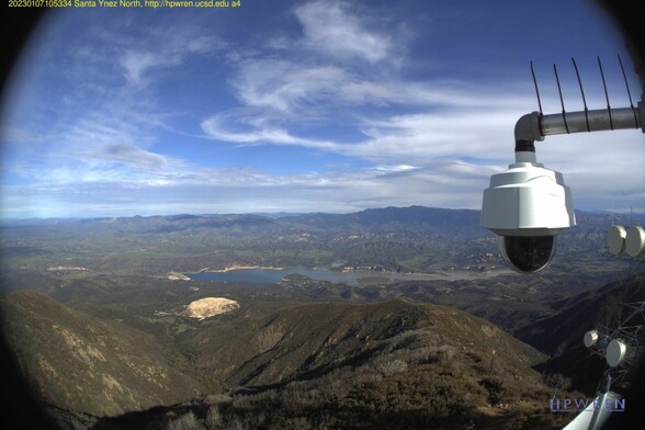
Looking out towards the Los Padres National Forest from Santa Ynez Peak yesterday. This is the north-facing view. The view to the south includes the Pacific Ocean and Channel Islands National Park. The route to this location can be difficult. Image credit the High Performance Wireless Research and Education Network (HPWREN) project at the University of California, San Diego, and the National Science Foundation. Learn more at http://hpwren.ucsd.edu and #hpwren #ucsd #usfs #forest #photography
#hpwren #UCSD #usfs #forest #photography