
Manish Vij · @vij
126 followers · 8519 posts · Server sfba.social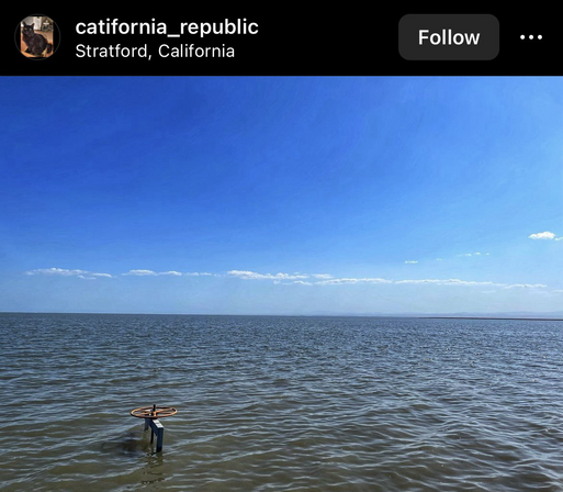
California’s central bowl is partly flooded again after a wildly wet winter. #LakeTulare looks like the ocean, almost size of #LakeTahoe though not as deep. https://www.nytimes.com/2023/06/25/us/california-storms-tulare-lake.html

AI6YR · @ai6yr
3862 followers · 23008 posts · Server m.ai6yr.org#TulareLake finally receding. #LakeTulare #CAwx https://www.latimes.com/environment/story/2023-06-29/tulare-lake-floodwaters-have-begun-to-recede-state-says
AI6YR · @ai6yr
3718 followers · 20906 posts · Server m.ai6yr.org
AI6YR · @ai6yr
3643 followers · 18920 posts · Server m.ai6yr.org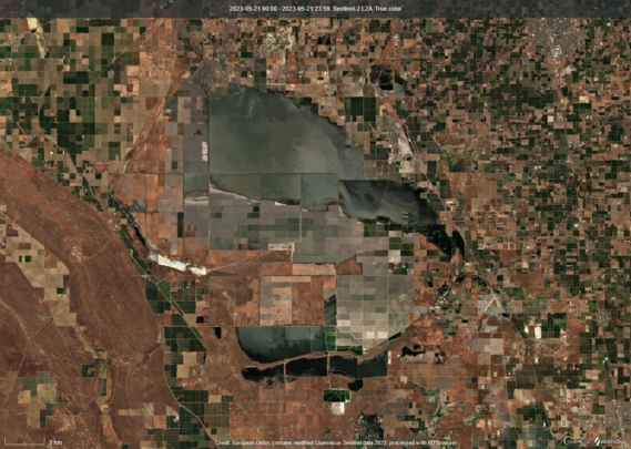
#LakeTulare on May 21, 2023 via Sentinel-2 #satellite. The white color you see on the non-flooded fields are blooming cherry trees; it appears the biggest impact of this flooding is going to be loss of cherry trees and cherry crops. #CAwx

Geewhizpat · @Geewhizpat
824 followers · 2295 posts · Server newsie.socialSTRATFORD, CA: A petition has been started as #Stratford is under threat of flooding…it asks that the government take immediate oversight and intervention of this emerging #LakeTulare #caflooding …the details are in the attached petition
https://www.change.org/p/stop-the-flooding-of-california-towns-by-tulare-lake
#stratford #laketulare #caflooding

Ron Franke · @rdfranke
119 followers · 537 posts · Server sfba.socialReestablish #LakeTulare
#California should seriously consider reestablishing Lake Tulare along with it's historic wetlands and ecosystem habitats. This should include enabling it's tributary rivers to substantially flow back into the southern San Joaquin Valley basin.
"Tulare Lake was once the largest freshwater lake west of the Mississippi River, and the second-largest freshwater lake entirely in the United States based upon surface area. ... Tulare Lake dried up after its tributary rivers were diverted for agricultural irrigation and municipal water uses." - Wikipedia
Building new dams in CA is not a solution to the long term water needs of CA especially with dryer periods caused by #climatechange.
A revitalized Lake Tulare could recharge the San Joaquin Valley ground water and could be used as a water resource during extreme #drought periods.
"Estimates have found that Tulare Lake could hold twice the water of the proposed Temperance Flat Dam at one-fifth the cost." - Wikipedia
#laketulare #california #climatechange #drought

andybrwn · @andybrwn
571 followers · 5358 posts · Server sfba.social
AI6YR · @ai6yr
3231 followers · 13742 posts · Server m.ai6yr.org
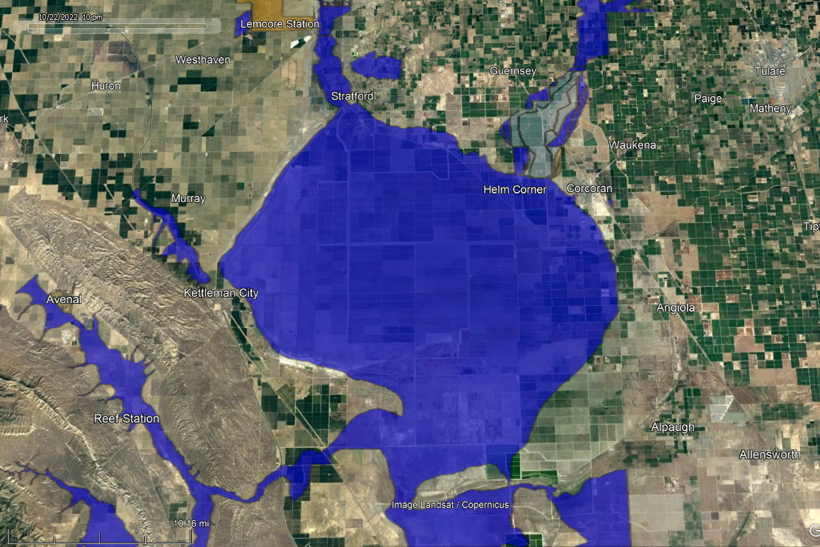
#gis #CAwx Figured out where to snag the lowest part of Tulare Lake's footprint! The areas in blue have a 1% annual chance of flooding and 26% chance of flooding over the life of a 30 year mortgage, per FEMA. #TulareLake #LakeTulare #mapping #floods #Tulare (the lake was larger than this at some point, however)
#gis #cawx #laketulare #mapping #floods #tularelake #tulare
AI6YR · @ai6yr
3169 followers · 12777 posts · Server m.ai6yr.org
Floodwaters continue to flow
To the old Lake Tulare lakebed below
It's getting kinda deep
Too much for any sheep
I hope the cows know how to row
#poem (human) #LakeTulare