Hari Tulsidas :verified: · @haritulsidas
74 followers · 575 posts · Server masto.ai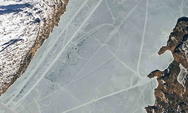
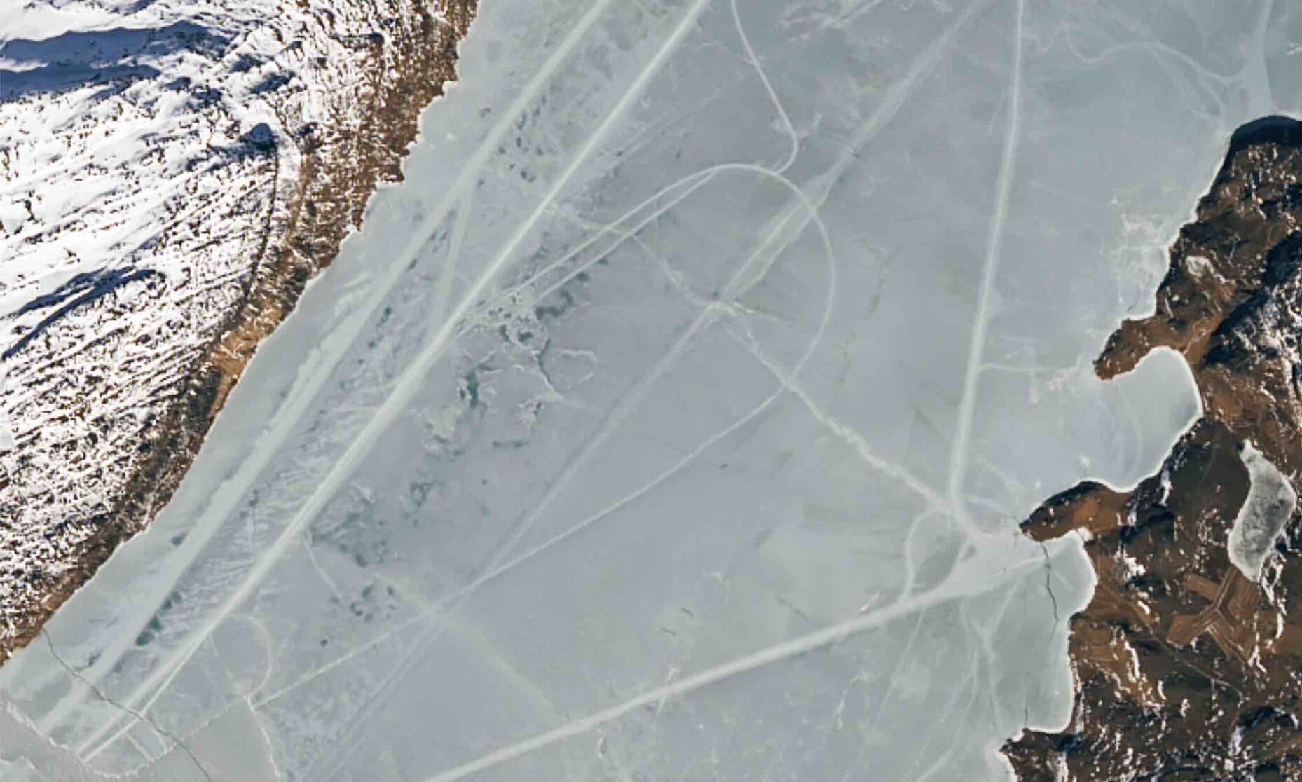
Landsat 9 satellite images over Greenland have revealed mysterious tracks on the ice. The tracks appear to originate from towns along the Tunulliarfik Fjord and form straight lines and loops. NASA scientists suspect that the tracks are caused by vehicles moving across the ice, possibly for hunting or traveling.
#landsat9 #greenland #icetracks

Robbi Bishop-Taylor · @SatelliteSci
554 followers · 43 posts · Server mapstodon.spaceVersion 2.0 of Geoscience Australia's #DEACoastlines coastal change dataset is available now!
This update includes lots of exciting new improvements:
🌊 Brand new annual shoreline data for 2021
🏝️ Extra coverage of remote islands and reefs
⚠️ Improved quality data flags for each individual shoreline and rates of change
🛰️ Now includes #Landsat9 satellite data and a new global tide model
More information and important links in the #DigitalEarthAU story here!
https://www.dea.ga.gov.au/news/dea-coastlines-2-now-available
#deacoastlines #landsat9 #digitalearthau
Conor Graham · @geoconor
139 followers · 157 posts · Server mastodon.ie
Ladies of Landsat · @LadiesOfLandsat
566 followers · 65 posts · Server mapstodon.space
Exciting news! We have 3️⃣ new #LadiesofLandsat leaders who we will highlight this month on #LoLManuscriptMonday.
Today we feature Sarah Schenkein, who helps with our #Landsat9 trading cards & represented us at #AGU22. Be sure to connect with her! #EOChat
Last week, Sarah presented about #LadiesofLandsat with Matilda Anokye at the Google Earth booth at #AGU22 with support from Kate Fickas! Thanks for all your efforts ladies; we’re honoured to work with you!
#LadiesofLandsat #LoLManuscriptMonday #landsat9 #agu22 #eochat
Chuixiang (Tree) Yi · @TreeYi
7 followers · 908 posts · Server mastodon.world
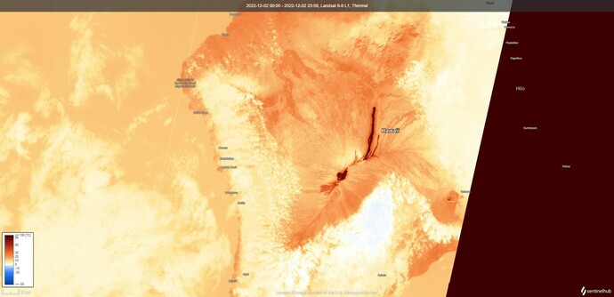
RT @i_ameztoy
Extra 1 - #MaunaLoa 🌋 lava flow ~16,5 km.
#Landsat9 🛰️ 2022-12-02 20:50 UTC #MaunaLoaVolcano (Open thread for more)
#maunaloa #landsat9 #maunaloavolcano
