Marcos Dione · @mdione
17 followers · 329 posts · Server en.osm.town@dcz property-wise, #cartocss is a thin layer on top of #mapnik XML:
https://github.com/mapnik/mapnik/wiki/XMLConfigReference
As for the operators, check:
https://github.com/mapnik/mapnik/wiki/Filter
Make sure you read the examples, because it has more types of expressions that are not defined elsewhere, I think.
Finally #OSM 's style has more examples, but it might be tedious to read them all:
Pierre Huyghebaert · @crickxson
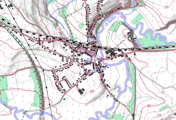
798 followers · 1876 posts · Server post.lurk.org"From 2019, the #cartographic style #OpenArdenneMap is updated every 6 months. OpenArdenneMap is a cartographic style for topographic maps based on #OSM data.OpenArdenneMap was originally developed as a cartographic style with the #imposm importer and a #cartoCSS style derived from #OSMBright. Later the #osm2pgsqlimporter was used instead of the imposm. From 2023, the OpenArdenneMap is also available in #QGIS"
#mapnik #cartography #belgium
https://www.nobohan.be/2023/03/02/openardennemap-hiver-22-23/
#cartographic #OpenArdenneMap #osm #imposm #cartocss #osmbright #osm2pgsqlimporter #qgis #mapnik #cartography #belgium
MapAm💜re · @MapAmore
626 followers · 1113 posts · Server en.osm.town#Mapnik, the #OpenStreetMap default layer now renders unpaved roads differently.
It is now visually distinct from other highways, based on the surface=* tags.
Other map renderers, of course, handled this differently.
Nakaner · @nakaner
168 followers · 197 posts · Server sueden.social@justb4
To be honest, #MapProxy is poor choice for rendering with #Mapnik if you do not want to maintain your own fork of MapProxy. Without one of the many unmerged MapProxy patches, rendering performance will be poorer than possible.
Reason: MapProxy does not cache the Mapnik objects and therefore it initialises the map style on each request. This causes unnecessary Postgres queries.
@jakobmiksch
MapAm💜re · @MapAmore
523 followers · 1021 posts · Server en.osm.townScreen caps from a #CNA news program stream showing Certis CISCO Secure Logistics, a security company in #Singapore using #OpenStreetMap (the #mapnik layer, specifically) in their operations centre.
#OpenStreetMapInTheWild #CNA #singapore #OpenStreetMap #mapnik #awesomeOSM
MapAm💜re · @MapAmore
523 followers · 1021 posts · Server en.osm.townSurprise, it's #OpenStreetMap! 😅
While trying to verify information, I found a link from a local government website about a district.
Suprised (and disappointed, actually), that it's basically just an embelished #Mapnik map
To their credit, they did attempt to attribute.
#OpenStreetMap #mapnik #OpenStreetMapInTheWild
nilocram · @nilocram
469 followers · 1172 posts · Server framapiaf.org#MyOSMatic è un servizio web basato su #softwarelibero che permette di creare e stampare in diversi formati #mappe cittadine costruite su dati di #OpenStreetMap: https://maposmatic.osm-baustelle.de/ #OSM #mapnik @maupao @informapirata @filippodb @ItaLinuxSociety @scuola @lealternative @wikimediaitalia
#MyOSMatic #softwarelibero #mappe #openstreetmap #osm #mapnik


