
Tomo Bacinger · @tomo
219 followers · 52 posts · Server hachyderm.io
A fresh view of Mediterian Europe and North Africa, with a playful touch of shadows.
I love custom map orders—they challenge me the most, put me outside my usual comfort zone, and provide new and fresh ideas I would never think to explore.

Josh Wells · @josh
1599 followers · 1627 posts · Server fediscience.orgCopypasta from USGS on birdsite
“July is National Park & Recreation Month, as well as National Picnic Month! We have topo maps available through our USGS topoView website for your park and picnic needs!”
https://ow.ly/uUmy50P2Bsy
Topographic Maps Symbols sheet: https://ow.ly/yuEv50P2Bsx
Tomo Bacinger · @tomo
154 followers · 78 posts · Server hachyderm.io
And finally, maps of the British Isles—in their first iteration compared to the recent remakes.
Maps are made with #blender, Copernicus EU DEM data, and Sentinel-2 satellite imagery. #cartography #mappingmonday
#Blender #cartography #mappingmonday
Tomo Bacinger · @tomo
154 followers · 77 posts · Server hachyderm.io
Here are maps of Italy—in their first iteration compared to the recent remakes.
Maps are made with #blender, Copernicus EU DEM data, and Sentinel-2 satellite imagery. #cartography #mappingmonday
#Blender #cartography #mappingmonday
Tomo Bacinger · @tomo
154 followers · 76 posts · Server hachyderm.io
Practice makes perfect.
As I keep doing these maps, I pick up some new tricks, learn what works, and figure out how to make things look better. I can now better apply satellite imaging, control the colors, and make the sea appears more natural.
Here are maps of Greece—in their first iteration compared to the recent remakes.
Maps are made with #blender, Copernicus EU DEM data, and Sentinel-2 satellite imagery. #cartography #mappingmonday
#Blender #cartography #mappingmonday
Tomo Bacinger · @tomo
151 followers · 75 posts · Server hachyderm.io
⛰️ The Grand Canyon State — #arizona 🇺🇸
Map made with #blender, Copernicus EU DEM data, and Sentinel-2 satellite imagery.
https://www.etsy.com/listing/1407020853/arizona-shaded-relief-map-print
#arizona #Blender #cartography #mappingmonday #gischat
Tomo Bacinger · @tomo
142 followers · 61 posts · Server hachyderm.io
🌲 The Evergreen State — #Washington 🇺🇸
Shaded relief map made with JAXA ALOS Global Digital Surface Model data #dem for a 3D-like visual perspective and overlayed with Sentinel-2 #satellite imagery.
#Blender #Cartography #DataViz #GisChat #GeoSpatial #Maps #MappingMonday
Available in print: https://www.etsy.com/listing/1457125273/washington-shaded-relief-map-print
#Washington #dem #satellite #Blender #cartography #dataviz #gischat #geospatial #Maps #mappingmonday

ScribblersEmporium · @ScribblersEmporium
45 followers · 407 posts · Server mastodon.world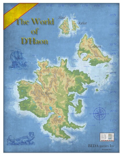
#mappingMonday #cartography #cartographie
#fantasymap
Open for commissions.
#mappingmonday #cartography #cartographie #fantasymap

Deborah Lee-Talbot · @DLeeTalbot
946 followers · 867 posts · Server ausglam.space
From the Archive of the Archivist: Mount Wilson, ‘Where the cow bells ring’.
This map is a worthy item for researchers to examine should they be concerned with Australian mythology, fantastical cartographic representations, cartography, poetry, Australian artists, flora and fauna, and the local history of NSW.
#cartography #mappingmonday #history #research #ECR #archive #library #collections #women #missedinhistory #historian #histodon
#cartography #mappingmonday #history #research #ecr #archive #library #collections #women #missedinhistory #historian #histodon