
Joseph Elfelt · @mappingsupport
480 followers · 412 posts · Server m.ai6yr.org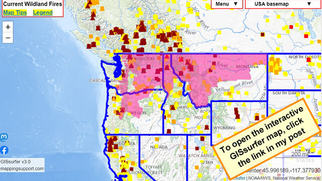
#RedFlagWarning includes *west* slopes of Cascade Mountains.
For details open the map, zoom in, click your area of interest, follow the link.
Click “Map tips” upper left corner for more info.
#PNW #WAfire #WAwx #ORfire #ORwx #IDfire #IDwx #MTfire #MTwx #Wildfire #GIS
Open #GISsurfer map:
https://mappingsupport.com/p2/gissurfer.php?center=46.148533,-115.048828&zoom=5&basemap=USA_basemap&overlay=VIIRS_7_day,MODIS_7_day,State_boundary,Red_flag_warning&data=https://mappingsupport.com/p2/special_maps/disaster/USA_wildland_fire.txt
#redflagwarning #pnw #wafire #wawx #orfire #orwx #idfire #idwx #mtfire #mtwx #Wildfire #gis #gissurfer
Joseph Elfelt · @mappingsupport
429 followers · 322 posts · Server m.ai6yr.org
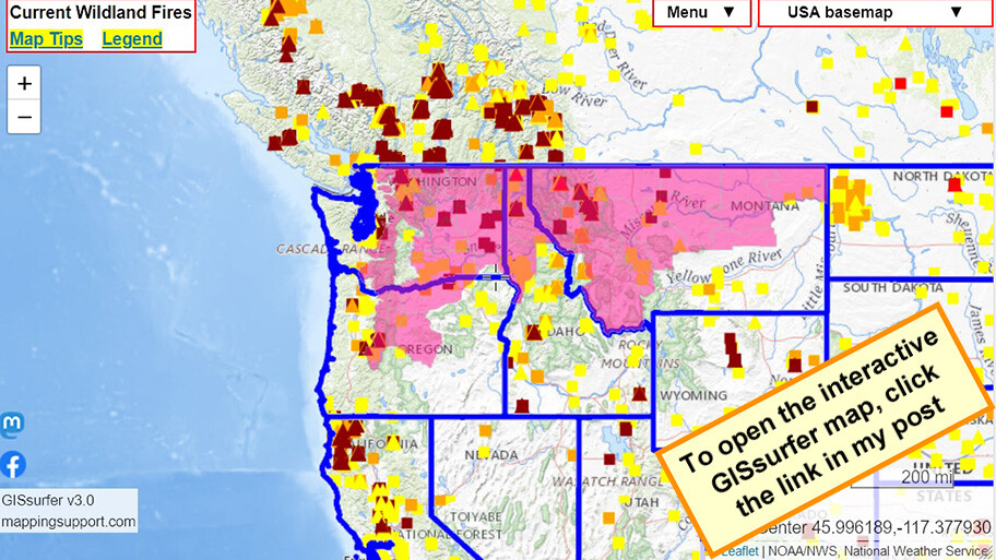
8/2 morning. Interactive #GIS map for #NiaradaFire and #MillPocketFire west of Flathead Lake, MT.
Infrared flight last night 12:07am. IR analyst determined Niarada burned 12,421 acres, MillPocket burned 1,879 acres.
Please read the 2 links in the upper left corner. That info will help you get the most benefit from the map which has *lots* of layers you can turn on/off.
#MTfire #MTwx #Geospatial #Maps #Mapping #Leaflet #ArcGIS #WebMap
Open #GISsurfer map:
https://mappingsupport.com/p2/gissurfer.php?center=47.808309,-114.498138&zoom=11&basemap=USA_basemap&overlay=VIIRS_7_day,MODIS_7_day,State_boundary,USA_roads&fire=MT,Niarada&data=https://mappingsupport.com/p2/special_maps/disaster/USA_wildland_fire.txt
#gis #niaradafire #millpocketfire #mtfire #mtwx #geospatial #maps #mapping #leaflet #arcgis #webmap #gissurfer