Alan · @alan
6 followers · 55 posts · Server piaille.frThinking about publishing some #experimental data in fluid dynamics in an open format that could be a standard, and trying not to reproduce this piece of art
https://xkcd.com/927/
#hdf5 looks interesting, or #netCDF but my data are not so standardized.
ashwinvis :cc: · @ashwinvis
189 followers · 1311 posts · Server fediscience.org:python: tip
https://www.scivision.dev/xarray-to-netcdf-compression/
#xarray to_netcdf() can compress data variables to save considerable disk space, but it is not trivial until your read the docs.
gauteh · @gauteh
18 followers · 26 posts · Server hachyderm.ioNew release of hidefix (https://github.com/gauteh/hidefix) updated to work with xarrays plugin registration. pip install hidefix should do the trick, conda package in the wait: https://github.com/conda-forge/staged-recipes/pull/21742 #hidefix #rust #hdf5 #netcdf
偉吉 · @weiji14
53 followers · 47 posts · Server mastodon.nz☯️ #zen3geo v0.6.0. Scale to new heights if you dare. Open 📂 STAC Assets backed by Zarr, NetCDF or CloudOptimizedGeoTIFF files using the new XpySTACAssetReader DataPipe. Attempt super-resolution 🔭 with the walkthrough on handling multi-resolution CMIP6 climate data from CarbonPlan over the Philippines 🇵🇭 at https://zen3geo.readthedocs.io/en/v0.6.0/multi-resolution.html. Clarity, seek it, give it 🥽
@zarr #STAC #NetCDF #CloudOptimizedGeoTIFF #xarray @pytorch #DataPipe #SuperResoluton #MultiResolution #CarbonPlan #CMIP6 #ClimateModel
#zen3geo #STAC #netcdf #cloudoptimizedgeotiff #xarray #DataPipe #superresoluton #multiresolution #carbonplan #cmip6 #ClimateModel
Romain Caneill · @rcaneill
28 followers · 12 posts · Server fediscience.orgWorking with #NEMO gcm and #python?
I just released version 0.4.1 of #xnemogcm, a package that can read nemo #netcdf outputs, and adds the proper attributes (+ change dimension names) to be read by the fantastic #xgcm package.
It is compatible with NEMO 3.6 to 4.2.0 versions, but could probably work with other versions.
#xgcm #netcdf #xnemogcm #python #nemo
Sam Harrison · @samharrison7
154 followers · 163 posts · Server mas.to📢 Public service announcement 📢
As of a month ago, Conda Forge has a #NetCDF #Fortran package for #Windows! Historically this package has only been available on Linux and Mac. This is big for us folk who (are forced to) work on Windows! https://anaconda.org/conda-forge/netcdf-fortran
Fred · @fred
108 followers · 140 posts · Server m.baldhead.beGIS people, I've initiated a STAC extension proposal to list CF parameters. If you're working with #NetCDF or you're active in #geospatial #oceanography or #climate science, please look at it in the GitHub repository. It sure needs some love and tweaking!
Your feedback is much appreciated.
#netcdf #geospatial #oceanography #climate #gischat #stac #spatiotemporalassetcatalog #cf
Thomas Lavergne · @lavergnetho
591 followers · 460 posts · Server fediscience.orgRomain Caneill · @rcaneill
17 followers · 7 posts · Server fediscience.orgWorking with #NEMO gcm and #python?
I just released version 0.4.0 of #xnemogcm, a package that can read nemo #netcdf outputs, and adds the proper attributes (+ change dimension names) to be read by the fantastic #xgcm package.
It tries to automatically discover the T, U, V, W, etc point of variables, and sets everything for you :). For more complicated cases (dataset already loaded into #xarray, dataset with no attributes, etc) you can easily set the point by hand.
#xarray #xgcm #netcdf #xnemogcm #python #nemo
legraLeGra · @atthenius
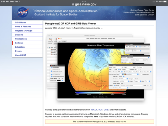
568 followers · 618 posts · Server fediscience.orgHappy 20th Anniversary Panoply.
You make the easiest prettiest climate plots on every platform I’ve used.
And you’ve helped my students more times than I can count.
(You are also SO much better than nmapsX.)
https://www.giss.nasa.gov/tools/panoply/
#climate #dataviz #netCDF #HDF #GRIB
Thank you
@roadskater
#grib #HDF #netcdf #dataviz #Climate
Thomas Lavergne · @lavergnetho
439 followers · 329 posts · Server fediscience.orgHummmmm...
warning: invalid maximum data value for colorbar: 1424172807353459855674457511132397568.000000. Not setting colorbar
Lejo Flores, PhD · @HydroLejo
545 followers · 184 posts · Server scicomm.xyzFor my graduate #ScientificComputing class I made this little #JupyterNotebook for my students showing how to download #CFS data from #AWS, concatenate with #xarray, and save as a #NetCDF file.
This is the data intake step in an Idaho climate forecast dashboard pipeline the class is working on. It could be automated and sped up significantly. Also need to look at #Kerchunk to see if there's a way to stream only the required data (data is GrIB) https://github.com/LejoFlores/Download_CFS_S3/blob/main/DownloadCFS_files.ipynb
#kerchunk #netcdf #xarray #aws #cfs #jupyternotebook #scientificcomputing
James Goldie · @jimjamslam
189 followers · 104 posts · Server aus.socialPaging #netcdf experts! I'm working with some CORDEX and NARCliM projections, but the ones in files in the 10km regional domain are all giving me the following when I try to do anything with them (even just selname):
"Error (cdf_put_var_int): NetCDF: Not a valid data type or _FillValue type mismatch"
It doesn't seem like the fill values are wrong here... any other possible causes?
Fred · @fred
85 followers · 57 posts · Server m.baldhead.beI still miss some #NetCDF #zarr #GeoTIFF #COG #geoparquet #HDF5 #OGC #geospatial people.
Anyone out there? :)
#netcdf #zarr #geotiff #cog #geoparquet #hdf5 #ogc #geospatial
Thomas Lavergne · @lavergnetho
362 followers · 222 posts · Server fediscience.orgSo here comes a little challenge:
Step 1) install #ncmaps (https://github.com/TomLav/ncmaps). Really easy.
Step 2) make a #ncview screenshot of a #NetCDF file using one of the ncmaps colormaps.
Step 3) Post it here below, explaining what the image shows, and naming the colormap used.
I'll #boost your contribution 😊!
#boost #netcdf #ncview #ncmaps
Thomas Lavergne · @lavergnetho
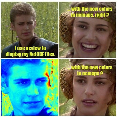
362 followers · 220 posts · Server fediscience.orgDo you use #ncview to quickly browse your #NetCDF files?
You are not the only one !
Of course, a problem with #ncview is that it comes with bad #colormaps, including many 🌈 rainbows 😭 .
But we have a solution for you !
#ncmaps #colormaps #netcdf #ncview
Steven J Gibbons · @stevenjgibbons
582 followers · 186 posts · Server oslo.townAny #netcdf gurus?
I have a time-dependent file nc file with LON = 350.9, 351.1, ... , 376.5, 376.7
and want LON = -9.1, -8.9, ... , 16.5, 16.7
etc.
Is there a quick fix with e.g. cdo/ncks or others?
Raphael Grandin · @RaphaelGrandin
104 followers · 103 posts · Server social.linux.pizza@jenngwalter You can access the data behind this finding (stereophotogrammetric analysis 👨💻 of geostationary #satellite images 🛰️ acquired during the course of the #volcanic #eruption 🌋) here: https://zenodo.org/record/6450424#.Y2vyaNXftp0 😉 #opendata #netcdf #goes17 #Himawari8 #stereophotogrammetry
#stereophotogrammetry #Himawari8 #goes17 #netcdf #opendata #eruption #volcanic #satellite


