
Huub Eggen · @huubeggen
350 followers · 231 posts · Server socialserver.science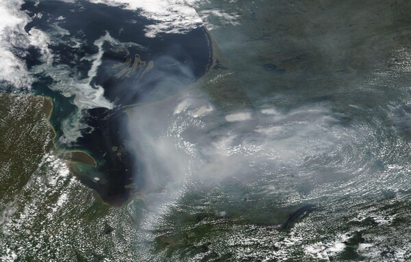
It looks like the smoke of the #Quebec, #Canada wildfires has locked itself in a circular airstream. Image taken on 3 July 2023 by @NASA satellite #NOAA20. Original https://wvs.earthdata.nasa.gov/api/v1/snapshot?REQUEST=GetSnapshot&TIME=2023-07-03T00:00:00Z&BBOX=49.2931,-84.0776,58.5979,-69.5274&CRS=EPSG:4326&LAYERS=VIIRS_NOAA20_CorrectedReflectance_TrueColor&WRAP=day&FORMAT=image/jpeg&WIDTH=3311&HEIGHT=2117&ts=1688497804000l

· @TheDoorOKC
236 followers · 14187 posts · Server kolektiva.social
RT @JPSSProgram
A severe geomagnetic storm created a large aurora borealis display on April 24, which was captured in this image from the #NOAA20 satellite. 🔎
The aurora stretched over Canada and part of the United States, reaching as far south as Oklahoma, Arkansas and Arizona.
· @TheDoorOKC
235 followers · 14033 posts · Server kolektiva.social
RT @NOAASatellites
It's #WhereInTheWorld Wednesday!🤠
Yesterday, the #NOAA20 🛰️ had a view of this highly saline terminal lake in southern California. It lies on the San Andreas Fault within the Salton Trough, which stretches to the Gulf of California in Mexico.

cmam · @cmam
37 followers · 4406 posts · Server piaille.fr
RT @NOAASatellites
It's #WhereInTheWorld Wednesday! 🌍
Time for a new quiz! 🥳
This waterway, as seen from the #NOAA20 satellite yesterday, is a southern inlet of the Barents Sea and hosts many species of fish and marine mammals, such as the beluga whale.

Météo-France · @meteofrance
24 followers · 235 posts · Server techhub.social
RT @MeteoFrance_O: Esthétique intéressante de la fauchée du 🛰️ #NOAA20 à midi ce jour, mettant en évidence le flux de sud-ouest à tout niveau sur la #Bretagne associé à l'arrivée d'air froid en altitude déstabilisant la masse d'air et produisant ces rues de cumulus parfois porteurs d'averses 🌦️.
🐦🔗: https://twitter.com/meteofrance/status/1636756462709116928
[17/03 15:48]
cmam · @cmam
37 followers · 3550 posts · Server piaille.frRT @JPSSProgram
According to the latest update from the World Meteorological Organization (@WMO), Tropical #CycloneFreddy is on track to break the record as the longest-lasting cyclone.
In #NOAA20 satellite images from Feb. 6 to 21, see the storm's initial path across the Indian Ocean.

NWS Medford Oregon · @NWS_Medford_rss
18 followers · 89 posts · Server botsin.space
<p>As the <a href="https://https://nitter.net/search?q=%23NOAA20">#NOAA20</a> 🛰️ passed over Australia yesterday, it captured daytime imagery of Tropical Cyclones <a href="https://https://nitter.net/search?q=%23Dingani">#Dingani</a> and <a href="https://https://nitter.net/search?q=%23Freddy">#Freddy</a>, currently churning over the Indian Ocean, and Tropical Cyclone <a href="https://https://nitter.net/search?q=%23Gabrielle">#Gabrielle</a> over the Coral Sea in the South Pacific. <br />
<br />
L
#noaa20 #dingani #freddy #gabrielle

Disruption toots · @cont
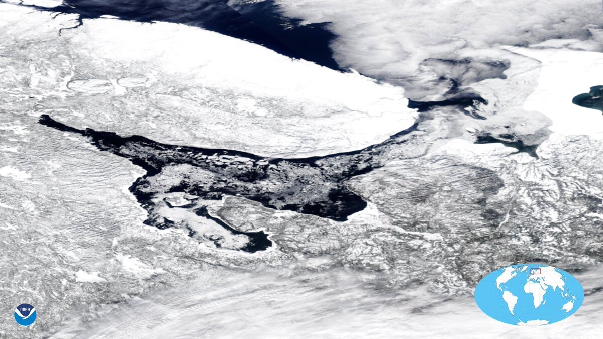
19 followers · 2095 posts · Server social.vivaldi.netRT @UWCIMSS: Here's the #NOAA20 VIIRS True Color view of the wintry #GreatLakes with stunning #lakeeffect clouds and snow. Did you know we post a Great Lakes composite image everyday on our VIIRS Imagery Viewer? https://t.co/AyOlSstzSu https://t.co/xDQwbtvvmX #SMEM
#noaa20 #greatlakes #lakeeffect #smem

Huub Eggen · @huubeggen
100 followers · 56 posts · Server mastodon.social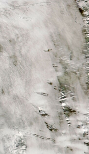
Lots of punch hole or #fallstreakhole clouds ('pilotengaten' in Dutch) today over western Germany. Image from #NOAA20 satellite.