
Mark Ingalls :pdx_badge: · @ingalls
1343 followers · 4478 posts · Server pdx.social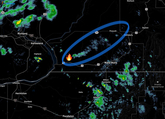
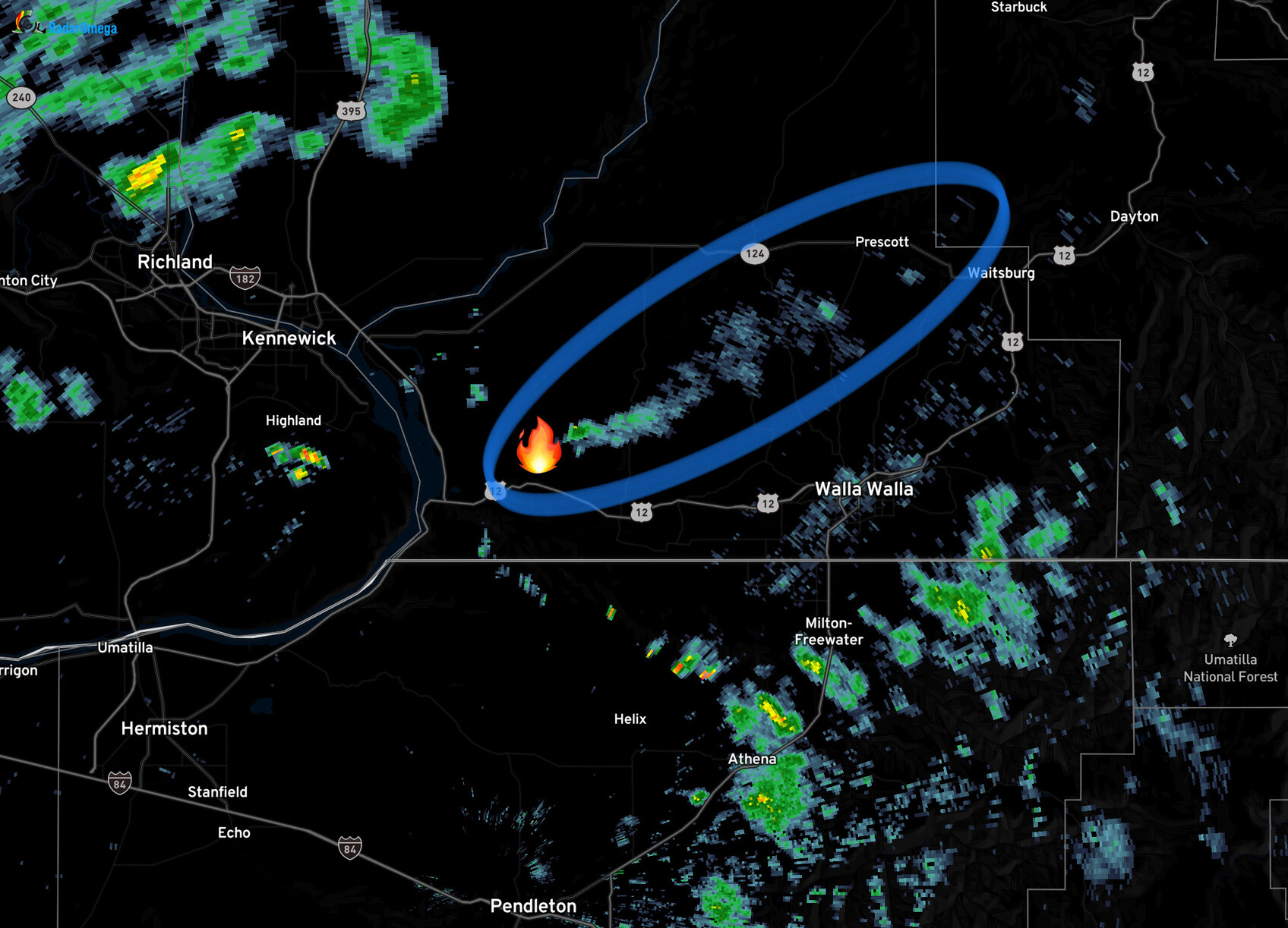
18:20 Monday - Smoke from the estimated 600 ha #OasisFire in Walla Walla County, #Washington is visible on #weather radar.
#oasisfire #washington #weather #wildfire #fire #wawx #wafire #TriCities

Joseph Elfelt · @mappingsupport
153 followers · 79 posts · Server m.ai6yr.org
Interactive #GIS map showing #OasisFire in Walla Walla County, Washington. Large red squares are heat detections by GOES West satellite.
For more info about satellite heat detection see “Map tips” link upper left corner.
#Geospatial #Spatial #Wildfire
Open #GISsurfer map:
https://mappingsupport.com/p2/gissurfer.php?center=46.091924,-118.792076&zoom=12&basemap=USA_imagery&overlay=VIIRS_7_day,MODIS_7_day,State_boundary,Wildland_fire_name,GOES_west_heat_detection,USA_roads&data=https://mappingsupport.com/p2/special_maps/disaster/USA_wildland_fire.txt
#gis #oasisfire #geospatial #spatial #Wildfire #gissurfer