BC Info Bot · @bcinfo
615 followers · 44770 posts · Server mastodon.roitsystems.caThe Tyee: Mapping. If Conditions Allow https://thetyee.ca/Culture/2023/09/05/Mapping-If-Conditions-Allow/ #bcnews #TheTyee - via @tyee@mstdn.ca #NationalOceanicandAtmosphericAdministration #exclusiveeconomiczone #OceanExplorationTrust #AnnamariaDeAngelis #DSSVPressureDrop #NicoleRaineault #PointConception #Beaufortscale #oceanmapping #ErinHeffron #RenatoKane #Seabed2030 #U.S.EEZ
#BCNews #TheTyee #nationaloceanicandatmosphericadministration #exclusiveeconomiczone #oceanexplorationtrust #annamariadeangelis #dssvpressuredrop #nicoleraineault #pointconception #beaufortscale #oceanmapping #erinheffron #renatokane #seabed2030 #U
GregCocks · @GregCocks
508 followers · 473 posts · Server techhub.social7% 25% Of The Ocean Floor Mapped From 2017 (Seabed 2030)
--
https://seabed2030.org/ <-- @Seabed2030 web site
--
H/T Dennis Haines
“🗺 Did you know that in 2017, only 6% of the world’s seafloor had been mapped to modern standards? Considering the ocean spans some 70% of the Earth’s surface, that’s a significant gap!
But over the past five years since Seabed 2030 launched, we’ve been able to map almost 25% of the ocean floor.
By discovering more about the seabed, we gain a greater understanding of our environment and can ensure its protection. After all, we can’t protect what we don’t know…”
#seabed2030 #mappingthefuture #oceanscience #hydrospatial
#GIS #spatial #mapping #seabed2030 #mappingthefuture #oceanscience #hydrospatial #ocean #marine #bathymetry #topobathy #remotesensing #sonar #satellite #charts #navigation #oceanmapping #seafloor #Seabed2030 #oceanfloor #oceanconservation #environment #oceanography #marineenvironment #marineconservation #gischat
#seabed2030 #mappingthefuture #oceanscience #hydrospatial #gis #spatial #mapping #ocean #marine #bathymetry #topobathy #remotesensing #sonar #satellite #charts #navigation #oceanmapping #seafloor #oceanfloor #OceanConservation #Environment #oceanography #marineenvironment #marineconservation #gischat
IBCSO · @ibcso
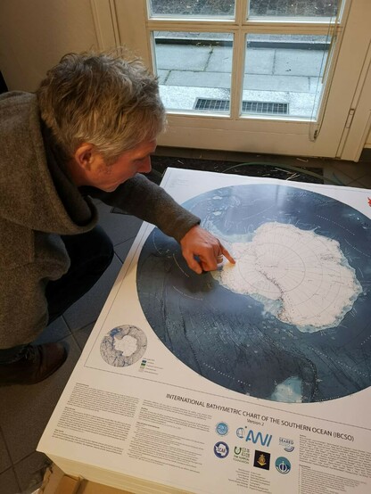
11 followers · 8 posts · Server masto.aiRight in time for Christmas, we have received the printed maps of IBCSO v2! We will send them to all co-authors. Do You want to get a poster? Contribute Your data to the next IBCSO version! ;) #seafloor #donate #hydrography #hydrospatial #geological #awi #oceanmapping #topography #seafloor #bathymetry #ship #vessel #boat #cruise #echosounder #science #data #datascience #gift
#seafloor #donate #hydrography #hydrospatial #geological #awi #oceanmapping #topography #bathymetry #ship #vessel #boat #cruise #echosounder #science #data #datascience #gift
IBCSO · @ibcso
11 followers · 7 posts · Server masto.aiDo u have bathymetry data and do you want to be part of the amazing https://seabed2030.org/ project? Whether singlebeam or mutlibeam, lead line or cheap echosounder, check out this video on how to contribute and get ready to join the gang: https://cutt.ly/kORVqUZ. Every datapoint completes the puzzle! #seafloor #donate #hydrography #hydrospatial #geological #awi #oceanmapping #topography #seafloor #bathymetry #ship #vessel #boat #cruise #echosounder #science #data #datascience
#seafloor #donate #hydrography #hydrospatial #geological #awi #oceanmapping #topography #bathymetry #ship #vessel #boat #cruise #echosounder #science #data #datascience
IBCSO · @ibcso
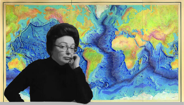
11 followers · 5 posts · Server masto.aiThe mean age of the #seafloor is ~64 million years old but #oceanmapping is a relatively new thing (~65 years, #MarieTharp). Unfortunately, accurate mapping is a challenge. Just look how many people contributed to IBCSO version 2 https://bit.ly/3c6LFAx. And there is still a lot to do, filling the gaps of https://ibcso.org/ibsco-v2/. Do you want to expand that list? Just get in contact and provide bathymetry data south of 50°S! https://bit.ly/3PIFFwD . Easy as 1, 2, 3!
#seafloor #oceanmapping #marietharp
Laura Trethewey, ocean journo · @Ltrethew
37 followers · 2 posts · Server journa.hostAlert, alert! Ocean mapper extraordinaire Marie Tharp is Google's image of the day. #deepsea #oceanmapping


