
SK53 · @SK53
99 followers · 302 posts · Server en.osm.town@jakecoppinger @MapAmore I was showing this to someone last night, but via #OpenAerialMap

Jake Coppinger · @jakecoppinger
184 followers · 132 posts · Server aus.social
I wrote a technical guide on how you can create your own aerial imagery and 3D models of streets with the built in iPhone LiDAR sensor and open source tools in the OpenDroneMap package.
I've found you can attach your iPhone to your bike and generate LiDAR point clouds of the kerb and cycleway infrastructure if you go slow!
https://jakecoppinger.com/2023/03/generating-aerial-imagery-with-your-iphones-lidar-sensor/
#lidar #openstreetmap #maps #iphone #openaerialmap #cycling #infrastructure #urbanism #sydney #australia #betterstreets #opendronemap #odm #webodm
#lidar #openstreetmap #maps #iphone #openaerialmap #cycling #infrastructure #urbanism #sydney #australia #betterstreets #opendronemap #odm #webodm

MaptimeBogota · @MaptimeBogota
4 followers · 38 posts · Server en.osm.town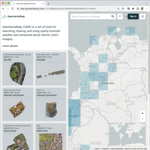
Tienes un drone y tomas fotos aéreas? Puedes convertirlas en ortofotos con #OpenDroneMap subirlas a #OpenAerialMap y eso permitirá mapear mejor en #OpenStreetMap.
¡Anímate a apoyar el mapeo colaborativo!
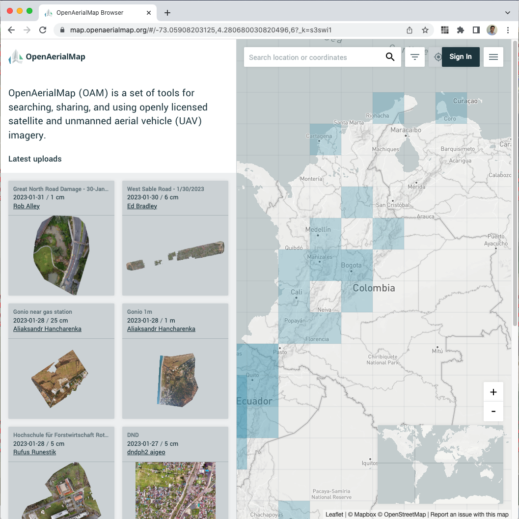
https://map.openaerialmap.org/#/-74.11720275878906,4.650342383235499,12?_k=kenpb4
#opendronemap #openaerialmap #OpenStreetMap

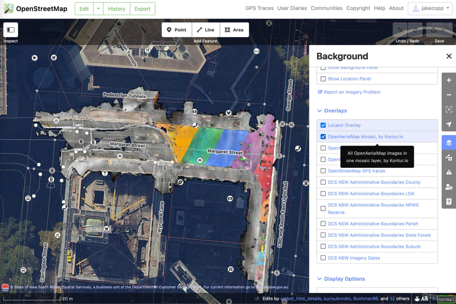
MapAm💜re · @MapAmore
523 followers · 1021 posts · Server en.osm.town
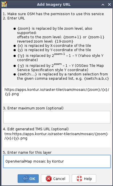
I forgot to mention that the TMS layer URI for the #OpenAerialMap (OAM) mosaic provided by #Kontur is
https://apps.kontur.io/raster-tiler/oam/mosaic/{zoom}/{x}/{y}.png
You can add that TMS to your favorite #OpenStreetMap (OSM) editor.
🎗️ All OAM imagery is allowed to be used with OSM -- but use with caution! There may be alignment issues, and Kontur will always put the latest available imagery on top.
If you're after a specific imagery, best to so directly from OAM.
#openaerialmap #Kontur #OpenStreetMap
MapAm💜re · @MapAmore
523 followers · 1021 posts · Server en.osm.town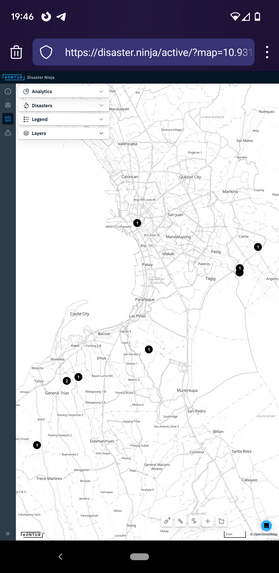
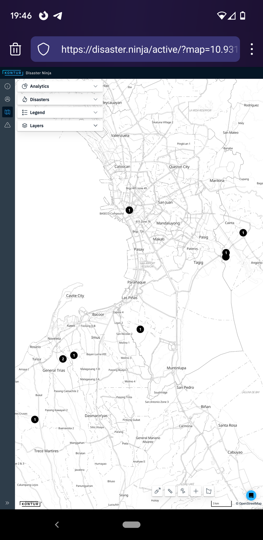
Did you know that #Kontur now serves a mosaic layer of the latest #OpenAerialMap imagery ?
Below are the latest captures made by the awesome #DatumPH team, collaborating with the local #OpenStreetMap community for identifying AOIs.
Have fun with mapping details on OSM!
#Kontur #openaerialmap #DatumPH #OpenStreetMap
MapAm💜re · @MapAmore
523 followers · 1021 posts · Server en.osm.town
This Wednesday 7:30pm, #WeMap is helping out with building validation for the Lupang Arenda project in Taytay, Rizal
This was made possible by #OpenStreetMap volunteers who contributed drone and street-level imagery to #OpenAerialMap and #Mapillary
See: http://is.gd/ed7ppq
#WeMap #OpenStreetMap #openaerialmap #mapillary
MapAm💜re · @MapAmore
524 followers · 1021 posts · Server en.osm.town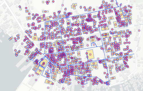
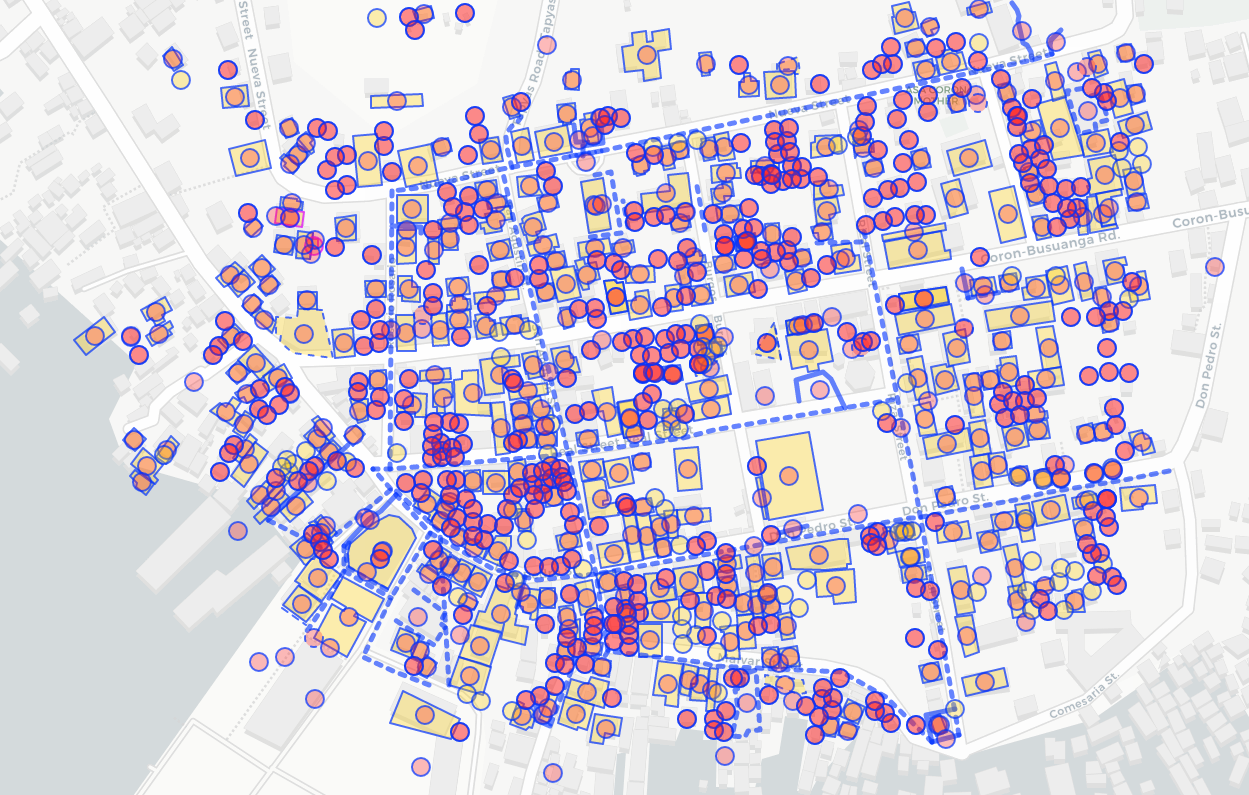
Today's #MapaTime #mapathon session with #PUPSJCWTS volunteers mapped the town of Coron on #OpenStreetMap using #OpenAerialMap imagery by local drone enthusiasts, processed with #OpenDroneMap
#mapatime #mapathon #pupsjcwts #OpenStreetMap #openaerialmap #opendronemap

blub · @blub
413 followers · 5064 posts · Server norden.social@hikerus Bei Voice tragen Freiwillige ihre Stimme als Audiodaten bei. Andere können damit einen Voice-Corpus bauen, um gesprochene Sprache zu erkennen. Keiner zwingt dich, beim #crowdsourcing mitzumachen, genauso wenig, wie dich niemand zwingt bei #Wikipedia, #Gutenberg, #OpenStreetMap, #Mapillary, #OpenAerialMap, ... mitzumachen.
#crowdsourcing #wikipedia #gutenberg #openstreetmap #mapillary #openaerialmap