
Joana Simoes · @doublebyte
176 followers · 164 posts · Server noc.social
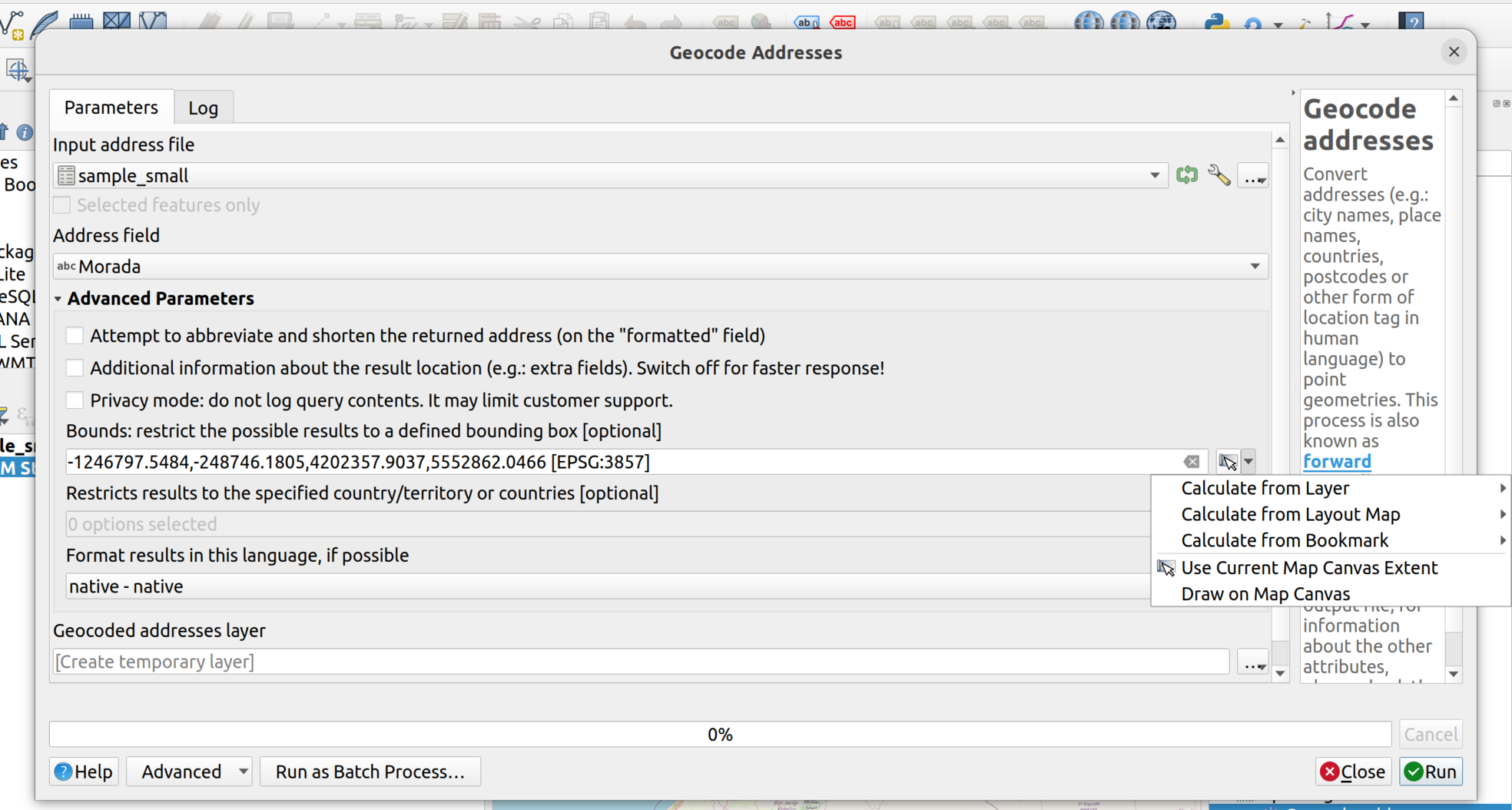
"Geocodificación en QGIS con OpenCage" - tutorial in Spanish to use #geocoding with the #QGIS #opencage plugin https://mappinggis.com/2023/05/geocodificacion-en-qgis-con-opencage/ #geocoding #tutorial @qgis @opencage
#tutorial #opencage #qgis #geocoding
Joana Simoes · @doublebyte
176 followers · 164 posts · Server noc.social"Geocodificación en QGIS con OpenCage" https://mappinggis.com/2023/05/geocodificacion-en-qgis-con-opencage/ #QGIS #opencage #geocoding #tutorial @qgis
#tutorial #geocoding #opencage #qgis
Joana Simoes · @doublebyte
169 followers · 156 posts · Server noc.social
Joana Simoes · @doublebyte
159 followers · 137 posts · Server noc.social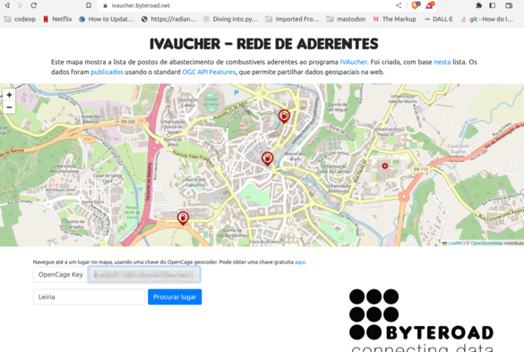
I launched a new version of the #IVaucher app, which displays the subsidized gas stations in Portugal, using #OGC Standards and the #OpenCage geocoder https://ivaucher.byteroad.net/ @opencage

Jim Easterbrook · @jim_easterbrook
96 followers · 247 posts · Server mstdn.social#IPTC location structure: http://www.iptc.org/std/photometadata/specification/IPTC-PhotoMetadata#location-structure
#OpenCage geocoding result format: https://opencagedata.com/api#reverse-resp
#Pixelfed location issues: https://github.com/pixelfed/pixelfed/issues/3277
Jim Easterbrook · @jim_easterbrook
96 followers · 247 posts · Server mstdn.socialOne thing missing from my #Pixelfed uploader (for my #Photini metadata editing program) is a way to set the location. Photini allows users to set latitude+longitude for each photo (by dragging it on to a map) but there's no obvious way to convert that to a Pixelfed location. (Pixelfed uses a data base of towns with >5000 inhabitants.)
I currently use #OpenCage to convert latitude+longitude to an IPTC location (a hierarchical address). They can also do various location ids, but not Pixelfed's.
Joana Simoes · @doublebyte
143 followers · 102 posts · Server noc.social
@ianturton @opencage @cartocalypse actually, there is already an interface for geocoding apis in the #QGIS core. The current implementations are #OSM and #GoogleMaps, but what do you think about adding one for #OpenCage ? @qgis https://github.com/qgis/QGIS/tree/master/src/core/geocoding
#opencage #googlemaps #osm #qgis
Joana Simoes · @doublebyte
143 followers · 102 posts · Server noc.social
· @barefootstache
123 followers · 600 posts · Server en.osm.town
Those who are following the #OpenCage contest, the results are finally out: https://blog.opencagedata.com/post/announcing-the-winners-of-our-openstreetmap-mapscaping-promotion
The winners are:
* https://beforeafter.baato.io/
* https://mapcomplete.osm.be/
* https://weeklyosm.eu/
* https://healthsites.io/
#opencage #OpenStreetMap #mapping
· @barefootstache
123 followers · 600 posts · Server en.osm.town#MappingChallenge (Day 52/100)
Updated my OSM Wiki page and worked on a purposeful for #OpenCage.
Just did one simple change and add some landuse.
Summary:
#JOSM: 1
#MappingChallenge #opencage #josm #OpenStreetMap