
𝑪𝒐𝒓𝒆𝒚 𝑺𝒏𝒊𝒑𝒆𝒔 🌤 · @coreysnipes
435 followers · 1453 posts · Server fosstodon.orgLooking forward to my fourth year at DroneCamp next week. This event is a joint effort by the Univ of California, CSU, and Monterey Bay DART. The presentations tend to focus on drone mapping for academics, agriculture, and conservation.
I'll be giving the workshop on ODM/WebODM and just generally helping out where I can.
#drone #drones #uav #OpenDroneMap #odm #WebODM #DroneMapping #monterey #DroneCamp #DroneCamp2023 #DroneCampCAP #DroneCampCA2023
#drone #drones #uav #opendronemap #odm #WebODM #dronemapping #monterey #dronecamp #dronecamp2023 #dronecampcap #dronecampca2023

ODMUpdatesBot · @OpenDroneMapUpdatesBot
14 followers · 12 posts · Server botsin.spaceOpenDroneMap/ODMSemantic3D
v1.0.4
- New model trained
...
#OpenDroneMap #ODMSemantic3D #ODMUpdatesBot
https://github.com/OpenDroneMap/ODMSemantic3D/releases/tag/v1.0.4
#opendronemap #odmsemantic3d #odmupdatesbot
ODMUpdatesBot · @OpenDroneMapUpdatesBot
14 followers · 9 posts · Server botsin.spaceOpenDroneMap/ODMSemantic3D
v1.0.1
- New model trained
...
#OpenDroneMap #ODMSemantic3D #ODMUpdatesBot
https://github.com/OpenDroneMap/ODMSemantic3D/releases/tag/v1.0.1
#opendronemap #odmsemantic3d #odmupdatesbot
ODMUpdatesBot · @OpenDroneMapUpdatesBot
14 followers · 11 posts · Server botsin.space
OpenDroneMap/ODM
v3.1.7
- fisheye_opencv, Parrot Sequoia
- FLANN LSH
- Align models
- Rem pc-tile
- Edge Collapse
- Edge Inpaint
- sfm-no-partial
- DJI Image Renamer
- DJI Mavic Mini v1, Mavic2 Enterprise Advanced, Zenmuse Z30 RSC
- Direct georeferencing
- Update proj4 guidance
- Zenmuse XT Thermal
- matcher-order
- Lower blur threshold
- PDF report fix
- Fix COPC
- PDAL translate fix
- max_tile check
- uint16 3-channel images
...
#OpenDroneMap #ODM #ODMUpdatesBot
#opendronemap #odm #odmupdatesbot
ODMUpdatesBot · @OpenDroneMapUpdatesBot
14 followers · 11 posts · Server botsin.space
OpenDroneMap/WebODM
v2.0.3
- Drop ImageUpload
- Efficient camera markers
- Update task.py
- Fixed imports
- Docker compose support
- Fix start.sh
- Include MPRI index
- --db-dir option
- --db-data README
- Silence Warning
- Columns in admin
- Inline CSS compression
- Docker-compose: expose ports
- Allow single file upload
- CPU usage chart
- Support single band thermal data
- Task notification plugin
...
#OpenDroneMap #WebODM #ODMUpdatesBot
https://github.com/OpenDroneMap/WebODM/releases/tag/v2.0.3
#opendronemap #WebODM #odmupdatesbot

blub · @blub
443 followers · 5589 posts · Server norden.social@aviancer Same here, would be interested to know your results. Maybe somebody of #opendronemap community can share their experiences?
Trevor Caughlin · @trevorcaughlin
388 followers · 115 posts · Server ecoevo.socialwe've also published our open source workflow, which uses
@OpenDroneMap
for orthomosaic and structure-for-motion products: https://doi.org/10.7923/92HF-GP09 #opendronemap #uas #drone #orthomosaic #sfm
#opendronemap #uas #drone #orthomosaic #sfm
ODMUpdatesBot · @OpenDroneMapUpdatesBot
14 followers · 11 posts · Server botsin.spaceOpenDroneMap/ODM
v3.1.1
- Fix strange python launcher error when folder has spaces
- Update Obj2Tiles
- mod: Add post installation fix of OpenCV pathes instead of hot fixing
...
#OpenDroneMap #ODM #ODMUpdatesBot
#opendronemap #odm #odmupdatesbot
𝑪𝒐𝒓𝒆𝒚 𝑺𝒏𝒊𝒑𝒆𝒔 🌱 · @coreysnipes
331 followers · 893 posts · Server fosstodon.orgA very nice experiment examining different overlap values for drone mapping flights, ranging from 95% to 35%.
https://www.youtube.com/watch?v=9WMTc3HH4uM
#drone #drones #dronemapping #photogrammetry #opendronemap #metashape #dronedeploy #pix4d
#drone #drones #dronemapping #photogrammetry #opendronemap #metashape #dronedeploy #pix4d
ODMUpdatesBot · @OpenDroneMapUpdatesBot
14 followers · 11 posts · Server botsin.spaceOpenDroneMap/WebODM
v2.0.0
- Expose start_date, end_date in Task API
- Remove Ultra preset
- Cleanup Help Links On Diagnostics Page
- Add ARVI formula
- Better Project and Task Management
- Updated translations
- Login required for GCPI plugin
- Fix dashboard crash when task names are empty
- Project sharing fixes
...
#OpenDroneMap #WebODM #ODMUpdatesBot
#opendronemap #WebODM #odmupdatesbot

LB4FH · @lb4fh
65 followers · 54 posts · Server mastodon.radioHad fun making #orthophotos and #photogrammetry of a waterfall using #opendronemap #webodm . Surprised how well this thing handled a quick moving waterfall
#webodm #opendronemap #photogrammetry #orthophotos
ODMUpdatesBot · @OpenDroneMapUpdatesBot
14 followers · 11 posts · Server botsin.spaceOpenDroneMap/ODM
v3.1.0
- EXIF capture_uuid for Parrot Sequoia
- Do not require lazrs on MacOS
- Update obj2tiles, fix lat/lon/alt
- Feature/admin64bit
- Fix outdated docs for angles in geo file
- Point spacing estimation
- Do not merge partial non-georeferenced reconstructions
- Remove laspy
- Fix pc rectify userdata
- Add Autel Nano+ rolling shutter value
- Automated point classification and other improvements
...
#OpenDroneMap #ODM #ODMUpdatesBot
#opendronemap #odm #odmupdatesbot
Stephen Mather · @smathermather
220 followers · 1264 posts · Server mapstodon.spaceI’ve got a technical student (CS major) looking for a summer internship. Really sharp: did some cool additions to #OpenDroneMap to enable it for #hpc use. Any suggestions?

MapAm💜re · @MapAmore
637 followers · 1125 posts · Server en.osm.town
Got a new-ish #iPhone? If yours has #Lidar, and you're frustrated with stake #OpenStreetMap imagery, well, you capture some yourself.
Check out Jake Coppinger's post:
Generating aerial imagery with your iPhone’s LiDAR sensor - Jake Coppinger https://jakecoppinger.com/2023/03/generating-aerial-imagery-with-your-iphones-lidar-sensor/
>This technical guide details how you can create your own aerial imagery and 3D models of streets with the built in iPhone LiDAR sensor and open source tools in the #OpenDroneMap package.
#iphone #lidar #OpenStreetMap #opendronemap

Jake Coppinger · @jakecoppinger
184 followers · 132 posts · Server aus.social
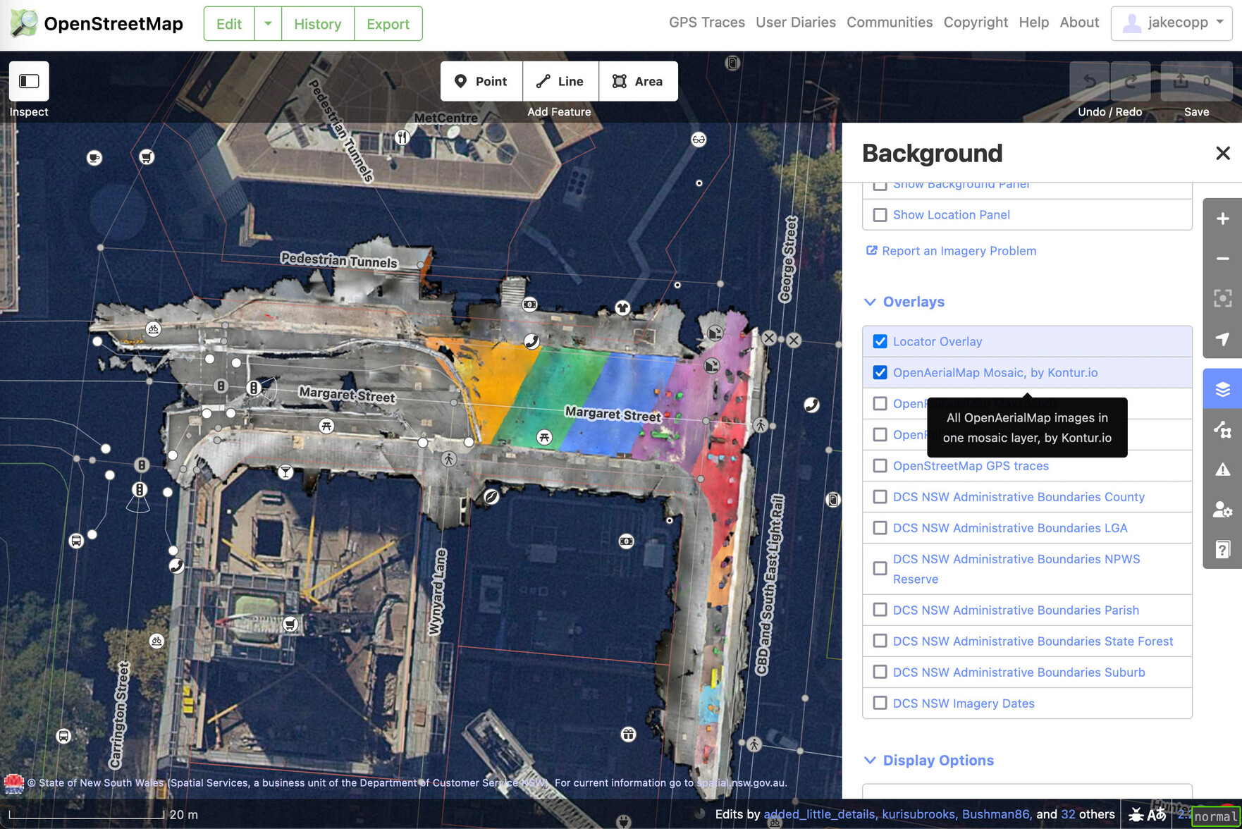
I wrote a technical guide on how you can create your own aerial imagery and 3D models of streets with the built in iPhone LiDAR sensor and open source tools in the OpenDroneMap package.
I've found you can attach your iPhone to your bike and generate LiDAR point clouds of the kerb and cycleway infrastructure if you go slow!
https://jakecoppinger.com/2023/03/generating-aerial-imagery-with-your-iphones-lidar-sensor/
#lidar #openstreetmap #maps #iphone #openaerialmap #cycling #infrastructure #urbanism #sydney #australia #betterstreets #opendronemap #odm #webodm
#lidar #openstreetmap #maps #iphone #openaerialmap #cycling #infrastructure #urbanism #sydney #australia #betterstreets #opendronemap #odm #webodm

MaptimeBogota · @MaptimeBogota
4 followers · 38 posts · Server en.osm.town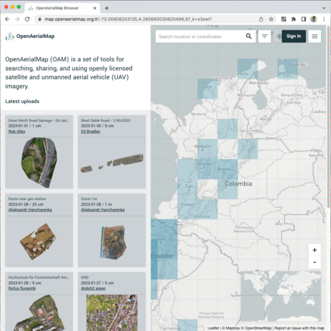
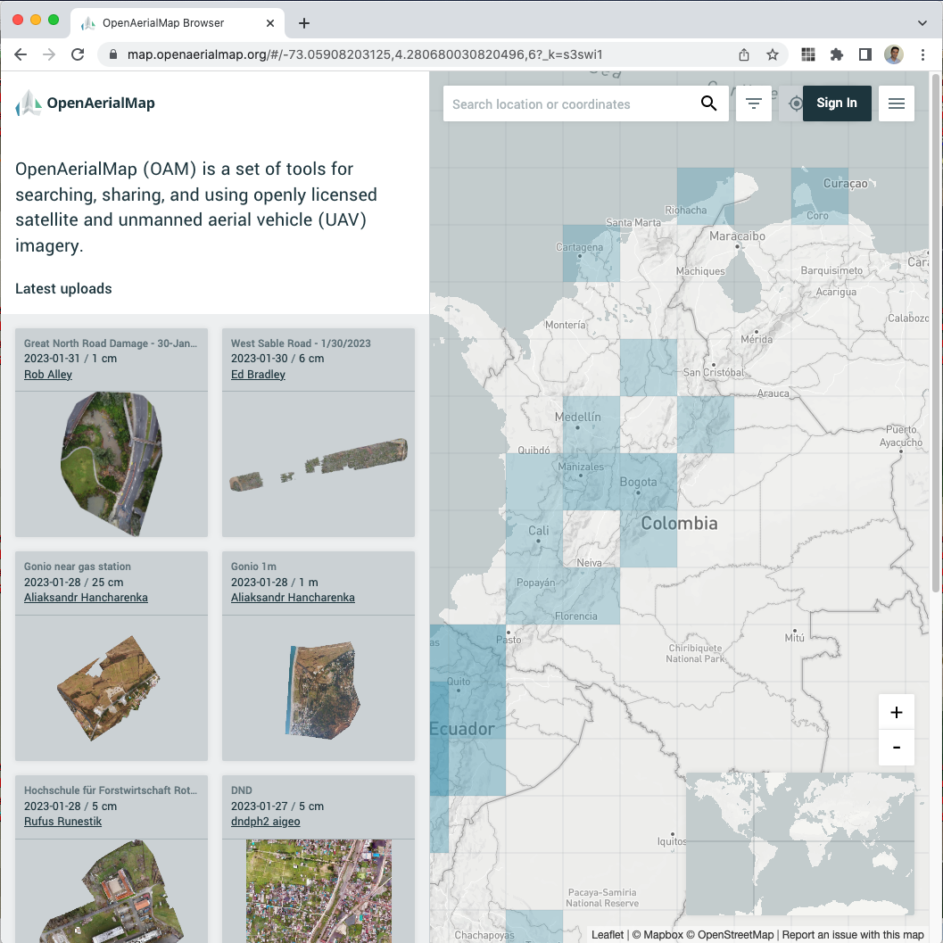
Tienes un drone y tomas fotos aéreas? Puedes convertirlas en ortofotos con #OpenDroneMap subirlas a #OpenAerialMap y eso permitirá mapear mejor en #OpenStreetMap.
¡Anímate a apoyar el mapeo colaborativo!
https://map.openaerialmap.org/#/-74.11720275878906,4.650342383235499,12?_k=kenpb4
#opendronemap #openaerialmap #OpenStreetMap

OpenDroneMap · @OpenDroneMap
258 followers · 8 posts · Server fosstodon.orgHello everyone!
The OpenDroneMapUpdatesBot on BotsIn.Space is part of our team.
They aren't running from GitHub actions yet, so they might be a bit delayed as someone has to write each post 🤣
Each post will have the following tags:
#OpenDroneMap #ODMUpdatesBot
You can use those to subscribe or mute, as needed.
Each post will also have the updated project as a tag, again for easy subscription and muting.
Please reach out here if you have any suggestions!
OpenDroneMap · @OpenDroneMap
258 followers · 8 posts · Server fosstodon.orgHello everyone!
The ODMUpdatesBot on BotsIn.Space is part of our team.
They aren't running automated from GitHub actions yet, so they might be a bit delayed as someone has to write each post 🤣
Each post will have the following tags:
#OpenDroneMap #ODMUpdatesBot
You can use those to subscribe or mute, as needed.
Each post will also have the updated project as a tag, again for easy subscription and muting.
Please reach out here if you have any suggestions!
@ODMUpdatesBot@BotsIn.Space
ODMUpdatesBot · @OpenDroneMapUpdatesBot
14 followers · 11 posts · Server botsin.spaceOpenDroneMap/NodeODM
v2.2.2
- Create initial Apptainer definition file and some initial instructions on running Apptainer on HPC
- Rename singularity.def to apptainer.def
- Fix confusing order to readme on rootless
- add directions on building apptainer.def
- Add precautions when building apptainer container
- Automatically set --gltf when processing with WebODM
- Add glTF test files
...
https://github.com/OpenDroneMap/NodeODM/releases/tag/v2.2.2
#opendronemap #nodeodm #odmupdatesbot

danbjoseph · @danbjoseph
25 followers · 15 posts · Server floss.socialThanks to user `trendspotter` on Transifex the #OpenDroneMap docs are 85% translated to Czech!
If you can help translate, we have a guide: https://github.com/OpenDroneMap/docs#translations
Give the #OpenSource project a follow on Mastodon @OpenDroneMap and go check out the docs at https://docs.opendronemap.org/cs/