
Sam Wilson · @samwilson
425 followers · 954 posts · Server wikis.world@TimStarling I think there's a long way between notable and verifiable, and it sounds like lots of the deletion requests are for the latter.. But yeah, I wouldn't suggest adding individual houses or farms to Wikidata (with many exceptions, e.g. heritage listing, notability). I've been wondering lately if #OpenHistoricalMap couldn't be a good all-time gazetteer; all these minor places are accepted there (still must be verifiable).

Open Source San José · @opensourcesanjose
14 followers · 11 posts · Server sfba.social
Oops! All this time, we hadn’t updated #OpenStreetMap to show #HackerDojo’s move back to Mountain View, even though it’s the location of our monthly in-person meetups. Well, now it’s updated, and #OpenHistoricalMap even shows all the times it’s had to move over the years. Just another drop in the bucket of #SiliconValley #LocalHistory.
Find out how to contribute to both projects at tonight’s #SouthBay Map Night, starting at 7 PDT. https://www.meetup.com/open-source-san-jose/events/295064263
#openstreetmap #hackerdojo #openhistoricalmap #siliconvalley #localhistory #southbay

Richard Welty · @nfgusedautoparts
113 followers · 796 posts · Server en.osm.townhaving fought my way through the thicket of update issues involved in bringing a project that's been idle for 2 years back into action, i have now managed to submit a handful of EDTF dates (2 good, one bad) to the EDTF parser with correct results. woo hoo, now to get a more formal test setup in place. #OpenHistoricalMap #ISODates
Richard Welty · @nfgusedautoparts
113 followers · 791 posts · Server en.osm.townreasons to use EDTF - open standard. 8601 is behind a paywall, which is why most people learn about it from vendor docs, not the standard itself. #ISO8601 #DateFormat #OpenStreetMap #OpenHistoricalMap
https://webstore.ansi.org/standards/iso/iso86012019?msclkid=c8821b1afe341ba254557f8a58966e30
#iso8601 #dateformat #OpenStreetMap #openhistoricalmap
Richard Welty · @nfgusedautoparts
113 followers · 785 posts · Server en.osm.townthe LoC took 8601-02 and extracted a subset and redid EDTF, which is now an official profile of ISO-8601. the EDTF subset is well matched to #OpenHistoricalMap needs.
Richard Welty · @nfgusedautoparts
113 followers · 782 posts · Server en.osm.townideally i'll implement backend routines that can do the translation from gregorian dates into the internal #OpenHistoricalMap timeline. i've also put in hooks for Julian dates and Julian day formats, which look like the OSM start_date hooks. i can probably just use a version of the ISO parser for julian dates with different backend coding to map to the timeline.
Richard Welty · @nfgusedautoparts
112 followers · 759 posts · Server en.osm.townsurvived my SOTM US lightning talk. now two days to worry about my longer talk on sunday. woo hoo. #openstreetmap #SOTMUS2023 #OpenHistoricalMap
#OpenStreetMap #sotmus2023 #openhistoricalmap
Richard Welty · @nfgusedautoparts
112 followers · 755 posts · Server en.osm.townfinally got decent drafts for my two #OpenHistoricalMap presentations for SOTM US this coming weekend, then i checked the schedule and realized that one of them is only scheduled for a 5 minute lightning talk - so a lot of slides went away. #OpenStreetMap #History
#openhistoricalmap #OpenStreetMap #history
Richard Welty · @nfgusedautoparts
111 followers · 743 posts · Server en.osm.townlet's see, things i need to do...
i have two presentations about OpenHistoricalMap accepted for SOTM US next month in Richmond, so i need to write them Real Soon Now.
i know, i'll submit a new presentation abstract for NYSGeoCon in September. that'll make things better for sure!
#OpenStreetMap #OpenHistoricalMap #geography #history
#OpenStreetMap #openhistoricalmap #geography #history

David Coombe · @david_coombe_cbr
105 followers · 405 posts · Server aus.social
I just ran the sun across the sky as if it was 1844!
Where did the shadows fall? (Albeit from modern buildings not historical ones.) This helps solve a question of a colonial artist painting the streets with the sun seeming to shine from the south. I can see eventual potential for historical streetscapes.
Image: screenshot of 3D map of Adelaide, South Australia showing shadow animation for 10 August 1844
Run it on desktop or laptop: https://streets.gl/#-34.92467,138.59914,46.31,0.00,2549.12
Introductory article to this new tool: "Streets GL — a new 3D renderer for OSM": https://community.openstreetmap.org/t/streets-gl-a-new-3d-renderer-for-osm/98594
#streetsgl #openstreetmap #openhistoricalmap #adelaide

SK53 · @SK53
87 followers · 245 posts · Server en.osm.town
I wrote a little about this area in a couple of blog posts, mainly exploring ideas about how to map change (& how much of it there might be) for #OpenHistoricalMap
http://sk53-osm.blogspot.com/2013/02/persistence-in-urban-environment-1.html
http://sk53-osm.blogspot.com/2014/05/editing-historical-road-layouts.html
Richard Welty · @nfgusedautoparts
96 followers · 552 posts · Server en.osm.townState Of The Map US 2023 planning has launched.
contribute to making the conference you want to attend by coming up with a great presentation to submit.
i've started poking the #OpenHistoricalMap community with a stick. #SOTMUS2023
#openhistoricalmap #sotmus2023
Richard Welty · @nfgusedautoparts
96 followers · 552 posts · Server en.osm.town@failedLyndonLaRouchite this isn't really the space that i play in with #OpenStreetMap and #OpenHistoricalMap
i do agree that it's a major issue.
#OpenStreetMap #openhistoricalmap
Richard Welty · @nfgusedautoparts
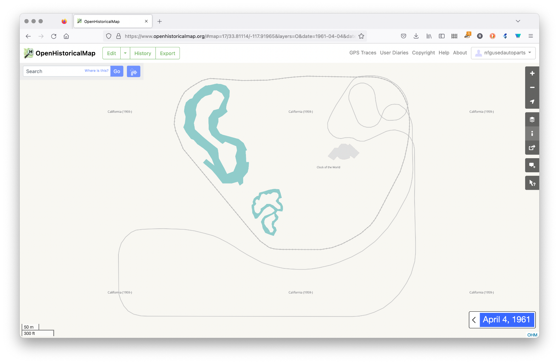
86 followers · 378 posts · Server en.osm.townthere is a reason why i started adding #disneyland to #OpenHistoricalMap. i'd previously done a bit of mapping of the 1964-5 NY world's fair in OHM, and that fair significantly altered the trajectory of Walt and the emerging Disney empire. tracking the attractions originally built for the fair to their eventual roles at Disney Parks is an interesting exercise, and also is a laboratory for the exploration of linking with #wikidata & #wikipedia
#disneyland #openhistoricalmap #wikidata #wikipedia
Richard Welty · @nfgusedautoparts
86 followers · 378 posts · Server en.osm.town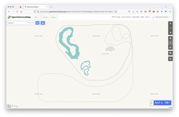
the beginnings of a historical map of Disneyland (1961 shown). Because #OpenHistoricalMap could use some theme parks. #mapping #history #geography
#openhistoricalmap #mapping #history #geography
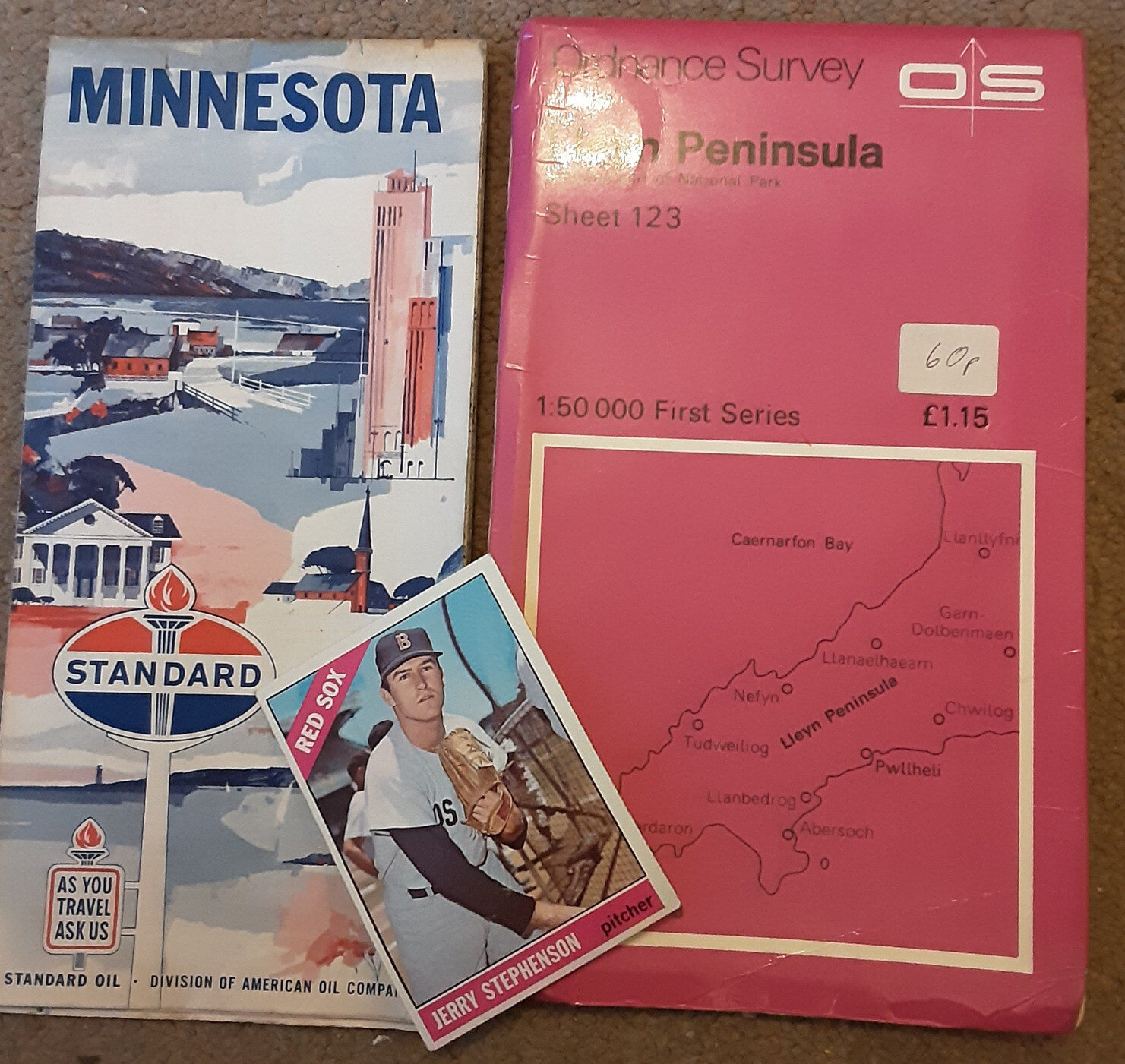
SK53 · @SK53
75 followers · 84 posts · Server en.osm.town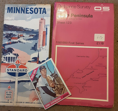
@nfgusedautoparts Presumably USGS topo are public domain anyway. Shame to have to wait for so long to make use of the the gas station freebies.
OSGB here go out of copyright after 50 years, so we're on the cusp of the first 1:50k maps (although most were photo-enlarged from earlier 1 inch maps so probably already OOC).
Most commercial maps use OSGB data, so probably same applies to them.
Bonus 1966 Topps Baseball Card
Richard Welty · @nfgusedautoparts
80 followers · 342 posts · Server en.osm.townnote for #OpenHistoricalMap mappers - as of january first, maps made in 1927 are now public domain in the US.
SK53 · @SK53
75 followers · 84 posts · Server en.osm.town
@nfgusedautoparts Oddly, for something else entirely, I've been delving into early C19 road networks in Spain. A good paper here https://link.springer.com/article/10.1007/s11698-020-00218-x. Bridges rare enough to help delineate the base network (although often destroyed in war)
#openhistoricalmap #spain #transportnetworks
Richard Welty · @nfgusedautoparts
80 followers · 327 posts · Server en.osm.towna new #OpenHistoricalMap entertainment - tracking Disney attractions from the 1964-5 NYC World's Fair leads to the beginnings of the historical map of Disneyland - a work in progress.
https://openhistoricalmap.org/#map=16/33.8094/-117.9251&layers=O&date=1962-08-03&daterange=1922-01-01,2022-12-31
#disneyland #disney
#openhistoricalmap #disneyland #disney