Maptime Amsterdam · @MaptimeAMS
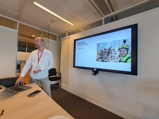
7 followers · 3 posts · Server mastodon.nlLast Friday the first Maptime Amsterdam since 2019 took place! @shravan of #tmsystems, and Salim Baidoun and @marjanvdk of #tomtom welcomed more than 20 map enthusiasts in TomTom's Amsterdam office.
Salim and Marjan presented TomTom’s OSM Engagement team and how it contributes to #openstreetmap, while Stéphane De Greef of @osm_be wowed the audience with how he mapped all of Brussels with just a bike, cell phone and camera.
It was a great night of learning, networking and … #maps of course.
#maps #openstreetmap #tomtom #tmsystems
buwel · @buwel
165 followers · 3597 posts · Server social.tchncs.deGuck an, wo meine™ Arbeit überall landet 🤩
BKG · @BKG
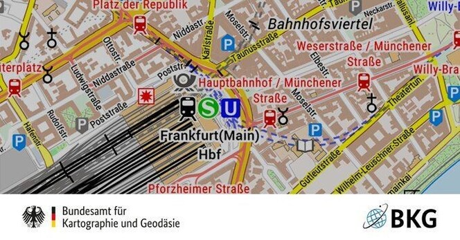
1813 followers · 287 posts · Server social.bund.de🗺️ Die Daten der TopPlusOpen Präsentationsgraphiken wurden aktualisiert und stehen in unserem #OpenData-Bereich als WMS und als WMTS und als Direktdownload zur Verfügung. Die TopPlusOpen basiert auf #amtlich|en #Geodaten und #OpenStreetMap-Daten.
➡️ https://www.bkg.bund.de/SharedDocs/Produktinformationen/BKG/DE/P-2023/230911-TopPlusOpen.html
#opendata #amtlich #geodaten #openstreetmap
codl · @codl
1643 followers · 93026 posts · Server chitter.xyzhey osm editors how do you tag public sports equipment in parks, like bars and stuff with instructions explaining how to stretch well
eg https://www.openstreetmap.org/note/3882921 and its neighbours
(reposting as public and with the #OpenStreetMap tag)
Mathew Attlee · @codeinabox
41 followers · 126 posts · Server hachyderm.ioPart of me is tempted to build an app using #OpenStreetMap data for finding nearby #coffee shops. I'd like it to list if they serve cold brew or offer discounts for reusable cups, though I am not sure if that information should be stored in OSM or my own database 🤔
GNU/Linux.ch · @gnulinux
5956 followers · 4142 posts · Server social.anoxinon.deUmfrage: Welche Karten-Apps nutzt Du und warum? Hast Du schon Kartendaten ergänzt?
In einer kleinen Umfrage möchten wir erfahren, welche Karten-Apps Ihr zur Navigation und Orientierung nutzt und ob Ihr auch zur Mitarbeit an Kartenmaterial bereit seid oder schon Erfahrung damit habt.
#Umfrage #Karten #Maps #GoogleMaps #AppleMaps #OpenStreetMap #OrganicMaps #MagicEarth #StreetComplete #OSM #Android #Ios #OsmAnd #CryptPad #Digitalcourage #Linux
https://gnulinux.ch/einladung-zur-umfrage-karten-apps-openstreetmap
#umfrage #karten #maps #googlemaps #applemaps #openstreetmap #organicMaps #magicearth #streetcomplete #osm #android #ios #osmand #cryptpad #digitalcourage #linux
Ertain · @Ertain
169 followers · 9131 posts · Server mast.linuxgamecast.comEnrico "meldrian" Michaelis · @meldrian
299 followers · 835 posts · Server social.tchncs.deWie @vinzv bin ich zur Prime Time nochmal raus mit dem Smartphone in der Hand und #streetcomplete offen. Einen neuen Fussweg konnte ich ausfindig machen und bei Bänken die Frage klären, ob diese eine Rückenlehne haben. Außerdem wurden viele Gebäudetypen bestimmt.
Ich kann, nicht ohne einen gewissen Stolz, sagen, dass der kleine Nordzipfel meiner Stadt nach der heutigen Aktion in besagter App keine zu lösenden Aufgaben mehr aufzeigt. Alles erledigt.
#streetcomplete #openstreetmap
butterflyofZbeul ⏚:thaenkin: · @ButterflyOfFire
1046 followers · 4660 posts · Server mstdn.frActivity on #Openstreetmap
#hotosm-project-15468 #moroccoearthquake2023
#moroccoearthquake2023 #hotosm #openstreetmap
z3z · @z3z
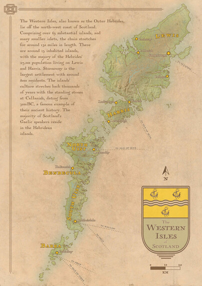
151 followers · 202 posts · Server mastodon.scotAnother wee #map, this time showing the Outer Hebrides, the Western Isles of #Scotland.
Made with #QGIS and #Inkscape with a helping hand from #OpenStreetMap
I had a lot of fun with this one. Hope you like!
#maps #cartography #WesternIsles #hebrides #mapmaking #openstreetmap #inkscape #qgis #scotland #map
Sabine Hiller · @sabinehiller
170 followers · 367 posts · Server mastodon.ieUrgent Call for Mappers & Validators!
In the aftermath of the #earthquake in #Morocco, we need your support to help map the affected area and aid relief efforts.
Be part of this critical mission by joining the project in #HOT's Tasking Manager https://tasks.hotosm.org/projects/15468
Please read instructions carefully & check out training materials:
🌐 https://m.youtube.com/watch?v=Ir-3K0pjwOI
🌐 Learn OSM: https://learnosm.org/en/
#disastermapping #HOTOSM #MoroccoEarthquake2023 #OpenStreetMap #OSM #OpenMapping
#earthquake #morocco #hot #disastermapping #hotosm #moroccoearthquake2023 #openstreetmap #osm #openmapping
Daltux · @daltux
35 followers · 142 posts · Server ayom.media@organicmaps @AzureFubuki @openstreetmap Let's also remember #OpenStreetMap is filled by mainly volunteer work, not owned by #BigTech (even though some actually help the community), so everybody is welcome and encouraged to contribute, e.g. with their local knowledge.
Wikidata Taiwan 臺灣維基數據社群 · @wikidatatw
84 followers · 157 posts · Server liker.socialOpenStreetMap x Wikidata 月聚會 #56
地點: #摩茲工寮 (100 台北市中正區八德路一段 94 號 3F https://www.openstreetmap.org/way/527672473)
時間:2023-9-11 (一) 19:30-21:30
聚會流程:
場地介紹
摩茲工寮的設備、廁所
參加者自我介紹
用三個關鍵字介紹自己,兩分鐘說明你正在進行的事情或想達成的事情,目前進展到什麼程度,需要什麼樣的人幫忙。任何關於針對 OSM 的特定問題或專案項目。
針對現場參與者調整相關議題
歡迎活動前預先提報議題,方便資深圖客預先準備解答。
依照議題順序逐一討論或帶開手把手教學。
#meetup #聚會 #月聚 #開放街圖 #維基資料 #維基數據 #openstreetmap #wikidata #摩茲工寮
Jean-Baptiste · @jibec
298 followers · 3660 posts · Server mamot.frSi vous savez cartographier, vous pouvez donner un coup de main à distance suite au tremblement de terre au #maroc
https://tasks.hotosm.org/projects/15468
Bonne contribution! Courage aux gens là-bas!
Ertain · @Ertain
169 followers · 9109 posts · Server mast.linuxgamecast.comAnother day, more places contributed to #OpenStreetMap. #OSM #StreetComplete #Vespucci
#openstreetmap #osm #streetcomplete #vespucci
Daltux · @daltux
32 followers · 134 posts · Server ayom.media@organicmaps is a carefully well designed app, using monthly updated data from @openstreetmap . If you do not need advanced features or lots of customized options, just a smooth map with pretty fast user experience and simple, straight to the point offline navigation, it is a very strong option that respects your privacy and your freedom.
#FreeSoftware #opensource #FOSS #openstreetmap #maps #map #routing #navigation #gps #hiking #cycling #driving #privacy
#freesoftware #opensource #foss #openstreetmap #maps #map #routing #navigation #gps #hiking #cycling #driving #privacy
Tourbine · @Tourbine
12 followers · 164 posts · Server digitalcourage.socialIch bin Neuling im Bereich #Videobearbeitung und möchte aus MP4s meiner #GoPro Hero9 unter #MacOS Standbilder mit Geo-Daten exportieren. Diese JPGs möchte ich dann mit JOSM für die Bearbeitung von #OpenStreetMap einsetzen.
Mit der Quik-App von GoPro auf dem iPhone geht es nicht, da sind in den exportierten Standbildern keine Geodaten drin, obwohl sie in einer MP4-Spur vorhanden sind.
Kennt jemand ein Programm zur Videobearbeitung, das das kann, bevor ich alle einzeln durchprobiere? Die Einarbeitung ist für einen Anfänger ganz schön zeitaufwändig.
Erstmal habe ich mir eine Liste von Videobearbeitungsprogrammen erstellt, die ich sonst durchprobieren müßte:
- #iMovie
- #shotcut
- #openshot
- #kdenlive
- #DaVinciResolve
- #Lightworks
Wenn Ihr welche davon kennt, die den Export von Standbildern aus GoPro-Videos mit Geolokalisierung nicht können, hilft mir das auch schon weiter, dann kann ich diese schon von meiner Liste streichen.
#lightworks #davinciresolve #kdenlive #openshot #shotcut #imovie #openstreetmap #macos #gopro #Videobearbeitung
Brian Krohne · @krohne
771 followers · 283 posts · Server social.tchncs.deI'm glad to see some #OpenStreetMap folks are working on adding US-style highway shields. The map always felt illegible to me without them. https://wiki.openstreetmap.org/wiki/OpenStreetMap_Americana
une famille à vélo · @unefamilleavelo
416 followers · 680 posts · Server masto.bikeEnfin, pour vous éviter de chercher partout dans la gare (je n'ai pas vu de fléchage), et parce que vous le valez bien, j'ai précisé son emplacement sur #openstreetmap
https://www.openstreetmap.org/node/11176881352#map=19/45.75961/4.86077
De rien 😉 🚴
une famille à vélo · @unefamilleavelo
416 followers · 679 posts · Server masto.bikeD'ailleurs c'est pareil sur #OpenStreetMap : si on trace la piste comme un segment séparé de la route (parce qu'il y a une bordure physique) il faut bien penser à créer une connexion à chaque carrefour.
Le routeur ne peut pas deviner si ça passe. Alors il t'envoie loin au prochain carrefour pour revenir en arrière par la route.


