
Trufi Association · @trufiassoc
88 followers · 151 posts · Server transportation.social
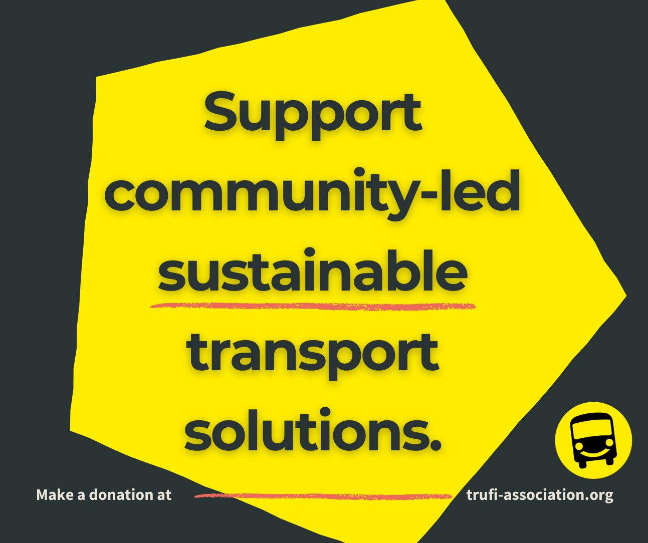
Open Source. Open Data. Better Cities. Help us shape urban mobility with one-time or a recurring donation to Trufi Association
#digitaldevelopment #ict4d #ict4dev #informaltransport #innovation #MaaS #mapping #Mobility #morningcommute #multimodal #Multimodality #opendata #opensource #opensourcesoftware #opensteetmap #OpenTripPlanner #publictransit #publictransport #PublicTransportation #software #sustainabletransport #tech #technology #transportation #donate
#digitaldevelopment #ICT4D #ict4dev #informaltransport #innovation #maas #mapping #mobility #morningcommute #multimodal #multimodality #opendata #opensource #opensourcesoftware #opensteetmap #opentripplanner #publictransit #publictransport #publictransportation #software #sustainabletransport #tech #technology #transportation #donate

Binh ATL · @bdatlrides
100 followers · 559 posts · Server social.ridetrans.itNew MARTA rail schedule takes effect this weekend, but people will only notice on Monday when they ride the trains. Also, MARTA provided a GTFS feed that contains errors.
#atlanta #marta #transit #data #GTFS #opentripplanner
Binh ATL · @bdatlrides
99 followers · 555 posts · Server social.ridetrans.itWeb reminder ofr the day: responses do not necessarily finish in the same order as their corresponding requests.
#opentripplanner #transit #webdev #webdevelopment #javascript
#opentripplanner #transit #webdev #webdevelopment #javascript
Binh ATL · @bdatlrides
94 followers · 532 posts · Server social.ridetrans.itI tried to build the OTP-react-redux UI on my phone, node ran out of memory and crashed!
#OpenTripPlanner #transit #app #webdev #javascript #reactjs #nodejs #samsungdex #android #termux
#opentripplanner #transit #app #webdev #javascript #reactjs #nodejs #samsungdex #android #termux

ConstantOrbit · @constantorbit
939 followers · 2215 posts · Server hachyderm.io@amcewen Aha, thank you! (and I figured I maybe wasn't using quite the right term for that kind of map - I will edit my post).
Interesting... I have done some work with OTP in a past job, but not sure I have the time at the moment to do that myself. Thank you for the reminder!

Mark Stosberg · @markstos
353 followers · 1171 posts · Server urbanists.social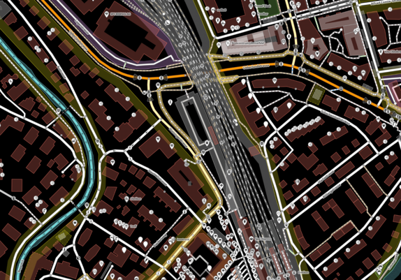
How bike directions are calculated:
#openstreetmap data represents the road network as a graph. Each road segment has metadata connected to it, such as the type of road and which road users are allowed to use it, the signed speed limit and so on. Software analyzes the connections and metadata and assigns a score to each segment based on the metadata. The route with the best score wins!
How #OpenTripPlanner converts the metadata to weights: https://github.com/opentripplanner/OpenTripPlanner/blob/5a4a5671dd09d259c68137447dbc2ef3d196323a/src/main/java/org/opentripplanner/openstreetmap/tagmapping/DefaultMapper.java
#OpenStreetMap #opentripplanner #mapping
Mark Stosberg · @markstos
353 followers · 1170 posts · Server urbanists.social#OpenTripPlanner uses #OpenStreetMap tags differently for routing depending on the location.
Here you can find the locations have special mapping rules. In the US, this includes Atlanta, Houston and Portland.
Why? Mappers in different parts of the world use OSM tags a bit different and sometimes it's easier to "route around" those differences than try to make the OSM data perfectly consistent.
#opentripplanner #OpenStreetMap

MapAm💜re · @MapAmore
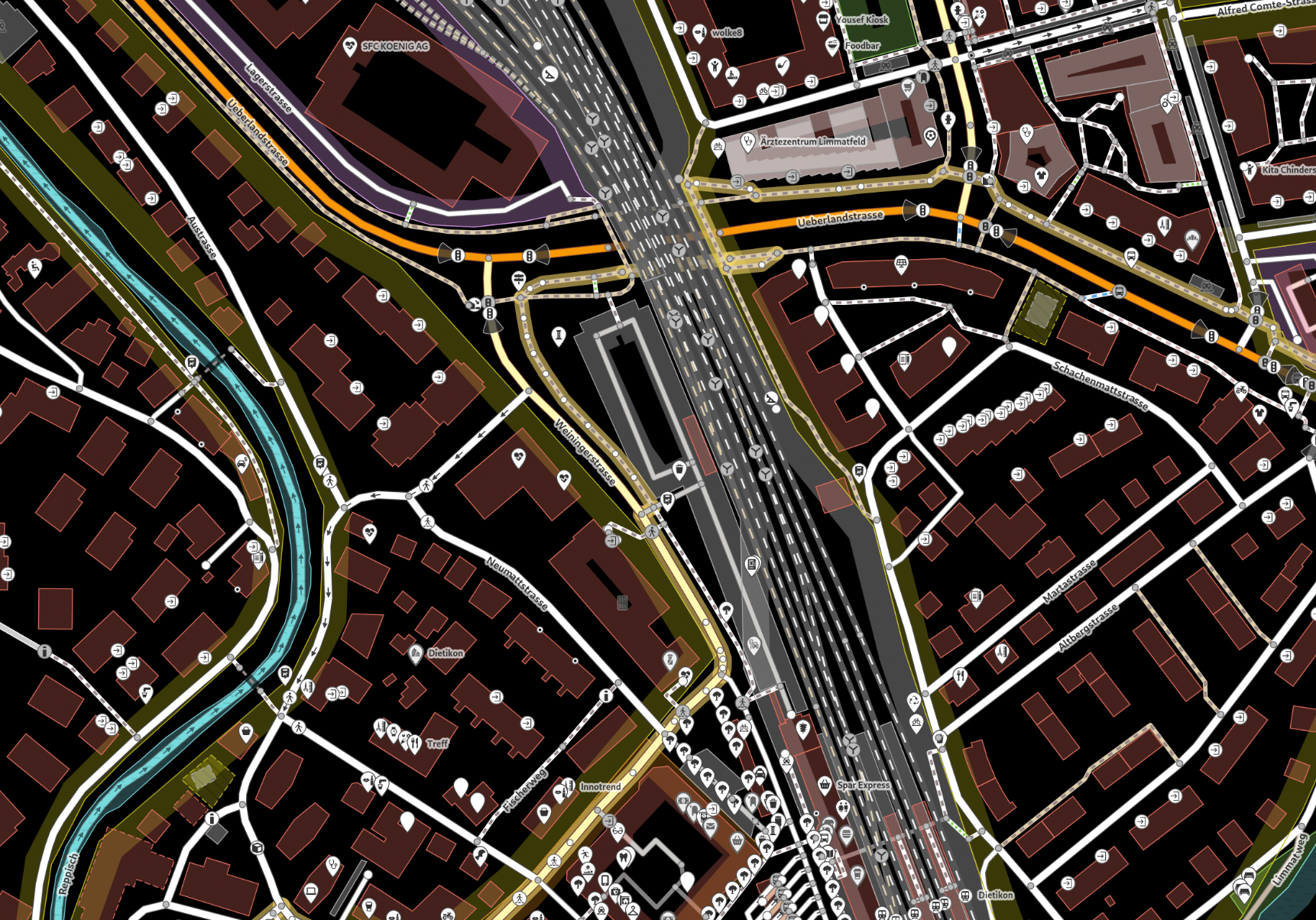
664 followers · 1158 posts · Server en.osm.townHave you ever tried the #OpenTripPlanner instance from #BiciMadrid ?
https://otp.bici.madrid/?setLng=en
It's awesome how it lets you save travel time (if that's what you wanted 😉 ) by walking your bike, instead of just giving you just a riding route.

Harald Kliems · @haraldkliems
287 followers · 1053 posts · Server fosstodon.orgTrying to set up an #OpenTripPlanner server for the first time. Wish me luck! The instructions make it sound easy, but we all know how that goes sometimes. https://docs.opentripplanner.org/en/v2.2.0/Basic-Tutorial/
Mark Stosberg · @markstos
322 followers · 916 posts · Server urbanists.social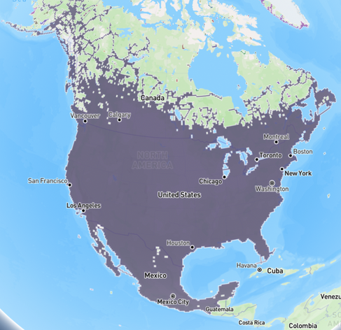
This is a map of the coverage area of the Valhalla routing engine based on #OpenStreetMap data of North America. The holes in the map and the exposed land in Canada and Alaska indicate there are no routable roads nearby.
#Valhalla is so efficient that when you boot it to start starting driving directions, it takes only about 30 MB of memory initially. A competing product, #OpenTripPlanner takes more than 300,000 MB.
Valhalla unfortunately lacks complete GTFS, GTFS-RT & GBFS support.
#OpenStreetMap #valhalla #opentripplanner
Mark Stosberg · @markstos
294 followers · 732 posts · Server urbanists.social
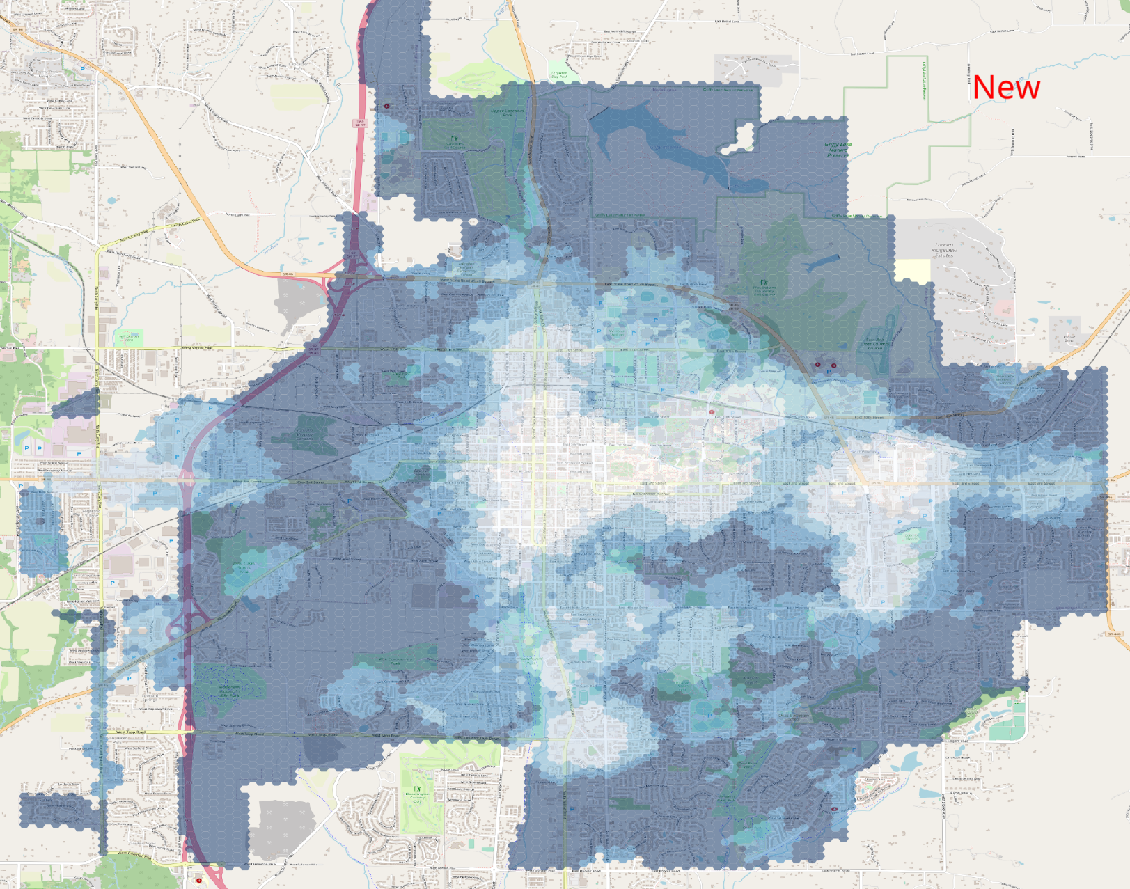
v3.0 of my "Walk Potential" software has been released. This an #UrbanPlanning #mapping tool used in planning to quantify the number of "interesting" places nearby to walk. Useful metric for demand to fix sidewalk network gaps.
Release notes: https://gitlab.com/markstos/walk-potential/-/releases/v3.0.0
Docs: https://gitlab.com/markstos/walk-potential/-/blob/main/README.md
First reply with a boundary polygon for their city wins free Walk Potential analysis for that city.
#gis #BloomingtonIN #OpenStreetMap #OpenTripPlanner #TurfJS
Example Walk Potential Heatmap:
#UrbanPlanning #mapping #gis #bloomingtonin #OpenStreetMap #opentripplanner #turfjs

Askan 🇪🇺 · @askans
190 followers · 4977 posts · Server bonn.social
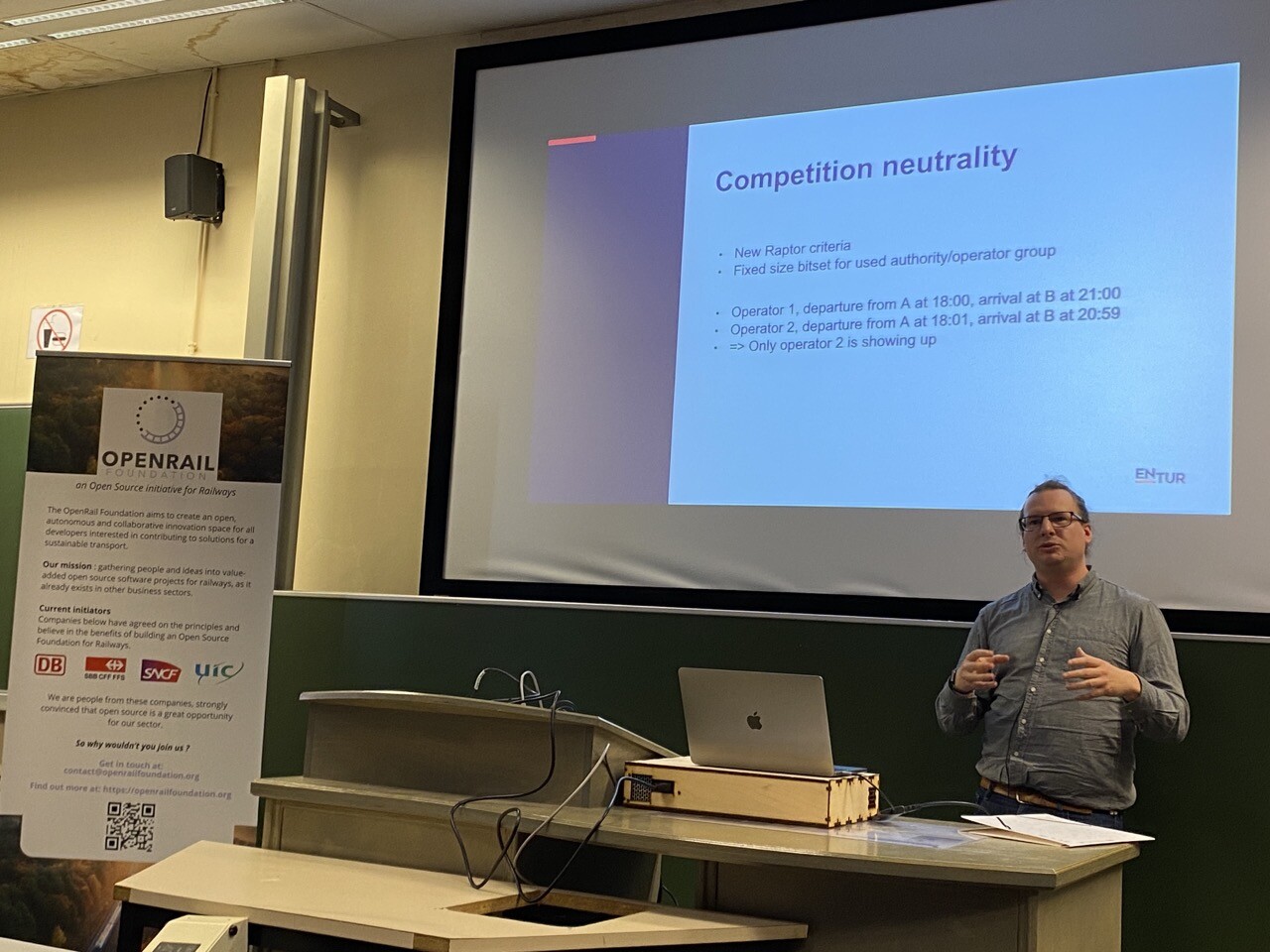
#fosdem
Public transport operators cheat with their time table to get better search positions in #OpenTripPlanner
Kind of a different SEO
Trufi Association · @trufiassoc
63 followers · 82 posts · Server transportation.social
Be Like Sören: Volunteer for Trufi
What does Sören do for Trufi? How much time do you have? He does a lot.
#developer #digital #digitaldevelopment #diy #flutter #foss #geek #germany #github #informaltransport #MaaS #mapping #mobileapp #Mobility #opendata #opensource #opensteetmap #OpenTripPlanner #programmer #programming #publictransit #publictransport #software #sustainabletransport #tech #technology #volunteer #noxp
https://tinyurl.com/24lmn6cu
#developer #digital #digitaldevelopment #diy #flutter #foss #geek #germany #github #informaltransport #maas #mapping #mobileapp #mobility #opendata #opensource #opensteetmap #opentripplanner #programmer #programming #publictransit #publictransport #software #sustainabletransport #tech #technology #volunteer #noxp

Baloo Uriza · @BalooUriza
777 followers · 10281 posts · Server social.tulsa.ok.us@graue Have you looked at #OpenTripPlanner? That's what #Trimet is using in the Portland area for the same thing.

Mark Stosberg · @markstos
261 followers · 556 posts · Server urbanists.social
I'm working on making a 36"x48" wall map of the walk potential of #BloomingtonIn
On my first attempt I used a low-resolution raster base map designed for the web (seen here), but thankfully I caught the mistake in time and am now working on the the next iteration with a vector base map from MapTiler:
https://www.maptiler.com/news/2020/06/vector-tiles-in-qgis-3-14/
#bloomingtonin #gis #mapping #opentripplanner

Robin Lovelace · @robinlovelace
906 followers · 272 posts · Server fosstodon.orgRT @DrMalcolmMorgan
Version 0.5 of #OpenTripPlanner for #RStats is now on CRAN 🥳 with:
🏃Much faster routing
🖥️ Reduced CPU and memory use
✅ Support for OTP 2.2
#Rspatial #Transport #DataScience
#opentripplanner #rstats #rspatial #transport #datascience

Daniel Heppner :vbus: · @danielhep
927 followers · 358 posts · Server social.ridetrans.itTime to do my #introduction. I am a software developer working on #OpenTripPlanner. I am a huge transit nerd, I love exploring new cities with an unlimited day pass. I live in #Seattle without a car, but I have an #eCargoBike. I am also an electrical engineer and enjoy doing personal projects. I mostly post about things related to my interests in Seattle, but sometimes other cities as well.
#introduction #opentripplanner #seattle #eCargobike

Fredrik Fyksen · @fredrik
144 followers · 392 posts · Server mastodon.fyksen.me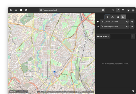
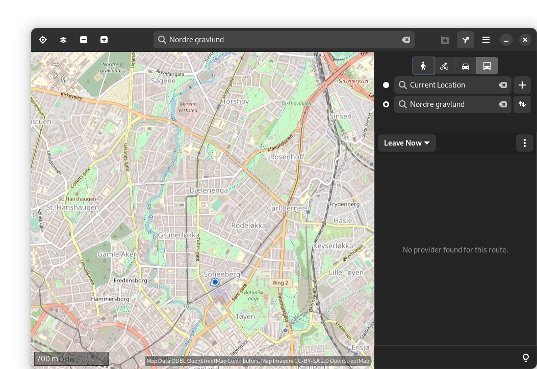
Hmm, how can we make Norway #entur public transport provider show up on #gnome #maps?
I found some documentation for adding providers here:
https://wiki.gnome.org/Apps/Maps/PublicTransportation
(very dated)
But it looks like it's using #OpenTripPlanner and it looks to me that #Entur is the main developer of the platform?
https://om.entur.no/bedrift/blog/opentripplanner-2-0-is-here/
#entur #gnome #maps #opentripplanner

norwin · @norwin
172 followers · 2313 posts · Server mastodon.artsadly that still rules out selfhosting transit-routing (#opentripplanner) for my usecase.
incomplete coverage -> still using #HAFAS :(
#opendata #HAFAS #opentripplanner

norwin · @norwin
183 followers · 2465 posts · Server mastodon.artsadly that still rules out selfhosting transit-routing (#opentripplanner) for my usecase.
incomplete coverage -> still using #HAFAS :(
#opendata #HAFAS #opentripplanner